Mapleton Township, Blue Earth County, Minnesota
| Mapleton Township, Minnesota | |
|---|---|
| Township | |
 Mapleton Township, Minnesota Location within the state of Minnesota | |
| Coordinates: 43°53′30″N 93°57′14″W / 43.89167°N 93.95389°WCoordinates: 43°53′30″N 93°57′14″W / 43.89167°N 93.95389°W | |
| Country | United States |
| State | Minnesota |
| County | Blue Earth |
| Area | |
| • Total | 34.4 sq mi (89.1 km2) |
| • Land | 34.1 sq mi (88.4 km2) |
| • Water | 0.3 sq mi (0.7 km2) |
| Elevation | 1,024 ft (312 m) |
| Population (2000) | |
| • Total | 310 |
| • Density | 9.1/sq mi (3.5/km2) |
| Time zone | Central (CST) (UTC-6) |
| • Summer (DST) | CDT (UTC-5) |
| ZIP code | 56065 |
| Area code(s) | 507 |
| FIPS code | 27-40328[1] |
| GNIS feature ID | 0664908[2] |
Mapleton Township is a township in Blue Earth County, Minnesota, United States. The population was 310 as of the 2000 census.[3]
History
Mapleton Township was organized in 1861, and named from the Maple River.[4]
Geography
According to the United States Census Bureau, the township has a total area of 34.4 square miles (89.0 km²), of which 34.1 square miles (88.4 km²) is land and 0.3 square miles (0.7 km²) (0.76%) is water.
The city of Mapleton is within the township geographically but is a separate entity.
Major highways
Lakes
- Knights Lake (east half)
- Lura Lake (west edge)
Adjacent townships
- Beauford Township (north)
- Medo Township (northeast)
- Danville Township (east)
- Lura Township, Faribault County (south)
- Delavan Township, Faribault County (southwest)
- Sterling Township (west)
- Lyra Township (northwest)
Cemeteries
The township includes the following cemeteries: Calvary, Chase and Union.
Demographics
As of the census[1] of 2000, there were 310 people, 112 households, and 90 families residing in the township. The population density was 9.1 people per square mile (3.5/km²). There were 117 housing units at an average density of 3.4/sq mi (1.3/km²). The racial makeup of the township was 97.74% White, 0.32% African American, 0.32% Native American, 0.65% Asian, 0.97% from other races. Hispanic or Latino of any race were 0.97% of the population.
There were 112 households out of which 31.3% had children under the age of 18 living with them, 73.2% were married couples living together, 3.6% had a female householder with no husband present, and 19.6% were non-families. 15.2% of all households were made up of individuals and 6.3% had someone living alone who was 65 years of age or older. The average household size was 2.77 and the average family size was 3.06.
In the township the population was spread out with 24.5% under the age of 18, 6.5% from 18 to 24, 25.2% from 25 to 44, 27.7% from 45 to 64, and 16.1% who were 65 years of age or older. The median age was 41 years. For every 100 females there were 116.8 males. For every 100 females age 18 and over, there were 118.7 males.
The median income for a household in the township was $50,000, and the median income for a family was $60,114. Males had a median income of $37,250 versus $26,500 for females. The per capita income for the township was $22,557. About 5.3% of families and 9.7% of the population were below the poverty line, including 24.6% of those under age 18 and none of those age 65 or over.
References
- United States National Atlas
- United States Census Bureau 2007 TIGER/Line Shapefiles
- United States Board on Geographic Names (GNIS)
- 1 2 "American FactFinder". United States Census Bureau. Retrieved 2008-01-31.
- ↑ "US Board on Geographic Names". United States Geological Survey. 2007-10-25. Retrieved 2008-01-31.
- ↑ United States Census Bureau American FactFinder - Mapleton Township total population
- ↑ Upham, Warren (1920). Minnesota Geographic Names: Their Origin and Historic Significance. Minnesota Historical Society. p. 62.
Municipalities and communities of Blue Earth County, Minnesota, United States | ||
|---|---|---|
| Cities | 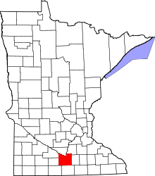 | |
| Townships | ||
| CDP | ||
| Unincorporated communities | ||
| Footnotes | ‡This populated place also has portions in an adjacent county or counties | |