McCune, Kansas
| McCune, Kansas | |
|---|---|
| City | |
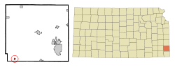 Location within Crawford County and Kansas | |
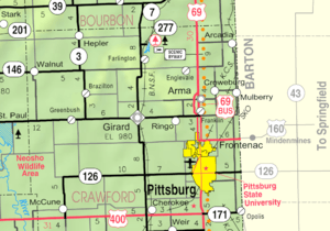 KDOT map of Crawford County (legend) | |
| Coordinates: 37°21′14″N 95°1′10″W / 37.35389°N 95.01944°WCoordinates: 37°21′14″N 95°1′10″W / 37.35389°N 95.01944°W | |
| Country | United States |
| State | Kansas |
| County | Crawford |
| Area[1] | |
| • Total | 0.31 sq mi (0.80 km2) |
| • Land | 0.31 sq mi (0.80 km2) |
| • Water | 0 sq mi (0 km2) |
| Elevation | 912 ft (278 m) |
| Population (2010)[2] | |
| • Total | 405 |
| • Estimate (2012[3]) | 407 |
| • Density | 1,300/sq mi (510/km2) |
| Time zone | Central (CST) (UTC-6) |
| • Summer (DST) | CDT (UTC-5) |
| ZIP code | 66753 |
| Area code(s) | 620 |
| FIPS code | 20-43725 [4] |
| GNIS feature ID | 0469634 [5] |
McCune is a city in Crawford County, Kansas, United States. As of the 2010 census, the city population was 405.[6]
History
The first post office in McCune was established in August, 1878.[7]
McCune was laid out in 1879.[8] It was named for its founder, Isaac McCune.[9] McCune was incorporated as a city in 1881.[10]
McCune was located on the St. Louis–San Francisco Railway.[8]
Geography
McCune is located at 37°21′14″N 95°1′10″W / 37.35389°N 95.01944°W (37.353911, -95.019334).[11] According to the United States Census Bureau, the city has a total area of 0.31 square miles (0.80 km2), all of it land.[1]
Climate
The climate in this area is characterized by hot, humid summers and generally mild to cool winters. According to the Köppen Climate Classification system, McCune has a humid subtropical climate, abbreviated "Cfa" on climate maps.[12]
Demographics
| Historical population | |||
|---|---|---|---|
| Census | Pop. | %± | |
| 1880 | 170 | — | |
| 1890 | 700 | 311.8% | |
| 1900 | 657 | −6.1% | |
| 1910 | 736 | 12.0% | |
| 1920 | 591 | −19.7% | |
| 1930 | 584 | −1.2% | |
| 1940 | 556 | −4.8% | |
| 1950 | 532 | −4.3% | |
| 1960 | 433 | −18.6% | |
| 1970 | 487 | 12.5% | |
| 1980 | 528 | 8.4% | |
| 1990 | 462 | −12.5% | |
| 2000 | 426 | −7.8% | |
| 2010 | 405 | −4.9% | |
| Est. 2015 | 404 | [13] | −0.2% |
| U.S. Decennial Census | |||
2010 census
As of the census[2] of 2010, there were 405 people, 169 households, and 110 families residing in the city. The population density was 1,306.5 inhabitants per square mile (504.4/km2). There were 207 housing units at an average density of 667.7 per square mile (257.8/km2). The racial makeup of the city was 93.6% White, 2.5% Native American, 0.5% Asian, 0.7% from other races, and 2.7% from two or more races. Hispanic or Latino of any race were 2.2% of the population.
There were 169 households of which 35.5% had children under the age of 18 living with them, 50.9% were married couples living together, 8.3% had a female householder with no husband present, 5.9% had a male householder with no wife present, and 34.9% were non-families. 28.4% of all households were made up of individuals and 9.5% had someone living alone who was 65 years of age or older. The average household size was 2.40 and the average family size was 2.92.
The median age in the city was 39.4 years. 24.9% of residents were under the age of 18; 9.4% were between the ages of 18 and 24; 22.7% were from 25 to 44; 29.4% were from 45 to 64; and 13.6% were 65 years of age or older. The gender makeup of the city was 51.1% male and 48.9% female.
2000 census
As of the census[4] of 2000, there were 426 people, 173 households, and 115 families residing in the city. The population density was 1,384.6 people per square mile (530.6/km²). There were 203 housing units at an average density of 659.8 per square mile (252.8/km²). The racial makeup of the city was 97.65% White, 0.94% Native American, 0.23% Asian, 0.23% from other races, and 0.94% from two or more races. Hispanic or Latino of any race were 1.41% of the population.
There were 173 households out of which 40.5% had children under the age of 18 living with them, 54.3% were married couples living together, 7.5% had a female householder with no husband present, and 33.5% were non-families. 30.6% of all households were made up of individuals and 13.3% had someone living alone who was 65 years of age or older. The average household size was 2.46 and the average family size was 3.10.
In the city the population was spread out with 29.1% under the age of 18, 8.9% from 18 to 24, 27.9% from 25 to 44, 22.1% from 45 to 64, and 12.0% who were 65 years of age or older. The median age was 35 years. For every 100 females there were 105.8 males. For every 100 females age 18 and over, there were 96.1 males.
The median income for a household in the city was $30,347, and the median income for a family was $34,375. Males had a median income of $29,375 versus $20,625 for females. The per capita income for the city was $12,563. About 12.9% of families and 16.7% of the population were below the poverty line, including 18.0% of those under age 18 and 6.9% of those age 65 or over.
References
- 1 2 "US Gazetteer files 2010". United States Census Bureau. Archived from the original on January 24, 2012. Retrieved 2012-07-06.
- 1 2 "American FactFinder". United States Census Bureau. Retrieved 2012-07-06.
- ↑ "Population Estimates". United States Census Bureau. Archived from the original on June 17, 2013. Retrieved 2013-05-29.
- 1 2 "American FactFinder". United States Census Bureau. Archived from the original on September 11, 2013. Retrieved 2008-01-31.
- ↑ "US Board on Geographic Names". United States Geological Survey. 2007-10-25. Retrieved 2008-01-31.
- ↑ "2010 City Population and Housing Occupancy Status". U.S. Census Bureau. Archived from the original on July 21, 2011. Retrieved April 10, 2012.
- ↑ "Kansas Post Offices, 1828-1961 (archived)". Kansas Historical Society. Archived from the original on October 9, 2013. Retrieved 6 June 2014.
- 1 2 A Twentieth Century History and Biographical Record of Crawford County, Kansas. The Lewis Publishing Company. 1905. p. 31.
- ↑ Kansas State Historical Society (1916). Biennial Report of the Board of Directors of the Kansas State Historical Society. Kansas State Printing Plant. p. 171.
- ↑ Blackmar, Frank Wilson (1912). Kansas: A Cyclopedia of State History, Volume 2. Standard Publishing Company. p. 203.
- ↑ "US Gazetteer files: 2010, 2000, and 1990". United States Census Bureau. 2011-02-12. Retrieved 2011-04-23.
- ↑ Climate Summary for McCune, Kansas
- ↑ "Annual Estimates of the Resident Population for Incorporated Places: April 1, 2010 to July 1, 2015". Retrieved July 2, 2016.
External links
| Wikimedia Commons has media related to McCune, Kansas. |
- City
- Schools
- USD 247, local school district
- Maps
- McCune City Map, KDOT
Municipalities and communities of Crawford County, Kansas, United States | ||
|---|---|---|
| Cities | 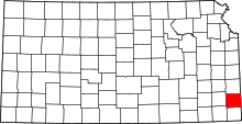 | |
| Townships | ||
| CDPs | ||
| Unincorporated communities | ||
| Footnotes | ‡This populated place also has portions in an adjacent county or counties | |