Miles, Queensland
| Miles Queensland | |||||||
|---|---|---|---|---|---|---|---|
 The main street of Miles | |||||||
 Miles | |||||||
| Coordinates | 26°39′30″S 150°11′14″E / 26.65833°S 150.18722°ECoordinates: 26°39′30″S 150°11′14″E / 26.65833°S 150.18722°E | ||||||
| Population | 1,854 (2011 census)[1] | ||||||
| Established | 1878 | ||||||
| Postcode(s) | 4415 | ||||||
| Elevation | 302 m (991 ft)[2] | ||||||
| Location | |||||||
| LGA(s) | Western Downs Region | ||||||
| State electorate(s) | Warrego | ||||||
| Federal Division(s) | Maranoa | ||||||
| |||||||
Miles is a small town in Queensland, Australia. At the 2011 census, Miles had a population of 1,854.[1]
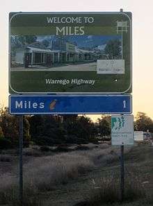
The town is on the Warrego Highway, 340 kilometres (210 mi) west of Brisbane, the state capital.
History
Formerly known as Dogwood Crossing, the town is situated on Dogwood Creek, named by German explorer Ludwig Leichhardt in 1844. The town was renamed Miles in honour of the Queensland Colonial Secretary, William Miles. Miles Post Office opened on 3 January 1878.[3]

The Miles War Memorial and Wall of Remembrance was erected by the Murilla Shire Council and dedicated on 25 April 1967.[4]
Climate
Miles is located on the Western Downs, at an elevation of 304 m. The region around Miles has hot summers with mean maximum temperatures in January of 33.4° Celsius falling to 19.6 in July. Average rainfall is 655.7 mm, falling mainly in the period between November and March[5]
| Climate data for Miles (Combined sites, 1885–2014) | |||||||||||||
|---|---|---|---|---|---|---|---|---|---|---|---|---|---|
| Month | Jan | Feb | Mar | Apr | May | Jun | Jul | Aug | Sep | Oct | Nov | Dec | Year |
| Record high °C (°F) | 43.2 (109.8) |
42.1 (107.8) |
41.4 (106.5) |
36.1 (97) |
33.0 (91.4) |
31.1 (88) |
28.4 (83.1) |
36.2 (97.2) |
39.9 (103.8) |
40.7 (105.3) |
41.9 (107.4) |
43.8 (110.8) |
43.8 (110.8) |
| Average high °C (°F) | 33.4 (92.1) |
32.4 (90.3) |
31.0 (87.8) |
27.7 (81.9) |
23.5 (74.3) |
20.0 (68) |
19.6 (67.3) |
21.9 (71.4) |
25.8 (78.4) |
29.0 (84.2) |
31.0 (87.8) |
32.7 (90.9) |
27.3 (81.1) |
| Average low °C (°F) | 19.9 (67.8) |
19.6 (67.3) |
17.3 (63.1) |
12.9 (55.2) |
7.8 (46) |
5.4 (41.7) |
3.9 (39) |
5.1 (41.2) |
9.3 (48.7) |
13.4 (56.1) |
16.7 (62.1) |
18.8 (65.8) |
12.5 (54.5) |
| Record low °C (°F) | 10.9 (51.6) |
7.4 (45.3) |
4.3 (39.7) |
0.1 (32.2) |
−4.4 (24.1) |
−5.0 (23) |
−6.1 (21) |
−4.9 (23.2) |
−2.2 (28) |
−0.6 (30.9) |
3.4 (38.1) |
7.9 (46.2) |
−6.1 (21) |
| Average rainfall mm (inches) | 84.7 (3.335) |
75.4 (2.969) |
56.3 (2.217) |
35.1 (1.382) |
33.6 (1.323) |
40.6 (1.598) |
26.6 (1.047) |
31.4 (1.236) |
26.1 (1.028) |
43.8 (1.724) |
60.6 (2.386) |
94.6 (3.724) |
608.8 (23.969) |
| Average rainy days (≥ 0.2mm) | 8.0 | 7.5 | 5.9 | 4.7 | 5.2 | 5.7 | 5.0 | 4.2 | 4.4 | 6.2 | 8.0 | 8.6 | 73.4 |
| Source: Bureau of Meteorology[6][7] | |||||||||||||
Industry
The economy of Miles is based mainly on agriculture and cropping, producing wheat, sorghum, barley and cotton. Timber production is another area of economic activity and in common with much of Western Queensland, cattle and sheep grazing, including feedlots is widespread.
A mining industry utilising rich deposits of bentonite clay is developing.[8]
In addition, there are the following developing industries:
Transport
Miles is connected to Brisbane, Toowoomba and Roma by the Warrego Highway and Goondiwindi and Rockhampton by the Leichhardt Highway. Greyhound Australia operates 3 daily bus services between Brisbane and Mount Isa via Longreach and Charleville, and Coach QLD operates three buses a week between Toowoomba and Rockhampton, via Miles. The Westlander train also comes through Miles twice a week, on its way between Brisbane and Charleville, at very early hours of Wednesday & Friday mornings (westbound) and Thursdays & Saturdays (Eastbound).
The town is served by the Miles Airport (IATA: WLE) which is located along the Leichhardt Highway approximately 19 km (12 mi) south of the Leichhardt and Warrego Highway intersection, Miles, Queensland, and 14 km (8.7 mi) north of the Leichhardt Highway and Roma-Condamine Road intersection, Condamine, Queensland.
References
- 1 2 Australian Bureau of Statistics (31 October 2012). "Miles (Urban Centre/Locality)". 2011 Census QuickStats. Retrieved 2008-07-05.
- ↑ Bureau of Meteorology. Retrieved on 2008-07-05.
- ↑ Premier Postal History. "Post Office List". Premier Postal Auctions. Retrieved 10 May 2014.
- ↑ "Miles War Memorial and Wall of RemembrancePrint Page". Monument Australia. Retrieved 3 April 2014.
- ↑ Bureau of Meteorology (Australia) Retrieved 22 October 2006
- ↑ "MILES CONSTANCE STREET". Climate statistics for Australian locations. Bureau of Meteorology. January 2014. Retrieved 7 January 2014.
- ↑ "MILES POST OFFICE". Climate statistics for Australian locations. Bureau of Meteorology. January 2014. Retrieved 7 January 2014.
- ↑ "Queensland Department of State Development and Industry" Retrieved 22 October 2006
External links
![]() Media related to Miles, Queensland at Wikimedia Commons
Media related to Miles, Queensland at Wikimedia Commons
- University of Queensland: Queensland Places: Miles
- Sydney Morning Herald Travel
- Dogwood Crossing - The local gallery, library and IT resource centre.