Minamiaizu
| Minamiaizu 南会津町 | |||
|---|---|---|---|
| Town | |||
|
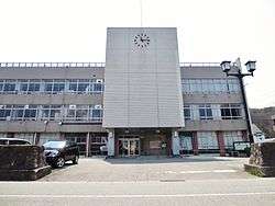
Minamiaizu Town Hall | |||
| |||
|
Location of Minamiaizu in Fukushima Prefecture | |||
 Minamiaizu
| |||
| Coordinates: 37°12′1″N 139°46′24″E / 37.20028°N 139.77333°ECoordinates: 37°12′1″N 139°46′24″E / 37.20028°N 139.77333°E | |||
| Country | Japan | ||
| Region | Tōhoku | ||
| Prefecture | Fukushima Prefecture | ||
| District | Minamiaizu District | ||
| Area | |||
| • Total | 886.52 km2 (342.29 sq mi) | ||
| Population (September 2014) | |||
| • Total | 16,516 | ||
| • Density | 18.6/km2 (48/sq mi) | ||
| Time zone | Japan Standard Time (UTC+9) | ||
| Phone number | 0241-62-6100 | ||
| Address | 3531-1 Tajima Gohara, MInamiaizu-machi, MInamiaizu-gun, Fukushima-ken 967-0004 | ||
| Website | Official HP | ||
Minamiaizu (南会津町 Minamiaizu-machi) is a town located in Minamiaizu District, Fukushima Prefecture, in northern Honshū, Japan. As of September 2014, the town had an estimated population of 16,516 and a population density of 18.6 persons per km². The total area was 886.52 km².
Geography
MInamiaizu is located the in mountainous southern portion of the Aizu region of Fukushima Prefecture, bordered Tochigi Prefecture to the south. The climate is like many other parts of northern Japan, with cold winters and heavy snowfalls.
- Mountains : Onsabi Mountains, Nasudake, Mount Nanatsugadake
- Rivers : Okawa, Ina River
Neighboring municipalities
History
The area of present-day Minamiaizu was part of ancient Mutsu Province and formed part of the holdings of Aizu Domain during the Edo period. After the Meiji Restoration, it was organized as part of Minamiaizu District.
Minamiaizu was formed on March 20, 2006 by the merging of Tajima (the largest town in Minamiaizu District) with the villages of Ina, Nangō, and Tateiwa to form a new administrative township.
Economy
The economy of Minamiaizu is primarily agricultural. Rice, tomatoes and asparagus are the main crops.
Education
- Fukushima Prefectural Tajima High School
- Fukushima Prefectural Minamiaizu High School
Transportation
Railway
- Aizu Railway – Aizu Line
- Yagan Railway – Aizu Kinugawa Line
Highway
- Japan National Route 121
- Japan National Route 289
- Japan National Route 352
- Japan National Route 400
- Japan National Route 401
Local attractions
- Okuaizu Museum
- Komado Wetlands
- Tashiroyama Wetlands
- Yunohama Onsen
- Hosoi Residence Museum
- Ōuichi-juku
- Tsuruga Castle
- Maezawa Magariya Village (Museum of "L" Shaped Old Folk Houses)
Noted people from Minamiaizu
- Kozo Watanabe - politician
External links
-
 Media related to Minamiaizu at Wikimedia Commons
 - Official website (Japanese)
- Minamiaizu on Facebook (English)