Samegawa, Fukushima
| Samegawa 鮫川村 | ||
|---|---|---|
| Town | ||
|
samegawa Village Hall | ||
| ||
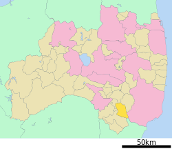
 Location of Samegawa in Fukushima Prefecture | ||
 Samegawa
| ||
| Coordinates: 37°02′33″N 140°30′35″E / 37.04250°N 140.50972°ECoordinates: 37°02′33″N 140°30′35″E / 37.04250°N 140.50972°E | ||
| Country | Japan | |
| Region | Tōhoku | |
| Prefecture | Fukushima Prefecture | |
| District | Higashishirakawa District | |
| Area | ||
| • Total | 131.30 km2 (50.70 sq mi) | |
| Population (November 2014) | ||
| • Total | 3,665 | |
| • Density | 27.9/km2 (72/sq mi) | |
| Time zone | Japan Standard Time (UTC+9) | |
| City symbols | ||
| • Tree | White birch | |
| • Flower | Lilium auratum | |
| • Bird | Green pheasant | |
| • Insect | Sasakia charonda | |
| Phone number | 0247-49-3111 | |
| Address | 39-5 Akasaka Nakano Shinjuku, Tanagura, Samegawa-mura, Higashishirakawa-gun, Fukushima-ken 963-8401 | |
| Website | Official HP | |
Samegawa (鮫川村 Samegawa-mura) is a village located in Higashishirakawa District, Fukushima Prefecture, in northern Honshū, Japan. As of November 2014, the village had an estimated population of 3,665 and a population density of 27.9 persons per km2. The total area was 131.30 km2.
Geography
Samegawa is located in the southernmost portion of Fukushima prefecture, bordering on Ibaraki Prefecture to the southeast. The area of the village is hilly with an altitude of between 400 and 600 meters, and over fifty percent covered in forest.
Neighboring municipalities
History
The area of present-day Samegawa was part of ancient Mutsu Province. Most of the area formed part of the holdings of Tanagura Domain, in the Edo period. After the Meiji Restoration, it was organized as part of Nakadōri region of Iwaki Province.
Modern Samegawa village was formed on April 1, 1889 with the creation of the municipalities system.
Education
High schools
- Fukushima Prefectural Shumei Commercial High School
Junior High school
- Samegawa Junior High School
Transportation
Railway
- Samegawa is not served by any train stations
Highway
External links
![]() Media related to Samegawa, Fukushima at Wikimedia Commons
Media related to Samegawa, Fukushima at Wikimedia Commons
- Official website (Japanese)