Nakajima, Fukushima
| Nakajima 中島村 | |||
|---|---|---|---|
| Village | |||
|
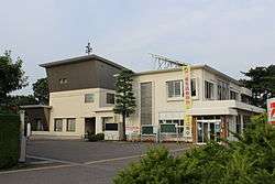
Nakajima Village Hall | |||
| |||
|
Location of Nakajima in Fukushima Prefecture | |||
 Nakajima
| |||
| Coordinates: 37°8′56″N 140°21′0.6″E / 37.14889°N 140.350167°ECoordinates: 37°8′56″N 140°21′0.6″E / 37.14889°N 140.350167°E | |||
| Country | Japan | ||
| Region | Tōhoku | ||
| Prefecture | Fukushima Prefecture | ||
| District | Nishishirakawa District | ||
| Area | |||
| • Total | 18.91 km2 (7.30 sq mi) | ||
| Population (November 2014) | |||
| • Total | 5,022 | ||
| • Density | 266/km2 (690/sq mi) | ||
| Time zone | Japan Standard Time (UTC+9) | ||
| - Tree | Pinus densiflora | ||
| - Flower | Rhododendron indicum | ||
| Phone number | 0248-52-2111 | ||
| Address | Nametsu Nakajima-nishi 11-1 Nakajima-mura, Nishishirakawa-gun, Fukushima-ken 961-0192 | ||
| Website | Official HP | ||
| 〒961-0192 | |||
Nakajima (中島村 Nakajima-mura) is a village located in Nishishirakawa District, Fukushima Prefecture, in northern Honshū, Japan. As of November 2014, the village had an estimated population of 5,022 and a population density of 266 persons per km². The total area was 18.91 km².
Geography
Nakajima is located in the flatlands of south-central Fukushima prefecture.
- Rivers: Abukuma River
Neighboring municipalities
History
The area of present-day Nakajima was part of ancient Mutsu Province. The area was mostly tenryo territory under the direct control of the Tokugawa shogunate during the Edo period, except for a portion which was under the control of Takeda Domain of Echigo Province. After the Meiji Restoration, it was organized as part of Nakadōri region of Iwaki Province.
Nakajima Village was formed on January 1, 1955 through the merger of the villages of Nametsu and Yoshikogawa.
Economy
The economy of Nakajima is primarily agricultural.
Education
- Nakajima Middle School
Transportation
Railway
- Nakajma is not served by any train station
Highway
- Nakajima is not served by any national highway
External links
![]() Media related to Nakajima, Fukushima at Wikimedia Commons
Media related to Nakajima, Fukushima at Wikimedia Commons
- Official website (Japanese)