Ōkuma, Fukushima
| Ōkuma 大熊町 | |||
|---|---|---|---|
| Town | |||
|
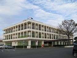
Ōkuma Town Hall | |||
| |||
|
Location of Ōkuma in Fukushima Prefecture | |||
 Ōkuma
| |||
| Coordinates: 37°24′16″N 140°59′1″E / 37.40444°N 140.98361°ECoordinates: 37°24′16″N 140°59′1″E / 37.40444°N 140.98361°E | |||
| Country | Japan | ||
| Region | Tōhoku | ||
| Prefecture | Fukushima | ||
| District | Futaba | ||
| Area | |||
| • Total | 78.70 km2 (30.39 sq mi) | ||
| Population (October 2016) | |||
| • Total | 0 | ||
| • Density | 0/km2 (0/sq mi) | ||
| Time zone | Japan Standard Time (UTC+9) | ||
| - Tree | Momi fir | ||
| - Flower | Nashi pear | ||
| - Bird | Black kite | ||
| Phone number | 0120-26-3844 | ||
| Address | Shimonogami Ōno 634, Ōkuma-machi, Futaba-gun, Fukushima-ken 979-1308 | ||
| Website | Official website | ||
Ōkuma (大熊町 Ōkuma-machi) is a town located in Futaba District, Fukushima Prefecture, Japan. In 2010, the town had a population of 11,515[1] However, the town was totally evacuated in the aftermath of the Fukushima Daiichi nuclear disaster and residents have been permitted return during daylight hours from May 2013. As of November 2016, the town had an official registered population of 10,700, however this number is due to the municipality continuing to keep track of its residents despite them having been evacuated elsewhere throughout the country.[2] The total area was 78.70 square kilometres (30.39 sq mi).[3]
Geography
Ōkuma is located on the Pacific Ocean coastline of central Fukushima. Ōkuma lies in the center of the Hamadōri region of Fukushima, bordered to the west by the Abukuma Highlands and to the east by the Pacific Ocean. It is set between the cities of Namie and Futaba to the north, Tamura to the west, and Kawauchi and Tomioka to the south. The town is the site of the Fukushima Daiichi Nuclear Power Plant.
Mt. Higakure (日隠山 Higakure-yama), with a height of 601.5 meters, is within the city. The Kuma River (熊川 Kuma-gawa) also flows within the city.
Surrounding municipalities
History
Early history of the area
The area of present-day Ōkuma was part of Mutsu Province. While historical records are unclear, it is believed that the area of present-day Ōkuma was ruled by the Shineha clan beginning in the mid-12th century. Later, during the Sengoku period, in December 1492 the Sōma clan defeated the Shineha clan, and the area transferred to the Sōma clan's control.[4][5]
During the Edo period, the Kumagawa Post Town (熊川宿 Kumagawa-juku) was established along the Iwaki-Sōma Road (岩城相馬街道), also referred as Coastal Road (浜通り Hamadōri), in the area of present-day Ōkuma. The Iwaki-Sōma Road connected the region to Mito in the south and Sendai in the north. Modern-day National Route 6, which runs through Ōkuma, generally follows the same route as the Iwaki-Sōma Road.[6]
Creation of the municipality
In 1888, the national government passed the Municipal Government Act (市制町村制 Shi-sei Chōson-sei), and in accordance with the act, on 1 April of the following year the villages of Ōno (大野村 Ōno-mura) and Kumamachi (熊町村 Kumamachi-mura) were inaugurated as parts of the district of Shineha (標葉郡 Shineha-gun).
On 1 April 1896, the Shineha district merged with the district of Naraha (楢葉郡 Naraha-gun) to become the present-day district of Futaba. Over a half a century later, on 11 November 1954, the villages of Ōno and Kumamachi merged to form the present-day town of Ōkuma.
From coal mining to nuclear power
Beginning during the 1870s, coal mining became an integral part of the economy of the Hamadōri region. This continued through the beginning stages of Japan's post-World War II rapid economic growth period, leading Fukushima Prefecture to lag behind the country as a whole in industrial and economic development. In the tail end of the 1950s, the prefecture began promoting electricity generation as a way to alleviate the economic problems on the horizon from the impending closure of the coal mines.
On 30 September – 22 October 1961 the town councils of Futaba and Ōkuma, respectively, unanimously voted to invite Tokyo Electric Power Company to build a nuclear power plant on the border of the two towns.[7] In September 1967 construction began on unit one of the Fukushima Daiichi Nuclear Power Plant. By October 1978, units one through four, which are on the Ōkuma side of the plant, had been commissioned. Units five and six (on the Futaba side) were commissioned by March 1979.[8]
2011 Tōhoku earthquake, tsunami, and nuclear disaster
On 11 March 2011 the 2011 Tōhoku earthquake and tsunami occurred. The earthquake and tsunami caused severe damage to Ōkuma, especially devastating coastal areas. The tsunami hit and flooded the Fukushima Daiichi Nuclear Power Plant, located on the Pacific coast of Ōkuma, and set off the Fukushima Daiichi nuclear disaster. By the following morning, the Japanese government had ordered residents to evacuate to outside of a 10 km radius of the power plant. Many residents were evacuated to the nearby city of Tamura, among other cities.[9]
Shortly thereafter Ōkuma set up a temporary town office in the Tamura City General Gymnasium (田村市総合体育館 Tamura-shi Sōgō Taiikukan). The temporary town office was later moved on 3 April to Aizuwakamatsu. Ōkuma residents had scattered to about 20 evacuation centers located in the cities of Tamura and Kōriyama and the towns of Miharu and Ono, and by 30 April approximately 1,800 residents had expressed the desire to also move to Aizuwakamatsu.[10]
On 10 December 2012 Ōkuma modified the areas of the town under evacuation orders and permitted residents of select regions of the town to return to their homes. Within the first 19 days 104 residents returned, however other residents of Ōkuma, like some other communities in Fukushima, are "starting to come to terms with a sobering realization: their old homes are probably lost forever, and they must start anew elsewhere."[11]
As of 2015, the town is aiming to develop a forested area for inhabitation by 2018.[12] The seaside area of the town, which was once heavily populated, will be turned into a nature reserve.[13]
Education
Ōkuma formerly had one high school, one middle school and three elementary schools.
Transportation
Railway
(At present, all train services are suspended)[14]
Highway
International relations
 – Bathurst, New South Wales, Australia, since March 1991[15]
References
- ↑ Satoshi Narita (5 August 2011). "統計Today No.41: 被災3県(岩手県、宮城県及び福島県)の沿岸地域の状況" (in Japanese). Ministry of Internal Affairs and Communications Statistics Bureau. Retrieved 7 May 2012.
- ↑ "大熊町の避難状況" (in Japanese). Ōkuma-machi. 7 November 2016. Retrieved 28 November 2016.
- ↑ "Ōkuma official home page" (in Japanese). Japan: Ōkuma Town.
- ↑ 武家家伝_標葉氏 [Samurai Family History: Shineha Clan] (in Japanese). 戦国武将の家紋. Retrieved 26 June 2012.
- ↑ Fujiwara, Ichirō (1 December 2011). 相馬の歴史講座 [Lecture on Sōma History] (in Japanese). Sōma City. Retrieved 26 June 2012.
- ↑ 百街道一歩の岩城相馬街道 [A Step on a Hundred Roads: Iwaki-Sōma Road] (in Japanese). 3 September 2011. Retrieved 26 June 2012.
- ↑ 横須賀正雄 (1968). 東電・福島原子力発電所の用地交渉報告. 用地補償実務例 第1 (in Japanese). 日本ダム協会: 60–61.
- ↑ "Fukushima Daiichi Information Screen". Icjt.org. Retrieved 8 May 2012.
- ↑ 【覆された備え11】再避難 強いられ分散 所在確認 今も続く (in Japanese). The Fukushima Minpo newspaper. 29 April 2012. Retrieved 8 May 2012.
- ↑ 東日本大震災特報 写真特集 (in Japanese). The Fukushima Minpo newspaper. 31 March 2011. Retrieved 8 May 2012.
- ↑ Tabuchi, Hiroko (11 March 2013). "Uprooted by Tsunami, Church's Flock Regroups". New York Times. Retrieved 25 March 2013.
- ↑ 大熊町、2018年度の居住再開めざす 時期の表明は初
- ↑ 2013 Interim Report
- ↑ 長期運転見合わせ区間 [Area of Long-Term Train Cancellations] (PDF) (in Japanese). East Japan Railway Company. 5 June 2012. Retrieved 26 June 2012.
- ↑ "Council Sister City". Bathhurst Regional council. Retrieved 2 Feb 2014.
External links
| Wikimedia Commons has media related to Okuma, Fukushima. |
- Official website (Japanese)
| Geology | |||||||||||||
|---|---|---|---|---|---|---|---|---|---|---|---|---|---|
| Affected areas | |||||||||||||
| Affected infrastructure | |||||||||||||
| Fukushima Daiichi nuclear disaster |
| ||||||||||||
| Aftershocks |
| ||||||||||||
| People | |||||||||||||
| Fundraisers | |||||||||||||
| Other | |||||||||||||