Penns Grove, New Jersey
| Penns Grove, New Jersey | |
|---|---|
| Borough | |
| Borough of Penns Grove | |
|
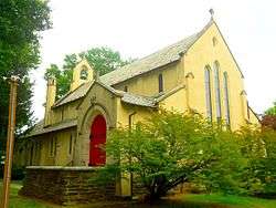
Church of Our Merciful Saviour | |
| Motto: Pride in Progress[1] | |
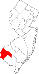
 Penns Grove Borough highlighted in Salem County. Inset map: Salem County highlighted in the State of New Jersey. | |
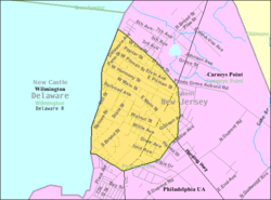 Census Bureau map of Penns Grove, New Jersey | |
| Coordinates: 39°43′38″N 75°28′04″W / 39.727355°N 75.467698°WCoordinates: 39°43′38″N 75°28′04″W / 39.727355°N 75.467698°W[2][3] | |
| Country |
|
| State |
|
| County | Salem |
| Incorporated | March 8, 1894 |
| Named for | William Penn |
| Government[4] | |
| • Type | Borough |
| • Body | Borough Council |
| • Mayor | John A. Washington, Sr. (D, term ends December 31, 2019)[5][6] |
| • Clerk | Sharon R. Williams[7] |
| Area[2] | |
| • Total | 0.912 sq mi (2.361 km2) |
| • Land | 0.910 sq mi (2.357 km2) |
| • Water | 0.002 sq mi (0.004 km2) 0.18% |
| Area rank |
512th of 566 in state 14th of 15 in county[2] |
| Elevation[8] | 7 ft (2 m) |
| Population (2010 Census)[9][10][11] | |
| • Total | 5,147 |
| • Estimate (2015)[12] | 4,945 |
| • Rank |
373rd of 566 in state 4th of 15 in county[13] |
| • Density | 5,656.0/sq mi (2,183.8/km2) |
| • Density rank |
92nd of 566 in state 1st of 15 in county[13] |
| Time zone | Eastern (EST) (UTC-5) |
| • Summer (DST) | Eastern (EDT) (UTC-4) |
| ZIP code | 08069[14][15] |
| Area code(s) | 856 exchanges: 299, 351[16] |
| FIPS code | 3403357750[2][17][18] |
| GNIS feature ID | 0885348[2][19] |
| Website |
www |
Penns Grove is a borough in Salem County, New Jersey, United States. As of the 2010 United States Census, the borough's population was 5,147,[9][10][11] reflecting an increase of 261 (+5.3%) from the 4,886 counted in the 2000 Census, which had in turn declined by 342 (-6.5%) from the 5,228 counted in the 1990 Census.[20]
History
This area was long primarily agricultural. Penns Grove was incorporated as a borough by an act of the New Jersey Legislature on March 8, 1894, from portions of Upper Penns Neck Township (now Carneys Point Township), based on the results of a referendum held two days earlier.[21] It began to industrialize around this time. The borough's name comes from William Penn.[22][23]
In the early 20th century, many Italian immigrants from Valle San Giovanni and the surrounding southern province of Teramo came to work at the local E.I. DuPont de Nemours plant in Carneys Point. Many settled on Pitman Street in Penns Grove. In 1925, the Italian community arranged to commission a copy of the statue of the Madonna and Child from the Chiesa della Madonna delle Grazie in Teramo, and had it installed in the Saint James Roman Catholic Church in Penns Grove.[24] Other immigrants from eastern Europe also settled in the county, markedly increasing the population.
Also in the 20th century, this area became a destination for Black Americans in the Great Migration who came north for industrial jobs. Some Black Americans in the area were descended from slave families from the colonial and early federal period. Since the late 20th century, new immigrants have arrived from Central and South America, and are among the rising Latino minority.
Geography
According to the United States Census Bureau, the borough had a total area of 0.912 square miles (2.361 km2), including 0.910 square miles (2.357 km2) of land and 0.002 square miles (0.004 km2) of water (0.18%).[2][3]
The borough borders Carneys Point Township and the Delaware River. The borough is located across the Delaware River from Wilmington, which is part of the Delaware Valley, and 33 miles (53 km) south of Philadelphia.
Demographics
| Historical population | |||
|---|---|---|---|
| Census | Pop. | %± | |
| 1900 | 1,826 | — | |
| 1910 | 2,118 | 16.0% | |
| 1920 | 6,060 | 186.1% | |
| 1930 | 5,895 | −2.7% | |
| 1940 | 6,488 | 10.1% | |
| 1950 | 6,669 | 2.8% | |
| 1960 | 6,176 | −7.4% | |
| 1970 | 5,727 | −7.3% | |
| 1980 | 5,760 | 0.6% | |
| 1990 | 5,228 | −9.2% | |
| 2000 | 4,886 | −6.5% | |
| 2010 | 5,147 | 5.3% | |
| Est. 2015 | 4,945 | [12][25] | −3.9% |
| Population sources: 1900-2000[26] 1900-1920[27] 1900-1910[28] 1910-1930[29] 1930-1990[30] 2000[31][32] 2010[9][10][11] | |||
Census 2010
The 2010 United States Census counted 5,147 people, 1,801 households, and 1,235 families residing in the borough. The population density was 5,656.0 per square mile (2,183.8/km2). The borough contained 2,004 housing units at an average density of 2,202.2 per square mile (850.3/km2). The racial makeup of the borough was 41.83% (2,153) White, 39.77% (2,047) Black or African American, 0.66% (34) Native American, 0.49% (25) Asian, 0.00% (0) Pacific Islander, 12.40% (638) from other races, and 4.86% (250) from two or more races. Hispanics or Latinos of any race were 28.27% (1,455) of the population.[9]
Out of a total of 1,801 households, 36.8% had children under the age of 18 living with them, 29.9% were married couples living together, 31.6% had a female householder with no husband present, and 31.4% were non-families. 25.3% of all households were made up of individuals, and 9.4% had someone living alone who was 65 years of age or older. The average household size was 2.85 and the average family size was 3.38.[9]
In the borough, 32.3% of the population were under the age of 18, 10.1% from 18 to 24, 26.9% from 25 to 44, 21.2% from 45 to 64, and 9.5% who were 65 years of age or older. The median age was 29.7 years. For every 100 females the census counted 89.5 males, but for 100 females at least 18 years old, it was 82.5 males.[9]
The Census Bureau's 2006-2010 American Community Survey showed that (in 2010 inflation-adjusted dollars) median household income was $30,104 (with a margin of error of +/- $9,093) and the median family income was $37,663 (+/- $9,442). Males had a median income of $42,908 (+/- $8,706) versus $30,353 (+/- $5,538) for females. The per capita income for the borough was $15,785 (+/- $2,169). About 28.1% of families and 28.2% of the population were below the poverty line, including 41.2% of those under age 18 and 15.8% of those age 65 or over.[33]
Census 2000
As of the 2000 United States Census[17] there were 4,886 people, 1,827 households, and 1,231 families residing in the borough. The population density was 5,275.8 people per square mile (2,028.5/km2). There were 2,075 housing units at an average density of 2,240.5 per square mile (861.5/km2). The racial makeup of the borough was 48.85% White, 39.75% African American, 0.37% Native American, 0.29% Asian, 0.16% Pacific Islander, 8.13% from other races, and 2.46% from two or more races. Hispanic or Latino of any race were 17.29% of the population.[31][32]
There were 1,827 households out of which 38.4% had children under the age of 18 living with them, 34.6% were married couples living together, 27.5% had a female householder with no husband present, and 32.6% were non-families. 28.1% of all households were made up of individuals and 13.0% had someone living alone who was 65 years of age or older. The average household size was 2.67 and the average family size was 3.26.[31][32]
In the borough the population was spread out with 33.0% under the age of 18, 8.9% from 18 to 24, 27.9% from 25 to 44, 18.5% from 45 to 64, and 11.8% who were 65 years of age or older. The median age was 31 years. For every 100 females there were 85.5 males. For every 100 females age 18 and over, there were 79.6 males.[31][32]
The median income for a household in the borough was $26,227, and the median income for a family was $34,076. Males had a median income of $30,871 versus $20,983 for females. The per capita income for the borough was $13,330. About 18.1% of families and 21.0% of the population were below the poverty line, including 29.1% of those under age 18 and 13.3% of those age 65 or over.[31][32]
Government
Local government
Penns Grove is governed under the Borough form of New Jersey municipal government. The governing body consists of a Mayor and a Borough Council comprising six council members, with all positions elected at-large on a partisan basis as part of the November general election. A Mayor is elected directly by the voters to a four-year term of office. The Borough Council consists of six members elected to serve three-year terms on a staggered basis, with two seats coming up for election each year in a three-year cycle.[4] The Borough form of government used by Penns Grove, the most common system used in the state, is a "weak mayor / strong council" government in which council members act as the legislative body with the mayor presiding at meetings and voting only in the event of a tie. The mayor can veto ordinances subject to an override by a two-thirds majority vote of the council. The mayor makes committee and liaison assignments for council members, and most appointments are made by the mayor with the advice and consent of the council.[34][35]
As of 2016, the Mayor of Penns Grove is Democrat John A. Washington, Sr., whose term of office ends December 31, 2019. Members of the Borough Council are Council President Clifford E. Poindexter (D, 2016), Bertha N. Burl (D, 2017), Roxzanne Forman (D, 2018), Mark Oliver (D, 2017), Deborah Scott (D, 2018) and Carl J. Washington, Jr. (D, 2016).[5][36][37][38][39][40][41]
In February 2014, the Borough Council selected Ulpiano Padilla and Deborah Scott from lists of names nominated by the Democratic municipal committee to fill the vacant seats of Darwin Coleman and Stephanie Stewart.[42]
Federal, state and county representation
Penns Grove is located in the 2nd Congressional District[43] and is part of New Jersey's 3rd state legislative district.[10][44][45]
New Jersey's Second Congressional District is represented by Frank LoBiondo (R, Ventnor City).[46] New Jersey is represented in the United States Senate by Cory Booker (D, Newark, term ends 2021)[47] and Bob Menendez (D, Paramus, 2019).[48][49]
For the 2016–2017 session (Senate, General Assembly), the 3rd Legislative District of the New Jersey Legislature is represented in the State Senate by Stephen M. Sweeney (D, West Deptford Township) and in the General Assembly by John J. Burzichelli (D, Paulsboro) and Adam Taliaferro (D, Woolwich Township).[50] The Governor of New Jersey is Chris Christie (R, Mendham Township).[51] The Lieutenant Governor of New Jersey is Kim Guadagno (R, Monmouth Beach).[52]
Salem County is governed by a seven-member Board of Chosen Freeholders who are elected at-large to serve three-year terms of office on a staggered basis, with either two or three seats coming up for election each year. At an annual reorganization meeting held in the beginning of January, the board selects a Director and a Deputy Director from among its members. As of 2014, Salem County's Freeholders (with party, residence, term-end year and committee chairmanship listed in parentheses) are Director Julie A. Acton (R, Pennsville Township, 2016; Administration), Deputy Director Dale A. Cross (R, Pennsville Township, 2014; Public Safety), Bruce L. Bobbitt (D, Pilesgrove Township, 2014; Public Services), Ben Laury (R, Elmer, 2015; Public Works) Beth E. Timberman (D, Woodstown, 2015; Social Services), Robert J. Vanderslice (R, Pennsville Township, 2014; Health and Human Services) Lee R. Ware (D, Elsinboro Township, 2016; Transportation, Agriculture and Cultural Affairs).[53][54] Constitutional officers elected on a countywide basis are County Clerk Gilda T. Gill (2014),[55] Sheriff Charles M. Miller (2015)[56] and Surrogate Nicki A. Burke (2015).[57][58]
Politics
As of March 23, 2011, there were a total of 2,697 registered voters in Penns Grove, of which 1,482 (54.9% vs. 30.6% countywide) were registered as Democrats, 170 (6.3% vs. 21.0%) were registered as Republicans and 1,045 (38.7% vs. 48.4%) were registered as Unaffiliated. There were no voters registered to other parties.[59] Among the borough's 2010 Census population, 52.4% (vs. 64.6% in Salem County) were registered to vote, including 77.4% of those ages 18 and over (vs. 84.4% countywide).[59][60]
In the 2012 presidential election, Democrat Barack Obama received 81.6% of the vote (1,234 cast), ahead of Republican Mitt Romney with 17.5% (265 votes), and other candidates with 0.9% (13 votes), among the 1,524 ballots cast by the borough's 2,902 registered voters (12 ballots were spoiled), for a turnout of 52.5%.[61][62] In the 2008 presidential election, Democrat Barack Obama received 1,349 votes (76.0% vs. 50.4% countywide), ahead of Republican John McCain with 314 votes (17.7% vs. 46.6%) and other candidates with 13 votes (0.7% vs. 1.6%), among the 1,774 ballots cast by the borough's 3,108 registered voters, for a turnout of 57.1% (vs. 71.8% in Salem County).[63] In the 2004 presidential election, Democrat John Kerry received 1,003 votes (68.0% vs. 45.9% countywide), ahead of Republican George W. Bush with 444 votes (30.1% vs. 52.5%) and other candidates with 14 votes (0.9% vs. 1.0%), among the 1,474 ballots cast by the borough's 2,671 registered voters, for a turnout of 55.2% (vs. 71.0% in the whole county).[64]
In the 2013 gubernatorial election, Democrat Barbara Buono received 51.4% of the vote (414 cast), ahead of Republican Chris Christie with 44.3% (357 votes), and other candidates with 4.2% (34 votes), among the 915 ballots cast by the borough's 2,793 registered voters (110 ballots were spoiled), for a turnout of 32.8%.[65][66] In the 2009 gubernatorial election, Democrat Jon Corzine received 491 ballots cast (58.2% vs. 39.9% countywide), ahead of Republican Chris Christie with 205 votes (24.3% vs. 46.1%), Independent Chris Daggett with 56 votes (6.6% vs. 9.7%) and other candidates with 40 votes (4.7% vs. 2.0%), among the 844 ballots cast by the borough's 3,009 registered voters, yielding a 28.0% turnout (vs. 47.3% in the county).[67]
Education
Students in public school for Kindergarten through twelfth grade attend the Penns Grove-Carneys Point Regional School District, together with students from Carneys Point Township. As of the 2011-12 school year, the district's five schools had an enrollment of 2,312 students and 202.0 classroom teachers (on an FTE basis), for a student–teacher ratio of 11.45:1.[68] Schools in the district (with 2011-12 enrollment data from the National Center for Education Statistics[69]) are Lafayette-Pershing School[70] for grades Pre-K to K (368 students), Field Street School[71] for grades 1 - 3 (519), Paul W. Carleton School[72] for grades 4 and 5 (344), Penns Grove Middle School[73] for grades 6 - 8 (516) and Penns Grove High School[74] grades 9 - 12 (565).[75][76]
A majority of students in ninth through twelfth grades from Oldmans Township, New Jersey attend the district's high school as part of a sending/receiving relationship with the Oldmans Township School District, with the balance attending Woodstown High School in the Woodstown-Pilesgrove Regional School District.[77][78]
Transportation
Roads and highways
As of May 2010, the borough had a total of 19.19 miles (30.88 km) of roadways, of which 13.76 miles (22.14 km) were maintained by the municipality, 4.14 miles (6.66 km) by Salem County and 1.29 miles (2.08 km) by the New Jersey Department of Transportation.[79]
U.S. Route 130 (locally called Virginia Avenue)[80] and Route 48 (starting at its western terminus and called Main Street within Penns Grove)[81] both pass through the borough.
Public transportation
New Jersey Transit provides bus service between the borough and Philadelphia on the 402 route and to Woodstown on the 468 route.[82][83]
Notable people
People who were born in, residents of, or otherwise closely associated with Penns Grove include:
- Giuseppe Bracale, alias "Joe Firpo", welterweight boxing champion.[84]
- Don Bragg (born 1935), Gold medal winner in the pole vault at the 1960 Summer Olympics held in Rome, Italy.[85]
- Roy Elsh (1892–1978), professional baseball player.[86]
- John Forsythe (1918–2010), television and character actor.[87]
- Paul Foster (born 1931), playwright.[88]
- Ernest Martin Hennings (1888-1956), landscape and portrait painter who was a memberof the Taos Society of Artists.[89]
- Dave Romansky (born 1938), competitive racewalker who represented the United States at the 1968 Summer Olympics.[90]
- Bruce Willis (born 1955), actor, moved to Penns Grove as child and graduated from Penns Grove High School.[91]
References
- ↑ Home page, Borough of Penns Grove. Accessed August 12, 2012.
- 1 2 3 4 5 6 2010 Census Gazetteer Files: New Jersey County Subdivisions, United States Census Bureau. Accessed May 21, 2015.
- 1 2 US Gazetteer files: 2010, 2000, and 1990, United States Census Bureau. Accessed September 4, 2014.
- 1 2 2012 New Jersey Legislative District Data Book, Rutgers University Edward J. Bloustein School of Planning and Public Policy, March 2013, p. 19.
- 1 2 Committees, Borough of Penns Grove. Accessed July 30, 2016. As of date accessed, 2015 membership is listed.
- ↑ 2016 New Jersey Mayors Directory, New Jersey Department of Community Affairs. Accessed June 14, 2016.
- ↑ Municipal Clerk's Office, Borough of Penns Grove. Accessed July 30, 2016.
- ↑ U.S. Geological Survey Geographic Names Information System: Borough of Penns Grove, Geographic Names Information System. Accessed March 8, 2013.
- 1 2 3 4 5 6 DP-1 – Profile of General Population and Housing Characteristics: 2010 for Penns Grove borough, Salem County, New Jersey, United States Census Bureau. Accessed August 12, 2012.
- 1 2 3 4 Municipalities Grouped by 2011-2020 Legislative Districts, New Jersey Department of State, p. 2. Accessed January 6, 2013.
- 1 2 3 Profile of General Demographic Characteristics: 2010 for Penns Grove borough, New Jersey Department of Labor and Workforce Development. Accessed August 12, 2012.
- 1 2 PEPANNRES - Annual Estimates of the Resident Population: April 1, 2010 to July 1, 2015 - 2015 Population Estimates for New Jersey municipalities, United States Census Bureau. Accessed May 22, 2016.
- 1 2 GCT-PH1 Population, Housing Units, Area, and Density: 2010 – State – County Subdivision from the 2010 Census Summary File 1 for New Jersey, United States Census Bureau. Accessed January 17, 2013.
- ↑ Look Up a ZIP Code for Penns Grove, NJ, United States Postal Service. Accessed August 12, 2012.
- ↑ Zip Codes, State of New Jersey. Accessed August 29, 2013.
- ↑ Area Code Lookup - NPA NXX for Penns Grove, NJ, Area-Codes.com. Accessed August 29, 2013.
- 1 2 American FactFinder, United States Census Bureau. Accessed September 4, 2014.
- ↑ A Cure for the Common Codes: New Jersey, Missouri Census Data Center. Accessed August 12, 2008.
- ↑ US Board on Geographic Names, United States Geological Survey. Accessed September 4, 2014.
- ↑ Table 7. Population for the Counties and Municipalities in New Jersey: 1990, 2000 and 2010, New Jersey Department of Labor and Workforce Development, February 2011. Accessed August 12, 2012.
- ↑ Snyder, John P. The Story of New Jersey's Civil Boundaries: 1606-1968, Bureau of Geology and Topography; Trenton, New Jersey; 1969. p. 216. Accessed April 17, 2012.
- ↑ Hutchinson, Viola L. The Origin of New Jersey Place Names, New Jersey Public Library Commission, May 1945. Accessed September 16, 2015.
- ↑ Penns Grove, NJ, DiscoverSalemCounty.com. Accessed September 17, 2015. "ohn Fenwick and William Penn later owned this land, the town was later named in honor of William Penn."
- ↑ Relationship of Valle San Giovanni & Penns Grove, NJ, Valle San Giovanni. Accessed October 31, 2013.
- ↑ Census Estimates for New Jersey April 1, 2010 to July 1, 2015, United States Census Bureau. Accessed May 22, 2016.
- ↑ Barnett, Bob. Population Data for Salem County Municipalities, 1810–2000, WestJersey.org, January 6, 2011. Accessed January 17, 2013.
- ↑ Compendium of censuses 1726-1905: together with the tabulated returns of 1905, New Jersey Department of State, 1906. Accessed October 31, 2013.
- ↑ Thirteenth Census of the United States, 1910: Population by Counties and Minor Civil Divisions, 1910, 1900, 1890, United States Census Bureau, p. 338. Accessed January 17, 2013.
- ↑ Fifteenth Census of the United States : 1930 – Population Volume I, United States Census Bureau, p. 718. Accessed January 17, 2013.
- ↑ Table 6. New Jersey Resident Population by Municipality: 1930 - 1990, New Jersey Department of Labor and Workforce Development. Accessed June 28, 2015.
- 1 2 3 4 5 Census 2000 Profiles of Demographic / Social / Economic / Housing Characteristics for Penns Grove borough, New Jersey, United States Census Bureau. Accessed August 12, 2012.
- 1 2 3 4 5 DP-1: Profile of General Demographic Characteristics: 2000 – Census 2000 Summary File 1 (SF 1) 100-Percent Data for Penns Grove borough, Salem County, New Jersey, United States Census Bureau. Accessed August 12, 2012.
- ↑ DP03: Selected Economic Characteristics from the 2006-2010 American Community Survey 5-Year Estimates for Penns Grove borough, Salem County, New Jersey, United States Census Bureau. Accessed August 12, 2012.
- ↑ Cerra, Michael F. "Forms of Government: Everything You've Always Wanted to Know, But Were Afraid to Ask", New Jersey State League of Municipalities. Accessed November 30, 2014.
- ↑ "Forms of Municipal Government in New Jersey", p. 6. Rutgers University Center for Government Studies. Accessed June 3, 2015.
- ↑ 2016 Municipal User Friendly Budget, Borough of Penns Grove. Accessed July 30, 2016.
- ↑ The Official Salem County Directory, Salem County, New Jersey, February 4, 2016. Accessed July 29, 2016.
- ↑ Municipalities in Salem County, Salem County, New Jersey Clerk. Accessed July 29, 2016.
- ↑ November 3, 2015 Summary Report Salem County Official Results, Salem County, New Jersey Clerk, updated January 13, 2016. Accessed July 29, 2016.
- ↑ November 4, 2014 Summary Report Salem County Official Results, Salem County, New Jersey Clerk, updated November 24, 2014. Accessed July 29, 2016.
- ↑ November 5, 2013 Summary Report Salem County Unofficial Results, Salem County, New Jersey, updated November 5, 2013. Accessed July 29, 2016.
- ↑ Young, Alex. "Two new members sworn in to Penns Grove Borough Council", South Jersey Times, February 6, 2014. Accessed August 17, 2015. "Ulpiano Padilla and Deborah Scott were sworn in to fill two seats that had been left vacant on council.Council members Darwin Coleman and Stephanie Stewart both submitted letters of resignation to the council, leaving two seats vacant for un-expired terms.... From the names provided by the committee, borough council tapped Padilla and Scott to fill the vacant seats of Stewart and Coleman respectively."
- ↑ Plan Components Report, New Jersey Redistricting Commission, December 23, 2011. Accessed January 6, 2013.
- ↑ 2016 New Jersey Citizen's Guide to Government, p. 62, New Jersey League of Women Voters. Accessed July 20, 2016.
- ↑ Districts by Number for 2011-2020, New Jersey Legislature. Accessed January 6, 2013.
- ↑ Directory of Representatives: New Jersey, United States House of Representatives. Accessed January 5, 2012.
- ↑ About Cory Booker, United States Senate. Accessed January 26, 2015. "He now owns a home and lives in Newark's Central Ward community."
- ↑ Biography of Bob Menendez, United States Senate, January 26, 2015. "He currently lives in Paramus and has two children, Alicia and Robert."
- ↑ Senators of the 114th Congress from New Jersey. United States Senate. Accessed January 26, 2015. "Booker, Cory A. - (D - NJ) Class II; Menendez, Robert - (D - NJ) Class I"
- ↑ Legislative Roster 2016-2017 Session, New Jersey Legislature. Accessed January 17, 2016.
- ↑ "About the Governor". State of New Jersey. Retrieved 2010-01-21.
- ↑ "About the Lieutenant Governor". State of New Jersey. Retrieved 2010-01-21.
- ↑ Board of Chosen Freeholders, Salem County, New Jersey. Accessed July 27, 2014.
- ↑ 2014 County Data Sheet, Salem County, New Jersey. Accessed July 27, 2014.
- ↑ County Clerk, Salem County Clerk's Office . Accessed July 27, 2014.
- ↑ Sheriff's Office, Salem County, New Jersey. Accessed July 27, 2014.
- ↑ Surrogate's Court, Salem County, New Jersey. Accessed July 27, 2014.
- ↑ The Official 2013 Salem County Directory, Salem County, New Jersey. Accessed July 27, 2014.
- 1 2 Voter Registration Summary – Salem, New Jersey Department of State Division of Elections, March 23, 2011. Accessed January 17, 2013.
- ↑ GCT-P7: Selected Age Groups: 2010 – State – County Subdivision; 2010 Census Summary File 1 for New Jersey, United States Census Bureau. Accessed January 17, 2013.
- ↑ "Presidential General Election Results - November 6, 2012 - Salem County" (PDF). New Jersey Department of Elections. March 15, 2013. Retrieved December 24, 2014.
- ↑ "Number of Registered Voters and Ballots Cast - November 6, 2012 - General Election Results - Salem County" (PDF). New Jersey Department of Elections. March 15, 2013. Retrieved December 24, 2014.
- ↑ 2008 Presidential General Election Results: Salem County, New Jersey Department of State Division of Elections, December 23, 2008. Accessed January 17, 2013.
- ↑ 2004 Presidential Election: Salem County, New Jersey Department of State Division of Elections, December 13, 2004. Accessed January 17, 2013.
- ↑ "Governor - Salem County" (PDF). New Jersey Department of Elections. January 29, 2014. Retrieved December 24, 2014.
- ↑ "Number of Registered Voters and Ballots Cast - November 5, 2013 - General Election Results - Salem County" (PDF). New Jersey Department of Elections. January 29, 2014. Retrieved December 24, 2014.
- ↑ 2009 Governor: Salem County, New Jersey Department of State Division of Elections, December 31, 2009. Accessed January 17, 2013.
- ↑ District information for Penns Grove-Carneys Point Regional School District, National Center for Education Statistics. Accessed October 20, 2014.
- ↑ School Data for the Penns Grove - Carneys Point Regional School District, National Center for Education Statistics. Accessed October 20, 2014.
- ↑ Lafayette-Pershing School, Penns Grove-Carneys Point Regional School District. Accessed September 2, 2013.
- ↑ Field Street School, Penns Grove-Carneys Point Regional School District. Accessed September 2, 2013.
- ↑ Paul W. Carleton School, Penns Grove-Carneys Point Regional School District. Accessed September 2, 2013.
- ↑ Penns Grove Middle School, Penns Grove-Carneys Point Regional School District. Accessed September 2, 2013.
- ↑ Penns Grove High School, Penns Grove-Carneys Point Regional School District. Accessed September 2, 2013.
- ↑ Schools, Penns Grove-Carneys Point Regional School District. Accessed September 2, 2013.
- ↑ New Jersey School Directory for the Penns Grove-Carneys Point Regional School District, New Jersey Department of Education. Accessed September 2, 2013.
- ↑ Bumpus, Robert L. "Salem County Report on Consolidation and Regionalization, Office of the Executive County Superintendent of Salem County, March 15, 2010, available at the website of the Asbury Park Press. Accessed October 20, 2014. "A contiguous elementary district, Oldmans Township, sends its students primarily to Penns Grove High School and a smaller number of students to Woodstown High School."
- ↑ Oldmans Township School District 2015 Report Card Narrative, New Jersey Department of Education. Accessed June 1, 2016. "Oldmans sends students in grades 9-12 to the Penns Grove-Carneys Point and Woodstown School Districts, as well as the Academy Programs, and the Salem County Vocational Technical School."
- ↑ Salem County Mileage by Municipality and Jurisdiction, New Jersey Department of Transportation, May 2010. Accessed October 31, 2013.
- ↑ U.S. Route 130 Straight Line Diagram, New Jersey Department of Transportation, February 2006. Accessed October 31, 2013.
- ↑ Route 48 Straight Line Diagram, New Jersey Department of Transportation, February 2009. Accessed October 31, 2013.
- ↑ Salem County Bus / Rail Connections, New Jersey Transit, backed up by the Internet Archive as of May 22, 2009. Accessed October 31, 2013.
- ↑ South Jersey Transit Guide, Cross County Connection, as of April 1, 2010. Accessed October 20, 2014.
- ↑ "YOUNG JOE FIRPO 'JOSEPH BRACALE'". njboxinghof.org. Retrieved June 4, 2010.
- ↑ Staff. "Sport: The Twig Was Bent", TIME (magazine), April 20, 1959. Accessed October 31, 2013. "He was just a ten-year-old in Penns Grove, N.J. when he set his mind on becoming Tarzan—or a movieland version of him.... At Villanova University, Don Bragg neglected rope swinging for pole vaulting, flew so high, despite his hefty 200 lbs., that two months ago he set the world's indoor record of 15 ft. 9½ in."
- ↑ Roy Elsh – BR Bullpen, Baseball-Reference.com. Accessed October 31, 2013.
- ↑ Corliss, Richard. "Charlie's an Angel Now: John Forsythe Dies at 92", Time (magazine), April 3, 2010. Accessed April 17, 2012. "Born in 1918 in Penns Grove, N.J., as John Lincoln Freund, the son of a Wall Street stockbroker, Forsythe married and divorced early, joined the Army and, as a soldier, appeared in the Broadway play Winged Victory and the war movie Destination Tokyo, both in 1943."
- ↑ Kirkpatrick, D. L.; and Vinson, James. Contemporary Dramatists, p. 162. St. James Press, 1988. ISBN 9780312166649. Accessed September 17, 2015. "James Roose-Evans FOSTER, Paul. American. Born in Penns Grove, New Jersey, 15 October 1931."
- ↑ E. Martin Hennings, Smithsonian American Art Museum. Accessed October 31, 2013. "Painter, printmaker. After graduating from high school, Hennings left his native Pennsgrove, New Jersey, for five years of study at the Art Institute of Chicago."
- ↑ Gross, Jane. 'Blue-collar Walker", Sports Illustrated, November 23, 1970. Accessed October 31, 2013. "While race walking is a laughing matter for many, for Dave Romansky it has been a means of changing a life that began in Penns Grove, N.J. and seemed to be leading no farther than Pennsville, N.J., seven miles away, where he now lives with his wife Dot and their three children."
- ↑ Beale, Lewis. "CLASS CLOWN MAKES GOOD Series: LOCAL HERO: Another in an occasional Calendar series on how the folks back home view their local boys and girls who have attained celebrityhood.", Los Angeles Times, August 24, 1986. Accessed June 3, 2015. "Whether or not Willis' celebrity has really affected the town is, however, a subject of differing opinions in Penns Grove. 'He's been an object of conversation in town,' says borough clerk Gill. 'I have not noticed that people are talking about the show, but I have noticed that people have started watching the show because he was a Penns Grove resident. It sparked some interest, some loyalty to the town.'"
External links
| Wikimedia Commons has media related to Penns Grove, New Jersey. |
- Penns Grove official website
- Penns Grove – Carneys Point Regional School District
- Penns Grove – Carneys Point Regional School District's 2014–15 School Report Card from the New Jersey Department of Education
- School Data for the Penns Grove – Carneys Point Regional School District, National Center for Education Statistics
-

Wikivoyage has a travel guide for Penns_Grove.