Mount Ball
| Mount Ball | |
|---|---|
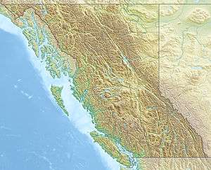 Mount Ball Location on British Columbia / Alberta border | |
| Highest point | |
| Elevation | 3,311 m (10,863 ft) [1][2] |
| Prominence | 1,187 m (3,894 ft) [3] |
| Coordinates | 51°09′23″N 116°00′23″W / 51.15639°N 116.00639°WCoordinates: 51°09′23″N 116°00′23″W / 51.15639°N 116.00639°W [4] |
| Geography | |
| Location | Alberta-BC, Canada |
| Parent range | Ball Range, Canadian Rockies |
| Topo map | NTS 82N/01 |
| Climbing | |
| First ascent | 1904 by J.D. Patterson, guided by Christian & Hans Kaufmann[3] |
| Easiest route | Scramble |
Mount Ball is a mountain located on the Continental Divide, on the borders of Banff and Kootenay national parks in Canada. Mt. Ball is the highest peak of the Ball Range in the Canadian Rockies.
The mountain was named in 1858 by James Hector after John Ball, a politician who helped secure funding for the Palliser Expedition.[5] The name was officially adopted in 1924 based on Palliser's 1863 map of British North America.[4]
Mt. Ball can be ascended from a scrambling route by late summer but involves remote bushwhacking, which limits the number of attempts per year. The trailhead is located at the Marble Canyon Campground in Kootenay National Park.[2]
References
- ↑ "Mount Ball". PeakFinder.com. Retrieved 2004-08-24.
- 1 2 Kane, Alan (1999). Scrambles in the Canadian Rockies. Calgary: Rocky Mountain Books. pp. 216–217. ISBN 0-921102-67-4.
- 1 2 "Mount Ball". Bivouac.com. Retrieved 2013-06-15.
- 1 2 "Mount Ball". BC Geographical Names. Retrieved 2013-06-15.
- ↑ Boles, Glen W.; Laurilla, Roger W.; Putnam, William L. (2006). Canadian Mountain Place Names. Vancouver: Rocky Mountain Books. p. 36. ISBN 978-1-894765-79-4.
External links
- Mt. Ball on PeakFinder - photos
This article is issued from Wikipedia - version of the 5/24/2015. The text is available under the Creative Commons Attribution/Share Alike but additional terms may apply for the media files.