Mount Pleasant, Ohio
| Mount Pleasant, Ohio | |
|---|---|
| Village | |
|
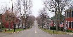
Union Street in Mount Pleasant | |
 Location of Mount Pleasant, Ohio | |
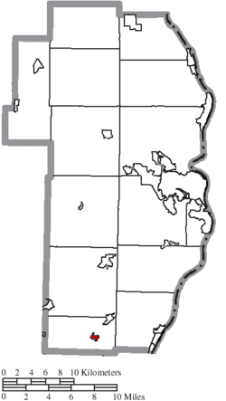 Location of Mount Pleasant in Jefferson County | |
| Coordinates: 40°10′32″N 80°47′59″W / 40.17556°N 80.79972°WCoordinates: 40°10′32″N 80°47′59″W / 40.17556°N 80.79972°W | |
| Country | United States |
| State | Ohio |
| County | Jefferson |
| Township | Mount Pleasant |
| Area[1] | |
| • Total | 0.26 sq mi (0.67 km2) |
| • Land | 0.26 sq mi (0.67 km2) |
| • Water | 0 sq mi (0 km2) |
| Elevation[2] | 1,240 ft (378 m) |
| Population (2010)[3] | |
| • Total | 478 |
| • Estimate (2012[4]) | 466 |
| • Density | 1,838.5/sq mi (709.8/km2) |
| Time zone | Eastern (EST) (UTC-5) |
| • Summer (DST) | EDT (UTC-4) |
| ZIP code | 43939 |
| Area code(s) | 740 |
| FIPS code | 39-52976[5] |
| GNIS feature ID | 1048993[2] |
Mount Pleasant is a village in Jefferson County, Ohio, United States. The population was 478 at the 2010 census. It is part of the Weirton–Steubenville, WV-OH Metropolitan Statistical Area.
History
Mount Pleasant was laid out in 1803. It was named from its scenic landscape.[6] An early variant name was Jesse-Bobtown.[7]
In 1817, Quaker Charles Osborn established The Philanthropist, the first newspaper in the country advocating the abolition of slavery, in Mount Pleasant.[8] The abolitionist James Birney would later adopt the name The Philanthropist for his anti-slavery newspaper, published in Cincinnati and distributed in New Richmond, Ohio beginning in 1836.[9]
In 1821, the Quaker abolitionist Benjamin Lundy started publishing The Genius of Universal Emancipation, another abolitionist newspaper, also in Mount Pleasant. The paper eventually moved to Baltimore, Maryland. Lundy's house is a National Historic Landmark. Most of the village has been designated a historic district, the Mount Pleasant Historic District; it too is a National Historic Landmark.[10]
Geography
Mount Pleasant is located at 40°10′32″N 80°47′59″W / 40.17556°N 80.79972°W (40.175602, -80.799686).[11]
According to the United States Census Bureau, the village has a total area of 0.26 square miles (0.67 km2), all land.[1]
Demographics
| Historical population | |||
|---|---|---|---|
| Census | Pop. | %± | |
| 1810 | 246 | — | |
| 1820 | 421 | 71.1% | |
| 1830 | 554 | 31.6% | |
| 1850 | 755 | — | |
| 1870 | 563 | — | |
| 1880 | 693 | 23.1% | |
| 1890 | 644 | −7.1% | |
| 1900 | 626 | −2.8% | |
| 1910 | 701 | 12.0% | |
| 1920 | 635 | −9.4% | |
| 1930 | 674 | 6.1% | |
| 1940 | 717 | 6.4% | |
| 1950 | 760 | 6.0% | |
| 1960 | 656 | −13.7% | |
| 1970 | 635 | −3.2% | |
| 1980 | 616 | −3.0% | |
| 1990 | 498 | −19.2% | |
| 2000 | 535 | 7.4% | |
| 2010 | 478 | −10.7% | |
| Est. 2015 | 455 | [12] | −4.8% |
2010 census
As of the census[3] of 2010, there were 478 people, 192 households, and 143 families residing in the village. The population density was 1,838.5 inhabitants per square mile (709.8/km2). There were 226 housing units at an average density of 869.2 per square mile (335.6/km2). The racial makeup of the village was 97.7% White, 0.8% African American, 0.4% Native American, 0.6% Asian, and 0.4% from two or more races. Hispanic or Latino of any race were 0.2% of the population.
There were 192 households of which 32.8% had children under the age of 18 living with them, 59.9% were married couples living together, 10.9% had a female householder with no husband present, 3.6% had a male householder with no wife present, and 25.5% were non-families. 22.9% of all households were made up of individuals and 15.1% had someone living alone who was 65 years of age or older. The average household size was 2.49 and the average family size was 2.89.
The median age in the village was 44.5 years. 20.9% of residents were under the age of 18; 6.7% were between the ages of 18 and 24; 23.2% were from 25 to 44; 32.2% were from 45 to 64; and 16.9% were 65 years of age or older. The gender makeup of the village was 48.3% male and 51.7% female.
2000 census
As of the census[5] of 2000, there were 535 people, 201 households, and 158 families residing in the village. The population density was 2,136.6 people per square mile (826.3/km²). There were 222 housing units at an average density of 886.6 per square mile (342.9/km²). The racial makeup of the village was 97.57% White, 1.31% African American, 0.37% Asian, and 0.75% from two or more races. Hispanic or Latino of any race were 0.19% of the population.
There were 201 households out of which 34.8% had children under the age of 18 living with them, 64.2% were married couples living together, 11.9% had a female householder with no husband present, and 20.9% were non-families. 19.9% of all households were made up of individuals and 14.9% had someone living alone who was 65 years of age or older. The average household size was 2.66 and the average family size was 3.03.
In the village the population was spread out with 24.9% under the age of 18, 7.3% from 18 to 24, 26.4% from 25 to 44, 23.4% from 45 to 64, and 18.1% who were 65 years of age or older. The median age was 40 years. For every 100 females there were 96.0 males. For every 100 females age 18 and over, there were 88.7 males.
The median income for a household in the village was $43,750, and the median income for a family was $46,591. Males had a median income of $39,821 versus $19,688 for females. The per capita income for the village was $15,647. About 7.7% of families and 9.3% of the population were below the poverty line, including 12.9% of those under age 18 and 5.0% of those age 65 or over.
Education
Public education in the village of Mount Pleasant is provided by the Buckeye Local School District.
Notable people
- William Lawrence, Republican politician
- Elzy Lay, an outlaw of the Old West
- Stephen Mason Merrill, Methodist clergyman
- Moses Fleetwood Walker, first, African American, professional baseball player[14]
References
- 1 2 "US Gazetteer files 2010". United States Census Bureau. Retrieved 2013-01-06.
- 1 2 "US Board on Geographic Names". United States Geological Survey. 2007-10-25. Retrieved 2008-01-31.
- 1 2 "American FactFinder". United States Census Bureau. Retrieved 2013-01-06.
- ↑ "Population Estimates". United States Census Bureau. Retrieved 2013-06-17.
- 1 2 "American FactFinder". United States Census Bureau. Retrieved 2008-01-31.
- ↑ Doyle, Joseph Beatty (1910). 20th Century History of Steubenville and Jefferson County, Ohio and Representative Citizens. Richmond-Arnold Publishing Company. p. 486.
- ↑ Overman, William Daniel (1958). Ohio Town Names. Akron, OH: Atlantic Press. p. 92.
- ↑ Ryan, Daniel J. (1912). History of Ohio: The Rise and Progress of an American State, Vol. 4. New York: The Century History Country. p. 124.
- ↑ Shriver, Phillip R.; Wunderlin, Jr., Clarence E. (2000). The Documentary Heritage of Ohio. Athens, Ohio: Ohio University Press. p. 208.
- ↑ "Mount Pleasant Historic District". National Historic Landmark summary listing. National Park Service. Retrieved 2009-11-21.
- ↑ "US Gazetteer files: 2010, 2000, and 1990". United States Census Bureau. 2011-02-12. Retrieved 2011-04-23.
- ↑ "Annual Estimates of the Resident Population for Incorporated Places: April 1, 2010 to July 1, 2015". Retrieved July 2, 2016.
- ↑ "Census of Population and Housing". Census.gov. Retrieved June 4, 2015.
- ↑ Reichler, Joseph L., ed. (1979) [1969]. The Baseball Encyclopedia (4th ed.). New York: Macmillan Publishing. ISBN 0-02-578970-8.
Municipalities and communities of Jefferson County, Ohio, United States | ||
|---|---|---|
| Cities | 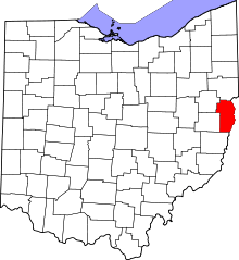 | |
| Villages | ||
| Townships | ||
| CDPs |
| |
| Unincorporated communities |
| |
| Ghost town | ||
| Footnotes | ‡This populated place also has portions in an adjacent county or counties | |
| Counties |  Map of the Pittsburgh Tri-State with green counties in the metropolitan area and yellow counties in the combined area. | |
|---|---|---|
| Major cities | ||
| Cities and towns 15k-50k (in 2010) | ||
| Airports | ||
| Topics | ||
| ||