New Alexandria, Ohio
| New Alexandria, Ohio | |
|---|---|
| Village | |
|
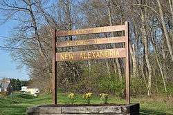
Welcome sign near west entrance of the village | |
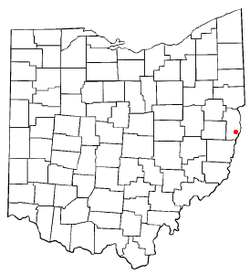 Location of New Alexandria, Ohio | |
 Location of New Alexandria in Jefferson County | |
| Coordinates: 40°17′25″N 80°40′20″W / 40.29028°N 80.67222°WCoordinates: 40°17′25″N 80°40′20″W / 40.29028°N 80.67222°W | |
| Country | United States |
| State | Ohio |
| County | Jefferson |
| Townships | Cross Creek, Wells |
| Area[1] | |
| • Total | 0.37 sq mi (0.96 km2) |
| • Land | 0.37 sq mi (0.96 km2) |
| • Water | 0 sq mi (0 km2) |
| Elevation[2] | 1,224 ft (373 m) |
| Population (2010)[3] | |
| • Total | 272 |
| • Estimate (2012[4]) | 268 |
| • Density | 735.1/sq mi (283.8/km2) |
| Time zone | Eastern (EST) (UTC-5) |
| • Summer (DST) | EDT (UTC-4) |
| ZIP code | 43938 |
| Area code(s) | 740 |
| FIPS code | 39-54012[5] |
| GNIS feature ID | 1043814[2] |
New Alexandria is a village in Jefferson County, Ohio, United States. The population was 272 at the 2010 census. It is part of the Weirton–Steubenville, WV-OH Metropolitan Statistical Area.
Geography
New Alexandria is located at 40°17′25″N 80°40′20″W / 40.29028°N 80.67222°W (40.290397, -80.672328).[6] The village is situated on the south side of Cross Creek township, Wells Township line making its southern boundary.
According to the United States Census Bureau, the village has a total area of 0.37 square miles (0.96 km2), all land.[1]
History
General History
New Alexandria derives its name from the former proprietor, Alexander Smith, who laid out the town in 1831. Prior to this, the area was known as "Tempo" by the surrounding local community deriving from either a temperance hotel that was kept there (something that was unusual for the time) by Matthew Thompson as far back as 1820, this could also have been because Mr. Thomson grew up in a village in Ireland called Tempo. The area that Thompson spoke of would have been Tempo in Fermanagh County, Ireland. This information can be found in a privately printed biography of the Scott Family which was written primarily by a nephew of Thompson[7] there is still however no further evidence as to if Mr. Thompson's temperance hotel has anything to do with the name, there was also a small collection of houses here prior to Smith laying out the area. Mr. Thomson also started the first store and was the first postmaster of the village In 1831 Mr. Smith opened a hotel and store in the newly organized area. Being distant from any rail or water transportation the village grew at a slow rate, it did however have a fairly large area of local trade with the rural community surrounding it. The village was incorporated in 1871 and has been the home of several small businesses, churches, clubs a cemetery, a post office, a community park a school and a volunteer fire department over the years. [8] [9]
Morgan's Raid
During Morgan's Raid, a Union victory in the Civil War in 1863, Confederate Brid. Gen. John Hunt Morgan traveled through the Moorefield, Harrisville, New Athens, Smithfield, New Alexandria, Wintersville, Two Ridge, Richmond, East Springfield, Bergholz, and Monroeville on his way to defeat at the Battle of Salineville.
Demographics
| Historical population | |||
|---|---|---|---|
| Census | Pop. | %± | |
| 1850 | 198 | — | |
| 1860 | 228 | 15.2% | |
| 1870 | 167 | −26.8% | |
| 1880 | 175 | 4.8% | |
| 1890 | 122 | −30.3% | |
| 1900 | 148 | 21.3% | |
| 1910 | 185 | 25.0% | |
| 1920 | 141 | −23.8% | |
| 1930 | 241 | 70.9% | |
| 1940 | 328 | 36.1% | |
| 1950 | 383 | 16.8% | |
| 1960 | 396 | 3.4% | |
| 1970 | 425 | 7.3% | |
| 1980 | 410 | −3.5% | |
| 1990 | 257 | −37.3% | |
| 2000 | 222 | −13.6% | |
| 2010 | 272 | 22.5% | |
| Est. 2015 | 264 | [10] | −2.9% |
2010 census
As of the census[3] of 2010, there were 272 people, 107 households, and 74 families residing in the village. The population density was 735.1 inhabitants per square mile (283.8/km2). There were 116 housing units at an average density of 313.5 per square mile (121.0/km2). The racial makeup of the village was 97.1% White, 1.5% African American, and 1.5% from two or more races.
There were 107 households of which 26.2% had children under the age of 18 living with them, 57.0% were married couples living together, 6.5% had a female householder with no husband present, 5.6% had a male householder with no wife present, and 30.8% were non-families. 22.4% of all households were made up of individuals and 12.1% had someone living alone who was 65 years of age or older. The average household size was 2.54 and the average family size was 3.00.
The median age in the village was 45.7 years. 21% of residents were under the age of 18; 4% were between the ages of 18 and 24; 24.2% were from 25 to 44; 32% were from 45 to 64; and 18.8% were 65 years of age or older. The gender makeup of the village was 53.3% male and 46.7% female.
2000 census
As of the census[5] of 2000, there were 222 people, 90 households, and 70 families residing in the village. The population density was 614.7 people per square mile (238.1/km²). There were 98 housing units at an average density of 271.3 per square mile (105.1/km²). The racial makeup of the village was 98.20% White, and 1.80% from two or more races.
There were 90 households out of which 28.9% had children under the age of 18 living with them, 64.4% were married couples living together, 12.2% had a female householder with no husband present, and 22.2% were non-families. 20.0% of all households were made up of individuals and 11.1% had someone living alone who was 65 years of age or older. The average household size was 2.47 and the average family size was 2.79.
In the village the population was spread out with 17.1% under the age of 18, 9.0% from 18 to 24, 23.9% from 25 to 44, 31.1% from 45 to 64, and 18.9% who were 65 years of age or older. The median age was 45 years. For every 100 females there were 88.1 males. For every 100 females age 18 and over, there were 82.2 males.
The median income for a household in the village was $31,250, and the median income for a family was $31,250. Males had a median income of $42,500 versus $18,750 for females. The per capita income for the village was $15,184. About 13.6% of families and 15.8% of the population were below the poverty line, including 23.8% of those under the age of eighteen and 11.4% of those sixty five or over.
Education
Public education for the village of New Alexandria is provided by the Buckeye Local School District.
References
- 1 2 "US Gazetteer files 2010". United States Census Bureau. Retrieved 2013-01-06.
- 1 2 "US Board on Geographic Names". United States Geological Survey. 2007-10-25. Retrieved 2008-01-31.
- 1 2 "American FactFinder". United States Census Bureau. Retrieved 2013-01-06.
- ↑ "Population Estimates". United States Census Bureau. Retrieved 2013-06-17.
- 1 2 "American FactFinder". United States Census Bureau. Retrieved 2008-01-31.
- ↑ "US Gazetteer files: 2010, 2000, and 1990". United States Census Bureau. 2011-02-12. Retrieved 2011-04-23.
- ↑ Our Clan A Biological and Geological account of the Family of Rev. Andrew Scott. p. 25.
- ↑ "History of Belmont and Jefferson Counties, Ohio, and Incidentally Historical Collections Pertaining to Border Warfare and the Early Settlement of the Adjacent Portion of the Ohio Valley 1880 Pg 646".
- ↑ 20th Century History of Steubenville and Jefferson County, Ohio and Representative Citizens pg 469.
- ↑ "Annual Estimates of the Resident Population for Incorporated Places: April 1, 2010 to July 1, 2015". Retrieved July 2, 2016.
- ↑ "Census of Population and Housing". Census.gov. Retrieved June 4, 2015.
Municipalities and communities of Jefferson County, Ohio, United States | ||
|---|---|---|
| Cities | 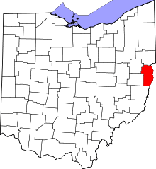 | |
| Villages | ||
| Townships | ||
| CDPs |
| |
| Unincorporated communities |
| |
| Ghost town | ||
| Footnotes | ‡This populated place also has portions in an adjacent county or counties | |
| Counties |  Map of the Pittsburgh Tri-State with green counties in the metropolitan area and yellow counties in the combined area. | |
|---|---|---|
| Major cities | ||
| Cities and towns 15k-50k (in 2010) | ||
| Airports | ||
| Topics | ||
| ||