Muzaffarpur Airport
| Muzaffarpur Airport मुजफ्फरपुर हवाई अड्डा Mujaphpharapura Havāī Aḍḍā | |||||||||||
|---|---|---|---|---|---|---|---|---|---|---|---|
| IATA: MZU – ICAO: VEMZ | |||||||||||
| Summary | |||||||||||
| Airport type | Public | ||||||||||
| Operator | Airports Authority of India | ||||||||||
| Serves | Muzaffarpur & North Bihar | ||||||||||
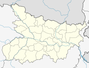
| Location | Muzaffarpur | ||||||||||
| Elevation AMSL | 174 ft / 53 m | ||||||||||
| Coordinates | 26°07′09″N 085°18′49″E / 26.11917°N 85.31361°ECoordinates: 26°07′09″N 085°18′49″E / 26.11917°N 85.31361°E | ||||||||||
| Map | |||||||||||
 Muzaffarpur Airport | |||||||||||
| Runways | |||||||||||
| |||||||||||
Muzaffarpur Airport (IATA: MZU, ICAO: VEMZ) is an under-construction civil airport at Muzaffarpur, in the state of Bihar, India. It was to be built for the arrival of Indira Gandhi, the then Prime Minister of India. The airport is to be built over 102 acres, located five kilometers west of the city on State Highway 46. In a bid to give a boost to civil aviation sector and enhance air connectivity to Tier-II and Tier-III cities, the government has proposed to set up a low-cost airport here.[1]
The airport is located at an elevation of 174 feet (53 m) above mean sea level. It has one paved runway designated 10/28 which measures 3,990 (1,216 m) with asphalt surface.[1]

The under construction view of Muzaffarpur Airport.
See also
References
- 1 2 "Muzaffarpur". Airports Authority of India. Retrieved 17 November 2016.
External links
- Muzaffarpur Airport - India Airport Global Website
- Airport information for VEMZ at World Aero Data. Data current as of October 2006.
This article is issued from Wikipedia - version of the 11/17/2016. The text is available under the Creative Commons Attribution/Share Alike but additional terms may apply for the media files.