Nagaur
| Nagaur नागौर | |
|---|---|
| City | |
 Nagaur Location in Rajasthan, India | |
| Coordinates: 27°12′N 73°44′E / 27.2°N 73.73°ECoordinates: 27°12′N 73°44′E / 27.2°N 73.73°E | |
| Country |
|
| State | Rajasthan |
| District | Nagaur |
| Government | |
| • Type | Democracy |
| • Body | District Collector |
| • MP | C.R.Choudhary |
| • Collector & DM | Rajan Vishal , IAS |
| • Chairman,City Council | Kriparam Solanki |
| Elevation | 302 m (991 ft) |
| Population (2011) | |
| • Total | 102,872 |
| Languages | |
| • Official | Hindi and Rajasthani |
| • Local | Marwari |
| Languages | |
| Time zone | IST (UTC+5:30) |
| Vehicle registration | RJ-21 |
| Website | http://nagaur.rajasthan.gov.in/ |
Nagaur (Nāgaur) is a city in the state of Rajasthan in India. It is the administrative headquarters of Nagaur District. The Nagaur city lies about midway between Jodhpur and Bikaner.
History
The fort is of historical importance.[1] The Rajput rulers dominated Nagaur for a longer period. Nagaur ruler were repeatedly forced to pay tribute to the Sisodias of Chittor while their lands were slowly annexed by the Rathors of Jodhpur. In fact the case of Nagaur vividly illustrates the turning back of the tide of Islamic conquests in Rajputana in the 14th and 15th Centuries. Nagaur, north to Bikaner, and up to the border of Punjab, was called Jangladesh in ancient times. The remains of some of the earliest settlements along the banks of the long dried-up Saraswati River can be seen to this day—in a later age it came under the Naga rulers after whom the town of Nagaur (Naga-pura) is named. The name of Jangladesh was known till a very late period. The Rajput rulers of Bikaner, whose territory eventually embraced the bulk of Jangla country, sported the title Jai Jangaldhar Badshah, which was emblazoned on the state coat of arms during the British Raj. In the medieval era the town of Nagaur sat astride trade routes coming north from Gujarat and Sindh and those on the west crossing the Indus from Multan. With a dead flat plain all around, the defense of the fort depended on the military and economic power of its rulers—and from the period of the Ghaznavid invasions Nagaur was under the powerful Chauhan clan. A succession of rulers kept the whole of Jangladesh free from foreign rule down to the reign of Prithviraj Chauhan III at the close of the 12th Century. That Nagaur town came under the invaders is clear since Balban, before becoming Sultan, was given an estate centered on this desert town. But just as there were petty Hindu chiefs (of numerous castes) in the vast lands between Ajmer and Delhi, it is reasonable to suppose that such landholders were also present in the lands between Ajmer and Nagaur, paying land revenue to the Muslims and probably joining their army.
Another similarity between Ajmer and Nagaur is the early founding of Sufi shrines at both places. One of the earliest Sufis to come to Nagaur was Sultan Tarkin, whose shrine was established during Hindu rule. After Khwaja Moinuddin established the Chishti Sufi order at Ajmer one of his disciples, named Hamiduddin, came to Nagaur. Hazrat Hamiduddin accommodated some Hindu principles in his teachings—he became a strict vegetarian and lovingly reared a cow in his shrine.
In 1306 a Mongol army ravaged Nagaur. The Khalji Turks had begun pushing deeper into the lands of the independent Rajput rulers and even further into South India. In the midst of this expansion they lost some of the important Rajput forts like Jaisalmer, Chittor, and Siwana, while guerrilla warfare made the regions of Marwar and Mewar impassable for the Muslim armies. Some of the other forts and towns were lost to the Rajputs after the break-up of the Delhi Sultanate in 1351. With the death of Firuz Tughlaq in 1388 the remaining strongholds like Ajmer and Nagaur came under their own hereditary governors. Turks of the Dandani tribe became Sultans, The Sultans of Nagaur taxed the money earned by the people from trade, agriculture, and from the vast herds of cattle, goats, and camels. In addition, like in the Delhi Sultanate, jaziya and a pilgrimage tax taken from Hindus brought significant sums to the treasury and enabled the Dandani Turks to match their neighbors in battle.
While Nagaur was still swearing a nominal allegiance to Delhi, two ominous events occurred in the neighborhood within a short period. One was the campaign of Rana Lakha (1389–1404) of Mewar, which saw a Rajput army ravaging Ajmer and pushing on to the Jhunjhunun region near Delhi. The second was the capture of Mandore by Rao Chunda (1390–1422) of the Rathor clan—this city henceforth became the Rathor capital and gave Rao Chunda a convenient base for attacking Nagaur. Rao Chunda also changed horses mid-stream and formed an alliance with Mewar, where the Rathor princess Hamsabai was married to the old Rana Lakha, who in turn promised to make her son the next Rana. On the strength of this alliance Chunda subdued Rajput clans like the Bhatis and Mohils and again invaded Nagaur, forcing Muslim rulers to make peace by paying him tribute. In 1422 these three defeated powers made an alliance and killed Chunda on the outskirts of Nagaur—Chunda’s son Ranamalla was then at Mewar and his brothers sought to capture the throne at Mandore.
With the help of the Mewar army, Ranamall defeated his brothers and became the head of the Rathor clan. In 1428 he led this joint Sesodia-Rathor army to punish the Turks of Nagaur where he stormed the fort and killed Firuz Khan. The next Sultan of Nagaur Qiyam Khan paid tribute to Mewar till 1438 when Ranamall Rathor was killed at Chittor and the Sesodias invaded Marwar. The conflict between the two Rajput clans was the opportunity for the Nagaur that had been smarting under their dominance—the Sultans of Gujarat and Malwa fought Mewar for almost twenty years and were ultimately compelled to form an alliance against the strong Rajput state.
With its two Rajput enemies simultaneously in trouble, Nagaur regained independence and its Sultans their former power, which was reflected in the internal politics of the neighboring Delhi Sultanate. In 1451 the minister of the last Sayyid ruler invited Qiyam Khan to seize Delhi and become Sultan—at the same time he sent a similar invitation to Buhlul Lodi, the Afghan governor of Sirhind. The latter, being closer to Delhi, reached first and established the Lodi dynasty, while the disappointed Qiyam Khan retired with his army to Nagaur.
After his death in 1453 the succession to the Nagaur throne was disputed between the brothers Mujahid Khan and Shams Khan. Rana Kumbha, who had emerged victorious in the long war with the Sultan of Malwa and the Rathors, sent his army to aid Shams Khan who was installed as the Sultan. As a price of his support Kumbha demanded that a portion of the Nagaur fort be demolished, but this Shams Khan Dandani would not do—instead he formed a matrimonial alliance with Sultan Qutb-ud-din of Gujarat.
In 1456 Rana Kumbha defeated the allied Muslim army and again captured Nagaur. On this occasion the great mosque at Nagaur, built by Firuz Khan, was demolished by the Rajputs to signify Kumbha’s displeasure against Shams Khan and to impose the status of a vassal on him.
For the next two years the Sultans of Gujarat and Malwa formed an alliance to fight against Rana Kumbha, but by this time Mewar had again become the dominant power in North India—not the least because of a peace treaty with the Rathor clan.
Rao Jodha, the head of the Rathor clan, had founded a new capital called Jodhpur and had recovered most of his other forts from the Sisodias. The war between the two clans was brought to an end in 1458 by a treaty. But this did not make Nagaur independent—rather its territory became food for the hungry and fast multiplying Rathor clan.
Jodha’s son Bika, with a portion of the Rathor clansmen, captured the northern portions of Nagaur and founded a new city called Bikaner. Another son named Duda captured Merta lying to the east of Nagaur—the Sultanate of Nagaur was now shrunk to the main town and a few surrounding villages. The policy of the sultans was to maintain independence by either paying tribute to the head of the Rathor clan or to the Lodis of Delhi.
In 1513 Nagaure was defeated and compelled to pay tribute—subsequently Rao Lunkaran protected Nagaur, as his vassal state, from an attack by his own kinsman Rao Ganga of Jodhpur. The territory of the Sultanate had now shrunk to just the town of Nagaur. In Nagaur though, the powerless dynasty of the Dandani Turks was formally ended and an Afghan army was left in control of the fort and town. This force was ousted by the Mughals under Akbar in 1562. Akbar also captured the fief of Merta—the Rathor ruler of Merta, the famous Jaimal took up service with the Rana of Chittor and died defending that fort from Akbar in 1569. Akbar’s campaign in Rajputana had some similarity with Sher Shah’s in that he made alliances with the smaller Rajput states like Bikaner and Amber and used them against the bigger states.
Nagaur remained under Mughal control, but was actually administered by one of the nearby Rajput rulers. In the time of Shah Jahan the heir of the Jodhpur throne, Amar Singh Rathore was disinherited by his father and was granted Nagaur as compensation by the Mughal Emperor. Many of the buildings in the town date from this period. During Aurangzeb’s war against the Rathors in 1679 the headship of the clan was given to Indra Singh (nephew of the dead Maharaja Jaswant Singh) of Nagaur—but he was overthrown by Jaswant's son Ajit Singh and his general Durgadas who permanently annexed Nagaur to the Kingdom of Jodhpur. After independence, Nagaur had the honour of being selected as the place in the country from where the Democratic Decentralisation process was launched by the late Shri Jawaharlal Nehru, the first Prime Minister of India on 2 October 1959.
Nagaur has importance in cattle fair, Every year in month of February, it organizes huge bullock/camel fair "Ramdev Pashumela". Nagaur district has got plenty of limestone, salt and other type of stones. Industry In 1984 India's first white cement plant, JK White Cement was established in gotan,100 km from nagaur.
Climate
Nagaur has a dry climate with a hot summer. Sand storms are common in summer. The district's climate is marked by extreme dryness, large variations of temperature & highly irregular rainfall patterns. The maximum temperature recorded in district is 117F with 32F as the lowest recorded temperature. The average temperature of the district is 74 F. The winter season extends from mid November until the beginning of March. The rainy season is relatively short, extending from July through mid September. There are ten climatological stations within the district, being within the cities of Nagaur, Khinvsar, Didwana, Merta, Parbatsar, Makarana, Nawa, Jayal, Degana & Ladnun. The average rainfall in the district is 36.16 cm & 51.5% relative humidity.
Geography
Nagaur is located at 27°12′N 73°44′E / 27.2°N 73.73°E.[2] It has an average elevation of 302 metres (990 feet). Nagaur is situated amidst seven districts namely Bikaner, Churu, Sikar, Jaipur, Ajmer, Pali, Jodhpur. Nagaur is the fifth largest district in Rajasthan with a vast terrain spreading over 17,718 km2 Its geographical spread is a good combine of plain, hills, sand mounds & as such it is a part of the great Indian Thar Desert.
Demographics
As of 2011 India census,[3] Nagaur District's Demographics statues:-
| Total Population | 3340234 |
| Male | 1679570 |
| Female | 1660474 |
| % Decadal Growth (2001–11) | 19.25 |
| Sex Ratio | 948 |
| Density | 187 |
| Child Population (0-6) | 498585 |
| Literacy Rate (Total) | 64.08 |
| Literacy Rate (Male) | 78.90 |
| Literacy Rate (Female) | 48.63 |
Merta, Degana, Ladnun, Deedwana, Makarana, Parbatsar and Kuchaman are the major towns of the district. The total area of the district is 17,718 km2, out of which 17,448.5 km2 is rural and 269.5 km2 is urban.
Forest, Flora & Faun
The district of Nagaur is poor in forest resources. The total area under including hills, is reported to be 240.92 km2., which is 1.3 percent of total geographical area of the district. Scanty rainfall & other geographical constraints account for this. The western part of the district is divided of natural vegetation cover except for low herbs & grass which grows on low sand dunes. However, the south-eastern part of the district & part of the northern tehsil of Ladnun & Didwana have much greater greenery as compared to north-west part of the district. Khejri trees are commonly found in the district. Its leaves are used as fodder. It also gives gum. Apart from commercial value, this tree is considered holy. The tree also plays an important role in checking soil crosion. The other common species found in the district are babul, neem, shisham, peepal, rohira, kalsi, dhangood, akara etc. Rohira & shisham trees provide timber & is used for making furniture. Dhangood is generally used for making cots. A common shrub-phog provides building material from its roots & twings. Common grass found in the district include bargers, bhambar etc.
Tourism
| Wikimedia Commons has media related to Forts in Nagaur district. |

- Nagaur Fort (Coordinates 27.19898N 73.73822E) (Ahhichatragarh or Fort of the Hooded Cobra) was one of the first Muslim strongholds in northern India[4] and one of the finest examples of Rajput-Mughal architecture.[5] Built in the early 12th century and repeatedly altered over subsequent centuries, it witnessed many battles. Underwent major renovations in 2007.[4][5] 90 fountains are now running in the gardens and buildings. The fort’s buildings and spaces, both external and internal, serve as venue, stage and home to a Sufi Music Festival.
- Ladnun- Ladnun is historical City of Old Chanderi Nagari and tourism site.10th century's Jain temples are rich with historical attraction. Ladnun is the spiritual hub of Ahimsa. Jain Vishva Bharti University (deemed University) - A famous centre of Jainism; a school of thought; a centre of spirituality & purification; a society of Ahimsa; a treasure of tranquility; an abode of humanity on earth.

- Bairathal Kallan - The Bairathal Kallan village was established about 700-750 years ago;This village was established by the Nath community;At that time the main saint of the Nath community was Bairaginath, and the village was named after him;There are three villages in Bairathal Kallan Gram Panchayats in India - Bairathal Kallan, Bairathal Khurd, and Jagrampura.
- Khinvsar town - Khimsar Fort - Situated 42 km from Nagaur on the National Highway No. 65 towards Jodhpur; 500-year-old fort in the middle of the Thar Desert; turned into a hotel furnished with modern facilities. Mugal Emperor Aurangzeb used to stay here; Khinvsar town has 25 small temples; black deer roaming in herds are a very popular tourist attraction.
- Jayal- Dadhimati Mata Temple - Also known as Goth-Manglod temple; 40 km from Nagaur; the oldest temple of the district constructed during the Gupta Dynasty (4th Century); Kul Devi of Dadhich Brahmins.
- Merta- Meera Bai Temple - Also known as the Charbhuja temple; 400 years old; evidences how total surrender helps attain godly qualities; how deep faith converts poison to 'Amrit'.
- Kuchaman City- Kuchaman Fort - One of the oldest & most inaccessible forts of Rajasthan; situated on top of a straight hill; unique water harvesting system; Jodhpurrulers used to mint their gold & silver currency here; affords a beautiful view of the city; fort converted into a hotel has a strong attraction for tourists.
- Khatu - Khatu's old name was Shatkup (six wells). When Shak rulers came to India then they brought two new wells with them which were called Shakandhu (Stepwell) & Kalandh (Rahat). According to Prathviraj Raso Khatu's old name was Khatwan. Old Khatu is almost destroyed. Now there are two villages, one is called Bari Khatu & other Chhoti Khatu. On the hillock of Chhoti Khatu a small fort is standing. Fort was built by Prithviraj Chauhan. An old stepwell is located in Chhoti Khatu, known as Phool Bawadi, it is believed that this stepwell was constructed in Gurjara Pratihara period. This stepwell is artistic in its style of architecture.
- Kurki - Kurki is a small village in the Merta Tehsil of Nagaur district. It is the birthplace of the famous princess and poet, Meera Bai, about 30 km from Merta.
- Kharnal - It is situated on the Nagaur-Jodhpur National Highway near about 15 km from Nagaur. It is the birthplace of Lok Devta Veer Tejaji. It is believed that Kharnal was established by Dhawal Khichi who was in the 5th generation of the Choudhan ruler Gundal Rao Khichi of Jayal state. It is believed that Veer Tejaji was the son of Dhawal Khichi.
- Jhorda - It is situated on the north of Nagaur about 30 km away. It is the birthplace of the Great Saint Baba Hariram and the poet Kandan Kalpit. Every year in the month of Bhadrapad Chaturthy & Panchmi a big annual fair is held here where about 1-2 lac people participate who come from Rajasthan, U.P., Haryana, Delhi & Punjab.
- Butati Dham - It is situated in Nagaur district, only a few kilometres away from Merta Jn railway station. There situated a temple of old saint Shree Chatur Das ji Maharaj. This temple is believed to be a spiritual healer of Paralysis patients. Thousand of patients arrive here and return with smile on their face.
See also
- Didwana
- Meethari Marwar
- Gotan
- merta city
- Bairathal Kallan
- Indawar
References
- ↑ http://nagaur.nic.in/
- ↑ Falling Rain Genomics, Inc - Nagaur
- ↑ "Census of India 2001: Data from the 2001 Census, including cities, villages and towns (Provisional)". Census Commission of India. Archived from the original on 2004-06-16. Retrieved 2008-11-01.
- 1 2 "Rehabilitation of Nagaur Fort". Aga Khan Award for Architecture. Aga Khan Development Network. Retrieved 23 October 2013.
- 1 2 Abraham, Melissa. "India's Vibrant Cultural Heritage Comes to Life at Nagaur Fort". The Getty Iris. Retrieved 24 October 2013.
External links
| Outline | 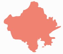 | ||||||||||||||||||||||||||
|---|---|---|---|---|---|---|---|---|---|---|---|---|---|---|---|---|---|---|---|---|---|---|---|---|---|---|---|
| Governance | |||||||||||||||||||||||||||
| Divisions and Districts |
| ||||||||||||||||||||||||||
| Major cities | |||||||||||||||||||||||||||
| Related templates |
| ||||||||||||||||||||||||||