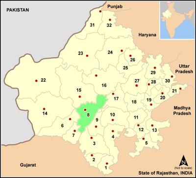
Pali district
| Pali district Pali district (पाली जिल्लौ) | |
|---|---|
| district | |
| Country | India |
| State | Rajasthan |
| District | Pali |
| Area | |
| • Total | 12,387 km2 (4,783 sq mi) |
| Population (2011) | |
| • Total | 2,038,533 |
| • Density | 165/km2 (430/sq mi) |
| Languages | |
| • Official | Marwari, Hindi |
| Time zone | IST (UTC+5:30) |
| PIN | 306401 |
| Telephone code | 02932 |
| Vehicle registration | RJ-22 |
| Literacy | 63.23% |
| Lok Sabha constituency | Pali (Lok Sabha Constituency) |
| Avg. annual temperature | 22.5 °C (72.5 °F) |
| Avg. summer temperature | 45 °C (113 °F) |
| Avg. winter temperature | 00 °C (32 °F) |
| Website |
pali |
Pali District (Rajasthani: पाली जिल्लौ) (Hindi: पाली ज़िला Pālī Zilā) is a district of the state of Rajasthan in western India.Pali is Rajput Dominated district.[1][2][3][4] The town of Pali is the district headquarters.
History
During the Kushana Age, King Kanishka had conquered Rohat and Jaitaran area, parts of today's Pali district, in 120 AD. Till the end of seventh century A. D. this area was ruled by the Chalukya King Harshavardhana along with other parts of the present state of Rajasthan .
During the period from 10th to 15th century, boundaries of Pali extended to adjoining Mewar, Godwad and Marwar. Nadol was the capital of Chauhans. All Rajput rulers resisted the foreign invaders but individually fought for each other's land and leadership. After the defeat of Prithviraj Chauhan, against Mohammed Gauri, the Rajput power of the area was disintegrated. Godwad area of Pali become the subjects of then ruler of Mewar, Maharana Kumbha. But Pali city which was ruled by Brahmin rulers with the patronage of neighbouring Rajput rulers, remained peaceful and progressive.
The 16th and 17th centuries saw a number of battles in the surrounding areas of Pali. Shershah Suri was defeated by Rajput rulers in the battle of Giri near Jaitaran, Mughal emperor Akbar's army had constant battles with Maharana Pratap in Godwad area. Again after the Mughals had conquered almost all of Rajputana, Veer Durga Das Rathore of Marwar made organized efforts to redeem the Marwar area from Aurangzeb, the last Mughal emperor. By then Pali had become subservient to Rathores of Marwar state. Pali was rehabilitated by Maharaja Vijay Singh and soon it became an important commercial center.
Under British era in India in 1857, various Thakurs of Pali under the stewardship of Thakur of Auwa fought against the British rule. Auwa fort was surrounded by the British army and then conflicts lasted many days.
Geologists trace the existence of Pali to pre-historic age and maintain that it has emerged from the vast western sea spread over a large part of the present day Rajasthan. In the Vedic age Maharshi Javali stayed in this area for meditation and interpretation of Vedas. The Pandavas in the Mahabharata age also have made this area (near Bali) their resting place during the exile. As a part of ancient Arbuda Province, this area was known as Balla-Desh.
Geography
The Aravalli Range forms the eastern boundary of the district and towards southern boundary it ends at Bamnera village in Sumerpur Tehsil. A zone of foothills lies to the west, through which run the many tributaries of the Luni River. The western portion of the district includes the alluvial plain of the Luni. It is bounded by eight districts, Nagaur District to the north, Ajmer District to the northeast, Rajsamand District to the east, Udaipur District to the southeast, Sirohi District to the southwest, Jalore District and Barmer District to the west, and Jodhpur District to the northwest. The major part of the district has elevations ranging from 200 to 300 m above MSL, but in the east toward the Aravalli Range the elevation increases and the average is nearer 600 m and at some places the elevations exceed 1000 m.[5]
Politics
Lok Sabha
Pali (Lok Sabha constituency) Pali Lok Sabha constituency is in two districrt Pali and Jodhpur.[6]
Member of parliament - Present MP is P P Choudhary he belong from Seervi community,Bharatiya Janata Party.[7]
Vidhan Sabha
In Pali district 6 Legislative Assembly here.1 constituency sojat is reserved for SC.[8][9]
- Sojat constituency - Present MLA is Sanjana Agari
- Sumerpur constituency - Present MLA is Madan Rathore
- Pali constituency - Present MLA is Gyan Chand Parakh
- Marwar Junction constituency - Present MLA is Kesaram Choudhary.
- Jaitaran constituency - Present MLA is Surendra Goyal (Minister Panchayati Raj and Rural Development, Government of Rajasthan)
- Bali constituency - Present MLA is Pushpendra Singh Ranawat (State Minister Energy Department, Government of Rajasthan)
Panchyat Samiti
Total 10 Panchyat Samiti in Pali District 5 are reserved for ST, SC & OBC and 5 are General.[10] Zila Pramukh Pali is Pemeram Sirvi.[11]
- Raipur (Reserved) - Shobha Chauhan
- Bali (Reserved) - Kapuraram Meghwal
- Desuri (Reserved) - Bheraram
- Pali (Reserved) - Sharwan Banjara
- Rani (Reserved) - Navratan choudhary
- Sojat - Girja Kanwar Rathore
- Jaitaran - Rasal Kanwar Rathore
- Marwar Junction - Sumer Singh
- Sumerpur - Rajendra Singh Deora Koliwada
- Rohat - Rashmi Singh Rathore
Hydrology
The area under irrigation is 2824.02 km2, which is about 22.79 percent of the total geographical area of the district. The main source of irrigation in the district is wells, which constitute seventy-five per cent of total irrigated area followed by ponds tanks twenty per cent, tube wells 5 per cent. In all; district has ninety-two dams out of which three dams, one each at Gajni, Potalia and Chipatia are broken. Total catchment area of all the dams is 238,150.14 acres (963.7594 km2). The capacity of eighty-nine dams was 20197.3 million cubic feet in 1990.[12]
There are forty-eight dams in the district, named with completion date where known:[13][14]
- Jawai Dam (1957)
- Sardar Samand dam (1905)
- Hemawas dam (1911)
- Phulad dam (1972)
- Sindroo (1977)
- Sadri dam
- Babra (1981)
- Kana (1961),
- Ker (1977),
- Juna Malari(1978),
- Dandiya (1978),
- Shivnath Sagar (1971),
- Giri-Nanda Dam,
- Bankli Dam,
- Kharda Dam,
- Rajpura dam,
- Takhatgarh dam,
- Mithari dam,
- Kalibor dam,
- Vayad,
- Sali ki Dhani,
- Khiwandi,
- Baniyawas,
- Endla,
- Giroliya,
- Borinada dam,
- Siriyari,
- Kantaliya,
- Jogdawas I,
- Jogdawas II,
- Saran,
- Sindarli[15]
- Chirpatiya,
- Kot Baliyan,
- Dantiwara,
- Latara,
- Futiya,
- Peepla,
- Sewari,
- Rajsagar Chopra,
- Malpuriya,
- Kanawas,
- Muthana,
- Bandi Nehara,
- Bomdara,
- Kesuli,
- Lodiya,
- Hariom Sagar,
- Sali ki Nal.
Some of the reservoirs created by these dams are used for irrigation purposes, as well as drinking water and flood control. Jawai Dam is the largest dam in the western Rajasthan, which is very useful source of drinking water for the district in summer days.
The biggest river in the district is the Luni and its major tributaries in the district are the Jawai, the Lilri, the Mithari, the Sukri, the Bandi and the Guhiya.[16]
The river Luni originates near Ajmer in the western slopes of the Aravalli Range at an elevation of about 550 m. About 495 km after the flow in a south-western of Rajasthan, it disappears in the marshy land of Rann of Kutch. The total catchment area of the Luni River Basin in Rajasthan is 37,363 km², covering parts of the Districts of Ajmer, Pali, Jodhpur, Nagaur, Barmer, Jalore and gujrat. in rajashtan 330 km and in gujrat 20 km<nandkishor tak>
Guhiya river originates near Khariyaniv and Tharasani villages in Pali District in the hillocks. It merges with Bandi River near Phekariya village. The catchment is about 3,835 km², which is situated in Pali district. Its tributaries are Raipur Luni, Radia Nadi, Guria Nadi, Lilri Nadi, Sukri and Phunpharia Bala.
- Khari (Hemawas)
River Khari is formed by the confluence of small streams namely Somesar (origination: near Somesar village in the western slopes of the Aravali), Khari Kherwa, Umrawas Ka Nala (origination: Near Bagol Kanklawas in the western slopes of the Aravali) and Kotki Nadi (origination: Dewair Reserved Forest Bhakar, after flow of about 30 km). After joining of all these small streams, the river is called Khari. After flowing for about 25 km, it joins Bandi River downstream of Hemawas reservoir . Its catchment area is 1,232 km².
- Bandi (Hemawas)
Near Bombadra pickup weir Khari and Mithari rivers join and form the Bandi River. Later Bandi river joins the Luni near the Lakhar village, after flowing for about 45 km. The catchment area is about 1,685 km² and situated in Pali District.
Mithari river originates by confluence of local nalas in the south-western slopes of the Aravali range in Pali district only. It disappears in sandy plains near Sankhwali village in Jalore district. It flows in a north-west direction through Jawai, Bali, India and Falna for about 80 km. The catchment area is in Pali and Jalore Districts and the catchment area of this river is 1,644 km².
Sukri river is formed by the confluence of several small nalas - Ghanerav Nadi, Muthana ka Bala, Magai Nadi etc. originating from the Aravallis in Pali and Udaipur Districts. It flow is in south-east to north-west directions for about 110 km and feeds Bankli Dam on the way. Near Samdari in Barmer District, it joins Luni river. The Jalore, Pali and Barmer Districts are covered in this Sub-Basin. Its catchment area is 3,036 km².
Jawai river originate in Udaipur district with its main tributary Sukri in the western slopes of the Aravallis. It joins Khari river in Jalore district near Sayala. This river flows in a north-west direction for about 96 km before that. Its catchment area is 2,976 km². Report
Divisions
Sub-divisions
Pali District have nine sub-division Sojat, Marwar Junction, Jaitaran, Raipur, Sumerpur, Bali, Pali, Rohat and Desuri.
Tehsils
There are nine tehsils: Sojat, Marwar Junction, Jaitaran, Raipur, Sumerpur, Bali, Pali, Rohat and Desuri. Rani is declared to be made 10th tehsil in Rajasthan budget-2012-13.[17]
Civic bodies
There are eight municipalities (Nagar Palika) in the district are Sojat, Jaitaran, Sumerpur, Sadri, Bali, Falna, Takhatgarh and Rani, while Pali is a Municipal Council (Nagar Parishad).
There are 1012 villages in the Pali District comes under 320 Gram panchayats. Some of the villages are Thakurla Rajpurohitan, Marwar Junction, Banta Town, shivlatov, Raipur, Sanderao, Rohat, Sojat Road,Khariya sodha, Bagri Nagar, Nimaj, Nadol, Akdawas (bhati), Bagol, Khinwara, Panota, Bharunda, Bamnera, Koliwara, Ranakpur, sinderli, Pipliya Kallan, Bijowa, Bijapur, Padarla (Padalla), Sewari,Shri Sela (Mostly populated by Chauhans warriors), Boya, Bhatund, Bhandar, Ghanerao, Nana, Beda, Basant, Chanchori, Punadiya, Vingarla, Khimel, Mandiya, [sendra],[jhala ki chowki]]Gadhwara(Rohat) etc.[18]
Legislative Assembly areas
The district is represented in the State Legislature by six MLAs (Sojat, Jaitaran, Sumerpur, Bali, Pali and Marwar Junction) and One Member of Lok Sabha in Parliament (Pali (Lok Sabha Constituency)).
Presently, the Collector and District Magistrate of Pali is Ambrish Kumar.
Transport
The only two modes of travel available in the district are roadways and railways.
Almost all the villages are connected with the roads. There are two depots of government- owned state transport Pali and Falna.
The only railway junction in the district is Marwar Junction, which is connected with Jodhpur, Ajmer, Ahmedabad and Udaipur. Pali railway station is on the Jodhpur route while the second highest earning railway station in the Ajmer division, Falna is on the Ahmedabad route. Other important railway stations in the district are Rani, Jawai Bandh, Sojat Road and Falna.
The district got railway in early age of Indian Railway in 1881, when Ahmedabad-Ajmer line opened by Rajputana State Railway. Pali got connected to Marwar Junction on 24 June 1882 and to Luni on 17 June 1884. Jodhpur is connected to the district via Luni in 1885 in Rajputana-Malwa Railway network and the first train started on this route on 9 March 1885. This line later becomes part of the Jodhpur-Bikaner Railway.[19]
Phulera-Marwar Junction line get converted from Meter Gauge to Broad Gauge in 1995, while Ahmedabad-Ajmer line got converted in 1997.[20] Till 1997-98 Jalore-Falna route of 72 km is also surveyd by the Indian Railway, but line is still not laid.[21]
Demographics
According to the 2011 census Pali district has a population of 2,038,533,[22] roughly equal to the nation of Slovenia[23] or the US state of New Mexico.[24] This gives it a ranking of 225th in India (out of a total of 640).[22] The district has a population density of 165 inhabitants per square kilometre (430/sq mi) .[22] Its population growth rate over the decade 2001–2011 was 11.99%.[22] Pali has a sex ratio of 987 females for every 1000 males,[22] and a literacy rate of 63.23%.[22]
Economy
Main existing industries of the district are Mehandi manufacturing units, textile dyeing and printing, umbrellas and wire netting, cotton ginning, ACSR conductors, agricultural equipment, conduct pipes, cement (Portland), Guar gum, handle manufacturing units, medicines, pesticides, steel furniture.
To promote the industries, there are 15 industrial areas developed by the state government: Mandia road (Pali), Old Industrial Area (Pali), Pali I Phase, Pali II Phase, Pali IVnd Phase, Marwar Junction, Punayata Road (Pali), Piplia Kalan, Sojat City I & II Phase, Sojat City III Phase, Sumerpur Industrial Area, Sumerpur Industrial Estate, M/s DLF Cement Ltd. Rabariyawas, Industrial Area Bar, Industrial Area Saradhana, Rani Industrial Area and Falna- Zadri.
Culture
Architecture
Ranakpur Jain Temple - Ranakpur is a village located in Desuri Tehsil near Sadri town in the Pali District of Rajasthan in western India. It is located between Jodhpur and Udaipur, in a valley on the western side of the Aravalli Range. The Ranakpur Jain Temples command huge respect from the Jain community worldwide. Built during the rule of Rana Kumbha, these temples have included Ranakpur in the list of five main pilgrim destinations of Jains in India. History has it that Rana Kumbha donated a vast stretch of land to Dhanna Shah so as to enable him to realize his dream of building a great temple. Today, these temples attract thousands of visitors every year from across the country and abroad.
Places of interest
- Ranakpur

Ranakpur village is home to important Jain temples. 400+ marble pillars support the temple. Opposite the Jain temple is the much older Sun Temple.Temples of Ranakpur present a distinct style of their own. The ceilings of the temples are adorned with foliate scrollwork and geometric patterns. The top and bottom part of the domes are joined by Brackets with figures of deities on them. The most important amongst all the temples within the complex is the Chaumukha Temple. Dedicated to the first Jain Tirthankara, Adinath, it is a four faced temple which has a basement of 48,000 square feet (4,500 m2). The temple boasts of four subsidiary shrines, 24 pillared halls and 80 domes standing on the support of nearly 400 columns (the total number of columns in the temple complex, however, is much larger, around 1444). Each of the columns is richly carved and interestingly no two columns present the same design. Moreover, the columns change colour from golden to pale blue with the passage of every hour during the day.
- Jain Temple, Nana
This place is associated with Jainism, where the life-size image of Mahavira was once worshipped. Nanavala or Jnanakiya gachchha (Jain saint community) was founded at Nanea by Prabhananda.Village Nana is also described in ancient Jain books. It is called as "NANA Diyana Nandiya...Jiwit Mahavir Swami Vihariya..." You can see ancient jain temple of Lord Mahavir. It is said that this temple is around 2600 years old. This idol is 120 cm in height. Recently Shree Munisuvrat Swami temple is also established on 16 May 2013 by huge make over.
- Shri Rata Mahaveer Jain Tirth
Shri Rata Mahaveer Jain Tirth or Hathundi Teerth was built in year 313(370 V.S.). This temple has Bhagwan Mahaveer Swami as its primary deity. This idol is made of bricks, sand and calcium, having bloodish(Rata) red colour and hence also called as Rata Mahaveerji.
- Shri Navlakha Parshwanath Jain Temple
The Jain temple is in the main city. Rs 9 lakhs were spent on raising the temple in 912(V.S. 969). It is said that the assumed cost of ghee was Rs. nine lakhs and the money later used for developing this temple, which later on called as Navlakha temple. Moolnayak of this temple is a White colored idol of Navlakha Parshvanath in the Padmasana posture. This temple belongs to Shwetambar Sect. of Jainism. Dharamshala (Lodging) and Bhojanshala (Food) facilities are available.
- Jain temples
Apart from Ranakpur has also famous Jain temples of Shri Varkana Parswanath Jain Tirth, Muchhal Mahavir Temple, Ghanerao, Shri Narlai Jain Tirth, Shri Nadol Jain Tirth,Shri Shantinath Jain Temple Sumer,Shri Chintamani Parswanath & Shri Shankheshwar Parswanath Bagol, Shri Astapadh Jain Tirth Rani, Shri Takhatgarh Jain Tirth, Shri Korthaji tirth at Bamnera, Shri Manmohan Parshvanath jinalaya Banta, Falna Swarn Temple, Sanderao Jain Temple, Khimel Jain Temple.
- Jawai dam
Jawai Dam is one of the biggest dam of western Rajasthan and situated in Sumerpur tehsil of Pali district, having capicity of 6000 million cubic feet. Jawai Dam is a good tourist spot.
- Parshuram Mahadev Temple
Parshuram Mahadev Temple is in Desuri tehsil and situated on the top of one of the hills of Aravalli. This is the famous temple of lord Shiva made by Parshuram with his axe. The temple is 14 km away from Sadri Town of Pali.
- Om Banna
The Sacred temple or than of Om Banna is 20 km away from the city on jodhpur-pali highway. This is the site where Om Banna died in road accident. The Moter bike of Om Banna is kept there for the devotees for worshiping.
- Aai Mata Ji Temple
There are famous temples of Shri Aai Mata jiDham called as Jekalji dham in Narlai and Shree Aai mataji temple called as Shree Jijivad Dham,Dailana where A Jyoti has a continuous flame which produces Kesar (a saffron colored soot) instead of Kajal (carbon black). Main followers of Aai Mata ji are Seervi सीरवी community.
- Nimbo Ka Nath Mahadev Temple
Nimbo Ka Nath Mahadev Temple is situated on Falna to Sanderao route. There is a myth which says that pandavas stayed here with mother Kunti during the exile. Kunti used to worship shiva at this place.
- Lawaji maharaj ka temple
Lawaji maharaj ka temple is situated on sojat city to marwar junction route, near to khariya sodha village.There is a mith which says Lawaji maharaj ( a Kshatriya warrior)secrifice his life for saving the animals like as cows.
- Other places
Apart from above Pali district has other tourist attractions like Jadan Aashram, Bangur Museum, Lakhotia Garden, Manpura Bhakhari, Maharana Pratap Smarak etc. Jadan Aashram is situated in Marwar Junction tehsil of Pali district and is hardly 20 km from Pali and is famous for its 'ॐ' (Om-sacred syllable among Hindus) shape building.
- People born in Pali District
Maharana Pratap was born in Pali at Nanihal (house of mother's father) near Dhanmandi kachedi. It was destroyed three times and reestablished again. Meera Bai born at kudki, Jaitaran in 1498. While Nadol was once the capital of the Chahamanas of Naddula.
Fairs
Shri Sonana Khetlaji's, at Aana Fair, Parshurama Mahadevji's Fair and Nimbo ka nath (Nimbeshwar Mahadev)'s fair are important fairs held in the district. All R Welcom By kothari family on Occasion Of Bagol Funfair Falgun-Festival Bhajan Sandhiya & Mahadev Gaer Dandiya March in Falgun Month. Bagol a 16th-century populated Village established in 1515 by Solanki Rulers
Notable personalities
- Adho Duraso (1538–1651) Poet. Born in Jaitaran
Education
Literacy rate of Pali district increased to 63.23% (according to 2001 census) from 54.92% in 1991. Male literacy is 78.16% and female literacy is 48.35% (compared to 36.70% in 2001). The district has been awarded Satyen Matriya award for its achievement during complete literacy campaign 1994.
There are many schools of primary, Upper Primary, secondary and higher secondary level. Under 1986 education policy, the Pali district have a Jawahar Navodaya Vidyalaya the village Jojawar in the Marwar Junction tehsil, named as Jawahar Navodaya Vidyalaya, Jojawar.
Colleges
- Mahaveer Bal Mandir Senior Secondary School(MBM), Pali, Rajasthan
- Bangur Government College, Pali
- Govt Girls College, Pali
- Lakshya Shikshan Sansthan, Pali web
- S.P.U. College, Falna
- Shree Paramhans Swami Madhavanand College, (Jadan, Pali)
- Shri Jain Terapanth College, Ranawas
- Leeladevi Parasmal Sancheti Kanya Mahavidyalaya, Vidhyavadi, Rani
- Guman singh Memorial College, Sumerpur
- Marwar College, Sojat
- Govt. Polytechnic college, Pali
- Shri Aai Mata Mahavidyalaya, Sojat City
- Sajjan International College, Pali
- Gurukul Sanskar Kanaya Mahavidyalya, Sumerpur
- Women Teachers Training College, Pali
- R.C. Memorial Shikshak Prakshishan Mahavidhyalay, Marwar Junction
- Sajjan Shikshak T T College, Manpura Bhankari, Pali
- Saraswati Teachers Training College, Naya Gawn, Pali
- Bhartiya Vidhya Mandir Mahila T T College, Ram Nagar, Pali
- Guman Singh Memorial Mahila T T College, Sumerpur
- Kasturba Gandhi Mahila T T College, Jaitaran
- Shri Jain Shwetambar Terapanthi Manav Hitkari Sang, Ranawas
- Pramod Vidyapeeth, Pali
- Shree Vinayak Vidyapeeth, Pali
- ILink Educations,220-Janta Colony, Opp. Bangur College, Pali
- Balaji Polytechnic College, Jadan
- Public Academy of Computer Education, (PACE)
- CLG engineering college, Sumerpur
- Kanku-Vijay College of Higher Education, Pali, Rajasthan
- Kanku-Vijay Teacher Training College, Pali, Rajasthan
- Smt. Kanku Devi Girl School, Pali, Rajasthan
- Govt College of Bali, Rajasthan
Notes
- ↑ "Ready for challenge". theweekendleader.com.
- ↑ Digital, Centenary. "Residents of Rajasthan's Pali district, India, oppose plans for Turkish First World War memorial". centenarynews.com.
- ↑ "Congress edges past BJP in Rajasthan - Current News". currentnews.in. 13 April 2009.
- ↑ "Define Rajput - Dictionary and Thesaurus". askdefinebeta.com.
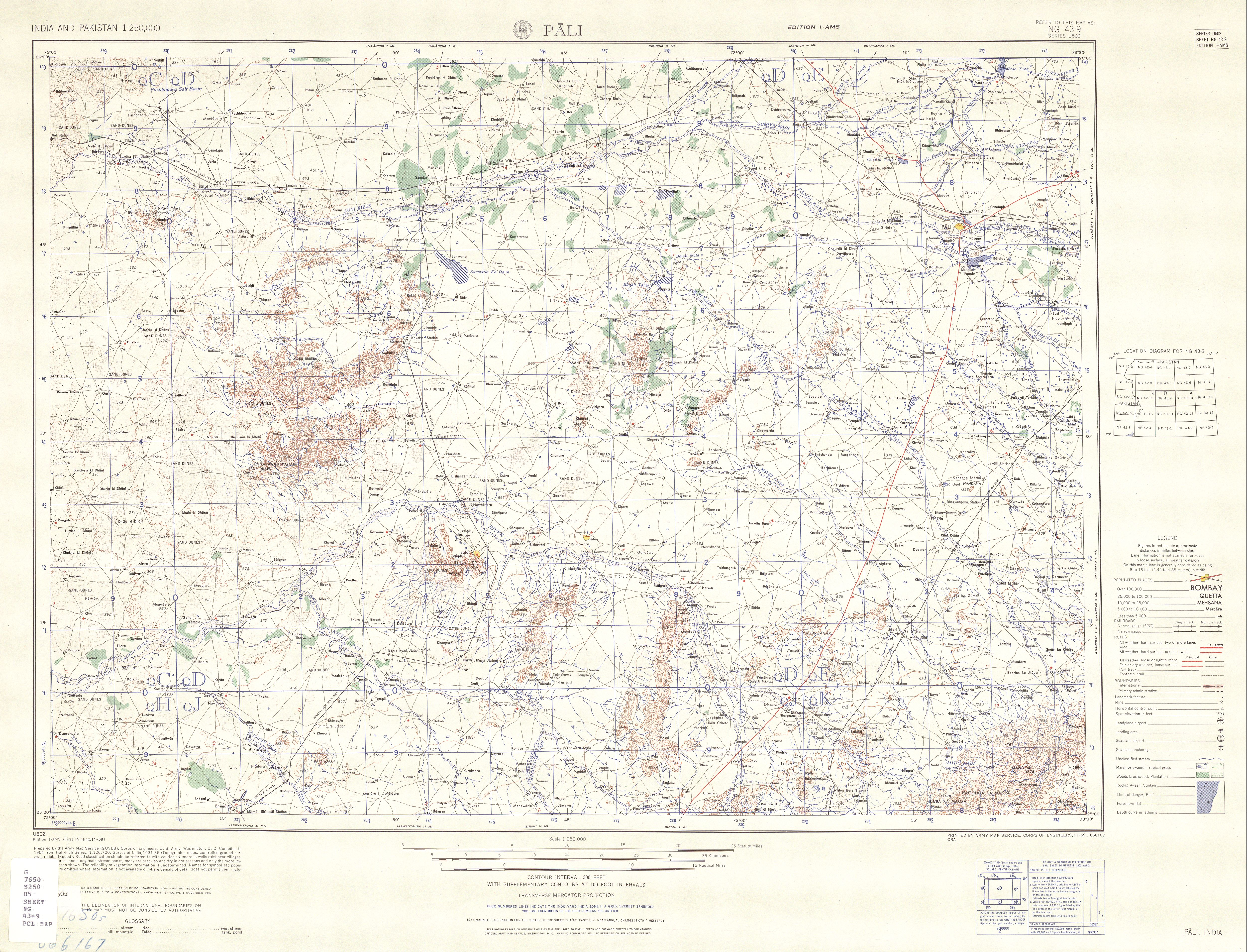
- ↑ Pali, India, Sheet NG 43-09 (topographic map, scale 1:250,000), Series U-502, United States Army Map Service, November 1959
- ↑ Pali (Lok Sabha constituency)
- ↑ "Pali 'dyeing': Jobless workers, farmers hoping against hope - Times of India". indiatimes.com.
- ↑ List of constituencies of Rajasthan Legislative Assembly
- ↑ http://eci.nic.in/eci_main/CurrentElections/CONSOLIDATED_ORDER%20_ECI%20.pdf
- ↑ http://www.rajpanchayat.gov.in/common/sidelinks/panchayat.htm
- ↑ "अजमेर, पाली में भाजपा के जिला प्रमुख, 10 में से 6 जगह प्रधान चुने गए". bhaskar.com. 7 February 2015.
- ↑ "Irrigation by Different Sources, District: Pali" (PDF). Central Groundwater Board.
- ↑ "National Register of Large Dams-2009" (PDF). Central Water Commission.
- ↑ "Dams". Archived from the original on February 27, 2012.
- ↑ Sindarli
- ↑ "Adminsitrative Setup, District: Pali" (PDF). Central Groundwater Board.
- ↑ Rajasthan Budget 2012-13
- ↑ Village Panchayats of PALI,RAJASTHAN
- ↑ "[IRFCA] Indian Railways FAQ: IR History: Early Days - 2". irfca.org.
- ↑ "[IRFCA] Indian Railways FAQ: IR History: Part 6". irfca.org.
- ↑ Survey of New Lines
- 1 2 3 4 5 6 "District Census 2011". Census2011.co.in. 2011. Retrieved 2011-09-30.
- ↑ US Directorate of Intelligence. "Country Comparison:Population". Retrieved 2011-10-01.
Slovenia 2,000,092 July 2011 est.
- ↑ "2010 Resident Population Data". U. S. Census Bureau. Retrieved 2011-09-30.
New Mexico - 2,059,179
References
- Pali District official Website
- "Pali District: Gram Panchayat, Samiti and Ward Map". Excise Department, Government of Rajasthan. Archived from the original on 11 March 2012.
- "Rivers: Luni Basin". Water Resources Department, Government of Rajasthan. Archived from the original on 18 October 2012.
External links
| Wikimedia Commons has media related to Pali district. |
 |
Jodhpur district | Nagaur district | Ajmer district | |
| Barmer district Jalor district |
|
Rajsamand district | ||
| ||||
| | ||||
| Sirohi district | Udaipur district |
| Outline | 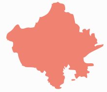 | ||||||||||||||||||||||||||
|---|---|---|---|---|---|---|---|---|---|---|---|---|---|---|---|---|---|---|---|---|---|---|---|---|---|---|---|
| Governance | |||||||||||||||||||||||||||
| Divisions and Districts |
| ||||||||||||||||||||||||||
| Major cities | |||||||||||||||||||||||||||
| Related templates |
| ||||||||||||||||||||||||||
Coordinates: 25°46′N 73°19′E / 25.767°N 73.317°E