National Register of Historic Places listings in Hunterdon County, New Jersey
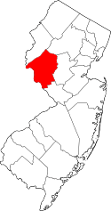
Location of Hunterdon County in New Jersey
List of the National Register of Historic Places listings in Hunterdon County, New Jersey
| Atlantic - Bergen - Burlington - Camden - Cape May - Cumberland - Essex - Gloucester - Hudson - Hunterdon - Mercer - Middlesex - Monmouth - Morris - Ocean - Passaic - Salem - Somerset - Sussex - Union - Warren |
This is intended to be a complete list of properties and districts listed on the National Register of Historic Places in Hunterdon County, New Jersey. The locations of National Register properties and districts (at least for all showing latitude and longitude coordinates below) may be seen in a Google map by clicking on "Map of all coordinates".[1]
- This National Park Service list is complete through NPS recent listings posted December 16, 2016.[2]
| [3] | Name on the Register[4] | Image | Date listed[5] | Location | City or town | Description |
|---|---|---|---|---|---|---|
| 1 | Amsterdam Historic District |  |
(#95000184) |
Roughly, area surrounding Amsterdam, Church, and Crab Apple Hill Rds., Holland Township 40°35′15″N 75°09′34″W / 40.5875°N 75.159444°W |
Holland Township | |
| 2 | Annandale Historic District |  |
(#94001108) |
Roughly bounded by Maple Ave., Main St., Beaver Ave. and East St., Clinton Township 40°38′36″N 74°52′40″W / 40.643333°N 74.877778°W |
Annandale | |
| 3 | J. K. Apgar Farmhouse |  |
(#79001494) |
CR 512 and Guinea Hollow Rd. 40°42′59″N 74°49′38″W / 40.716389°N 74.827222°W |
Califon | |
| 4 | Asbury Historic District | .JPG) |
(#93000132) |
Roughly, CR 643 from Maple Ave. to CR 623 and adjacent parts of Maple, CR 623 and Kitchen and School Sts. 40°41′53″N 75°00′50″W / 40.698056°N 75.013889°W |
Asbury | |
| 5 | Bartles House |  |
(#06000763) |
159 Oldwick Rd. 40°39′58″N 74°45′05″W / 40.666111°N 74.751389°W |
Tewksbury Township | |
| 6 | Bray-Hoffman House | Upload image | (#73001104) |
On Bray's Hill Rd. 40°38′13″N 74°51′33″W / 40.636944°N 74.859167°W |
Annandale | This house has been demolished |
| 7 | Califon Historic District |  |
(#76001157) |
Main and Academy Sts. 40°43′07″N 74°50′11″W / 40.718611°N 74.836389°W |
Califon | |
| 8 | Case-Dvoor Farmstead |  |
(#09001074) |
111 Mine St. 40°30′19″N 74°52′05″W / 40.505356°N 74.867942°W |
Raritan Township | |
| 9 | Case Farmstead | 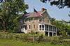 |
(#79001496) |
West of Pattenburg on SR 14 40°38′02″N 75°01′57″W / 40.633889°N 75.0325°W |
Pattenburg | |
| 10 | Clinton Historic District | 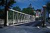 |
(#95001101) |
Roughly, along Center, W. Main, Main, E. Main, Halstead, Water, Leigh (Library) and Lower Center Sts. 40°38′17″N 74°54′37″W / 40.638056°N 74.910278°W |
Clinton | |
| 11 | Clover Hill Historic District | 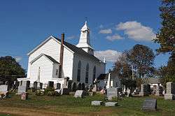 |
(#80002492) |
Amwell and Wertsville-Clover Hill Rds. 40°29′14″N 74°47′01″W / 40.487222°N 74.783611°W |
Flemington | |
| 12 | Cokesbury Historic District | 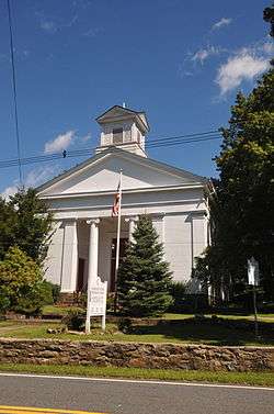 |
(#97000802) |
Along Cokebury-Califon Rd., Rt. 639, Water St., and McCatharn Rd. 40°40′56″N 74°50′20″W / 40.682222°N 74.838889°W |
Clinton | |
| 13 | Covered Bridge Historic District | 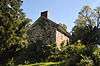 |
(#99000269) |
Roughly along CR 604, Pine Hill Rd., and Lower Creek Rd. 40°26′44″N 74°57′50″W / 40.445556°N 74.963889°W |
Delaware Township | |
| 14 | Dart's Mill Historic District | 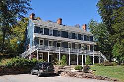 |
(#82003279) |
Northeast of Flemington on Rt. 523 40°32′16″N 74°50′04″W / 40.537778°N 74.834444°W |
Readington Township | |
| 15 | Dawlis Mill-Spring Mill Historic District | 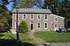 |
(#04001192) |
525 and 530 NJ 31 40°24′56″N 74°51′40″W / 40.415689°N 74.861006°W |
East Amwell | |
| 16 | Delaware and Raritan Canal | 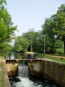 |
(#73001105) |
Follows the Delaware River to Trenton, then E to New Brunswick 40°32′40″N 75°02′50″W / 40.544444°N 75.047222°W |
Lambertville | |
| 17 | District No. 98 Schoolhouse |  |
(#04001477) |
19 S. Main St. 40°24′25″N 74°58′30″W / 40.406944°N 74.975°W |
Stockton Borough | |
| 18 | Dunham's Mill |  |
(#82003277) |
7 Center St. 40°38′11″N 74°54′45″W / 40.636389°N 74.9125°W |
Clinton | |
| 19 | Everittstown Historic District |  |
(#80002496) |
East of Milford at intersection of CR 513, CR 519 and Palmyra Rd. 40°33′58″N 75°01′41″W / 40.566111°N 75.028056°W |
Milford | |
| 20 | Charles Eversole House |  |
(#05001563) |
509 Cty Rd. 523 40°35′56″N 74°46′39″W / 40.598889°N 74.7775°W |
Readington Township | |
| 21 | Fairmount Historic District |  |
(#96001470) |
Roughly, NJ 517 from the Morris-Hunterdon Co. line to NJ 512 and NJ 517 from Fox Hill to Wildwood Rds. 40°43′08″N 74°46′34″W / 40.718889°N 74.776111°W |
Califon | |
| 22 | Fink-Type Truss Bridge | %2C_Flemington_vicinity%2C_Hunterdon_County_(New_Jersey).jpg) |
(#74001161) |
West of Allerton off NJ 31 over South Branch of Raritan River 40°36′14″N 74°54′10″W / 40.603889°N 74.902778°W |
Clinton Township | Demolished.[6] |
| 23 | Flemington Historic District | 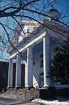 |
(#80002493) |
Roughly bounded by NJ 12, NJ 31, N. Main, Shields, and Hopewell Aves. 40°30′32″N 74°51′38″W / 40.508889°N 74.860556°W |
Flemington | |
| 24 | Frenchtown Historic District | 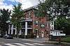 |
(#94000438) |
Bounded by 12th St., Washington St., the Delaware R. and Nishisakawick Cr. 40°31′39″N 75°03′45″W / 40.5275°N 75.0625°W |
Frenchtown | |
| 25 | Frog Hollow Road Bridge over minor tributary of the South Branch, Raritan River | 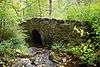 |
(#02001509) |
Frog Hollow Rd., approximately 1,400 feet (430 m) west of Beavers Rd. 40°43′47″N 74°49′01″W / 40.729722°N 74.816944°W |
Tewksbury | |
| 26 | Glen Gardner Pony Pratt Truss Bridge | 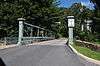 |
(#77000876) |
Mill St. at Spruce Run 40°42′03″N 74°56′39″W / 40.700833°N 74.944167°W |
Glen Gardner | |
| 27 | Green Sergeants Covered Bridge | 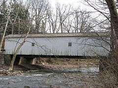 |
(#74001165) |
North of Stockton off Rosemont-Sergeantsville Rd. 40°26′39″N 74°57′59″W / 40.444167°N 74.966389°W |
Stockton | |
| 28 | Headquarters Historic District |  |
(#11000447) |
Rosemont-Ringoes Rd., Zentek Rd. 40°26′27″N 74°55′25″W / 40.440833°N 74.923611°W |
Sergeantsville | Boundary increase February 8, 2016. |
| 29 | High Bridge Reformed Church |  |
(#80002494) |
Church St. and CR 513 40°40′13″N 74°53′41″W / 40.670278°N 74.894722°W |
High Bridge | |
| 30 | Highfields |  |
(#94001096) |
End of Lindbergh Rd., East Amwell Township 40°25′26″N 74°46′04″W / 40.423889°N 74.767778°W |
East Amwell | |
| 31 | Hollow Brook Road Bridge over tributary of the Lamington River |  |
(#02001510) |
Hollow Brook Rd. approx. 700 feet (210 m) west of Homestead Rd. 40°43′02″N 74°44′12″W / 40.717222°N 74.736667°W |
Tewksbury | |
| 32 | Imlaydale Historic District | 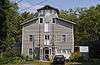 |
(#91000306) |
Imlaydale Rd. and surrounding land between NJ 31 and the Musconetcong R., Washington and Lebanon Townships 40°42′50″N 74°58′05″W / 40.713889°N 74.968056°W |
Hampton | |
| 33 | The Kalmia Club | 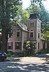 |
(#12000208) |
39 York St. 40°22′06″N 74°56′40″W / 40.368242°N 74.944507°W |
Lambertville | Clubhouses of New Jersey Women's Clubs Multiple Property Submission |
| 34 | Kline Farmhouse | 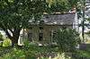 |
(#84002712) |
NJ 517 40°40′40″N 74°45′06″W / 40.677778°N 74.751667°W |
Oldwick | |
| 35 | Lambertville Historic District | 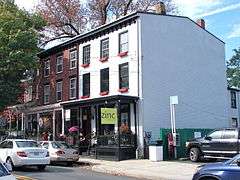 |
(#83001602) |
NJ 29 and NJ 179 40°21′58″N 74°56′34″W / 40.366111°N 74.942778°W |
Lambertville | |
| 36 | Lambertville House | 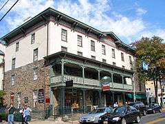 |
(#78001768) |
32 Bridge St. 40°21′57″N 74°56′44″W / 40.365833°N 74.945556°W |
Lambertville | |
| 37 | Lansdown | 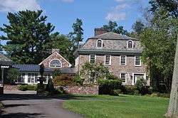 |
(#79001497) |
Northeast of Pittstown on SR 2 40°36′22″N 74°54′24″W / 40.606111°N 74.906667°W |
Pittstown | |
| 38 | Lebanon Historic District | 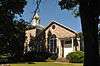 |
(#09000652) |
Main Street, Cherry Street, Brunswick Avenue, Maple Street, High Street 40°38′26″N 74°50′05″W / 40.640556°N 74.834722°W |
Lebanon | |
| 39 | Little York Historic District | 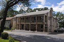 |
(#88001207) |
CR 614 and Sweet Hollow Rd. 40°36′47″N 75°04′35″W / 40.613056°N 75.076389°W |
Holland Township | |
| 40 | Locktown Baptist Church |  |
(#74001166) |
West of Stockton on Locktown-Stugeonville Rds. 40°29′05″N 74°58′21″W / 40.484722°N 74.9725°W |
Stockton | |
| 41 | James W. Marshall House |  |
(#70000386) |
60 Bridge St. 40°21′58″N 74°56′39″W / 40.366111°N 74.944167°W |
Lambertville | |
| 42 | David McKinney Mill |  |
(#74001162) |
56 Main Street 40°38′10″N 74°54′48″W / 40.636111°N 74.913333°W |
Clinton | known as the Red Mill |
| 43 | Mechlins Corner Tavern |  |
(#74001164) |
Northwest of Pittstown 40°36′38″N 74°59′18″W / 40.610556°N 74.988333°W |
Pittstown | |
| 44 | Miller Farmstead | 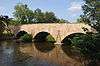 |
(#88002118) |
NJ 57 40°47′19″N 74°53′41″W / 40.788611°N 74.894722°W |
Lebanon Township | |
| 45 | Mount Airy Historic District | 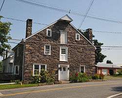 |
(#89001943) |
Roughly bounded by NJ 179, Rt. 605, Rt. 603, and Rt. 601 40°23′57″N 74°54′17″W / 40.399167°N 74.904722°W |
Lambertville | |
| 46 | Mount Pleasant Historic District | 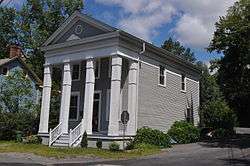 |
(#87002012) |
CR 519 & Rick Rd. 40°34′54″N 75°03′09″W / 40.581667°N 75.0525°W |
Mount Pleasant | |
| 47 | Mount Salem Methodist Episcopal Church | 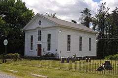 |
(#88000592) |
CR 579 40°36′19″N 74°59′00″W / 40.605278°N 74.983333°W |
Alexandria Township | |
| 48 | Mountainville Historic District |  |
(#93001360) |
Guinea Hollow Rd., Saw Mill Rd., Main St., Rockaway Creek Rd. and Philhower Rd., Tewksbury Township 40°41′29″N 74°48′33″W / 40.691389°N 74.809167°W |
Tewksbury Township | |
| 49 | M. C. Mulligan & Sons Quarry |  |
(#94001010) |
56 Main St. 40°38′11″N 74°54′50″W / 40.636389°N 74.913889°W |
Clinton | |
| 50 | Music Hall | 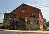 |
(#82003278) |
23 W. Main St. 40°38′01″N 74°54′50″W / 40.633611°N 74.913889°W |
Clinton | |
| 51 | New Hampton Historic District | 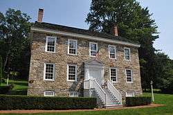 |
(#98000257) |
Roughly along Musconetcong River Rd, and Rymon Rd. 40°43′05″N 74°57′49″W / 40.718056°N 74.963611°W |
Lebanon | |
| 52 | New Hampton Pony Pratt Truss Bridge | 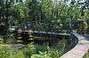 |
(#77000877) |
North of Hampton over Musconetcong River 40°43′13″N 74°57′50″W / 40.720278°N 74.963889°W |
Hampton | |
| 53 | New Market-Linvale-Snydertown Historic District | 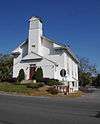 |
(#98000097) |
Roughly along NJ 31, Linvale, Snydertown, and Woodsville Rds. 40°23′46″N 74°50′05″W / 40.396111°N 74.834722°W |
East and West Amwell Townships | |
| 54 | Old Grandin Library | 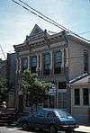 |
(#74001163) |
12 E. Main St. 40°38′13″N 74°54′34″W / 40.636944°N 74.909444°W |
Clinton | |
| 55 | Oldwick Historic District | 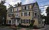 |
(#88002153) |
Roughly along CR 517, Church, King, James, Joliet and William Sts. 40°40′19″N 74°44′59″W / 40.671944°N 74.749722°W |
Oldwick | |
| 56 | Palatine Road Bridge over a minor tributary of the Lamington River | 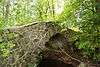 |
(#02001508) |
Palatine Rd., junction with Homestead and Cold Spring Roads. 40°41′58″N 74°44′48″W / 40.699444°N 74.746667°W |
Tewksbury | |
| 57 | Peck's Ferry Bridge | 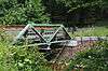 |
(#99001313) |
Locktown-Flemington Rd. (Delaware Township) 40°29′03″N 74°56′38″W / 40.484167°N 74.943889°W |
Locktown | |
| 58 | Perryville Tavern | 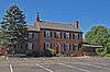 |
(#77000874) |
West of Clinton at I-78 and CR 42 40°37′59″N 74°58′14″W / 40.633056°N 74.970556°W |
Clinton | |
| 59 | Pittstown Historic District | 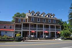 |
(#90001483) |
Pittstown Rd. and adjacent portions of Race St. and Quakertown Rds., Franklin and Alexandra Townships 40°34′43″N 74°57′42″W / 40.578611°N 74.961667°W |
Pittstown | |
| 60 | Pleasant Valley Historic District | 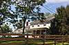 |
(#91000676) |
Centered on junction of Pleasant Valley Rd. with Woodens Ln. and Hunter Rd., Hopewell and West Amwell Twps. 40°20′18″N 74°53′44″W / 40.338333°N 74.895556°W |
Lambertville | |
| 61 | Potterstown Rural Historic District | 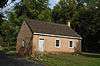 |
(#92000806) |
Along Potterstown and Hall's Mill Rds. and I-78, Readington and Clinton Townships 40°38′47″N 74°47′05″W / 40.646389°N 74.784722°W |
Potterstown | |
| 62 | Pottersville Village Historic District | 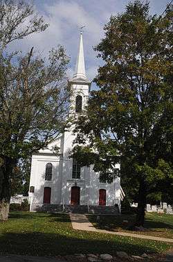 |
(#90001475) |
Properties fronting on Black River, Pottersville, McCann Mill and Hacklebarney Rds. and Fairmount Rd. E and Hill St. 40°42′52″N 74°43′21″W / 40.714444°N 74.7225°W |
Pottersville | |
| 63 | Prallsville District | 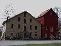 |
(#79001498) |
NJ 29 40°24′43″N 74°59′08″W / 40.411944°N 74.985556°W |
Prallsville | |
| 64 | Pursley's Ferry Historic District |  |
(#80002495) |
River and Church Rds. 40°34′36″N 75°11′28″W / 40.576667°N 75.191111°W |
Holland | |
| 65 | Quaker Meeting |  |
(#90001242) |
Roughly bounded by Quakertown, Cherryville Rds., Quaker Ln.,and Locust Grove Rd. (Franklin Township) 40°33′53″N 74°56′41″W / 40.564722°N 74.944722°W |
Quakertown | |
| 66 | Raritan-Readington South Branch Historic District |  |
(#89002410) |
Running roughly east of the Raritan River from NJ 31 to US 202 40°31′39″N 74°49′52″W / 40.5275°N 74.831111°W |
Readington Township & Raritan Township | |
| 67 | Raven Rock Historic District |  |
(#15000774) |
Quarry Rd. 40°24′46″N 75°01′45″W / 40.4127°N 75.0293°W |
Delaware Township | |
| 68 | Raven Rock Road Bridge | 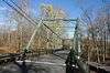 |
(#16000691) |
Rosemont-Raven Rock Rd. 40°24′59″N 75°01′03″W / 40.416254°N 75.017552°W |
Delaware Township | |
| 69 | John Reading Farmstead |  |
(#78001767) |
Northeast of Flemington at 523 River Rd. 40°31′28″N 74°50′18″W / 40.524444°N 74.838333°W |
Readington Township | |
| 70 | Readingsburg Historic District |  |
(#00000176) |
Cokesbury and Stone Mill Rds., CR 639 40°40′54″N 74°52′45″W / 40.681667°N 74.879167°W |
Clinton | |
| 71 | Readington Village Historic District | 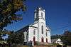 |
(#91000827) |
Readington, Hillcrest, Centerville and Brookview Roads 40°34′06″N 74°44′13″W / 40.568333°N 74.736944°W |
Readington | Includes Readington Reformed Church |
| 72 | Reaville Historic District | 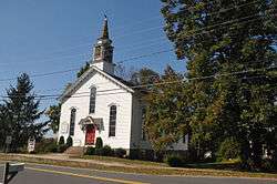 |
(#02000433) |
Old York, Amwell, Barley Sheaf, Kuhl, Manners Rds. 40°28′41″N 74°49′19″W / 40.478056°N 74.821944°W |
East Amwell Township | |
| 73 | Riegel Ridge Community Center | 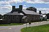 |
(#96000656) |
County Route 519, approximately 1.5 miles (2.4 km) north of the New Jersey-Pennsylvania state line, Holland Township 40°36′34″N 75°07′00″W / 40.609444°N 75.116667°W |
Milford | |
| 74 | Ringoes Historic District |  |
(#99001544) |
Old York, John Ringo, Wertsville and Boss Rds., and Larison Ln. 40°25′56″N 74°52′00″W / 40.432222°N 74.866667°W |
East Amwell Township | |
| 75 | Rockhill Agricultural Historic District | 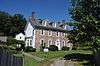 |
(#84002717) |
North of Pittstown on SR 513 40°35′59″N 74°57′12″W / 40.599722°N 74.953333°W |
Pittstown | |
| 76 | Rosemont Rural Agricultural District | 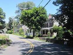 |
(#10000354) |
County Routes 519 and 604; Sanford Rd.; Covered Bridge Rd. 40°26′09″N 74°58′35″W / 40.435739°N 74.976306°W |
Delaware Township | |
| 77 | Sand Brook Historic District | 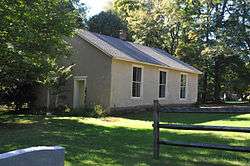 |
(#13000497) |
Cty. Rd. 523, Sand Brook-Headquarters & Britton Rds. 40°28′07″N 74°55′01″W / 40.468556°N 74.916846°W |
Sand Brook | |
| 78 | Sergeantsville Historic District |  |
(#09000972) |
County Routes 523 and 604, Lambert Rd., Delaware Dr. 40°26′45″N 74°56′39″W / 40.44597°N 74.94405°W |
Delaware Twp. | |
| 79 | St. Thomas Episcopal Church | 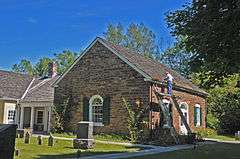 |
(#77000878) |
Southwest of Pittstown on Sky Manor Rd. 40°33′38″N 74°59′22″W / 40.560556°N 74.989444°W |
Pittstown | |
| 80 | Stanton Historic Rural District |  |
(#90001225) |
Jct. of Stanton and Mountain Rds., between Round and Cushetunk Mtns. 40°34′34″N 74°50′03″W / 40.576111°N 74.834167°W |
Stanton (Readington Township) |
|
| 81 | Stone Sign Post Road Bridge over Plum Brook | 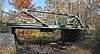 |
(#16000692) |
Stone Sign Post Rd. 40°29′26″N 74°56′19″W / 40.490499°N 74.938683°W |
Delaware Township | |
| 82 | Strimple's Mill Road Bridge over Lockatong Creek | 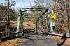 |
(#16000693) |
Strimple's Mill Rd. 40°26′14″N 75°00′43″W / 40.437115°N 75.011846°W |
Delaware Township | |
| 83 | Taylor's Mill Historic District | 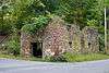 |
(#92000636) |
Jct. of Taylor's Mill and Rockaway Rds., Readington Township 40°39′48″N 74°46′06″W / 40.663333°N 74.768333°W |
Oldwick | |
| 84 | Turner-Chew-Carhart Farm | 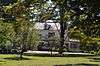 |
(#77000875) |
Northwest of Clinton on Syckles Corner Rd. 40°39′12″N 74°57′27″W / 40.653333°N 74.9575°W |
Clinton | |
| 85 | John Van Syckle House |  |
(#10000814) |
195 Rummel Rd. 40°35′52″N 75°04′30″W / 40.597751°N 75.075107°W |
Holland Township | |
| 86 | Van Syckel Corner District |  |
(#79001495) |
Van Syckels Corner and Norton Rds 40°38′58″N 74°58′38″W / 40.649444°N 74.977222°W |
Clinton | |
| 87 | Christoffel Vought Farmstead |  |
(#07001403) |
East of Grey Rock Rd., 600 feet (180 m) north of the junction with NJ 31. (Clinton Township) 40°38′36″N 74°53′54″W / 40.643278°N 74.89845°W |
Clinton | |
| 88 | Wertsville Historic District |  |
(#00001150) |
Wertsville and Lindbergh Rds. 40°26′54″N 74°47′46″W / 40.448333°N 74.796111°W |
East Amwell Township | |
| 89 | Whitehouse Station |  |
(#84002726) |
Main Street, Whitehouse Station (Readington Township) 40°36′55″N 74°46′16″W / 40.615278°N 74.771111°W |
Whitehouse Station (Readington Township) |
|
| 90 | Whitehouse-Mechanicsville Historic District |  |
(#15000093) |
Old New Jersey Route 28, Mill, Lamington and School Roads 40°37′17″N 74°45′34″W / 40.621389°N 74.759444°W |
Readington Township |
References
- ↑ The latitude and longitude information provided in this table was derived originally from the National Register Information System, which has been found to be fairly accurate for about 99% of listings. For about 1% of NRIS original coordinates, experience has shown that one or both coordinates are typos or otherwise extremely far off; some corrections may have been made. A more subtle problem causes many locations to be off by up to 150 yards, depending on location in the country: most NRIS coordinates were derived from tracing out latitude and longitudes off of USGS topographical quadrant maps created under the North American Datum of 1927, which differs from the current, highly accurate WGS84 GPS system used by most on-line maps. Chicago is about right, but NRIS longitudes in Washington are higher by about 4.5 seconds, and are lower by about 2.0 seconds in Maine. Latitudes differ by about 1.0 second in Florida. Some locations in this table may have been corrected to current GPS standards.
- ↑ "National Register of Historic Places: Weekly List Actions". National Park Service, United States Department of the Interior. Retrieved on December 16, 2016.
- ↑ Numbers represent an ordering by significant words. Various colorings, defined here, differentiate National Historic Landmarks and historic districts from other NRHP buildings, structures, sites or objects.
- ↑ National Park Service (2008-04-24). "National Register Information System". National Register of Historic Places. National Park Service.
- ↑ The eight-digit number below each date is the number assigned to each location in the National Register Information System database, which can be viewed by clicking the number.
- ↑ "New Jersey and National Registers of Historic Places" (PDF). NJ DEP - Historic Preservation Office. Retrieved 15 September 2010.
| Wikimedia Commons has media related to National Register of Historic Places in Hunterdon County, New Jersey. |
| Topics | 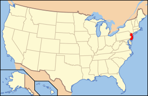 | ||
|---|---|---|---|
| Lists by county | |||
| Lists by city |
| ||
| Other lists | |||
| |||
This article is issued from Wikipedia - version of the 11/7/2016. The text is available under the Creative Commons Attribution/Share Alike but additional terms may apply for the media files.