| [3] |
Name on the Register[4] |
Image |
Date listed[5] |
Location |
City or town |
Description |
|---|
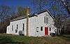
| 1 |
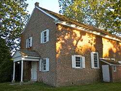
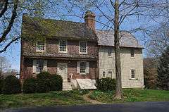
Alloways Creek Friends Meetinghouse |
|
000000002003-12-18-0000December 18, 2003
(#03001306) |
Buttonwood Ave, 150 ft. west of Main St.
39°30′08″N 75°27′33″W / 39.502222°N 75.459167°W / 39.502222; -75.459167 (Alloways Creek Friends Meetinghouse) |
Hancock's Bridge |
|
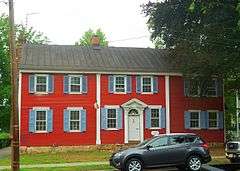
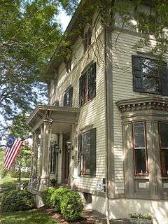
| 2 |
Moshe Bayuk House |
|
000000002012-03-27-0000March 27, 2012
(#12000159) |
984 Gershal Ave.
39°30′28″N 75°05′05″W / 39.5077°N 75.084858°W / 39.5077; -75.084858 (Moshe Bayuk House) |
Pittsgrove Township |
|
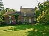
| 3 |
Richard Brick House |
|
000000001976-05-13-0000May 13, 1976
(#76001183) |
Northeast of Salem off NJ 45 on Compromise Rd.
39°36′44″N 75°22′56″W / 39.612222°N 75.382222°W / 39.612222; -75.382222 (Richard Brick House) |
Salem |
|
| 4 |
Broadway Historic District |
|
000000001992-03-05-0000March 5, 1992
(#92000098) |
Broadway from Front to Yorke Sts.
39°34′11″N 75°28′03″W / 39.569722°N 75.4675°W / 39.569722; -75.4675 (Broadway Historic District) |
Salem |
|
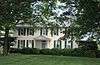
| 5 |
Dickinson House |
|
000000001975-02-20-0000February 20, 1975
(#75001156) |
Northeast of Alloway on Brickyard Rd.
39°36′01″N 75°20′02″W / 39.600278°N 75.333889°W / 39.600278; -75.333889 (Dickinson House) |
Alloway Township |
|
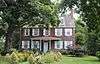
| 6 |
Zaccheus Dunn House |
|
000000001977-08-10-0000August 10, 1977
(#77000905) |
South of Woodstown on East Lake Rd.
39°37′55″N 75°19′32″W / 39.631944°N 75.325556°W / 39.631944; -75.325556 (Zaccheus Dunn House) |
Woodstown |
|
| 7 |
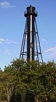
Finn's Point Rear Range Light |
|
000000001978-08-30-0000August 30, 1978
(#78001792) |
Northwest of Salem at Fort Mott and Lighthouse Rds.
39°37′01″N 75°32′05″W / 39.616944°N 75.534722°W / 39.616944; -75.534722 (Finn's Point Rear Range Light) |
Salem |
|
| 8 |
Fort Mott and Finns Point National Cemetery District |
|
000000001978-08-31-0000August 31, 1978
(#78001793) |
Northwest of Salem on Fort Mott Rd.
39°36′21″N 75°33′08″W / 39.605833°N 75.552222°W / 39.605833; -75.552222 (Fort Mott and Finns Point National Cemetery District) |
Salem |
|
| 9 |
Philip Fries House |
|
000000001990-09-28-0000September 28, 1990
(#90001451) |
Cohansey-Daretown Rd. North of Alloway-Friesburg Rd., Alloway Township
39°32′23″N 75°17′32″W / 39.539722°N 75.292222°W / 39.539722; -75.292222 (Philip Fries House) |
Alloway Township |
|
| 10 |
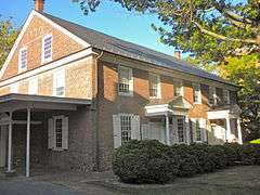
Hancock House |
|
000000001970-12-18-0000December 18, 1970
(#70000393) |
Rte. 49 and Front St.
39°30′27″N 75°27′38″W / 39.5075°N 75.460556°W / 39.5075; -75.460556 (Hancock House) |
Lower Alloways Creek Township |
|
| 11 |
Hedge-Carpenter-Thompson Historic District |
|
000000002001-03-26-0000March 26, 2001
(#01000236) |
Bounded by Hedge, Thompson, South Third Sts. and Oak St. Alley
39°34′15″N 75°28′32″W / 39.570833°N 75.475556°W / 39.570833; -75.475556 (Hedge-Carpenter-Thompson Historic District) |
Salem |
|
| 12 |
Benjamin Holmes House |
|
000000001978-08-31-0000August 31, 1978
(#78001794) |
West of Salem on Fort Elfsborg-Hancock's Bridge Rd.
39°32′43″N 75°30′46″W / 39.545278°N 75.512778°W / 39.545278; -75.512778 (Benjamin Holmes House) |
Salem |
|
| 13 |
James and Mary Lawson House |
|
000000002001-02-16-0000February 16, 2001
(#01000042) |
209 N. Main St.
39°39′20″N 75°19′39″W / 39.655556°N 75.3275°W / 39.655556; -75.3275 (James and Mary Lawson House) |
Woodstown |
|
| 14 |
Market Street Historic District |
|
000000001975-04-10-0000April 10, 1975
(#75001157) |
Irregular pattern on both sides of Market St. from Broadway to Fenwick Creek
39°34′28″N 75°28′00″W / 39.574444°N 75.466667°W / 39.574444; -75.466667 (Market Street Historic District) |
Salem |
|
| 15 |
Marshalltown Historic District |
|
000000002013-07-17-0000July 17, 2013
(#13000498) |
Marshalltown Rd. & Roosevelt Ave.
39°38′16″N 75°27′12″W / 39.637819°N 75.453225°W / 39.637819; -75.453225 (Marshalltown Historic District) |
Mannington Township |
African-American rural district[6]
|
| 16 |
Abel and Mary Nicholson House |
|
000000001997-01-16-0000January 16, 1997
(#96001548) |
Jct. of Hancocks Br. and Ft. Elfsborg Rd., Elfinsboro Township
39°31′15″N 75°29′13″W / 39.520833°N 75.486944°W / 39.520833; -75.486944 (Abel and Mary Nicholson House) |
Salem |
|
| 17 |
Sarah and Samuel Nicholson House |
|
000000001975-02-24-0000February 24, 1975
(#75001158) |
2 miles (3.2 km) south of Salem on Amwellbury Rd.
39°32′28″N 75°29′19″W / 39.541111°N 75.488611°W / 39.541111; -75.488611 (Sarah and Samuel Nicholson House) |
Salem |
|
| 18 |
Pittsgrove Presbyterian Church |
|
000000001977-09-19-0000September 19, 1977
(#77000904) |
Main St.
39°36′04″N 75°15′38″W / 39.601111°N 75.260556°W / 39.601111; -75.260556 (Pittsgrove Presbyterian Church) |
Upper Pittsgrove Township |
|
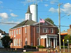
| 19 |
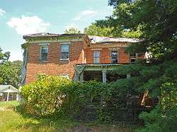
Salem County Insane Asylum |
|
000000002008-06-27-0000June 27, 2008
(#08000562) |
900 Route 45
39°37′54″N 75°21′48″W / 39.631556°N 75.3634°W / 39.631556; -75.3634 (Salem County Insane Asylum) |
Mannington Township |
Former asylum building eyed for preservation
|
| 20 |
Seven Stars Tavern |
|
000000001976-05-17-0000May 17, 1976
(#76001184) |
North of Woodstown at junction of Sharptown-Swedesboro and Woodstown-Auburn Rds.
39°41′08″N 75°20′23″W / 39.685556°N 75.339722°W / 39.685556; -75.339722 (Seven Stars Tavern) |
Woodstown |
|
| 21 |
Joseph Shinn House |
|
000000001979-03-07-0000March 7, 1979
(#79001518) |
68 N. Main St.
39°39′14″N 75°19′46″W / 39.653889°N 75.329444°W / 39.653889; -75.329444 (Joseph Shinn House) |
Woodstown |
|
| 22 |
David V. Smith House |
|
000000001976-05-17-0000May 17, 1976
(#76001182) |
104 S. Main St.
39°35′36″N 75°10′10″W / 39.593333°N 75.169444°W / 39.593333; -75.169444 (David V. Smith House) |
Elmer |
|
| 23 |
William Smith House |
|
000000001994-02-04-0000February 4, 1994
(#94000008) |
Jct. of NJ 45 and Bassett Rd., Mannington Township
39°36′49″N 75°24′29″W / 39.613611°N 75.408056°W / 39.613611; -75.408056 (William Smith House) |
Salem |
Reported to be destroyed by fire
|
| 24 |
Joseph Ware House |
|
000000001990-01-26-0000January 26, 1990
(#89002418) |
134 Poplar St.
39°30′21″N 75°29′09″W / 39.505833°N 75.485833°W / 39.505833; -75.485833 (Joseph Ware House) |
Hancock's Bridge |
|
| 25 |
John and Charlotte Wistar Farm |
|
000000002016-04-22-0000April 22, 2016
(#15001021) |
120 Harris Rd.
39°36′13″N 75°26′47″W / 39.603629°N 75.446425°W / 39.603629; -75.446425 (John and Charlotte Wistar Farm) |
Mannington Township |
|
| 26 |
Caspar & Rebecca Wister Farm |
|
000000002016-04-22-0000April 22, 2016
(#15001020) |
84 Pointers-Auburn Rd.
39°36′22″N 75°26′36″W / 39.606043°N 75.443233°W / 39.606043; -75.443233 (Caspar & Rebecca Wister Farm) |
Mannington Township |
|


_House%2C_Elsinboro_(Salem_County%2C_New_Jersey).jpg)