National Register of Historic Places listings in Knox County, Nebraska
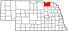
Location of Knox County in Nebraska
This is a list of the National Register of Historic Places listings in Knox County, Nebraska.
This is intended to be a complete list of the properties and districts on the National Register of Historic Places in Knox County, Nebraska, United States. The locations of National Register properties and districts for which the latitude and longitude coordinates are included below, may be seen in a map.[1]
There are 15 properties and districts listed on the National Register in the county.
- This National Park Service list is complete through NPS recent listings posted December 16, 2016.[2]
Current listings
| [3] | Name on the Register | Image | Date listed[4] | Location | City or town | Description |
|---|---|---|---|---|---|---|
| 1 | Argo Hotel | |
(#99000478) |
211 Kansas St. 42°43′54″N 97°29′49″W / 42.731667°N 97.496944°W |
Crofton | |
| 2 | The Commercial Hotel |  |
(#90000563) |
117 Main St. 42°36′00″N 98°02′00″W / 42.6°N 98.033333°W |
Verdigre | |
| 3 | Congregational Church and Manse | 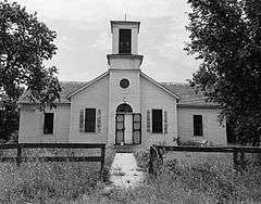 |
(#72000753) |
Santee Sioux Reservation 42°50′19″N 97°50′46″W / 42.838611°N 97.846111°W |
Santee | |
| 4 | Episcopal Church |  |
(#72000754) |
On the Missouri River in the Santee Sioux Reservation 42°50′27″N 97°50′15″W / 42.84085°N 97.83763°W |
Santee | |
| 5 | Gross State Aid Bridge | 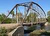 |
(#92000773) |
County road 885 Rd over Verdigris Creek, 3.5 miles north and 0.2 miles west of Verdigre 42°39′16″N 98°02′34″W / 42.654444°N 98.042778°W |
Verdigre | |
| 6 | Knox County Courthouse | _courtroom_1.JPG) |
(#90000972) |
Main St. between Brazile and Bridge Sts. 42°36′32″N 97°52′37″W / 42.608889°N 97.876944°W |
Center | |
| 7 | Niobrara River Bridge |  |
(#92001576) |
Over the Niobrara River 1.3 miles northwest of Niobrara 42°46′00″N 98°02′55″W / 42.766667°N 98.048611°W |
Niobrara | |
| 8 | Ponca Agency Archeological District | Upload image | (#06000555) |
Address Restricted |
Niobrara | |
| 9 | Ponca Fort Site | Upload image | (#73001066) |
Hilltop in Section 29, Township 33 North, Range 7 West[5] 42°48′29″N 98°09′50″W / 42.808056°N 98.163833°W |
Verdel | University of Nebraska excavations in the 1930s showed this site to be Arikara-affiliated and to date from circa 1790 to 1802[6] |
| 10 | Ponca Tribal Self-Help Community Building Historic District |  |
(#03000106) |
88915 521 Avenue;[7] approximately 3 miles southeast of Niobrara 42°42′50″N 98°04′30″W / 42.71381°N 98.07495°W |
Niobrara | |
| 11 | Pospeshil Theatre | |
(#88000935) |
123 Broadway 42°35′53″N 97°38′44″W / 42.598056°N 97.645556°W |
Bloomfield | Burned down; Bloomfield library was built in 2000 on former site[8] |
| 12 | Rad Sladkovsky | 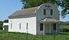 |
(#82003193) |
At Pishelville, northwest of Verdigre 42°43′34″N 98°12′41″W / 42.72619°N 98.21152°W |
Verdigre | |
| 13 | St. Rose of Lima Catholic Church and School Complex | 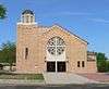 |
(#11000106) |
1302-1316 W. 5th St.[9] 42°43′45″N 97°30′03″W / 42.72922°N 97.50085°W |
Crofton | |
| 14 | Winnetoon Jail |  |
(#95000094) |
Junction of 1st St. and Sherman Ave. 42°30′52″N 97°57′43″W / 42.514444°N 97.961944°W |
Winnetoon | |
| 15 | Z.C.B.J. Opera House | 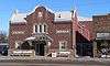 |
(#88000946) |
4th Ave. and Main 42°35′48″N 98°02′00″W / 42.596778°N 98.033333°W |
Verdigre |
See also
| Wikimedia Commons has media related to National Register of Historic Places in Knox County, Nebraska. |
- List of National Historic Landmarks in Nebraska
- National Register of Historic Places listings in Nebraska
References
- ↑ The latitude and longitude information provided in this table was derived originally from the National Register Information System, which has been found to be fairly accurate for about 99% of listings. For about 1% of NRIS original coordinates, experience has shown that one or both coordinates are typos or otherwise extremely far off; some corrections may have been made. A more subtle problem causes many locations to be off by up to 150 yards, depending on location in the country: most NRIS coordinates were derived from tracing out latitude and longitudes off of USGS topographical quadrant maps created under the North American Datum of 1927, which differs from the current, highly accurate WGS84 GPS system used by most on-line maps. Chicago is about right, but NRIS longitudes in Washington are higher by about 4.5 seconds, and are lower by about 2.0 seconds in Maine. Latitudes differ by about 1.0 second in Florida. Some locations in this table may have been corrected to current GPS standards.
- ↑ "National Register of Historic Places: Weekly List Actions". National Park Service, United States Department of the Interior. Retrieved on December 16, 2016.
- ↑ Numbers represent an ordering by significant words. Various colorings, defined here, differentiate National Historic Landmarks and historic districts from other NRHP buildings, structures, sites or objects.
- ↑ The eight-digit number below each date is the number assigned to each location in the National Register Information System database, which can be viewed by clicking the number.
- ↑ Howard, James H. "Known Village Sites of the Ponca". Plains Anthropologist 15.48 (1970): 109-134: 125.
- ↑ Wood, W. Raymond. "Historical and Archeological Evidence for Arikara Visits to the Central Plains". Plains Anthropologist 4 (1955): 27-39: 34.
- ↑ "Culture Department". Ponca Tribe of Nebraska. Retrieved 2013-05-28.
- ↑ Koertje, Norma. "Bloomfield Public Library". Nebraska Library Quarterly. 2000-06-25. Retrieved 2010-02-19.
- ↑ The National Park Service announcement has the address as South 5th St. Per the church website, the actual address is West 5th St.
| Topics | |
|---|---|
| Lists by states |
|
| Lists by insular areas | |
| Lists by associated states | |
| Other areas | |
| |
Municipalities and communities of Knox County, Nebraska, United States | ||
|---|---|---|
| Cities | ||
| Villages | ||
| Townships | ||
| CDP | ||
| Unincorporated communities | ||
| Indian reservations | ||
This article is issued from Wikipedia - version of the 6/5/2016. The text is available under the Creative Commons Attribution/Share Alike but additional terms may apply for the media files.