Litchfield, Connecticut
| Litchfield, Connecticut | ||
|---|---|---|
| Town | ||
| ||
 Location in Litchfield County, Connecticut | ||
| Coordinates: 41°44′50″N 73°11′23″W / 41.74722°N 73.18972°WCoordinates: 41°44′50″N 73°11′23″W / 41.74722°N 73.18972°W | ||
| Country | United States | |
| State | Connecticut | |
| NECTA | None | |
| Region | Litchfield Hills | |
| Incorporated | 1719[1] | |
| Government | ||
| • Type | Selectman-town meeting | |
| • First selectman | Leo Paul, Jr. (R) | |
| • Selectmen |
Paul J. Parsons (R) Jonathan E. Torrant (R) Diane Knox (D) Jeffrey J. Zullo (D) | |
| Area | ||
| • Total | 56.8 sq mi (147.1 km2) | |
| • Land | 56.1 sq mi (145.2 km2) | |
| • Water | 0.7 sq mi (1.9 km2) | |
| Elevation | 495 ft (151 m) | |
| Population (2005)[2] | ||
| • Total | 8,684 | |
| • Density | 155/sq mi (60/km2) | |
| Time zone | Eastern (UTC-5) | |
| • Summer (DST) | Eastern (UTC-4) | |
| ZIP code | 06750, 06759 | |
| Area code(s) | 860 | |
| FIPS code | 09-43370 | |
| GNIS feature ID | 0213452 | |
| Website |
www | |

Litchfield is a town in and former county seat of Litchfield County, Connecticut, United States.[3] The population was 8,466 at the 2010 census. The boroughs of Bantam and Litchfield are located within the town. There are also three unincorporated villages: East Litchfield, Milton, and Northfield.
History
Founded in 1719,[4] Litchfield was designated the county seat in 1751, and by the 1790s the town had become the leading commercial, social, cultural and legal center of Northwestern Connecticut. Its population grew from 1,366 in 1756 to 2,544 in 1774, and by 1810 Litchfield was the fourth largest settlement in the state with a population of 4,639.[5]
Beginning in 1784, Litchfield lawyer, Tapping Reeve, systematized his law lectures for young students, creating the Litchfield Law School. Reeve was the first to develop a series of formal, regular lectures that insured that all students had access to the same body of knowledge. The list of students who attended Tapping Reeve's law school includes two Vice Presidents of the United States (Aaron Burr and John C. Calhoun), 101 members of the United States House of Representatives, 28 United States senators, six United States cabinet secretaries, three justices of the United States Supreme Court, 14 state governors and 13 state supreme court chief justices. Litchfield Law School was the first Law School in the United States.
Established in 1792, Sarah Pierce's Litchfield Female Academy was one of the first major educational institutions for women in the United States.
Harriet Beecher Stowe, Henry Ward Beecher, Charles Beecher, Edward Beecher, Isabella Beecher Hooker, and Catharine Beecher all grew up in Litchfield, where their father Lyman Beecher was the Presbyterian minister from 1810 to 1826.[6]
During its "Golden Age" (1784–1834), Litchfield had an unusual number of college-educated inhabitants. In 1791 Samuel Miles Hopkins, a student at the Litchfield Law School, described Litchfield in his journal as a town of "hard, active, reading, thinking, intelligent men who may probably be set forth as a pattern of the finest community on earth."[5]
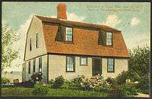
Litchfield's fortunes declined during the later years of the 19th century. The town did not have the ample water supply and rail transportation necessary to establish efficient industry, and the village became a sleepy backwater. Rediscovered as a resort community in the late 19th century, Litchfield became a popular spot for vacation, weekend and summer homes. The town embraced the Colonial Revival movement, and by the early 20th century many of the homes began to sport the white paint and black shutters seen today.[5]
Geography
Located southwest of Torrington, Litchfield also includes part of Bantam Lake. According to the United States Census Bureau, the town has a total area of 56.8 square miles (147.1 km²), of which, 56.1 square miles (145.2 km²) of it is land and 0.7 square miles (1.9 km²) of it (1.3%) is water.
Litchfield is about 95 mi (153 km) from Central Park in New York, about 50 mi (80 km) from the Hudson River valley, and about 40 mi (64 km) from the nearest sea coast, on Long Island Sound.
Principal communities
- Bantam (borough)
- East Litchfield (unincorporated village)
- Litchfield (borough / town center)
- Milton (unincorporated village)
- Northfield (unincorporated village)
Demographics
| Historical population | |||
|---|---|---|---|
| Census | Pop. | %± | |
| 1880 | 452 | — | |
| 1890 | 1,058 | 134.1% | |
| 1900 | 1,120 | 5.9% | |
| 1910 | 903 | −19.4% | |
| 1920 | 707 | −21.7% | |
| 1930 | 1,075 | 52.1% | |
| 1940 | 1,234 | 14.8% | |
| 1950 | 1,174 | −4.9% | |
| 1960 | 1,363 | 16.1% | |
| 1970 | 1,559 | 14.4% | |
| 1980 | 1,489 | −4.5% | |
| 1990 | 1,378 | −7.5% | |
| 2000 | 1,328 | −3.6% | |
| 2010 | 1,258 | −5.3% | |
| Est. 2015 | 1,215 | [7] | −3.4% |
| Historical population of Litchfield[9][10][11] | |
| 1830 | 4,456 |
| 1840 | 4,038 |
| 1850 | 3,953 |
| 1860 | 3,200 |
| 1870 | 3,113 |
| 1880 | 3,410 |
| 1890 | 3,304 |
| 1900 | 3,214 |
| 1910 | 3,005 |
| 1920 | 3,180 |
| 1930 | 3,574 |
| 1940 | 4,029 |
| 1950 | 4,964 |
| 1960 | 6,264 |
| 1970 | 7,399 |
| 1980 | 7,605 |
| 1990 | 8,365 |
| 2000 | 8,316 |
As of the census[12] of 2000, there were 8,316 people, 3,310 households, and 2,303 families residing in the town. The population density was 148.4 people per square mile (57.3/km²). There were 3,629 housing units at an average density of 64.7 per square mile (25.0/km²). The racial makeup of the town was 96.99% White, 0.75% Black or African American, 0.23% Native American, 0.47% Asian, 0.01% Pacific Islander, 0.46% from other races, and 1.09% from two or more races. Hispanic or Latino of any race were 1.56% of the population.
There were 3,310 households out of which 31.2% had children under the age of 18 living with them, 59.9% were married couples living together, 7.2% had a female householder with no husband present, and 30.4% were non-families. 26.5% of all households were made up of individuals and 13.2% had someone living alone who was 65 years of age or older. The average household size was 2.45 and the average family size was 2.98.
In the town the population was spread out with 25.2% under the age of 18, 3.6% from 18 to 24, 25.6% from 25 to 44, 28.6% from 45 to 64, and 17.0% who were 65 years of age or older. The median age was 43 years. For every 100 females there were 92.5 males. For every 100 females age 18 and over, there were 90.3 males.
The median income for a household in the town was $58,418, and the median income for a family was $70,594. Males had a median income of $50,284 versus $31,787 for females. The per capita income for the town was $30,096. About 2.8% of families and 4.0% of the population were below the poverty line, including 2.6% of those under age 18 and 5.2% of those age 65 or over.
| Voter registration and party enrollment as of October 25, 2005[13] | |||||
|---|---|---|---|---|---|
| Party | Active voters | Inactive voters | Total voters | Percentage | |
| Republican | 2,044 | 90 | 2,134 | 33.59% | |
| Democratic | 1,384 | 67 | 1,451 | 22.84% | |
| Unaffiliated | 2,596 | 165 | 2,761 | 43.45% | |
| Minor Parties | 8 | 0 | 8 | 0.13% | |
| Total | 6,032 | 322 | 6,354 | 100% | |
Transportation
Route 202 is the main east-west road connecting Bantam and Litchfield center to the city of Torrington. Route 63 runs north-south through the town center. The Route 8 expressway runs along the town line with Harwinton. It can be accessed from the town center via Route 118. The town is also served by buses from the Northwestern Connecticut Transit District connecting to the city of Torrington. The Shepaug Valley Railroad opened a Litchfield terminal in 1872, but passenger service ended in 1930 and freight service in 1948.[14]
Notable people
- Andrew Adams[15]
- Josephine Cables Aldrich (1843-1917), spiritualist, Theosophist, editor, and publisher
- Ethan Allen
- Catharine Beecher
- Isabella Beecher Hooker – women's suffrage activist[16]
- Harriet Beecher Stowe
- Henry Ward Beecher
- Lyman Beecher
- Solyman Brown
- Adelaide Deming
- Dick Ebersol
- Jerome Fuller
- Elizabeth Gilbert – author of Eat, Pray, Love
- F. Norton Goddard
- Benjamin Hanks (1755–1824) – goldsmith, instrument maker, and first maker of bronze cannons and church bells in America[17]
- Uriel Holmes[18]
- Madeleine L'Engle[19]
- Admiral Charles B. McVay III
- Phineas Miner[20]
- Samuel S. Phelps[21]
- Austin M. Purves, Jr.[22]
- Tapping Reeve
- Susan Saint James – actress[23]
- Benjamin Tallmadge[24]
- Frank Livingston Underwood (1844–1918), banker, copper magnate, railroad founder
- Emily Noyes Vanderpoel (1842–1939), painter, writer, philanthropist
- Paul Winter – saxophonist
- Oliver Wolcott, Sr.
- Oliver Wolcott, Jr.[25]
On the National Register of Historic Places
- Capt. William Bull Tavern — CT 202 (added July 30, 1983)
- Henry B. Bissell House — 202 Maple St. (added October 7, 1990)
- J. Howard Catlin House — 14 Knife Shop Rd. (added September 6, 1993) (Since demolished)
- Litchfield Historic District — Roughly both sides of North and South Sts. between Gallows Lane and Prospect St. (added December 24, 1968)
- Milton Historic District (added March 14, 1978)
- Northfield Knife Company Site (added May 8, 1997)
- Oliver Wolcott House — South St. (added December 11, 1971)
- Rye House — 122–132 Old Mount Tom Rd. (added September 10, 2000)
- Tapping Reeve House and Law School — South St. (added November 15, 1966)
- Topsmead — 25 and 46 Chase Rd. (added December 19, 1993)
See also
References
- ↑ "Litchfield Connecticut". City-Data.com. Retrieved November 4, 2012.
- ↑ U.S. Census Bureau Population Estimates
- ↑ "Find a County". National Association of Counties. Retrieved 2011-06-07.
- ↑ "Litchfield Connecticut". City-Data.com. Retrieved November 4, 2012.
- 1 2 3 A Brief History of Litchfield, courtesy of the Litchfield Historical Society.
- ↑ Lyman Beecher and the Beecher Family.
- ↑ "Annual Estimates of the Resident Population for Incorporated Places: April 1, 2010 to July 1, 2015". Retrieved July 2, 2016.
- ↑ "Census of Population and Housing". Census.gov. Retrieved June 4, 2015.
- ↑ Archived November 8, 2005, at the Wayback Machine.
- ↑ Archived August 19, 2006, at the Wayback Machine.
- ↑ Archived August 19, 2006, at the Wayback Machine.
- ↑ "American FactFinder". United States Census Bureau. Retrieved 2008-01-31.
- ↑ "Registration and Party Enrollment Statistics as of October 25, 2005" (PDF). Connecticut Secretary of State. Archived from the original (PDF) on September 23, 2006. Retrieved October 2, 2006.
- ↑ Alfred S. Dillistin (June 1949). "Shepaug Epic". The Lure of the Litchfield Hills. Retrieved April 30, 2014.
- ↑ "ADAMS, Andrew, (1736–1797)". Biographical Directory of the United States Congress. Retrieved November 4, 2012.
- ↑ "Isabella Beecher Hooker". Connecticut Women's Hall of Fame. Retrieved May 23, 2014.
- ↑ Skinner, Charles. "Bell Casting in Troy". Meneeley Bell Online Museum. Retrieved July 12, 2013.
- ↑ "HOLMES, Uriel, (1764–1827)". Biographical Directory of the United States Congress. Retrieved November 4, 2012.
- ↑ "Madeleine L'Engle". IMDb. Retrieved November 4, 2012.
- ↑ "MINER, Phineas, (1777–1839)". Biographical Directory of the United States Congress. Retrieved November 4, 2012.
- ↑ "PHELPS, Samuel Shethar, (1793–1855)". Biographical Directory of the United States Congress. Retrieved November 4, 2012.
- ↑ Austin M. Purves, Jr.
- ↑ "Susan Saint James". Connecticut Women's Hall of Fame. Retrieved May 23, 2014.
- ↑ "TALLMADGE, Benjamin, (1754–1835)". Biographical Directory of the United States Congress. Retrieved November 4, 2012.
- ↑ "Connecticut Governor Oliver Wolcott Jr.publisher=National Governors Association". Retrieved November 4, 2012.
Further reading
- Carley, Rachel. Litchfield: The Making of a New England Town (Litchfield: Litchfield Historical Society, 2011). 303 pp.
External links
| Wikimedia Commons has media related to Litchfield, Connecticut. |
- Litchfield town's web page
- General information about Litchfield
- Litchfield Historical Society
- Northwest Connecticut Convention and Visitors Bureau
- Northwest Connecticut Arts Council
- Northwestern Connecticut Community College in Winsted
- Litchfield Weather
- City-Data.com
- epodunk: Profile for Litchfield, Connecticut

Municipalities and communities of Litchfield County, Connecticut, United States | ||
|---|---|---|
| Consolidated city | 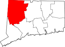 | |
| Towns | ||
| Non-consolidated city |
| |
| Boroughs | ||
| Other communities | ||