| [3] |
Name on the Register |
Image |
Date listed[4] |
Location |
City or town |
Description |
|---|
| 1 |
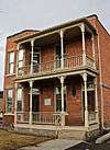
Apartment Building at 116 Spruce Street |
|
000000001990-04-30-0000April 30, 1990
(#90000644) |
116 W. Spruce St.
46°52′28″N 113°59′32″W / 46.874444°N 113.992222°W / 46.874444; -113.992222 (Apartment Building at 116 Spruce Street) |
Missoula |
|
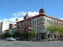
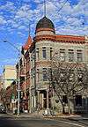
| 2 |
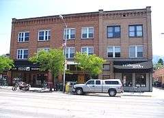
Atlantic Hotel |
|
000000001990-04-30-0000April 30, 1990
(#90000652) |
519 N. Higgins Ave.
46°52′29″N 113°59′30″W / 46.874722°N 113.991667°W / 46.874722; -113.991667 (Atlantic Hotel) |
Missoula |
|
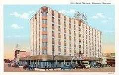
| 3 |
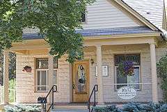
Bellows House |
|
000000001996-02-22-0000February 22, 1996
(#96000120) |
1637 S. Higgins Ave.
46°51′19″N 113°59′49″W / 46.855278°N 113.996944°W / 46.855278; -113.996944 (Bellows House) |
Missoula |
|
| 4 |
Belmont Hotel |
|
000000001983-04-20-0000April 20, 1983
(#83001071) |
430 N. Higgins Ave.
46°52′25″N 113°59′30″W / 46.873611°N 113.991667°W / 46.873611; -113.991667 (Belmont Hotel) |
Missoula |
|
| 5 |
Bluebird Building |
|
000000001996-08-08-0000August 8, 1996
(#96000881) |
220-224 N. Higgins Ave.
46°52′17″N 113°59′36″W / 46.871389°N 113.993333°W / 46.871389; -113.993333 (Bluebird Building) |
Missoula |
|
| 6 |
Brunswick Hotel |
|
000000001990-04-30-0000April 30, 1990
(#90000645) |
223 Railroad St.
46°52′35″N 113°59′37″W / 46.876389°N 113.993611°W / 46.876389; -113.993611 (Brunswick Hotel) |
Missoula |
|
| 7 |
Camp Paxson Boy Scout Camp |
Upload image |
000000001986-03-21-0000March 21, 1986
(#86000584) |
Seeley Lake
47°11′14″N 113°31′04″W / 47.187222°N 113.517778°W / 47.187222; -113.517778 (Camp Paxson Boy Scout Camp) |
Lolo National Forest |
|
| 8 |
Carlton Community Church |
Upload image |
000000002011-09-23-0000September 23, 2011
(#11000701) |
20075 Old MT 93
46°40′39″N 114°04′46″W / 46.6775°N 114.079444°W / 46.6775; -114.079444 (Carlton Community Church) |
Florence vicinity |
|
| 9 |
Carnegie Public Library |
|
000000001982-04-30-0000April 30, 1982
(#82003174) |
335 N. Pattee St.
46°52′21″N 113°59′29″W / 46.8725°N 113.991389°W / 46.8725; -113.991389 (Carnegie Public Library) |
Missoula |
|
| 10 |
Thomas J. Christie House |
|
000000001995-03-16-0000March 16, 1995
(#95000251) |
401 McLeod Ave.
46°51′32″N 113°59′28″W / 46.858889°N 113.991111°W / 46.858889; -113.991111 (Thomas J. Christie House) |
Missoula |
|
| 11 |
Cook Farm |
Upload image |
000000001996-05-16-0000May 16, 1996
(#96000546) |
5185 Old Marshall Grade Rd.
46°52′39″N 113°55′49″W / 46.8775°N 113.930278°W / 46.8775; -113.930278 (Cook Farm) |
Missoula |
|
| 12 |
DeSmet Schoolhouse |
Upload image |
000000001991-02-28-0000February 28, 1991
(#91000151) |
6105 Old Highway 10, W.
46°55′56″N 114°05′34″W / 46.932159°N 114.092790°W / 46.932159; -114.092790 (DeSmet Schoolhouse) |
Missoula |
|
| 13 |
Dixon-Duncan Block |
|
000000001997-10-17-0000October 17, 1997
(#90000654) |
232-240 N. Higgins Ave.
46°52′18″N 113°59′35″W / 46.871667°N 113.993056°W / 46.871667; -113.993056 (Dixon-Duncan Block) |
Missoula |
|
| 14 |
Double Arrow Lodge |
|
000000002014-11-24-0000November 24, 2014
(#14000958) |
301 Lodge Way
47°09′06″N 113°27′28″W / 47.151569°N 113.457642°W / 47.151569; -113.457642 (Double Arrow Lodge) |
Seeley Lake vicinity |
|
| 15 |
East Pine Street Historic District |
|
000000001989-07-13-0000July 13, 1989
(#89000768) |
Roughly bounded by E. Pine St., Madison St., E. Broadway, and Pattee St.
46°52′18″N 113°59′18″W / 46.871667°N 113.988333°W / 46.871667; -113.988333 (East Pine Street Historic District) |
Missoula |
|
| 16 |
Evaro School |
Upload image |
000000002003-05-01-0000May 1, 2003
(#03000321) |
6688 Grooms Rd.
47°02′02″N 114°05′23″W / 47.033889°N 114.089722°W / 47.033889; -114.089722 (Evaro School) |
Evaro |
|
| 17 |
Florence Hotel |
|
000000001992-06-18-0000June 18, 1992
(#92000782) |
111 N. Higgins Ave.
46°52′13″N 113°59′40″W / 46.870278°N 113.994444°W / 46.870278; -113.994444 (Florence Hotel) |
Missoula |
|
| 18 |
Flynn Ranch |
|
000000001980-03-19-0000March 19, 1980
(#80002426) |
West of Missoula on Mullan Rd.
46°53′30″N 114°03′54″W / 46.891667°N 114.065°W / 46.891667; -114.065 (Flynn Ranch) |
Missoula |
|
| 19 |
Forkenbrock Funeral Home |
|
000000001984-12-27-0000December 27, 1984
(#84000570) |
234 E. Pine St.
46°52′21″N 113°59′22″W / 46.8725°N 113.989444°W / 46.8725; -113.989444 (Forkenbrock Funeral Home) |
Missoula |
|
| 20 |
Fort Fizzle Site |
Upload image |
000000001977-07-21-0000July 21, 1977
(#77000821) |
5 miles (8.0 km) west of Lolo
46°44′48″N 114°10′19″W / 46.746667°N 114.171944°W / 46.746667; -114.171944 (Fort Fizzle Site) |
Lolo |
|
| 21 |
Fort Missoula Historic District |
|
000000001987-04-29-0000April 29, 1987
(#87000865) |
Reserve St. and South Ave.
Boundary increase (listed 000000002012-02-28-0000February 28, 2012, refnum 12000051): Junction of Reserve St. & South Ave.
46°50′34″N 114°03′16″W / 46.842778°N 114.054444°W / 46.842778; -114.054444 (Fort Missoula Historic District) |
Missoula |
|
| 22 |
Garden City Drug |
|
000000001990-04-30-0000April 30, 1990
(#90000660) |
118 N. Higgins Ave.
46°52′14″N 113°59′38″W / 46.870556°N 113.993889°W / 46.870556; -113.993889 (Garden City Drug) |
Missoula |
|
| 23 |
A.J. Gibson House |
|
000000001980-04-16-0000April 16, 1980
(#80002427) |
402 S. 2nd St.
46°51′36″N 114°01′39″W / 46.86°N 114.0275°W / 46.86; -114.0275 (A.J. Gibson House) |
Missoula |
|
| 24 |
Gleim Building |
|
000000001990-04-30-0000April 30, 1990
(#90000653) |
265 W. Front St.
46°52′20″N 113°59′50″W / 46.872222°N 113.997222°W / 46.872222; -113.997222 (Gleim Building) |
Missoula |
|
| 25 |
Gleim Building II |
|
000000001995-03-09-0000March 9, 1995
(#95000143) |
255-257 W. Front St.
46°52′20″N 113°59′50″W / 46.872222°N 113.997222°W / 46.872222; -113.997222 (Gleim Building II) |
Missoula |
|
| 26 |
Grand Pacific Hotel |
|
000000001983-09-29-0000September 29, 1983
(#83001072) |
118 W. Alder
46°52′31″N 113°59′29″W / 46.875278°N 113.991389°W / 46.875278; -113.991389 (Grand Pacific Hotel) |
Missoula |
|
| 27 |
Hammond Arcade |
Upload image |
000000001990-04-30-0000April 30, 1990
(#90000646) |
101 S. Higgins Ave.
46°52′12″N 113°59′42″W / 46.87°N 113.995°W / 46.87; -113.995 (Hammond Arcade) |
Missoula |
|
| 28 |
Headquarters Building and Daily Company Annex |
|
000000001996-05-17-0000May 17, 1996
(#96000547) |
113-119 W. Front St.
46°52′13″N 113°59′42″W / 46.870278°N 113.995°W / 46.870278; -113.995 (Headquarters Building and Daily Company Annex) |
Missoula |
|
| 29 |
Hellgate Lodge 383 BPOE |
|
000000001990-04-30-0000April 30, 1990
(#90000661) |
120 N. Pattee St.
46°52′13″N 113°59′32″W / 46.870278°N 113.992222°W / 46.870278; -113.992222 (Hellgate Lodge 383 BPOE) |
Missoula |
|
| 30 |
J.M. Herzog House |
|
000000001985-09-12-0000September 12, 1985
(#85002164) |
1210 Toole Ave.
46°52′42″N 114°00′28″W / 46.878333°N 114.007778°W / 46.878333; -114.007778 (J.M. Herzog House) |
Missoula |
|
| 31 |
Higgins Block |
|
000000001979-10-01-0000October 1, 1979
(#79003720) |
202 N. Higgins Ave.
46°52′17″N 113°59′36″W / 46.871389°N 113.993333°W / 46.871389; -113.993333 (Higgins Block) |
Missoula |
|
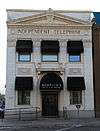
| 32 |
Independent Telephone Company Building |
|
000000001990-04-30-0000April 30, 1990
(#90000648) |
207 E. Main St.
46°52′14″N 113°59′30″W / 46.870556°N 113.991667°W / 46.870556; -113.991667 (Independent Telephone Company Building) |
Missoula |
|
| 33 |
John S. Johnston House |
|
000000001984-08-02-0000August 2, 1984
(#84002502) |
412 W. Alder St.
46°52′36″N 113°59′47″W / 46.876667°N 113.996389°W / 46.876667; -113.996389 (John S. Johnston House) |
Missoula |
|
| 34 |
John M. Keith House |
|
000000001983-07-07-0000July 7, 1983
(#83001073) |
1110 Gerald Ave.
46°51′39″N 113°59′40″W / 46.860833°N 113.994444°W / 46.860833; -113.994444 (John M. Keith House) |
Missoula |
|
| 35 |
Knowles Building |
|
000000001987-04-09-0000April 9, 1987
(#87000608) |
200-210 S. 3rd St., W.
46°52′03″N 113°59′54″W / 46.8675°N 113.998333°W / 46.8675; -113.998333 (Knowles Building) |
Missoula |
|
| 36 |
Labor Temple |
|
000000001990-04-30-0000April 30, 1990
(#90000650) |
208 E. Main St.
46°52′15″N 113°59′29″W / 46.870833°N 113.991389°W / 46.870833; -113.991389 (Labor Temple) |
Missoula |
|
| 37 |
Laird's Lodge Historic District |
Upload image |
000000001990-08-17-0000August 17, 1990
(#90001213) |
Northern end of Lindbergh Lake at the end of Lindbergh Lake Rd.
47°24′19″N 113°43′04″W / 47.405278°N 113.717778°W / 47.405278; -113.717778 (Laird's Lodge Historic District) |
Seeley Lake |
|
| 38 |
Lenox Flats |
|
000000002000-08-08-0000August 8, 2000
(#00000874) |
300-306 West Broadway
46°52′24″N 113°59′45″W / 46.873333°N 113.995833°W / 46.873333; -113.995833 (Lenox Flats) |
Missoula |
|
| 39 |
Lincoln School |
|
000000001997-06-03-0000June 3, 1997
(#97000500) |
1209 Lolo St.
46°53′04″N 113°57′52″W / 46.884444°N 113.964444°W / 46.884444; -113.964444 (Lincoln School) |
Missoula |
|
| 40 |
Lolo Trail |
|
000000001966-10-15-0000October 15, 1966
(#66000309) |
Parallel to U.S. Route 12 on the ridges of the Bitterroot Mountains from Lolo Pass to Weippe
46°38′06″N 114°34′47″W / 46.635111°N 114.579689°W / 46.635111; -114.579689 (Lolo Trail) |
Bitterroot Mountains |
Extends into Clearwater County, Idaho
|
| 41 |
Lower Rattlesnake Historic District |
Upload image |
000000001999-06-10-0000June 10, 1999
(#99000697) |
Roughly bounded by Vene St., Greenough Park, Elm St., and Pierce St.
46°52′18″N 113°58′37″W / 46.871667°N 113.976944°W / 46.871667; -113.976944 (Lower Rattlesnake Historic District) |
Missoula |
|
| 42 |
Lucy Building |
Upload image |
000000001990-04-30-0000April 30, 1990
(#90000656) |
330 N. Higgins Ave.
46°52′23″N 113°59′32″W / 46.873056°N 113.992222°W / 46.873056; -113.992222 (Lucy Building) |
Missoula |
|
| 43 |
Marsh and Powell Funeral Home |
|
000000001990-04-30-0000April 30, 1990
(#90000655) |
224 W. Spruce St.
46°52′30″N 113°59′39″W / 46.875°N 113.994167°W / 46.875; -113.994167 (Marsh and Powell Funeral Home) |
Missoula |
|
| 44 |
Masonic Lodge |
|
000000001990-04-30-0000April 30, 1990
(#90000649) |
120-136 E. Broadway Ave.
46°52′19″N 113°59′32″W / 46.871944°N 113.992222°W / 46.871944; -113.992222 (Masonic Lodge) |
Missoula |
|
| 45 |
McCormick Neighborhood Historic District |
Upload image |
000000002004-05-19-0000May 19, 2004
(#04000460) |
Roughly bounded by River Rd., S. 6th, W., S. Orange St., and the Bitterroot Line of the railroad
46°51′58″N 114°00′24″W / 46.866111°N 114.006667°W / 46.866111; -114.006667 (McCormick Neighborhood Historic District) |
Missoula |
|
| 46 |
Milwaukee Depot |
|
000000001982-04-30-0000April 30, 1982
(#82003175) |
250 Station Dr.
46°52′03″N 113°59′51″W / 46.8675°N 113.9975°W / 46.8675; -113.9975 (Milwaukee Depot) |
Missoula |
|
| 47 |
Milwaukee Road Railroad Substation No. 10 |
Upload image |
000000002014-07-08-0000July 8, 2014
(#14000394) |
5190 Primrose Dr.
46°55′39″N 114°10′00″W / 46.9276°N 114.1667°W / 46.9276; -114.1667 (Milwaukee Road Railroad Substation No. 10) |
Missoula |
|
| 48 |
Missoula County Courthouse |
|
000000001976-09-01-0000September 1, 1976
(#76001125) |
220 W. Broadway
46°52′24″N 113°59′42″W / 46.873333°N 113.995°W / 46.873333; -113.995 (Missoula County Courthouse) |
Missoula |
|
| 49 |
Missoula County Fairgrounds Historic District |
|
000000002010-09-16-0000September 16, 2010
(#10000765) |
1101 South Ave., W.
46°50′55″N 114°00′53″W / 46.848611°N 114.014722°W / 46.848611; -114.014722 (Missoula County Fairgrounds Historic District) |
Missoula |
|
| 50 |
Missoula Downtown Historic District |
|
000000002009-08-21-0000August 21, 2009
(#07000647) |
Roughly bounded by the former Northern Pacific railroad tracks, the Clark Fork River, Little McCormick Park, and Madison St.
Boundary increase/decrease (listed February 7, 2011): Higgins Ave. & Front St.
Boundary increase (listed April 8, 2011): Bounded by Montana Rail Link and BNSF Railway, Toole-Railroad-Alder Sts.
46°52′12″N 113°59′13″W / 46.87°N 113.986944°W / 46.87; -113.986944 (Missoula Downtown Historic District) |
Missoula |
Missoula MPS
|
| 51 |
Missoula Laundry Company |
|
000000001990-04-30-0000April 30, 1990
(#90000651) |
111 E. Spruce St.
46°52′26″N 113°59′29″W / 46.873889°N 113.991389°W / 46.873889; -113.991389 (Missoula Laundry Company) |
Missoula |
|
| 52 |
Missoula Mercantile |
|
000000001990-04-30-0000April 30, 1990
(#90000647) |
114 N. Higgins Ave.
46°52′13″N 113°59′38″W / 46.870278°N 113.993889°W / 46.870278; -113.993889 (Missoula Mercantile) |
Missoula |
|
| 53 |
Missoula Mercantile Warehouse |
|
000000002004-04-06-0000April 6, 2004
(#04000266) |
221, 229, and 231 E. Front St.
46°52′10″N 113°59′32″W / 46.869444°N 113.992222°W / 46.869444; -113.992222 (Missoula Mercantile Warehouse) |
Missoula |
|
| 54 |
Missoula Southside Historic District |
|
000000001991-03-22-0000March 22, 1991
(#91000334) |
Roughly bounded by the Clark Fork River, S. Higgins Ave., S. 6th St., W., and Orange St.
46°51′57″N 113°59′58″W / 46.865833°N 113.999444°W / 46.865833; -113.999444 (Missoula Southside Historic District) |
Missoula |
|
| 55 |
Model Laundry and Apartments |
|
000000001990-04-30-0000April 30, 1990
(#90000657) |
131 W. Alder St.
46°52′47″N 113°59′34″W / 46.879722°N 113.992778°W / 46.879722; -113.992778 (Model Laundry and Apartments) |
Missoula |
|
| 56 |
Montgomery Ward |
|
000000001990-04-30-0000April 30, 1990
(#90000659) |
201 N. Higgins Ave.
46°52′17″N 113°59′38″W / 46.871389°N 113.993889°W / 46.871389; -113.993889 (Montgomery Ward) |
Missoula |
|
| 57 |
Moon-Randolph Ranch |
Upload image |
000000002010-03-01-0000March 1, 2010
(#10000042) |
1515 Spurlock Rd.
46°54′01″N 114°00′10″W / 46.900233°N 114.002647°W / 46.900233; -114.002647 (Moon-Randolph Ranch) |
Missoula |
|
| 58 |
Mrs. Lydia McCaffery's Furnished Rooms |
|
000000002000-04-06-0000April 6, 2000
(#00000335) |
501 W. Alder
46°52′35″N 113°59′50″W / 46.876389°N 113.997222°W / 46.876389; -113.997222 (Mrs. Lydia McCaffery's Furnished Rooms) |
Missoula |
|
| 59 |
Northern Pacific Railroad Depot |
|
000000001985-03-28-0000March 28, 1985
(#85000644) |
Railroad and Higgins Ave.
46°52′31″N 113°59′30″W / 46.875278°N 113.991667°W / 46.875278; -113.991667 (Northern Pacific Railroad Depot) |
Missoula |
|
| 60 |
Northside Missoula Railroad Historic District |
|
000000001995-05-04-0000May 4, 1995
(#95000532) |
Roughly bounded by Worden Ave., 6th St., Interstate 90, C St. and the former Northern Pacific railroad tracks
46°52′44″N 113°59′35″W / 46.878889°N 113.993056°W / 46.878889; -113.993056 (Northside Missoula Railroad Historic District) |
Missoula |
|
| 61 |
Orange Street Underpass |
|
000000002012-03-26-0000March 26, 2012
(#12000172) |
Orange St. between N. 2nd St. W. & W. Alder St.
46°52′39″N 113°59′43″W / 46.877515°N 113.99535°W / 46.877515; -113.99535 (Orange Street Underpass) |
Missoula |
part of the Montana's Steel Stringer and Steel Girder Bridges Multiple Property Submission
|
| 62 |
Palace Hotel |
|
000000001982-10-25-0000October 25, 1982
(#82000594) |
147 W. Broadway
46°52′20″N 113°59′40″W / 46.872222°N 113.994444°W / 46.872222; -113.994444 (Palace Hotel) |
Missoula |
|
| 63 |
Edgar Paxson House |
|
000000001986-11-06-0000November 6, 1986
(#86002935) |
611 Stephens Ave.
46°51′38″N 114°00′24″W / 46.860556°N 114.006667°W / 46.860556; -114.006667 (Edgar Paxson House) |
Missoula |
|
| 64 |
Potomac School |
Upload image |
000000001992-03-30-0000March 30, 1992
(#92000244) |
220 Potomac Rd.
46°52′54″N 113°34′43″W / 46.881667°N 113.578611°W / 46.881667; -113.578611 (Potomac School) |
Potomac |
|
| 65 |
Clarence R. Prescott House |
|
000000001985-09-26-0000September 26, 1985
(#85002515) |
University of Montana campus
46°51′42″N 113°58′49″W / 46.861667°N 113.980278°W / 46.861667; -113.980278 (Clarence R. Prescott House) |
Missoula |
|
| 66 |
Reid House |
|
000000002003-12-18-0000December 18, 2003
(#03001297) |
526 E. Front
46°52′09″N 113°59′13″W / 46.869167°N 113.986944°W / 46.869167; -113.986944 (Reid House) |
Missoula |
|
| 67 |
Guy Ressler Homestead House |
Upload image |
000000002012-11-28-0000November 28, 2012
(#12000980) |
Near Burnt Fork Cr.
47°13′09″N 114°37′34″W / 47.219262°N 114.626158°W / 47.219262; -114.626158 (Guy Ressler Homestead House) |
Huson vicinity |
|
| 68 |
St. Francis Xavier Church |
|
000000001982-04-28-0000April 28, 1982
(#82003176) |
420 W. Pine St.
46°52′29″N 113°59′48″W / 46.874722°N 113.996667°W / 46.874722; -113.996667 (St. Francis Xavier Church) |
Missoula |
|
| 69 |
Saint John the Baptist Catholic Church |
Upload image |
000000001986-03-27-0000March 27, 1986
(#86000585) |
Mullan Rd.
47°00′47″N 114°13′40″W / 47.013056°N 114.227778°W / 47.013056; -114.227778 (Saint John the Baptist Catholic Church) |
Frenchtown |
|
| 70 |
Simons Block |
|
000000002000-02-18-0000February 18, 2000
(#00000047) |
314 N. Higgins Ave.
46°52′23″N 113°59′32″W / 46.873056°N 113.992222°W / 46.873056; -113.992222 (Simons Block) |
Missoula |
|
| 71 |
Stark School |
Upload image |
000000001995-10-12-0000October 12, 1995
(#95001165) |
Ninemile Rd. in Ninemile Valley
47°07′07″N 114°29′28″W / 47.118611°N 114.491111°W / 47.118611; -114.491111 (Stark School) |
Huson |
[5]
|
| 72 |
Fred T. Sterling House |
|
000000001983-07-07-0000July 7, 1983
(#83001074) |
1310 Gerald Ave.
46°51′31″N 113°59′43″W / 46.858735°N 113.995226°W / 46.858735; -113.995226 (Fred T. Sterling House) |
Missoula |
|
| 73 |
Studebaker Building |
|
000000001997-04-17-0000April 17, 1997
(#97000355) |
216 W. Main St.
46°52′20″N 113°59′45″W / 46.872222°N 113.995833°W / 46.872222; -113.995833 (Studebaker Building) |
Missoula |
|
| 74 |
Target Range Elementary School |
Upload image |
000000002011-08-10-0000August 10, 2011
(#11000526) |
4095 South Ave. W
46°50′53″N 114°04′49″W / 46.848056°N 114.080278°W / 46.848056; -114.080278 (Target Range Elementary School) |
Missoula |
[6]
|
| 75 |
John R. Toole House |
|
000000001983-04-25-0000April 25, 1983
(#83004308) |
1005 Gerald Ave.
46°51′43″N 113°59′43″W / 46.861944°N 113.995278°W / 46.861944; -113.995278 (John R. Toole House) |
Missoula |
|
| 76 |
Traveler's Rest |
|
000000001966-10-15-0000October 15, 1966
(#66000437) |
1 mile (1.6 km) south of Lolo near U.S. Route 93
46°44′24″N 114°04′06″W / 46.74°N 114.068333°W / 46.74; -114.068333 (Traveler's Rest) |
Lolo |
|
| 77 |
U.S. Forest Service Remount Depot |
|
000000001980-04-10-0000April 10, 1980
(#80002425) |
2.4 miles (3.9 km) southwest of Huson[7]
47°04′04″N 114°23′56″W / 47.067778°N 114.398889°W / 47.067778; -114.398889 (U.S. Forest Service Remount Depot) |
Huson |
|
| 78 |
U.S. Post Office |
|
000000001979-11-30-0000November 30, 1979
(#79001406) |
200 E. Broadway St.
46°52′20″N 113°59′26″W / 46.872222°N 113.990556°W / 46.872222; -113.990556 (U.S. Post Office) |
Missoula |
|
| 79 |
University Apartments |
|
000000001985-03-28-0000March 28, 1985
(#85000645) |
400-422 Roosevelt Ave.
46°51′45″N 113°59′48″W / 46.8625°N 113.996667°W / 46.8625; -113.996667 (University Apartments) |
Missoula |
|
| 80 |
University Area Historic District |
|
000000002000-12-13-0000December 13, 2000
(#00001523) |
Roughly bounded by S. 4th St., E., Beckwith Ave., Arthur Ave., and Higgins Ave.
46°51′40″N 113°59′33″W / 46.861111°N 113.9925°W / 46.861111; -113.9925 (University Area Historic District) |
Missoula |
|
| 81 |
University of Montana Historic District |
|
000000001992-10-02-0000October 2, 1992
(#92001284) |
Roughly bounded by Arthur, Connell, and Beckwith Aves., and the ridge lines of Mt. Sentinel
Boundary increase (listed December 1, 2011): 32 Campus Dr.
46°51′25″N 113°58′35″W / 46.856944°N 113.976389°W / 46.856944; -113.976389 (University of Montana Historic District) |
Missoula |
|
| 82 |
Wilma Theatre |
|
000000001979-12-31-0000December 31, 1979
(#79001407) |
104 S. Higgins Ave.
46°52′08″N 113°59′43″W / 46.868889°N 113.995278°W / 46.868889; -113.995278 (Wilma Theatre) |
Missoula |
|
| 83 |
Zip Auto |
|
000000001990-04-30-0000April 30, 1990
(#90000658) |
251 W. Main St.
46°52′19″N 113°59′47″W / 46.871944°N 113.996389°W / 46.871944; -113.996389 (Zip Auto) |
Missoula |
|

_-_Missoula_County%2C_Montana.png)


_-_Missoula_County%2C_Montana.png)


_-_Missoula_County%2C_Montana.png)

_-_Missoula_County%2C_Montana.png)


_-_Missoula_County%2C_Montana.png)

_-_Missoula_County%2C_Montana.png)
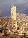

_-_Missoula_County%2C_Montana.png)
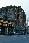


_-_Missoula_County%2C_Montana.png)
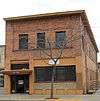

_-_Missoula_County%2C_Montana.png)


_-_Missoula_County%2C_Montana.png)
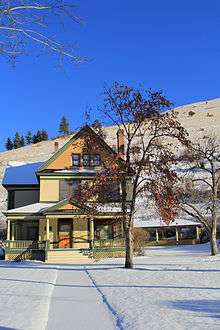
_-_Missoula_County%2C_Montana.png)




_-_Missoula_County%2C_Montana.png)