Nederweert
| Nederweert Ni-jwieërt | |||
|---|---|---|---|
| Municipality | |||
|
Saint Lambert church in Nederweert | |||
| |||
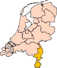
.svg.png) Location in Limburg | |||
| Coordinates: 51°17′N 5°45′E / 51.283°N 5.750°ECoordinates: 51°17′N 5°45′E / 51.283°N 5.750°E | |||
| Country | Netherlands | ||
| Province | Limburg | ||
| Government[1] | |||
| • Body | Municipal council | ||
| • Mayor | Henk Evers (PvdA) | ||
| Area[2] | |||
| • Total | 101.78 km2 (39.30 sq mi) | ||
| • Land | 100.23 km2 (38.70 sq mi) | ||
| • Water | 1.55 km2 (0.60 sq mi) | ||
| Elevation[3] | 33 m (108 ft) | ||
| Population (May 2014)[4] | |||
| • Total | 16,747 | ||
| • Density | 167/km2 (430/sq mi) | ||
| Demonym(s) | Nederweerter | ||
| Time zone | CET (UTC+1) | ||
| • Summer (DST) | CEST (UTC+2) | ||
| Postcode | 6030–6035, 6090–6092 | ||
| Area code | 0495 | ||
| Website |
www | ||


Nederweert (![]() pronunciation ) (Limburgish: Ni-jwieërt) is a municipality and a town in southeastern Netherlands with 16,747 as of 2014 and has an area of 101.78 km2 (39.30 sq mi) of which 1.55 km2 (0.60 sq mi) is water.
pronunciation ) (Limburgish: Ni-jwieërt) is a municipality and a town in southeastern Netherlands with 16,747 as of 2014 and has an area of 101.78 km2 (39.30 sq mi) of which 1.55 km2 (0.60 sq mi) is water.
Nederweert lies at the intersection of three channels: the Zuid-Willemsvaart, the Noordervaart and the channel Wessem-Nederweert. In the 19th century these channels provided transport routes to export peat that was harvested from the Peel. These channels connect Nederweert to Maastricht and 's-Hertogenbosch.
History
Nederweert was originally called 'Merefelt' which means 'amongst the lakes', though it was later named Weert van den nedersten eynde. A 'Weert' in old Dutch means a high place in the landscape. This latter name later changed into Nederweert as it is called today.
Before the 14th century Nederweert was part of the municipality of Weert. The first reference which speaks of Nederweert as independent was in 1419.
Nederweert has been under rule of the Graven van Horn (the dukes of Horn) until 1701. Later in 1715 it became part of the southern states of the Netherlands.
In 1785 it was annexed by the French. During this era it was part of the Belgian departement of the Nedermaas.
Monuments
The most prominent monument of Nederweert is the Sint-Lambertus Kerk. It is a Brabantine Gothic-style church that was built in 1467.
Population centres
Budschop, Leveroy, Nederweert, Nederweert-Eind, Ospel, Ospeldijk, Schoor.
Topography

Dutch Topographic map of the municipality of Nederweert, June 2015
References
- ↑ "Collegeleden" [Members of the board] (in Dutch). Gemeente Nederweert. Retrieved 13 November 2013.
- ↑ "Kerncijfers wijken en buurten" [Key figures for neighbourhoods]. CBS Statline (in Dutch). CBS. 2 July 2013. Retrieved 12 March 2014.
- ↑ "Postcodetool for 6031VR". Actueel Hoogtebestand Nederland (in Dutch). Het Waterschapshuis. Retrieved 13 November 2013.
- ↑ "Bevolkingsontwikkeling; regio per maand" [Population growth; regions per month]. CBS Statline (in Dutch). CBS. 26 June 2014. Retrieved 24 July 2014.
External links
 Media related to Nederweert at Wikimedia Commons
- Official website
 |
Someren (NB) | Asten (NB) | Peel en Maas | |
| Cranendonck (NB) | |
Leudal | ||
| ||||
| | ||||
| Weert |