Peel en Maas
| Peel en Maas | |||
|---|---|---|---|
| Municipality | |||
|
| |||
| |||
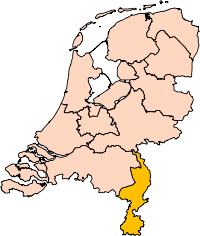
 Location in Limburg | |||
| Coordinates: 51°20′N 5°59′E / 51.333°N 5.983°ECoordinates: 51°20′N 5°59′E / 51.333°N 5.983°E | |||
| Country | Netherlands | ||
| Province | Limburg | ||
| Established | 1 January 2010[1] | ||
| Government[2] | |||
| • Body | Municipal council | ||
| • Mayor | Wilma Delissen-van Tongerlo (VVD) | ||
| Area[3] | |||
| • Total | 161.35 km2 (62.30 sq mi) | ||
| • Land | 159.44 km2 (61.56 sq mi) | ||
| • Water | 1.91 km2 (0.74 sq mi) | ||
| Elevation[4] | 34 m (112 ft) | ||
| Population (May 2014)[5] | |||
| • Total | 43,362 | ||
| • Density | 272/km2 (700/sq mi) | ||
| Time zone | CET (UTC+1) | ||
| • Summer (DST) | CEST (UTC+2) | ||
| Postcode | 5768, 5980–5995 | ||
| Area code | 077 | ||
| Website |
www | ||


Peel en Maas has been a new municipality in the southeastern Netherlands since 1 January 2010. It is situated in the province of Limburg. The municipality is formed by the former municipalities of Helden, Kessel, Maasbree, and Meijel.
Topography
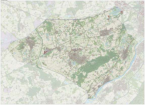
Dutch Topographic map of the municipality of Peel en Maas, June 2015
References
- ↑ "Gemeentelijke indeling op 1 januari 2010" [Municipal divisions on 1 January 2010]. cbs.nl (in Dutch). CBS. Retrieved 18 November 2013.
- ↑ "Burgemeester" [Mayor] (in Dutch). Gemeente Peel en Maas. Retrieved 20 November 2013.
- ↑ "Kerncijfers wijken en buurten" [Key figures for neighbourhoods]. CBS Statline (in Dutch). CBS. 2 July 2013. Retrieved 12 March 2014.
- ↑ "Postcodetool for 5981CC". Actueel Hoogtebestand Nederland (in Dutch). Het Waterschapshuis. Retrieved 19 November 2013.
- ↑ "Bevolkingsontwikkeling; regio per maand" [Population growth; regions per month]. CBS Statline (in Dutch). CBS. 26 June 2014. Retrieved 24 July 2014.
External links
 |
Horst aan de Maas | | ||
| Deurne (NB) Asten (NB) |
|
Venlo | ||
| ||||
| | ||||
| Nederweert | Leudal | Meuse Beesel |
This article is issued from Wikipedia - version of the 9/6/2016. The text is available under the Creative Commons Attribution/Share Alike but additional terms may apply for the media files.