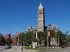
Lowell, Massachusetts
| City of Lowell | ||
|---|---|---|
| City | ||
|
Lowell on the Merrimack River with Cox Bridge | ||
| ||
| Nickname(s): Mill City, Spindle City | ||
| Motto: "Art is the Handmaid of Human Good."[1] | ||
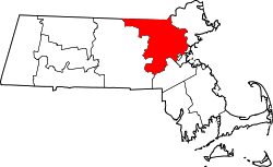
 Location in Middlesex County in Massachusetts | ||
 City of Lowell Location in the United States | ||
| Coordinates: 42°38′22″N 71°18′53″W / 42.63944°N 71.31472°WCoordinates: 42°38′22″N 71°18′53″W / 42.63944°N 71.31472°W | ||
| Country | United States | |
| State | Massachusetts | |
| County | Middlesex | |
| Settled | 1653 | |
| Incorporated | 1826 | |
| A city | 1836 | |
| Government | ||
| • Type | Manager-City council | |
| • Mayor | Edward J. Kennedy | |
| • City Manager | Kevin J. Murphy | |
| Area | ||
| • Total | 14.5 sq mi (37.7 km2) | |
| • Land | 13.8 sq mi (35.7 km2) | |
| • Water | 0.8 sq mi (2.0 km2) | |
| Elevation | 102 ft (31 m) | |
| Population (2014) | ||
| • Total | 109,945 | |
| • Density | 7,667/sq mi (3,079.7/km2) | |
| • Demonym | Lowellian | |
| Time zone | Eastern (UTC-5) | |
| • Summer (DST) | Eastern (UTC-4) | |
| ZIP code | 01850, 01851, 01852, 01853, 01854 | |
| Area code(s) | 978 / 351 | |
| FIPS code | 25-37000 | |
| GNIS feature ID | 0611832 | |
| Website | City of Lowell, Massachusetts | |

Lowell is a city in the US Commonwealth of Massachusetts. Located in Middlesex County, Lowell (along with Cambridge) served as a county seat until Massachusetts disbanded county government in 1999.[2] With an estimated population of 109,945 in 2014,[3] it is the fourth-largest city in Massachusetts, and the second-largest in the Boston metropolitan statistical area.[4] The city is also part of a smaller Massachusetts statistical area called Greater Lowell, as well as New England's Merrimack Valley region.
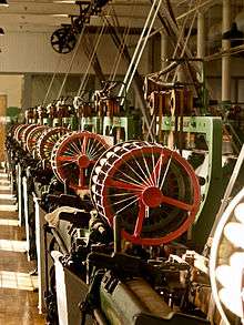
Incorporated in 1826 to serve as a mill town, Lowell was named after Francis Cabot Lowell, a local figure in the Industrial Revolution. The city became known as the cradle of the American Industrial Revolution, due to a large series of textile mills and factories. Many of the Lowell's historic manufacturing sites were later preserved by the National Park Service to create Lowell National Historical Park.[5] During the Cambodian genocide, the city took in an influx of refugees, leading to a Cambodia Town and America's second-largest Cambodian-American population.[6]
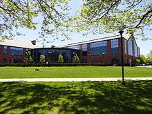
Lowell is home to two higher education schools, the University of Massachusetts Lowell and Middlesex Community College.
History

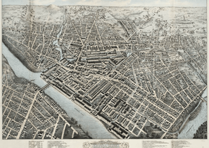
Founded in the 1820s as a planned manufacturing center for textiles, Lowell is located along the rapids of the Merrimack River, 25 miles northwest of Boston in what was once the farming community of East Chelmsford, Massachusetts. The so-called Boston Associates, including Nathan Appleton and Patrick Tracy Jackson of the Boston Manufacturing Company, named the new mill town after their visionary leader, Francis Cabot Lowell,[7] who had died five years before its 1823 incorporation. As Lowell's population grew, it acquired land from neighboring towns, and diversified into a full-fledged urban center. Many of the men who composed the labor force for constructing the canals and factories had immigrated from Ireland, escaping the poverty and Potato Famines of the 1830s and 1840s. The mill workers, young single women called Mill Girls, generally came from the farm families of New England.
_side%3B_2011-08-20.JPG)
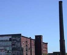
By the 1850s, Lowell had the largest industrial complex in the United States. The textile industry wove cotton produced in the South. In 1860, there were more cotton spindles in Lowell than in all eleven states combined that would form the Confederacy.[8] Yet the city did not simply finish raw materials produced in the American South, but rather became involved in the South in another way, too. Many of the coarse cottons produced in Lowell eventually returned to the South to clothe enslaved people, and, according to historian Sven Beckert, "'Lowell' became the generic term slaves used to describe coarse cottons."[9] The city continued to thrive as a major industrial center during the 19th century, attracting more migrant workers and immigrants to its mills. Next were the Catholic Germans, followed by a large influx of French Canadians during the 1870s and 1880s. Later waves of immigrants included Portuguese, Polish, Lithuanians, Swedes, Greeks, and eastern European Jews. They came to work in Lowell and settled in ethnic neighborhoods, with the city's population reaching almost 50% foreign-born by 1900.[10] By the time World War I broke out in Europe, the city had reached its economic and population peak of over 110,000 people.
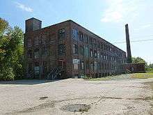
The Mill Cities' manufacturing base declined as companies began to relocate to the South in the 1920s.[10] The city fell into hard times, and was even referred to as a "depressed industrial desert" by Harper's Magazine in 1931, as the Great Depression worsened. At this time, more than one-third of its population was "on relief", as only three of its major textile corporations remained active.[10] Several years later, the mills were reactivated, making parachutes and other military necessities for the World War II effort. However, this economic boost was short-lived and the post-war years saw the last textile plants close.
In the 1970s, Lowell became part of the Massachusetts Miracle, being the headquarters of Wang Laboratories. At the same time, Lowell became home to thousands of new immigrants, many from Cambodia, following the genocide at the hands of the Khmer Rouge. The city continued to rebound, but this time, focusing more on culture. The former mill district along the river was partially restored and became part of the Lowell National Historical Park, founded in the late 1970s.

At this same time, the Lowell City Development Authority created a Comprehensive Master Plan which included recommendations for zoning adaptations within the city. The city's original zoning code was adopted in 1926 and was significantly revised in 1966 and 2004, with changes included to respond to concerns about overdevelopment.[11]
Although Wang went bankrupt in 1992, the city continued its cultural focus by hosting the nation's largest free folk festival, the Lowell Folk Festival, as well as many other cultural events. This effort began to attract other companies and families back to the urban center. Additional historic manufacturing and commercial buildings were adapted as residential units and office space. By the 1990s, Lowell had built a new ballpark and arena, which became home to two minor league sports teams, the Lowell Devils and Lowell Spinners. The city also began to have a larger student population. The University of Massachusetts Lowell and Middlesex Community College expanded their programs and enrollment.
In 2002, in lieu of updating the Comprehensive Master Plan, more broad changes were recommended so that the land use and development would be consistent with the current master plan. The most significant revision to the 1966 zoning code is the adoption of an inclusion of a transect-based zoning code and some aspects of a form-based code style of zoning that emphasizes urban design elements as a means to ensure that infill development will respect the character of the neighborhood or district in question. By 2004, the recommended zoning changes were unanimously adopted by the City Council and despite numerous changes to the 2004 Zoning Code, it remains the basic framework for resolving zoning issues in Lowell to this day.[12]
The Hamilton Canal District (HCD) is the first district in Lowell in which regulation and development is defined by Form-Based Code (HCD-FBC) and legislated by its own guiding framework consistent to the HCD Master Plan.[13] The HCD is a major redevelopment project that comprises 13-acres of vacant, underutilized land in downtown Lowell abutting former industrial mills. Trinity Financial was elected as the Master Developer to recreate this district with a vision of making a mixed-use neighborhood. Development plans included establishing the HCD as a gateway to downtown Lowell and enhanced connectivity to Gallagher Terminal.[14][15]
In July 2012, Lowell youth led a nationally reported campaign to gain voting privileges for 17-year-olds in local elections; it would have been the first municipality to do so.[16][17] The 'Vote 17' campaign was supported by national researchers; its goals were to increase voter turnout, create lifelong civic habits, and increase youth input in local matters.[18] The effort was led by youth at the United Teen Equality Center in downtown Lowell.[19]
Geography

Lowell is located at 42°38′22″N 71°18′53″W / 42.63944°N 71.31472°W (42.639444, -71.314722).[20] According to the United States Census Bureau, the city has a total area of 14.5 square miles (38 km2).13.8 square miles (35.7 km²) of it is land and 0.8 square miles (2.1 km2) of it (5.23%) is water.
Physical

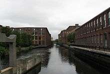
Lowell is located at the confluence of the Merrimack and Concord rivers. The Pawtucket Falls, a mile-long set of rapids with a total drop in elevation of 32 feet, ends where the two rivers meet. At the top of the falls is the Pawtucket Dam, designed to turn the upper Merrimack into a millpond, diverted through Lowell's extensive canal system.
The Merrimack, which flows southerly from Franklin, New Hampshire to Lowell, makes a northeasterly turn there before emptying into the Atlantic Ocean at Newburyport, Massachusetts, approximately 40 miles downriver from Lowell. It is believed that in prior ages, the Merrimack continued south from Lowell to empty into the ocean somewhere near Boston. The glacial deposits that redirected the flow of the river left the drumlins that dot the city, most notably, Fort Hill in the Belvidere neighborhood. Other large hills in Lowell include Lynde Hill, also in Belvidere, and Christian Hill, in the easternmost part of Centralville at the Dracut town line.
The Concord, or Musketaquid (its original name), forms from the confluence of the Assabet and Sudbury rivers at Concord, Massachusetts. This river flows north into the city, and the area around the confluence with the Merrimack was known as Wamesit. Like the Merrimack, the Concord, although a much smaller river, has many waterfalls and rapids that served as power sources for early industrial purposes, some well before the founding of Lowell. Immediately after the Concord joins the Merrimack, the Merrimack descends another ten feet in Hunt's Falls.
There is a ninety-degree bend in the Merrimack partway down the Pawtucket Falls. At this point, the river briefly widens and shallows. Here, Beaver Brook enters from the north, separating the City's two northern neighborhoods, Pawtucketville and Centralville. Entering the Concord River from the southwest is River Meadow, or Hale's Brook. This brook flows largely in a man-made channel, as the Lowell Connector was built along it. Both of these minor streams have limited industrial histories as well.
The bordering towns (clockwise from north) are Dracut, Tewksbury, Billerica, Chelmsford, and Tyngsborough. The border with Billerica is a point in the middle of the Concord River where Lowell and Billerica meet Tewksbury and Chelmsford.
The ten communities designated part of the Lowell Metropolitan area by the 2000 US Census are Billerica, Chelmsford, Dracut, Dunstable, Groton, Lowell, Pepperell, Tewksbury, Tyngsborough, and Westford, and Pelham, NH. See Greater Lowell.
Neighborhoods
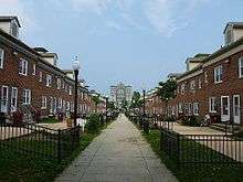
Lowell has eight distinct neighborhoods: the Acre, Back Central, Belvidere, Centralville, Downtown, Highlands, Pawtucketville, and South Lowell.[21] The city also has five ZIP codes: four are geographically distinct general ZIP codes, and one (01853) is for post-office boxes only.
The Centralville neighborhood, ZIP Code 01850, is the northeastern section of the city, north of the Merrimack River and east of Beaver Brook. Christian Hill is the section of Centralville east of Bridge Street.
The Highlands, ZIP Code 01851, is the most populated neighborhood, with almost a quarter of the city residing here. It is located in the southwestern section of the city, bordered to the east by the Lowell Connector and to the north by the railroad. Lowellians further distinguish the sections of the Highlands as the Upper Highlands and the Lower Highlands, the latter being the area closer to downtown. Middlesex Village, Tyler Park, and Drum Hill are in this ZIP Code.
Downtown, Belvidere, Back Central, and South Lowell make up the 01852 ZIP Code, and are the southeastern sections of the city (south of the Merrimack River and southeast of the Lowell Connector). Belvidere is the mostly residential area south of the Merrimack River, east of the Concord River, and north of the Lowell and Lawrence railroad. Belvidere Hill is a Historic District along Fairmount Street. Lower Belvidere is the section west of Nesmith Street. Back Central is an urban area south of downtown, toward the mouth of River Meadow Brook. South Lowell is the area south of the railroad and east of the Concord River. Other neighborhoods in this ZIP Code are Ayers City, Bleachery, Chapel Hill, the Grove, Oaklands, Riverside Park, Swede Village, and Wigginville. Although the use of the names of these smaller neighborhoods has been in decline in the past decades, there has been recently a reemergence of their use.
The ZIP Code 01854 is the northwestern portion of the city and includes Pawtucketville; the University of Massachusetts Lowell; and the Acre. Pawtucketville is where Jack Kerouac resided around the area of University Avenue (previously known as Moody Street). The north campus of UMass Lowell is in Pawtucketville. The older parts of the neighborhood are around University Avenue and Mammoth Road, whereas the newer parts are around Varnum Avenue. Middle and elementary schools for this area include Wang Middle School, Pawtucketville Memorial, McAvinnue Elementary School, and private school Ste Jeanne d'Arc. Pawtucketville is the official entrance to the Lowell-Dracut-Tyngsborough State Forest. Pawtucketville's Lowell–Dracut–Tyngsborough State Forest is the probable site of a Native American tribe, and in the age of the Industrial Revolution was a prominent source where granite for canals and factory foundations was obtained.[22]
Demographics
| Historical population | ||
|---|---|---|
| Year | Pop. | ±% |
| 1830 | 6,474 | — |
| 1840 | 20,796 | +221.2% |
| 1850 | 33,383 | +60.5% |
| 1860 | 36,827 | +10.3% |
| 1870 | 40,928 | +11.1% |
| 1880 | 59,475 | +45.3% |
| 1890 | 77,696 | +30.6% |
| 1900 | 94,969 | +22.2% |
| 1910 | 106,294 | +11.9% |
| 1920 | 112,759 | +6.1% |
| 1930 | 100,234 | −11.1% |
| 1940 | 101,389 | +1.2% |
| 1950 | 97,249 | −4.1% |
| 1960 | 92,107 | −5.3% |
| 1970 | 94,239 | +2.3% |
| 1980 | 92,418 | −1.9% |
| 1990 | 103,439 | +11.9% |
| 2000 | 105,167 | +1.7% |
| 2010 | 106,519 | +1.3% |
| 2014 | 109,945 | +3.2% |
| 2015 | 110,699 | +0.7% |
| * = population estimate. Source: United States Census records and Population Estimates Program data.[23][24][25][26][27][28][29][30][31][32][33] Source: | ||
According to the 2010 Census,[35] there were 106,519 people residing in the city. The population density was 7,842.1 people per square mile (2,948.8/km²). There were 41,431 housing units at an average density of 2,865.5 per square mile (1,106.7/km²). The racial makeup of the city was 60.3% White (49.3% Non-Hispanic White[36]), 20.2% Asian American (12.5% Cambodian, 2.0% Indian, 1.7% Vietnamese, 1.4% Laotian), 6.8% African American, 0.3% Native American, 8.8% from other races, 3.6% from two or more races. Hispanic or Latino of any race were 17.3% of the population. The largest Hispanic group was those of Puerto Rican ancestry, comprising 11.3% of the population.
In 2010 there were about 6,000 people of recent African heritage living in Lowell.[37] They come from a wide range of countries including Liberia, Kenya, and Togo.
Between 1990 and 2010, the city's proportion of ethnic minorities more than doubled, increasing from 23.5 percent of residents to 47.2 percent.[38] In 2010, Lowell had the highest proportion of residents of Cambodian origin of any place in the United States, at 12.5% of the population. Estimates of the total number of Cambodians living in the city of Lowell range from 11,000[39] to 25,000-35,000.[40] The Government of Cambodia had opened up its third U.S. Consular Office in Lowell, on April 27, 2009, with Sovann Ou as current advisor to the Cambodian Embassy.[40] The other two are in Long Beach and Seattle, Washington, which also have a large community.
In 2010, there were 38,470 households, and 23,707 families living in Lowell; the average household size was 2.66 and the average family size was 3.31. Of those households, 34.9% had children under the age of 18 living with them, 35.9% were married couples living together, 14.7% had a female householder with no husband present, 38.4% were non-families, 29.4% of all households were made up of individuals, and 8.3% had someone living alone who was 65 years of age or older.[35]
Lowell has also experienced a significant increase in the number of residents between the ages of 50-69 while the percentages of residents under the age of 15 and over the age of 70 decreased.[38] In 2010 the city's population had a median age of 32.6.[41] The age distribution was 23.7% of the population under the age of 18, 13.5% from 18 to 24, 29.4% from 25 to 44, 23.3% from 45 to 64, and 10.1% who were 65 years of age or older. For every 100 females there were 98.6 males; while for every 100 females age 18 and over, there were 97.6 males.[41]
The median income for a household in the city was $51,714, according to the American Community Survey 5-year estimate ending in 2012.[42] The median income for a family was $55,852. Males had a median income of $44,739 versus $35,472 for females. The per capita income for the city was $22,730. About 15.2% of families and 17.5% of individuals were below the poverty line, including 24.5% of those under age 18 and 13.2% of those age 65 or over.[43]
Crime


The city of Lowell is primarily policed and protected by the Lowell Police Department, secondarily by the Massachusetts State Police, the UMass Lowell Police, and the National Park Service.
In 2008, the violent crime rate for Lowell was 1,126.3 per 100,000 of the population, ranking it the 7th most violent city in Massachusetts right ahead of Boston with 1,104 per 100,000.[44] Lowell's crime rate has dropped tremendously since the 1990s
Since 1990, Lowell has averaged about 5 homicides per year with the highest being 13 homicides in 2006. As of 2008, the crime index rating was 446.8. The national average was 320.9. Lowell has been locally notorious over the years for being a place of high drug trafficking and gang activity. The Lowell Police Department has made positive progress in bringing the crime rates down in recent years. In the years from 1994 to 1999, crime dropped 50 percent, the highest rate of decrease for any city in America with over 100,000 residents.[45] In 2009, Lowell was ranked as the 139th most dangerous city of over 75,000 residents in the United States, out of 393 communities. Out of Massachusetts cities, nine are larger than 75,000 residents, and Lowell was fifth most dangerous or safest.[46] For comparison Lowell is rated safer than Boston (104 of 393), Providence RI (123), Springfield (51), Lynn (120), Fall River (103), and New Bedford (85), but rated more dangerous than Cambridge (303), Newton (388), Quincy (312), and Worcester (175).[46]
Income
Data is from the 2009-2013 American Community Survey 5-Year Estimates.[47][48][49]
| Rank | ZIP Code (ZCTA) | Per capita income |
Median household income |
Median family income |
Population | Number of households |
|---|---|---|---|---|---|---|
| Middlesex County | $42,861 | $82,090 | $104,032 | 1,522,533 | 581,120 | |
| Massachusetts | $35,763 | $66,866 | $84,900 | 6,605,058 | 2,530,147 | |
| United States | $28,155 | $53,046 | $64,719 | 311,536,594 | 115,610,216 | |
| 1 | 01852 | $26,878 | $48,951 | $59,749 | 33,106 | 13,668 |
| Lowell | $23,136 | $49,452 | $55,915 | 107,466 | 39,258 | |
| 2 | 01851 | $22,714 | $51,630 | $55,094 | 29,791 | 10,264 |
| 3 | 01850 | $22,503 | $51,538 | $56,817 | 15,496 | 5,494 |
| 4 | 01854 | $19,646 | $42,947 | $52,389 | 29,073 | 9,832 |
Arts and culture
Annual events


- February: Winterfest - celebration of winter.
- March: Lowell Women's Week[50] - A week of events recognizing women's achievements, struggles, and contributions to the Lowell community past and present. Irish Cultural Week - A celebration of Irish history and hulture within the Greater Lowell community.
- April: Lowell Film Festival[51]- Showcases documentary and feature-length films focusing on a variety of topics of interest to the Greater Lowell community and beyond
- May: Doors Open Lowell[52] - A celebration of preservation, architecture, and design where many historic buildings that normally have limited public access are open for viewing
- June: African Festival[53] - A celebration of the various African communities in and around Lowell
- July: Lowell Folk Festival - A three-day free folk music and traditional arts festival attended by on average 250,000 people on the last weekend in July
- August: Lowell Southeast Asian Water Festival[54] - celebrates Southeast Asian culture
- October: Lowell Celebrates Kerouac Festival[55] - A celebration of the works of Jack Kerouac and his roots in the city of Lowell
- October: Bay State Marathon marathon and half marathon
Points of interest
Among the many tourist attractions, Lowell also currently has 39 places on the National Register of Historic Places including many buildings and structures as part of the Lowell National Historical Park.
- Lowell National Historical Park: Maintains Lowell's history as an early manufacturing and immigrant city. Exhibits include weave rooms, a waterpower exhibit, and paths along 5.6 miles of largely restored canals.
- Lowell-Dracut-Tyngsboro State Forest: Hiking, biking, and cross-country skiing trails in an urban state forest
- University of Massachusetts Lowell: State university
- Vandenberg Esplanade: Walking, biking, swimming, and picnicking park along the banks of the Merrimack River. Contains the Sampas Pavilion.
- Lowell High School: The first desegregated and co-educational high school in the United States
- Western Avenue Studios:[56] Largest complex of artists studios in the United States at 122 Western Avenue.
- Jack Kerouac's birthplace: In the Centralville section of the city at 9 Lupine Road.
- Bette Davis's birthplace: In the Highlands section of the city at 22 Chester Street.
- Rosalind Elias's birthplace: In the Acre neighborhood at 144 School Street .
- Lowell Cemetery: burial site of many of Lowell's wealthy industrialists from the Victorian era, as well as several U.S. Congressmen, a Massachusetts Governor, and a U.S. Senator. 77 Knapp Avenue.
- Edson Cemetery: burial site of Jack Kerouac, John McFarland, Passaconaway and William Preston Phelps. 1375 Gorham Street.
- The Acre: Lowell's gateway neighborhood where waves of immigrants have established their communities.
- University of Massachusetts Lowell Radiation Laboratory: The site of a small nuclear reactor at the school
- Yorick Building: Former home of the gentlemen's club the "Yorick Club", currently a restaurant & function facility.
- Little Cambodia: In 2010, the city began an effort to make it a tourist destination.[57]
Culture
_side%3B_2011-08-20.JPG)

In the early years of the 1840s when the population quickly exceeded 20,000, Lowell became very active as a cultural center, with the construction of the Lowell Museum, the Mechanics Hall, as well as the new City Hall used for art exhibits, lectures, and for the performing arts. The Lowell Museum was lost in a devastating fire in the early morning of January 31, 1856,[58] but was quickly rehoused in a new location. The Lowell Art Association was founded in 1876, and the new Opera House was built in 1889.[59]
Continuing to inspire and entertain, Lowell currently has a plethora of artistic exhibitions and performances throughout a wide range of venues in the city:
Museums and public galleries
- The Lowell Gallery[60]
- 119 Gallery[61]
- The American Textile History Museum (closed in 2016)[62]
- Ayer Lofts[63] Artist Live-work Lofts
- The Boott Cotton Mills Museum: Lowell National Historic Park
- Brush Art Gallery and Studios[64]
- The New England Quilt Museum[65]
- National Streetcar Museum[66]
- Patrick J. Mogan Cultural Center: Lowell National Historic Park
- Whistler House Museum of Art - Art museum in birthplace of James McNeill Whistler.
- Western Avenue Studios - A converted mill with over 300 working artists and musicians.
Interactive and live performances
- Arts League of Lowell[67]
- Angkor Dance Troupe[68] - Cambodian classical and folk dance company and youth program[69]
- Center for Lowell History, University of Massachusetts Lowell[70] - local history library and archive
- Lowell Memorial Auditorium - Mid-sized venue for live performances.
- Lowell Summer Music Series[71] - Boarding House Park
- Lowell Rocks[72] - Lowell nightlife and entertainment web site
- Lowell Telecommunication Corporation[73] (LTC) - A community media and technology center
- Merrimack Repertory Theater - Professional equity theater
- Play by Player's Theatre Company - critically acclaimed community theater
- Lowell Philharmonic Orchestra[74] - Community orchestra presenting free concerts and offering youth programs
- RRRecords - Internationally known record label and store
- Standing Room Only Players - musical review troupe
- The Gentlemen Songsters[75] The Lowell Chapter of The Barbershop Harmony Society -Causing Harmony In The Merrimack Valley.
- Lowell Poetry Network[76] - A network of area poets and appreciators of poetry who host readings, receptions, and open mics.
- UMass Lowell Department of Music Performances[77]
- The United Teen Equality Center[19] A by teens, for teens youth center promoting peace, positivity and empowerment for young people in Lowell.
Sports
Boxing
Boxing has formed an important part of Lowell's working-class culture. The city's auditorium hosts the annual New England Golden Gloves tournament, which featured fighters such as Rocky Marciano, Sugar Ray Leonard, and Marvin Hagler. Micky Ward and Dicky Eklund both began their careers in Lowell, the subject of the 2010 film The Fighter.[78] Arthur Ramahlo's West End Gym is where many of the city's boxers train.[79]

Teams
- University of Massachusetts Lowell River Hawks, NCAA Division I Hockey, Soccer, Basketball, Baseball, Softball, Track & Field, Field Hockey Cross Country, Volleyball
- Lowell Spinners - Class A short-season professional baseball affiliate of the Boston Red Sox
- Lowell All-Americans - NECBL (Collegiate Summer Baseball)
- New England Riptide - National Pro Fastpitch League (Major League Softball)
- Lowell Nor'easter[80] - Semi-Professional football team (New England Football League)
- Greater Lowell United FC - Semi-Pro soccer team (NPSL)[81][82]
Venues
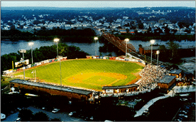
- Edward A. LeLacheur Park Baseball Stadium, shared by Lowell Spinners and the University of Massachusetts Lowell
- Lowell Memorial Auditorium - performance and boxing venue.
- Tsongas Center at UMass Lowell - multi-use sports and concert venue (6500 seats hockey, 7800 concerts)- the University of Massachusetts Lowell River Hawks, and various arena shows. On April 1, 2006, the arena held the 2006 World Curling Championships.
- Cawley Memorial Stadium- Stadium for Lowell High School and other sporting events around the Merrimack Valley. Uses FieldTurf. Home of the MICCA Marching Band Championship Finals
- Sampas Pavilion - Outdoor amphitheater on the banks of the Merrimack River
- Stoklosa Alumni Field - Baseball stadium, used by Lowell All-Americans (4,000 seats)
- Costello Athletic Center indoor arena on campus of the University of Massachusetts Lowell
- UMass Lowell Bellgarde Boathouse[83] used as a rowing and kayaking center for UMass Lowell and the greater Lowell area
Government
| Lowell City Council (as of 11/22/12)[84] |
|---|
* =former mayor |
Lowell has a council-manager government.[85] There are nine city councilors and six school committee members, all elected at large in a non-partisan election. The City Council chooses one of its members as mayor, and another as vice-mayor; the mayor serves as chair of the council and school committee, and performs certain ceremonial duties. As of January 2012, the members of the Lowell School Committee are Mayor Edward Kennedy, Jackie Doherty, Stephen Gendron, Robert Gignac, Vice Chair Connie Martin, Andre Descoteaux, Robert Hoey. The administrative head of the city government is the City Manager, who is responsible for all day-to-day operations, functioning within the guidelines of City Council policy, and is hired by and serves at the pleasure of the City Council as whole. As of April 2014, the City Manager is Kevin J. Murphy.[86]
Lowell is represented in the Massachusetts General Court by State Representatives Thomas Golden, Jr. (16th Middlesex 1995 to Present), David Nangle (17th Middlesex 2000 to Present), Rady Mom (18th Middlesex 2014 to Present), and by State Senator Eileen Donoghue (1st Middlesex), all of whom are Democrats. Federally, the city is part of Massachusetts's 3rd congressional district and represented by Democrat Niki Tsongas. The state's senior member of the United States Senate is Democrat Elizabeth Warren, elected in 2012. The state's junior member of the United States Senate is Democrat Ed Markey, elected in 2013.
| Registered Voters and Party Enrollment as of February 15, 2012[87] | |||||
|---|---|---|---|---|---|
| Party | Number of Voters | Percentage | |||
| Democratic | 20,420 | 40.48% | |||
| Republican | 4,542 | 9.00% | |||
| Unenrolled | 25,110 | 49.78% | |||
| Other | 374 | 0.74% | |||
| Total | 50,446 | 100% | |||
Education
Colleges and universities
With a rapidly growing student population, Lowell has been considered an emerging college town.[88] With approximately 10,000 students at Middlesex Community College (MCC) and 17,000 students at University of Massachusetts Lowell, Lowell is currently home to 27,000 college students. UMass Lowell is the second largest state university and fifth largest university in Massachusetts, while MCC is the second largest Associate's college in Massachusetts.[89]
Primary and secondary schools
Public schools
Lowell Public Schools operates district public schools. Lowell High School is the district public school. Non-district public schools include Greater Lowell Technical High School, Lowell Middlesex Academy Charter School,[90] Lowell Community Charter Public School,[91][92] and Lowell Collegiate Charter School.[93]
Private schools
- Community Christian Academy, (185 Students) (Grade K-12) Teacher/Student Ratio 1:9
- (Now Closed) Franco-American School, est. 1963 (Grades K-8) Teacher/Student Ratio 1:13[94]
- Hellenic American Academy, est. 1908 as the first Greek Orthodox day school in the United States (135 Students) (Grades K-8) Teacher/Student Ratio 1:12[95]
- Immaculate Conception School, (324 Students) (Grade K-8) Teacher/Student Ratio 1:17
- Lowell Catholic High School, est. 1989, is in Lowell.
- Riverside School, Nonsectarian, Special Education School (25 Students) (Grades 4-11) Teacher/Student Ratio 1:5
- St. Louis School, (457 Students) (Grades K-8) Teacher/Student Ratio 1:19
- St. Margaret School, (357 Students) (Grade K-8) Teacher/Student Ratio 1:20
- St. Michael Elementary School, (407 Students) (Grade K-8) Teacher/Student Ratio 1:16
- St. Patrick School, (181 Students) (Grade K-8) Teacher/Student Ratio 1:15
- St. Stanislaus School, est. 1906 (124 Students) (Grade K-8) Teacher/Student Ratio 1:12[96]
- Ste Jeanne d'Arc School, est. 1910 (375 Students) (Grades K1-8) Teacher/Student Ratio 1:17[97]
Libraries
_side%3B_2011-08-20.JPG)
Pollard Memorial Library / Lowell City Library
The first Lowell public library was established in 1844 with 3,500 volumes, and was set up in the first floor of the Old City Hall, 226 Merrimack St. In 1872, the expanding collection was relocated down the street to the Hosford Building[98] at 134 Merrimack St. In 1890-91, the City of Lowell hired local Architect Frederick W. Stickney to design the new Lowell City Library, known as "Memorial Hall, in honor of the city's men who lost their lives in the American Civil War.[99][100] In 1981, the library was renamed the Pollard Memorial Library in memory of the late Mayor Samuel S. Pollard. And, in the mid-2000s the century old National Historic building underwent a major $8.5m renovation.[101] The city also, recently expanded the library system to include the Senior Center Branch, located in the City of Lowell Senior Center.[102]
In fiscal year 2008, the city of Lowell spent 0.36% ($975,845) of its budget on its public libraries, which houses 236,000 volumes, and is a part of the Merrimack Valley Library Consortium. Currently, circulation of materials averages around 250,000 annually, with approximately one-third deriving from the children's collection.[99][103] In fiscal year 2009, Lowell spent 0.35% ($885,377) of its budget on the library—some $8 per person.[104]
As of 2012, the Pollard Library purchases access for its patrons to databases owned by: EBSCO Industries; Gale, of Cengage Learning; Heritage Archives, Inc.; New England Historic Genealogical Society; OverDrive, Inc.; ProQuest; and World Trade Press.[105]
Lydon Library
The Lydon Library is a part of the University of Massachusetts Lowell system, and is located on the North Campus. The building is named in honor of President Martin J. Lydon, whose vision expanded and renamed the college during his tenure in the 1950s and 1960s.[106] Its current collection concentrates on the sciences, engineering, business management, social sciences, humanities, and health.[107]
O'Leary Library
The O'Leary Library is a part of the University of Massachusetts Lowell system, and is located on the South Campus. The building is named in honor of former History Professor and then President O'Leary, whose vision helped merge the Lowell colleges during his tenure in the 1970s and 1980s.[108] Its current collection concentrates on music and art.[109]
Center for Lowell History
The Center for Lowell History [special collections and archives] is a part of the University of Massachusetts Lowell system, established in 1971 to assure the safekeeping, preservation, and availability for study and research of materials in unique subject areas, particularly those related to the Greater Lowell Area and the University of Massachusetts Lowell. Located downtown in the Patrick J. Mogan Cultural Center at 40 French Street, the Center is committed to the design and implementation of historical, educational, and cultural programs that link the university and the community in developing an economically strong and multi-culturally rich region. Its current collections and archives focus on historic and contemporary issues of Lowell (including: industrialization, textile technology, immigration, social history, regional history, labor history, women's history, and environmental history).[110]
Media

Newspaper
The Sun, headquartered in downtown Lowell, is a major daily newspaper serving Greater Lowell and southern New Hampshire. The newspaper had an average daily circulation of about 42,900 copies in 2011.[111] Continuing a trend of concentration of newspaper ownership, The Sun was sold to newspaper conglomerate MediaNews Group in 1997 after 119 years of family ownership.[112]
Radio
- WCAP AM 980, talk radio
- WLLH AM 1400 Spanish Tropical
- WUML FM 91.5, UMass Lowell-owned station
- WCRB FM 99.5, Classical music, licensed to Lowell
Infrastructure
Transportation
Lowell can be reached by automobile from Interstate 495, U.S. Route 3, the Lowell Connector, and Massachusetts Routes 3A, 38, 110, 113, and 133, all of which run through the city, the last one (Route 133) begins at the spot where Routes 110 and 38 branch off just south of the Merrimack River. Lowell can also be reached by Interstate 93 via exit 44B (I-495 south) in nearby Andover, and Interstate 95 via the U.S. Route 3 exit (32A) in nearby Burlington.[113] There are six bridges crossing the Merrimack River in Lowell, and four crossing the Concord River (not including the two for I-495).
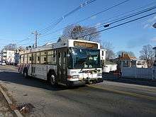
For public transit, Lowell is served by the Lowell Regional Transit Authority, which provides fixed route bus services and paratransit services to the city and surrounding area. These connect at the Gallagher Transit Terminal to the Lowell Line of the MBTA commuter rail system, which connects Lowell to Boston. The terminal is also served by several intercity bus lines.[113]
The Lowell National Historical Park provides a free streetcar shuttle between its various sites in the city center, using track formerly used to provide freight access to the city's mills. An expansion is currently being planned to expand the system to 6.9 miles. The system might be turned over to the Lowell Regional Transit Authority after the extension is built.
Hospitals
Businesses started and/or products invented in Lowell
- Cash Carriers
- CVS/pharmacy
- Father John's Medicine[114]
- Francis Turbine - A highly efficient water-powered turbine
- Fred C. Church Insurance (est. 1865)[115]
- Market Basket - Chain of approximately 70 grocery stores in Massachusetts and New Hampshire
- Moxie - the first mass-produced soft drink in the U.S.
- Telephone numbers, 1879, Lowell is the first U.S. city to have phone numbers, two years after Alexander Graham Bell demonstrates his telephone in Lowell.[116]
- Stuarts Department Stores
- Wang Laboratories - Massachusetts Miracle computer company
Notable people
See List of People from Lowell, Massachusetts
Twin towns and sister cities
| City | State | Year |
|---|---|---|
| Saint-Dié-des-Vosges | 1989 | |
| Berdiansk | 1997 | |
| Phnom Penh | 2015 |
Honors
- 2010, Lowell designated as a "Green Community"[117]
- 1997 and 1998, Lowell was a finalist for the All-American City award.[118]
- 1999, Lowell received an All-American City award.[118]
See also
References
- ↑ "FAQ City of Lowell, Massachusetts". City of Lowell, Massachusetts. Retrieved July 10, 2013.
- ↑ "Middlesex County QuickFacts from the US Census Bureau". www.thepublicrecords.com. ThePublicRecords.com.
- ↑ "State & Count QuickFacts: Lowell (city), Massachusetts". quickfacts.census.gov. U.S. Census Bureau.
- ↑ "Boston - Cambridge - Newton, MA-NH Metropolitan Statistical Area (USA): Places - Population Statistics in Maps and Charts".
- ↑ "Lowell National Historical Park". www.nps.gov. U.S. Department of the Interior.
- ↑ "Monument in Lowell the Cambodian community's past and its progress - The Boston Globe".
- ↑ "Profile for Lowell, Massachusetts, MA". ePodunk. Retrieved August 24, 2012.
- ↑ Stephen J. Goldfarb, "A Note on Limits to Growth of the Cotton-Textile Industry in the Old South," Journal of Southern History, 48, (1982), 545.
- ↑ Beckert, Sven (2014). Empire of Cotton: a Global History. New York: Knopf.
- 1 2 3 Marion, Paul, "Timeline of Lowell History From 1600s to 2009", Yankee magazine, November 2009.
- ↑ City of Lowell Master Plan Update: Existing Conditions Report, Department of Planning and Development, December 2011, 3.0 Land-Use pg 31
- ↑ City of Lowell Master Plan Update: Existing Conditions Report, Department of Planning and Development, December 2011, 3.0 Land-Use pg 32
- ↑ Hamilton Canal District Form-Based Code Zoning Section, City of Lowell Zoning Section 10.3, February 2009 pg 4
- ↑ "Hamilton Canal District, Lowell, Massachusetts". www.trinityfinancial.com. Trinity Financial LLC.
- ↑ Hamilton Canal District Master Plan, September 2008 pg. 6
- ↑ Plaisir, By Corinne; Kirksey, Carline. "Let 17-year-olds vote".
- ↑ Line, Molly (11 July 2012). "'Vote 17' movement pushing for teen voice in local elections".
- ↑ "my testimony in favor of lowering the voting age to 17 in Lowell, MA".
- 1 2 "Homepage - UTEC, Inc.".
- ↑ "US Gazetteer files: 2010, 2000, and 1990". United States Census Bureau. 2011-02-12. Retrieved 2011-04-23.
- ↑ "City of Lowell".
- ↑ Lowell-Dracut-Tyngsboro State Forest
- ↑ "TOTAL POPULATION (P1), 2010 Census Summary File 1". American FactFinder, All County Subdivisions within Massachusetts. United States Census Bureau. 2010.
- ↑ "Massachusetts by Place and County Subdivision - GCT-T1. Population Estimates". United States Census Bureau. Retrieved July 12, 2011.
- ↑ "1990 Census of Population, General Population Characteristics: Massachusetts" (PDF). US Census Bureau. December 1990. Table 76: General Characteristics of Persons, Households, and Families: 1990. 1990 CP-1-23. Retrieved July 12, 2011.
- ↑ "1980 Census of the Population, Number of Inhabitants: Massachusetts" (PDF). US Census Bureau. December 1981. Table 4. Populations of County Subdivisions: 1960 to 1980. PC80-1-A23. Retrieved July 12, 2011.
- ↑ "1950 Census of Population" (PDF). Bureau of the Census. 1952. Section 6, Pages 21-10 and 21-11, Massachusetts Table 6. Population of Counties by Minor Civil Divisions: 1930 to 1950. Retrieved July 12, 2011.
- ↑ "1920 Census of Population" (PDF). Bureau of the Census. Number of Inhabitants, by Counties and Minor Civil Divisions. Pages 21-5 through 21-7. Massachusetts Table 2. Population of Counties by Minor Civil Divisions: 1920, 1910, and 1920. Retrieved July 12, 2011.
- ↑ "1890 Census of the Population" (PDF). Department of the Interior, Census Office. Pages 179 through 182. Massachusetts Table 5. Population of States and Territories by Minor Civil Divisions: 1880 and 1890. Retrieved July 12, 2011.
- ↑ "1870 Census of the Population" (PDF). Department of the Interior, Census Office. 1872. Pages 217 through 220. Table IX. Population of Minor Civil Divisions, &c. Massachusetts. Retrieved July 12, 2011.
- ↑ "1860 Census" (PDF). Department of the Interior, Census Office. 1864. Pages 220 through 226. State of Massachusetts Table No. 3. Populations of Cities, Towns, &c. Retrieved July 12, 2011.
- ↑ "1850 Census" (PDF). Department of the Interior, Census Office. 1854. Pages 338 through 393. Populations of Cities, Towns, &c. Retrieved July 12, 2011.
- ↑ "1950 Census of Population" (PDF). 1: Number of Inhabitants. Bureau of the Census. 1952. Section 6, Pages 21-7 through 21-09, Massachusetts Table 4. Population of Urban Places of 10,000 or more from Earliest Census to 1920. Retrieved July 12, 2011.
- ↑ "Census of Population and Housing". Census.gov. Archived from the original on May 11, 2015. Retrieved June 4, 2015.
- 1 2 "Table DP-1: Profile of General Population and Housing Characteristics: 2010; 2010 Demographic Profile Data". US Census Bureau. Retrieved 2012-02-26.
- ↑ "Lowell (city), Massachusetts". American Community Survey 2013 1-year estimates. U.S. Census Bureau.
- ↑ "Ethnicity in Lowell: Lowell National Historical Park Ethnographic Overview and Assessment" (PDF). University of Lowell, Massachusetts Libraries; Ethnicity in Lowell. National Park Service. Retrieved 7 December 2014.
- 1 2 "Sustainable Lowell 2025" (PDF). www.lowellma.gov. p. xx. Retrieved 21 February 2015.
- ↑ VOAnews.com, Voice of America News Archived August 26, 2009, at the Wayback Machine.
- 1 2 "Cambodian Consulate Opens in Lowell", Khmerization, 27 Apr 2009, accessed 26 Oct 2010
- 1 2 "Table QT-P1: Age Groups and Sex: 2010; 2010 Census Summary File 1". US Census Bureau. Retrieved 2012-02-26.
- ↑ "State and County Quick Facts: Lowell (city) Massachusetts". US Census Bureau Quick Facts. United States Census Bureau. Retrieved 7 December 2014.
- ↑ "Table DP03 -- SELECTED ECONOMIC CHARACTERISTICS; 2006-2010 American Community Survey 5-Year Estimates". US Census Bureau, 2006-2010 American Community Survey.
- ↑ July 2009 – Crime Policy Brief Series Vol. No 5 Massachusetts Executive Office of Public Safety and Security; Data Source: 2008 Crime Data, Massachusetts State Police, Crime Reporting Unit. Population from U.S. Census 2008 estimates. Rate is per 100,000 persons
- ↑ The police behind America's biggest crime drop.(Edward F. Davis III and the Lowell, Massachusetts police department)
- 1 2 "CQ Press: City Crime Rankings 2009".
- ↑ "SELECTED ECONOMIC CHARACTERISTICS 2009-2013 American Community Survey 5-Year Estimates". U.S. Census Bureau. Retrieved 2015-01-12.
- ↑ "ACS DEMOGRAPHIC AND HOUSING ESTIMATES 2009-2013 American Community Survey 5-Year Estimates". U.S. Census Bureau. Retrieved 2015-01-12.
- ↑ "HOUSEHOLDS AND FAMILIES 2009-2013 American Community Survey 5-Year Estimates". U.S. Census Bureau. Retrieved 2015-01-12.
- ↑ "Lowell Women's Week".
- ↑ "Lowell Film Festival in Lowell, Massachusetts - Lowell.com".
- ↑ "Welcome — Doors Open Lowell - National Preservation Month".
- ↑ "Home".
- ↑ "Just another WordPress site – Just another WordPress site".
- ↑ "Lowell Celebrates Kerouac!".
- ↑ "WESTERN AVENUE - STUDIOS & LOFTS – Lowell MA".
- ↑ Schweitzer. Sarah. "Lowell hopes to put 'Little Cambodia' on the map." The Boston Globe. February 15, 2010. Retrieved on February 15, 2012.
- ↑ "New York Times" article "Destruction of the Lowell Museum by Fire" January 31, 1856
- ↑ LHS - Lowell Historical Society Archived June 21, 2010, at the Wayback Machine.
- ↑ "Lowell Gallery".
- ↑ "119 Gallery (911 Electronic Media Arts, Inc.) - Art, Music, Performance, and Community – Lowell MA".
- ↑ "American Textile History Museum - Telling America's story through the art, history, and science of textiles".
- ↑ "Untitled Document".
- ↑ "The Brush Art Gallery and Studios".
- ↑ "NEQM Home".
- ↑ "National Streetcar Museum: Lowell, Massachusetts".
- ↑ "Arts League of Lowell".
- ↑ "Angkor Dance Troupe".
- ↑ Tuttle, Nancye, "Cambodian art, a New England tradition", The Lowell Sun, May 15, 2008.
- ↑ Pohl, Janet. "University of Massachusetts Center for Lowell History".
- ↑ "Lowell Summer Music Series".
- ↑ "Lowell Rocks".
- ↑ "Home - LTC".
- ↑ "Home".
- ↑ Durant, Jeri. "Gentlemen Songsters Barbershop Harmony Chorus - Family Entertainment in the A Cappella Style - 2016".
- ↑ http://www.lowellpoetrynetwork.org/
- ↑ "Music Department - UMass Lowell".
- ↑ Halloran, Bob (2010). Irish Thunder: The Hard Life and Times of Micky Ward. Guilford, CT: First Lyons Press.
- ↑ Sackowitz, Karen (June 10, 2010). "Blood, sweat, cheers: Lowell gym helps youths learn boxing, confidence, and it stars in a new movie". The Boston Globe.
- ↑ "Lowell Nor'easter - New England Football League".
- ↑ "THE NPSL COMES TO LOWELL, MA". NPSL. Retrieved 19 November 2013.
- ↑ "New soccer team in Lowell will join Premier League". Lowell Sun. Retrieved 20 November 2013.
- ↑ http://www.uml.edu/CampusRecreation/Boathouse/About-Us.aspx
- ↑ "City of Lowell".
- ↑ "Overview". City of Lowell. Retrieved 2012-02-26.
- ↑ Moran, Lyle (April 15, 2014). "Lowell City Manager Murphy ready to roll up his sleeves". Lowell Sun. Retrieved April 16, 2014.
- ↑ "Registered Voters and Party Enrollment as of February 15, 2012" (PDF). Massachusetts Elections Division. Retrieved 2012-02-26.
- ↑ "Lowell Sun - College Town".
- ↑ "UMass Lowell Demographics". National Center for Education Statistics.
- ↑ "Lowell Middlesex Academy Charter School".
- ↑ "Home Page - Lowell Community Charter Public School".
- ↑ LCCPS.org Archived March 17, 2012, at the Wayback Machine.
- ↑ SABIS®. "Collegiate Charter School of Lowell".
- ↑ "Franco American School".
- ↑ "Home".
- ↑ Saint Stanislaus/History Archived January 14, 2011, at the Wayback Machine.
- ↑ http://www.sjdarc.org/pdf%20files/Fact%20Sheet%209-12.pdf
- ↑ C.B. Tillinghast. The free public libraries of Massachusetts. 1st Report of the Free Public Library Commission of Massachusetts. Boston: Wright & Potter, 1891. Google books
- 1 2 Pollardml.org Archived April 24, 2012, at the Wayback Machine.
- ↑ Pollardml.org, Retrieved 2010-11-08 Archived April 24, 2012, at the Wayback Machine.
- ↑ "City of Lowell".
- ↑ Pollardml.org Archived March 2, 2012, at the Wayback Machine.
- ↑ July 1, 2007 through June 30, 2008; cf. The FY2008 Municipal Pie: What's Your Share? Commonwealth of Massachusetts, Board of Library Commissioners. Boston: 2009. Available: Municipal Pie Reports. Retrieved 2010-08-04
- ↑ July 1, 2008 through June 30, 2009; cf. Massachusetts Board of Library Commissioners (2011). "FY 2009 Municipal Pie Report". Retrieved 2011-04-04.
- ↑ Pollard Memorial Library. "Databases". Retrieved 15 May 2012.
- ↑ "Dyeing for a living: a history of the American Association of Textile" By Mark Clark
- ↑ "UMass Lowell Libraries: Lydon Library".
- ↑ "Olearyforcongress.com".
- ↑ "UMass Lowell Libraries: Lydon Library".
- ↑ "UMass Lowell Libraries: Center for Lowell History".
- ↑ "eCirc for US Newspapers: FAS-FAX Report". Audit Bureau of Circulations. 2011-09-30. Retrieved 2012-03-01.
- ↑ Revah, Suzan (September 1997). "Bylines". American Journalism Review. Retrieved 2012-03-01.
- 1 2 "City of Lowell - Location". Retrieved 2007-10-02.
- ↑ Pohl, Janet. "Father John's Story".
- ↑ Fredcchurch.com
- ↑ "Timeline of Lowell History". 8 October 2009.
- ↑ "City Council gets wind of green bonus".
- 1 2 NCL.org Archived July 7, 2010, at the Wayback Machine.
Further reading
| Library resources about Lowell, Massachusetts |
- Dalzell, Robert F. Enterprising elite: The Boston Associates and the world they made (Harvard University Press, 1987)
- Deitch, Joanne Weisman. The Lowell Mill Girls: Life in the Factory (Perspectives on History Series) (1998)
- Dublin, Thomas. Women at Work: The Transformation of Work and Community in Lowell, Massachusetts, 1826-1860, (Columbia University Press, 1981)
- Eno, Arthur Louis. Cotton was king: A history of Lowell, Massachusetts (New Hampshire Publishing Company, 1976)
- Gross, Laurence F. The Course of Industrial Decline: The Boott Cotton Mills of Lowell, Massachusetts, 1835-1955 (Johns Hopkins University Press, 1993)
- Malone, Patrick M., Waterpower in Lowell: Engineering and Industry in Nineteenth-Century America, Johns Hopkins Introductory Studies in the History of Technology (2009)
- Mrozowski, Stephan A.; Ziesing, Grace H.; Beaudry, Mary C., Living on the Boott: Historical Archaeology at the Boott Mills Boardinghouses, Lowell, Massachusetts, The Lowell Historic Preservation Commission (1996)
- Savard, Rita, "Three Hard Words: I Need Help: Jobs gone and bills mounting, many more in Greater Lowell seek food aid", The Lowell Sun, January 22, 2010
- Stanton, Cathy, The Lowell Experiment: Public History in a Postindustrial City, University of Massachusetts Press. (2006)
- Weible, Robert, ed. The Continuing Revolution: A History of Lowell, Massachusetts (1991)
Primary sources
- Denenberg, Barry. So Far From Home: The Diary of Mary Driscoll, An Irish Mill Girl, Lowell, Massachusetts 1847 (Dear America Series) (2003)
- Eisler, Benita, The Lowell Offering: Writings by New England Mill Women (1840-1945), J.B. Lippincott (1977); Norton (1998)
- Larcom, Lucy, "Among Lowell Mill-Girls: a reminiscence", The Atlantic Monthly, v.XLVIII (48), no.268, November 1881, pp. 593–612.
- The Lowell Historical Society, Lowell: The Mill City (MA) (Postcard History Series), Arcadia Publishing. (2005), illustrated postcards
External links
| Wikimedia Commons has media related to Lowell, Massachusetts. |
| Wikivoyage has a travel guide for Lowell, Massachusetts. |
| Wikisource has the text of the 1911 Encyclopædia Britannica article Lowell. |
- City of Lowell official web site
- Merrimack Valley Region tourist information
- Lowell Sun newspaper
- University of Massachusetts Lowell, Center for Lowell History
- Lowell Online
-
 "Lowell, Massachusetts". The American Cyclopædia. 1879.
- "Lowell". New International Encyclopedia. 1905.
- "Lowell". Encyclopedia Americana. 1920.
Boston (capital) | |
| Topics |
|
| Society | |
| Regions | |
| Counties | |
| Cities |
|
| Topics | |||||||||||
|---|---|---|---|---|---|---|---|---|---|---|---|
| States | |||||||||||
| Major cities | |||||||||||
| State capitals | |||||||||||
| Transportation |
| ||||||||||
| |||||||||||
| ||
| ||