Northfield, New Hampshire
| Northfield, New Hampshire | ||
|---|---|---|
| Town | ||
|
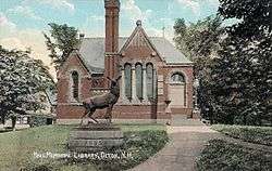
Hall Memorial Library c. 1905 | ||
| ||
| Motto: "A Great Place to Live!" | ||
 Location in Merrimack County and the state of New Hampshire | ||
| Coordinates: 43°26′15″N 71°35′35″W / 43.43750°N 71.59306°WCoordinates: 43°26′15″N 71°35′35″W / 43.43750°N 71.59306°W | ||
| Country | United States | |
| State | New Hampshire | |
| County | Merrimack | |
| Incorporated | 1780 | |
| Government | ||
| • Board of Selectmen |
Wayne Crowley Robert Southworth Dennis Allen | |
| • Town Administrator | Glenn Smith | |
| Area | ||
| • Total | 29.0 sq mi (75.2 km2) | |
| • Land | 28.8 sq mi (74.6 km2) | |
| • Water | 0.3 sq mi (0.7 km2) 0.89% | |
| Elevation | 440 ft (134 m) | |
| Population (2010) | ||
| • Total | 4,829 | |
| • Density | 170/sq mi (64/km2) | |
| Time zone | Eastern (UTC-5) | |
| • Summer (DST) | Eastern (UTC-4) | |
| Area code(s) | 603 | |
| FIPS code | 33-54260 | |
| GNIS feature ID | 0873686 | |
| Website |
www | |
Northfield is a town in Merrimack County, New Hampshire, United States. The population was 4,829 at the 2010 census.[1]
History
Settlers first arrived in Northfield in the early 1700s. Initially Northfield was incorporated as part of Canterbury when that town was established in 1741. At the time it was a frontier town protected by a garrison fort erected on a hill close to Canterbury Center and commanded by Capt. Jeremiah Clough. Tradition has it that the first settlers of the "north fields" of Canterbury came from the scouts from this fort who patrolled the area in the 1740s.[2]
The north fields of Canterbury prospered. Farming was the principal industry. Additionally, dams along the Winnipesaukee and Merrimack rivers and several brooks powered early sawmills and gristmills. By the 1770s there was a substantial population in the north fields of Canterbury.
By 1780 the residents of the north fields found it increasingly difficult to travel to the center of Canterbury to attend to town business. On March 30, 1780, they filed the following petition with the State of New Hampshire (spelling left as printed in 1780):
Canterbury, March 30, 1780
“The humble petition of ye Subscribers Inhabitants of ye North part of sd Canterbury to ye Honorable ye President and members of Council and house of Representatives of said State. We your Humble Petitioners Living at a great Distance from ye Center of the Towne Some of us nine or ten Miles and Consequently at a very great disadvantage in joining with them all Publick Town affairs, being encouraged Partly by our Living in that Part of ye Town that was Laid out for what was called ye upper Parish and Partly by ye Kind Reception our Request met with which we made to ye Town for a dismission but more particularly by our Confidence in your Honors desire to Promote ye Happiness of every Part of ye State Humbly Pray that Honors would take our Case into your Serious Consideration and grant that we together with all those Live in sd Upper Part may be Erected and Incorporated into a body Politick and Corporate to have Continuance in ye Name of Northfield with all such Powers and Authorities Privileges Immunities and Franchises with other Parishes or Towns in this State in General hold Enjoy with your Petitions as in duty bound Shall forever pray.”
The petition, signed by 43 residents, was approved by the state legislature, and the Town of Northfield was born.[2]
In 1848, the Boston, Concord and Montreal Railroad opened to Northfield, helping it develop symbiotically with Tilton across the river as a mill town. The Winnipesaukee River provided water power for mills, and by 1859, when the population was 1,332, Northfield had a woolen factory and a wrapping paper mill.[3]
Northfield continued to combine a strong industrial base with a healthy agricultural community throughout the 19th and most of the 20th centuries. Early sawmills and gristmills gave way to large textile and paper mills. As these industries died out in the area many old mill buildings were torn down. Others were used for the manufacture of other items, including optical lenses and lead batteries.
Geography
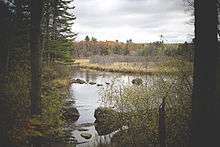
According to the United States Census Bureau, the town has a total area of 29.0 square miles (75.1 km2), of which 28.8 sq mi (74.6 km2) is land and 0.3 sq mi (0.8 km2) is water, comprising 0.89% of the town. It is drained by the Merrimack River, primarily by way of the Winnipesaukee River and its tributary Williams Brook. The town is characterized by gently rolling hills, the highest point in town being the summit of Bean Hill at 1,500 feet (460 m) above sea level, near the southern border. Two significant water bodies in Northfield are Sandogardy Pond in the southwest corner of town and Knowles Pond on the east side of town.
Economy
Today Northfield is the home of more than 70 large and small businesses. Its proximity to the robust commercial development in nearby Tilton has precluded the development of a strong commercial base in Northfield, but development in other sectors have provided Northfield with a strong and diverse economy. Manufacturers including Eptam Plastics, Blouin Steel Fabricators, Freudenberg NOK, and PCC Structurals form the backbone of the town's manufacturing/industrial base. The service sector employs more than 400 people and constitutes 40% of the overall workforce.[4]
Although many of the town's residents travel to nearby commercial and business centers in Tilton, Concord or Manchester for employment, nearly a thousand people work in Northfield, according to the NH Economic and Labor Market Information Bureau.[5]
Transportation
Northfield is located in central New Hampshire and is served by several state and federal transportation routes. Interstate 93 runs through Northfield and serves the town with one partial exit and one nearby exit. Exit 19, closest to the center of town, allows for entry onto the southbound lanes of I-93 and exit from the northbound lanes. A full I-93 interchange, exit 20, is located less than a mile from Northfield, in the neighboring town of Tilton.
Northfield is also crossed by New Hampshire Route 132, which provides north/south access parallel to Interstate 93. New Hampshire Route 140 runs east/west and crosses the northern tip of town, connecting Tilton with Belmont, Gilmanton, and Alton. The combined U.S. Route 3/NH Route 11 runs east/west through Tilton, just north of the town line with Northfield.
Manchester-Boston Regional Airport is the nearest major airport, located 40 miles (64 km) to the south.
Distances to area cities:
- Concord, New Hampshire - 17 miles (27 km)
- Manchester, New Hampshire - 34 miles (55 km)
- Boston, Massachusetts - 85 miles (137 km)
- New York, New York - 290 miles (470 km)
- Montreal, Quebec - 236 miles (380 km)
Education
Northfield is a member of the Winnisquam Regional School District. Elementary education is provided at Union Sanborn School and Southwick School, both located in Northfield. Winnisquam Regional Middle School and Winnisquam Regional High School are located in the adjacent town of Tilton. Along with Tilton, Northfield is home to the facilities of the Tilton School, an independent college-preparatory school serving grades 9 - 12.
Demographics
| Historical population | |||
|---|---|---|---|
| Census | Pop. | %± | |
| 1790 | 606 | — | |
| 1800 | 925 | 52.6% | |
| 1810 | 1,057 | 14.3% | |
| 1820 | 1,304 | 23.4% | |
| 1830 | 1,169 | −10.4% | |
| 1840 | 1,413 | 20.9% | |
| 1850 | 1,332 | −5.7% | |
| 1860 | 1,051 | −21.1% | |
| 1870 | 833 | −20.7% | |
| 1880 | 918 | 10.2% | |
| 1890 | 1,115 | 21.5% | |
| 1900 | 1,227 | 10.0% | |
| 1910 | 1,474 | 20.1% | |
| 1920 | 1,522 | 3.3% | |
| 1930 | 1,336 | −12.2% | |
| 1940 | 1,543 | 15.5% | |
| 1950 | 1,561 | 1.2% | |
| 1960 | 1,784 | 14.3% | |
| 1970 | 2,193 | 22.9% | |
| 1980 | 3,051 | 39.1% | |
| 1990 | 4,263 | 39.7% | |
| 2000 | 4,548 | 6.7% | |
| 2010 | 4,829 | 6.2% | |
| Est. 2015 | 4,808 | [6] | −0.4% |
As of the census[8] of 2000, there were 4,548 people, 1,706 households, and 1,211 families residing in the town. The population density was 158.0 people per square mile (61.0/km²). There were 1,782 housing units at an average density of 61.9 per square mile (23.9/km²). The racial makeup of the town was 98.18% White, 0.13% African American, 0.18% Native American, 0.42% Asian, 0.15% from other races, and 0.95% from two or more races. Hispanic or Latino of any race were 0.92% of the population.
There were 1,706 households out of which 38.1% had children under the age of 18 living with them, 53.6% were married couples living together, 11.5% had a female householder with no husband present, and 29.0% were non-families. 20.2% of all households were made up of individuals and 7.1% had someone living alone who was 65 years of age or older. The average household size was 2.63 and the average family size was 3.03.
In the town the population was spread out with 27.9% under the age of 18, 7.8% from 18 to 24, 32.0% from 25 to 44, 23.6% from 45 to 64, and 8.7% who were 65 years of age or older. The median age was 36 years. For every 100 females there were 98.9 males. For every 100 females age 18 and over, there were 95.4 males.
The median income for a household in the town was $44,333, and the median income for a family was $48,787. Males had a median income of $33,051 versus $25,000 for females. The per capita income for the town was $18,466. About 0.9% of families and 3.9% of the population were below the poverty line, including 0.4% of those under age 18 and 7.5% of those age 65 or over.
Notable people
- Jillian Beyor, Playboy's 2008 Model of the Year
- Joseph Libbey Folsom, US Army officer and real estate investor; founder of what is now Folsom, California
- Richard S. Molony, US congressman
- Robert Smith, US congressman
References
- ↑ United States Census Bureau, American FactFinder, 2010 Census figures. Retrieved March 23, 2011.
- 1 2 Cross, Lucy (1905). History of Northfield 1780 - 1905. Concord, New Hampshire.
- ↑ Coolidge, Austin J.; John B. Mansfield (1859). A History and Description of New England. Boston, Massachusetts. p. 604.
- ↑ Town of Northfield
- ↑ "Northfield, NH". NH Economic and Labor Market Information Bureau. Retrieved December 29, 2011.
- ↑ "Annual Estimates of the Resident Population for Incorporated Places: April 1, 2010 to July 1, 2015". Retrieved July 2, 2016.
- ↑ "Census of Population and Housing". Census.gov. Retrieved June 4, 2016.
- ↑ "American FactFinder". United States Census Bureau. Retrieved 2008-01-31.
External links
- Town of Northfield official website
- Hall Memorial Library
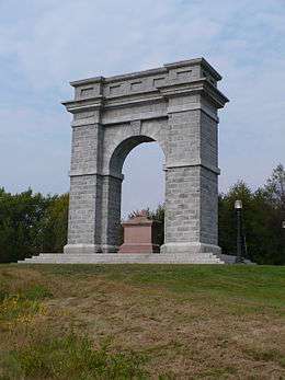
- Tilton-Northfield Arch Trail Travelers Snowmobile Club
- New Hampshire Economic and Labor Market Information Bureau Profile
Municipalities and communities of Merrimack County, New Hampshire, United States | ||
|---|---|---|
| Cities |  | |
| Towns | ||
| CDPs | ||
| Other unincorporated communities | ||
| Footnotes | ‡This populated place also has portions in an adjacent county or counties | |