O'Hare, Chicago
| O'Hare | |
|---|---|
| Community area | |
| Community Area 76 - O'Hare | |
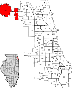 Location within the city of Chicago | |
| Coordinates: 42°00.0′N 87°55.2′W / 42.0000°N 87.9200°WCoordinates: 42°00.0′N 87°55.2′W / 42.0000°N 87.9200°W | |
| Country | United States |
| State | Illinois |
| County, | Cook, DuPage |
| City | Chicago |
| Neighborhoods |
list
|
| Population (2010) | |
| • Total | 12,576 |
| Demographics (2010)[1] | |
| • White | 77.18% |
| • Black | 3.16% |
| • Hispanic | 9.5% |
| • Asian | 8.29% |
| • Other | 1.87% |
| Time zone | CST (UTC-6) |
| • Summer (DST) | CDT (UTC-5) |
| ZIP Codes | 60656 and 60666 |
| Median income[2] | $49,601 |
| Source: U.S. Census, Record Information Services | |
O'Hare, located on the far northwest side of Chicago, Illinois, is one of the city's 77 official community areas. O'Hare International Airport is located within the boundaries of this community area. This community area is the only one that extends outside Cook County; the western edge (an area comprising the southwest part of the airport) is in DuPage County.
Due to it containing O'Hare International Airport as well as major roads such as Interstates 90, 190, and 294, Illinois Routes 72 and 171, and U.S. Routes 12 and 45, the O'Hare neighborhood is a major business center. Combined with nearby Rosemont, the region serves as an edge city, a major concentration of jobs, shopping, and entertainment.
Religion

A number of prominent religious institutions are based in this Community area. St. Joseph the Betrothed Ukrainian Greek Catholic Church is located on Cumberland Avenue, with a branch of the Ukrainian Selfreliance Credit Union located adjacent to it. The largest Lutheran denomination in the United States, the Evangelical Lutheran Church in America, also has its headquarters in O'Hare.
Consulates
The Consulate-General of the Dominican Republic is located at 8700 West Bryn Mawr Avenue.[3]
Economy
IGA,[4] U.S. Cellular,[5] True Value,[6] Bally Total Fitness, CareerBuilder, and uBid all have their headquarters in O'Hare. Nippon Cargo Airlines has its Americas headquarters on the property of O'Hare International Airport.[7]
Several airport hotels can also be found in the area.
Education
The O'Hare area is zoned to Chicago Public Schools. For the residential areas, the zoned K-8 school is Everett McKinley Dirksen School,[8] while Taft High School serves as the high school.[9]
The O'Hare neighborhood is also home to a DePaul University satellite campus.
| Historical population | |||
|---|---|---|---|
| Census | Pop. | %± | |
| 1960 | 311 | — | |
| 1970 | 6,230 | 1,903.2% | |
| 1980 | 11,073 | 77.7% | |
| 1990 | 11,214 | 1.3% | |
| 2000 | 11,940 | 6.5% | |
| 2010 | 12,576 | 5.3% | |
| [10] | |||
References
- ↑ Paral, Rob. "Chicago Demographics Data". Retrieved 21 September 2012.
- ↑ Paral, Rob. "Chicago Census Data". Retrieved 21 September 2012.
- ↑ "Dominican Consulates in the United States of America". Embassy of the Dominican Republic in the United States. Retrieved January 31, 2009.
- ↑ "Contact IGA." IGA. Retrieved on February 27, 2010.
- ↑ "Privacy Policy." U.S. Cellular. Retrieved on January 10, 2010.
- ↑ "Terms of Use." True Value. Retrieved on January 6, 2010. "True Value Company Truevalue.com Customer Service 8600 W. Bryn Mawr Ave. Chicago, IL 60631"
- ↑ "America." Nippon Cargo Airlines. Retrieved on February 17, 2012. "663 North Access Road, O'Hare International Airport, Chicago, IL 60666,U.S.A."
- ↑ "Elem North". Chicago Public Schools. 2013. Retrieved on September 30, 2016.
- ↑ "HS North/Near North". Chicago Public Schools. 2013. Retrieved on September 30, 2016.
- ↑ Paral, Rob. "Chicago Community Areas Historical Data". Chicago Community Areas Historical Data. Retrieved 30 August 2012.
External links
- Official City of Chicago O'Hare Community Map
- The Northwest Chicago Historical Society's page on O'Hare
- Everett McKinley Dirksen School

| |