West Elsdon, Chicago
| West Elsdon | |
|---|---|
| Community area | |
| Community Area 62 - West Elsdon | |
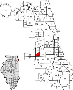
 Location within the city of Chicago | |
| Coordinates: 41°47.4′N 87°43.2′W / 41.7900°N 87.7200°WCoordinates: 41°47.4′N 87°43.2′W / 41.7900°N 87.7200°W | |
| Country | United States |
| State | Illinois |
| County | Cook |
| City | Chicago |
| Neighborhoods |
list
|
| Area | |
| • Total | 1.18 sq mi (3.06 km2) |
| Population (2010) | |
| • Total | 18,109 |
| • Density | 15,000/sq mi (5,900/km2) |
| Demographics2010[1] | |
| • White | 17.95% |
| • Black | 1.41% |
| • Hispanic | 79.04% |
| • Asian | 1.23% |
| • Other | 0.38% |
| Time zone | CST (UTC-6) |
| • Summer (DST) | CDT (UTC-5) |
| ZIP Codes | parts of 60629 and 60632 |
| Median income | $51,003 |
| Source: U.S. Census, Record Information Services | |
West Elsdon, one of the 77 official community areas, is located on the southwest side of the City of Chicago, Illinois. It is noted as a twin neighborhood of West Lawn. It has a population which includes a mix of dwindling Polish-American residents and increasing Mexican-American residents who currently constitute a clear majority. It has its own association, "West Elsdon Civic Association," which privately organizes the neighborhood. St. Turibius grade school, a Roman Catholic elementary school, located at 57th and Karlov, closed in 2013 and is currently inactive though the building remains and is adjacent to St. Turibius Roman Catholic church. The former Lourdes Roman Catholic girls' high school located from 55th to 56th street from Komensky to Karlov Avenue is now a Chicago Public Schools magnet high school, John Hancock High School.
History
Before the early 20th century, the area now designated West Elsdon was a marshy remnant of an ancient lake. The early settlers were German-Americans and Irish-Americans. During the 1930s, housing was built and Polish-Americans and other Central Europeans settled the area. The land remained rural until World War II, when growth resumed and brick houses were built. Mexican-Americans settled in the eastern part of the community. Soon public schools were registering more Hispanic-Americans, and the CTA Orange Line was built to connect Midway Airport to Downtown.
Actress/Author Jenny McCarthy grew up in the area and is a graduate of St. Turibius grammar school.
| Historical population | |||
|---|---|---|---|
| Census | Pop. | %± | |
| 1930 | 2,861 | — | |
| 1940 | 3,255 | 13.8% | |
| 1950 | 7,728 | 137.4% | |
| 1960 | 14,215 | 83.9% | |
| 1970 | 14,059 | −1.1% | |
| 1980 | 12,797 | −9.0% | |
| 1990 | 12,266 | −4.1% | |
| 2000 | 15,921 | 29.8% | |
| 2010 | 18,109 | 13.7% | |
| [2] | |||
References
- ↑ Paral, Rob. "Chicago Demographics Data". Retrieved 21 September 2012.
- ↑ Paral, Rob. "Chicago Community Areas Historical Data". Retrieved 3 September 2012.
External links
- West Elsdon map & neighborhood guide on ExploreChicago.org
- Official City of Chicago West Elsdon Community Map
 |
Archer Heights, Chicago | Brighton Park, Chicago |
| ||||
| Garfield Ridge, Chicago | |
||||||
| |
Gage Park, Chicago | ||||||
| |
|||||||
| Clearing, Chicago | West Lawn, Chicago | Chicago Lawn, Chicago |