Oak Ridge, Missouri
| Oak Ridge, Missouri | |
|---|---|
| Village | |
| Nickname(s): Lizard Lick | |
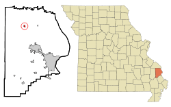 Location of Oak Ridge, Missouri | |
| Coordinates: 37°29′59″N 89°43′47″W / 37.49972°N 89.72972°WCoordinates: 37°29′59″N 89°43′47″W / 37.49972°N 89.72972°W | |
| Country | United States |
| State | Missouri |
| County | Cape Girardeau |
| Area[1] | |
| • Total | 0.57 sq mi (1.48 km2) |
| • Land | 0.57 sq mi (1.48 km2) |
| • Water | 0 sq mi (0 km2) |
| Elevation | 600 ft (183 m) |
| Population (2010)[2] | |
| • Total | 243 |
| • Estimate (2012[3]) | 247 |
| • Density | 426.3/sq mi (164.6/km2) |
| Time zone | Central (CST) (UTC-6) |
| • Summer (DST) | CDT (UTC-5) |
| ZIP code | 63769 |
| Area code(s) | 573 |
| FIPS code | 29-53786[4] |
| GNIS feature ID | 0723633[5] |
Oak Ridge is a village in the southern part of Apple Creek Township in Cape Girardeau County, Missouri, United States. The population was 243 at the 2010 census. It is part of the Cape Girardeau–Jackson, MO-IL Metropolitan Statistical Area.
Name
As the name implies, the village is built on a high ridge, which is a divide between the Apple Creek and Whitewater River watersheds, and surrounded by oak trees. The pioneer mocking name for the settlement was Lizard Lick.[6]
History
Andrew Ramsay and Alexander Giboney settled in the area around Ramsey Creek in 1795. The community of Oak Ridge was organized in 1852 by John M. Wilson who purchased the land at $2.50 per acre and established a store and a bar. The town was named for the natural surroundings.[6] Oak Ridge had a population of about 300 in 1888.[7] A The town is home to a Methodist church and a Baptist church dating from the 1860s, and was once home to a Presbyterian church. The first high school in Southeast Missouri was established in Oak Ridge in 1874.[8]
Education
The Oak Ridge R-6 School District is a small, public secondary education facility that runs throughout much of northern Cape Girardeau County. With an average yearly enrollment of 350 students in grades K-12, it is one of the smaller public schools in Southeast Missouri. Its school colors are blue and white, and its mascot is the blue jay. Athletics at ORHS consist of boys’ basketball, girls’ volleyball, boys’ baseball, girls’ softball, cross country, and cheerleading.
For adults aged 25 and older in Oak Ridge, 66.9% possess a high school diploma as their highest educational attainment, 15.9% have less than high school and 14.7% possess a bachelor's degree or higher educational degree while 2.5% of the population possesses a post-graduate or professional degree.
Geography
According to the United States Census Bureau, the village has a total area of 0.57 square miles (1.48 km2), all of it land. The village lies about ten miles northeast of Jackson, Missouri.[1][9]
Demographics
| Historical population | |||
|---|---|---|---|
| Census | Pop. | %± | |
| 1880 | 180 | — | |
| 1890 | 111 | −38.3% | |
| 1900 | 252 | 127.0% | |
| 1910 | 256 | 1.6% | |
| 1920 | 274 | 7.0% | |
| 1930 | 187 | −31.8% | |
| 1940 | 185 | −1.1% | |
| 1950 | 202 | 9.2% | |
| 1960 | 175 | −13.4% | |
| 1970 | 181 | 3.4% | |
| 1980 | 252 | 39.2% | |
| 1990 | 202 | −19.8% | |
| 2000 | 202 | 0.0% | |
| 2010 | 243 | 20.3% | |
| Est. 2015 | 249 | [10] | 2.5% |
2010 census
As of the census[2] of 2010, there were 243 people, 90 households, and 63 families residing in the village. The population density was 426.3 inhabitants per square mile (164.6/km2). There were 107 housing units at an average density of 187.7 per square mile (72.5/km2). The racial makeup of the village was 94.24% White, 0.41% Black or African American, 2.47% Native American, and 2.88% from two or more races. Hispanic or Latino of any race were 1.23% of the population.
There were 90 households of which 36.7% had children under the age of 18 living with them, 56.7% were married couples living together, 6.7% had a female householder with no husband present, 6.7% had a male householder with no wife present, and 30.0% were non-families. 21.1% of all households were made up of individuals and 6.6% had someone living alone who was 65 years of age or older. The average household size was 2.70 and the average family size was 3.08.
The median age in the village was 38.2 years. 24.3% of residents were under the age of 18; 9% were between the ages of 18 and 24; 28.3% were from 25 to 44; 24.7% were from 45 to 64; and 13.6% were 65 years of age or older. The gender makeup of the village was 56.0% male and 44.0% female.
2000 census
As of the census[4] of 2000, there were 202 people, 82 households, and 63 families residing in the town. The population density was 549.3 people per square mile (210.8/km²). There were 94 housing units at an average density of 255.6 per square mile (98.1/km²). The racial makeup of the town was 98.02% White, 0.99% African American, 0.50% Native American, and 0.50% from two or more races.
There were 82 households out of which 24.4% had children under the age of 18 living with them, 63.4% were married couples living together, 9.8% had a female householder with no husband present, and 22.0% were non-families. 18.3% of all households were made up of individuals and 8.5% had someone living alone who was 65 years of age or older. The average household size was 2.46 and the average family size was 2.78.
In the town the population was spread out with 20.8% under the age of 18, 5.0% from 18 to 24, 29.2% from 25 to 44, 30.2% from 45 to 64, and 14.9% who were 65 years of age or older. The median age was 39 years. For every 100 females there were 90.6 males. For every 100 females age 18 and over, there were 81.8 males.
The median income for a household in the town was $32,188, and the median income for a family was $41,875. Males had a median income of $34,167 versus $16,635 for females. The per capita income for the town was $18,310. About 5.3% of families and 4.7% of the population were below the poverty line, including none of those under the age of 18 and 6.7% of those 65 or over.
References
- 1 2 "US Gazetteer files 2010". United States Census Bureau. Archived from the original on January 24, 2012. Retrieved 2012-07-08.
- 1 2 "American FactFinder". United States Census Bureau. Retrieved 2012-07-08.
- ↑ "Population Estimates". United States Census Bureau. Archived from the original on June 17, 2013. Retrieved 2013-05-30.
- 1 2 "American FactFinder". United States Census Bureau. Archived from the original on September 11, 2013. Retrieved 2008-01-31.
- ↑ "US Board on Geographic Names". United States Geological Survey. 2007-10-25. Retrieved 2008-01-31.
- 1 2 State Historical Society of Missouri: Cape Girardeau County Place Names, 1928-1945 http://shs.umsystem.edu/manuscripts/ramsay/ramsay_cape_girardeau.html
- ↑ A Directory of Towns, Villages, and Hamlets Past and Present of Cape Girardeau County, Missouri Compiled by Arthur Paul Moser"Archived copy". Archived from the original on September 16, 2013. Retrieved September 18, 2013.
- ↑ "10th Anniversary Edition: Oak Ridge". Southeast Missourian. November 17, 2015.
- ↑ "US Gazetteer files: 2010, 2000, and 1990". United States Census Bureau. 2011-02-12. Retrieved 2011-04-23.
- ↑ "Annual Estimates of the Resident Population for Incorporated Places: April 1, 2010 to July 1, 2015". Retrieved July 2, 2016.
- ↑ "Census of Population and Housing". Census.gov. Archived from the original on May 11, 2015. Retrieved June 4, 2015.
Further reading
- Douglas, Robert Sidney. History of Southeast Missouri. Reprint ed. Cape Girardeau: Ramfre, 1961.
- "Tenth Anniversary Edition: 1904-1914." Cape Girardeau Republican.
- History of Oak Ridge, Missouri: 1852-1942. Prepared by students of history in Oak Ridge High School under the direction of *R.L. Ford, Superintendent of Schools. 1942.
- One Hundredth Anniversary History of the Oak Ridge United Methodist Church: 1873-1973.
- Reverend T.H. Jenkins, History of Oak Ridge Baptist Church: 1864-1901.
- One Hundredth Anniversary History of Oak Ridge Baptist Church: 1864-1964.
- One Hundred and Twentieth Anniversary History of the Oak Ridge Baptist Church: 1864-1984.
- Farmers Institute Catalogue, 1933.
External links
Municipalities and communities of Cape Girardeau County, Missouri, United States | ||
|---|---|---|
| Cities | 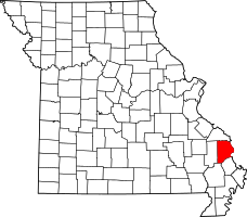 | |
| Villages | ||
| Townships | ||
| Unincorporated communities | ||
| Ghost towns | ||
| Footnotes | ‡This populated place also has portions in an adjacent county or counties | |