Allenville, Missouri
| Allenville, Missouri | |
|---|---|
| Village | |
 Location of Allenville, Missouri | |
| Coordinates: 37°13′20″N 89°45′15″W / 37.22222°N 89.75417°WCoordinates: 37°13′20″N 89°45′15″W / 37.22222°N 89.75417°W | |
| Country | United States |
| State | Missouri |
| County | Cape Girardeau |
| Named for | Thomas Allen[1] |
| Area[2] | |
| • Total | 0.16 sq mi (0.41 km2) |
| • Land | 0.16 sq mi (0.41 km2) |
| • Water | 0 sq mi (0 km2) |
| Elevation | 354 ft (108 m) |
| Population (2010)[3] | |
| • Total | 116 |
| • Estimate (2012[4]) | 118 |
| • Density | 725.0/sq mi (279.9/km2) |
| Time zone | Central (CST) (UTC-6) |
| • Summer (DST) | CDT (UTC-5) |
| FIPS code | 29-00748[5] |
| GNIS feature ID | 0713227[6] |
Allenville is a village in Hubble Township in Cape Girardeau County, Missouri, U.S. The population was 116 at the 2010 census. It is part of the Cape Girardeau–Jackson, MO-IL Metropolitan Statistical Area.
History and Industry
Allenville was named after Tom Allen who was the builder of the Belmont Branch Railroad and was platted in 1869 when the railroad was extended to that point.[7][8] The community was also a point on the old Lone Star Trail, and cattle were driven over the trail all the way from Texas to the Allenville railroad terminal. A post office was established at Allenville in 1869, and remained in operation until 1974.[9] [10]
Geography
Allenville is located at 37°13′20″N 89°45′15″W / 37.22222°N 89.75417°W (37.222360, -89.754262).[11]
According to the United States Census Bureau, the village has a total area of 0.16 square miles (0.41 km2), all of it land.[2]
Demographics
| Historical population | |||
|---|---|---|---|
| Census | Pop. | %± | |
| 1880 | 122 | — | |
| 1890 | 173 | 41.8% | |
| 1900 | 148 | −14.5% | |
| 1910 | 257 | 73.6% | |
| 1920 | 270 | 5.1% | |
| 1930 | 190 | −29.6% | |
| 1990 | 69 | — | |
| 2000 | 104 | 50.7% | |
| 2010 | 116 | 11.5% | |
| Est. 2015 | 119 | [12] | 2.6% |
2010 census
As of the census[3] of 2010, there were 116 people, 42 households, and 33 families residing in the village. The population density was 725.0 inhabitants per square mile (279.9/km2). There were 49 housing units at an average density of 306.3 per square mile (118.3/km2). The racial makeup of the village was 99.14% White and 0.86% from two or more races.
There were 42 households of which 40.5% had children under the age of 18 living with them, 64.3% were married couples living together, 9.5% had a female householder with no husband present, 4.8% had a male householder with no wife present, and 21.4% were non-families. 19.0% of all households were made up of individuals and 4.8% had someone living alone who was 65 years of age or older. The average household size was 2.76 and the average family size was 3.09.
The median age in the village was 35.5 years. 31% of residents were under the age of 18; 3.4% were between the ages of 18 and 24; 25% were from 25 to 44; 26.7% were from 45 to 64; and 13.8% were 65 years of age or older. The gender makeup of the village was 56.9% male and 43.1% female.
2000 census
As of the census[5] of 2000, there were 104 people, 42 households, and 29 families residing in the village. The population density was 598.2 people per square mile (236.2/km²). There were 51 housing units at an average density of 293.3/sq mi (115.8/km²). The racial makeup of the village was 100.00% White.
There were 42 households out of which 23.8% had children under the age of 18 living with them, 57.1% were married couples living together, 14.3% had a female householder with no husband present, and 28.6% were non-families. 26.2% of all households were made up of individuals and 16.7% had someone living alone who was 65 years of age or older. The average household size was 2.48 and the average family size was 2.97.
In the village the population was spread out with 21.2% under the age of 18, 13.5% from 18 to 24, 19.2% from 25 to 44, 27.9% from 45 to 64, and 18.3% who were 65 years of age or older. The median age was 41 years. For every 100 females there were 96.2 males. For every 100 females age 18 and over, there were 95.2 males.
The median income for a household in the village was $19,583, and the median income for a family was $33,750. Males had a median income of $21,875 versus $12,188 for females. The per capita income for the village was $15,993. There were 14.3% of families and 21.9% of the population living below the poverty line, including 31.3% of under eighteens and 9.1% of those over 64.
References
- ↑ Cape Girardeau County Place Names, 1928-1945, from the Western Historical Manuscript Collection at the University of Missouri
- 1 2 "US Gazetteer files 2010". United States Census Bureau. Archived from the original on 2012-01-24. Retrieved 2012-07-08.
- 1 2 "American FactFinder". United States Census Bureau. Retrieved 2012-07-08.
- ↑ "Population Estimates". United States Census Bureau. Archived from the original on 2013-06-17. Retrieved 2013-05-30.
- 1 2 "American FactFinder". United States Census Bureau. Archived from the original on 2013-09-11. Retrieved 2008-01-31.
- ↑ "US Board on Geographic Names". United States Geological Survey. 2007-10-25. Retrieved 2008-01-31.
- ↑ "Early settlements in Cape County". The Southeast Missourian. Feb 20, 1931. p. 9. Retrieved 3 November 2015.
- ↑ Eaton, David Wolfe (1916). How Missouri Counties, Towns and Streams Were Named. The State Historical Society of Missouri. p. 270.
- ↑ "Cape Girardeau County". Jim Forte Postal History. Retrieved 1 November 2015.
- ↑ "10th Anniversary Edition: Allenville, Missouri". Southeast Missourian. July 14, 2015.
- ↑ "US Gazetteer files: 2010, 2000, and 1990". United States Census Bureau. 2011-02-12. Retrieved 2011-04-23.
- ↑ "Annual Estimates of the Resident Population for Incorporated Places: April 1, 2010 to July 1, 2015". Retrieved July 2, 2016.
- ↑ "Census of Population and Housing". Census.gov. Archived from the original on May 11, 2015. Retrieved June 4, 2015.
Municipalities and communities of Cape Girardeau County, Missouri, United States | ||
|---|---|---|
| Cities | 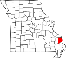 | |
| Villages | ||
| Townships | ||
| Unincorporated communities | ||
| Ghost towns | ||
| Footnotes | ‡This populated place also has portions in an adjacent county or counties | |