Paropamisadae
The Paropamisadae, also known by other names, were a people who lived in the area of Afghanistan and northern Pakistan during classical antiquity. The name was also used to refer to the lands these people inhabited, properly known as Paropamisus.
Name
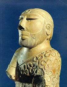
.jpeg)

Paropamisadae is the latinized form of the Greek name Paropotamisádai (Παροπαμισάδαι), used to refer to the inhabitants of the land of "Paropamisus"[2][3] (Παροπαμισός, Paropamisós)[4] in the Hindu Kush.[5][lower-alpha 1] The name derived from the Old Persian Para-upari-sena (lit. "Beyond the Raised Land"), which properly referred to the Peshawar Valley on the other side of the mountains from Persia, with its major settlements at Peshawar and Charsadda in what is now Pakistan's Gandhara district.
In many Greek and Latin sources, particularly editions of Ptolemy's Geography[9] where their realm is included on the 9th Map of Asia,[10] the names of the people and region are given as Paropanisadae and Paropanisus. They also appeared less frequently as Parapamisadae and Parapamīsus (Παραπάμισος, Parapámisos),[11] Paropamīsii, &c.[5]
The name was also applied to a nearby river, probably the Obi.[5]
History
In the ancient Buddhist texts, the Mahajanapada kingdom of Kamboja compassed the territories of Paropamisus and extended to the southwest of Kashmir as far as Rajauri. The region came under Achaemenid Persian control in the late 6th century BC, either during the reign of Cyrus the Great or Darius I.
In the 320s BC, Alexander the Great conquered the entire Persian Empire, beginning the Hellenistic period. The Greek name Παροπαμισάδαι or Παροπαμισσός was used extensively in Greek literature to describe the conquests of Alexander and those of the Greco-Bactrian and Indo-Greek kings, from the 3rd to the 1st centuries BCE. (The name possibly comes from an Avestan expression for "higher than an eagle can fly").
After Alexander's death in 323 BC, the area came under control of the Seleucid Empire, which gave the region to the Mauryan Dynasty of India in 305 BC. After the fall of the Mauryans in 185 BC, the Greco-Bactrians under King Demetrius I annexed the northwestern regions of the former Mauryan Empire, including Paropamisus, and it became part of his Euthydemid Indo-Greek Kingdom. The Eucratidians seized the area soon after the death of Menander I, but lost it to the Yuezhi around 125 BC.
Geography and peoples
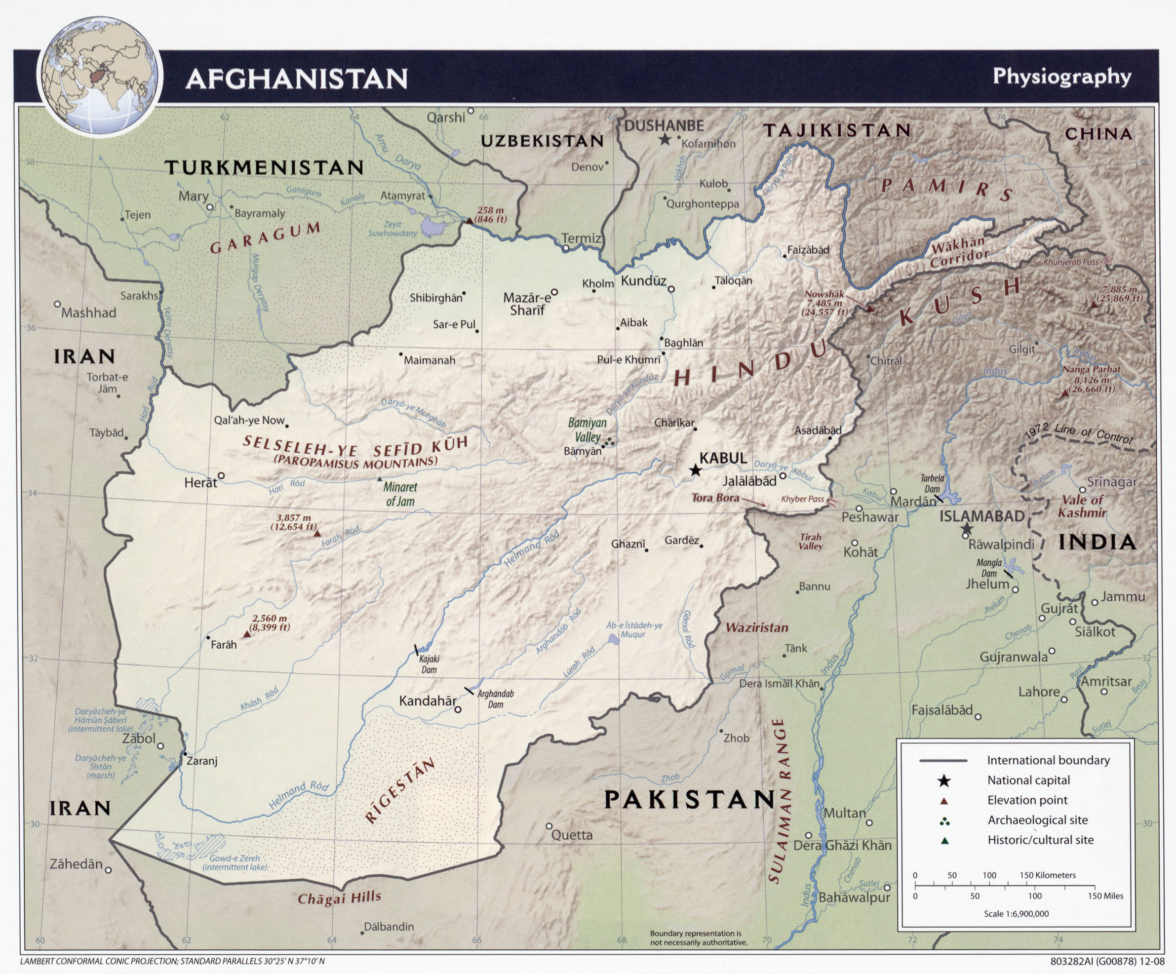
Paropamisus was located north of Arachosia and Drangiana, east of Aria, south of Bactria, and west of Kashmir. There were two main rivers flowing through the land, the Coas or Cophen (Κωφήν) and the Dorgamanes (Δοργαμάνης) or Orgomanes (Ὀργομάνης) farther north.
The nations who composed the Paropamisadae are recorded as the Cabolitae (Καβολῖται) in the north near modern Kabul; the Parsii (Πάρσιοι) in the northwest, the Ambautae (Ἀμβαῦται) in the east and the Par(g)yetae (Παρ(γ)υῆται) in the south, who were also found in Arachosia. The major cities of the land were the city of Ortospana (Ὀρτοσπάνα) or Carura (Κάρουρα), probably identifiable with Kabul, Gauzaca (Γαύζακα), probably modern Ghazni, Capissa (Καπίσσα) in the northeast, and Parsia (Παρσία), the capital of the Parsii.
See also
Notes
- ↑ The Paropamisus Mountains were sometimes particularly restricted to the area of the Hindu Kush between Herat in the west and Chaghcharan in the east.[6][7][8]
References
Citations
- ↑ Burney MS 111, f. 92v, held by the British Library.
- ↑ Mela, De Situ Orbis, Bk. I, Ch. 15, §2.
- ↑ Plin., Nat. Hist., Bk. VI, Ch. 17, §20.
- ↑ Strabo, Geog., Bk. XV, p. 689.
- 1 2 3 Short, Charles; et al. (1879), "Paropamisus or Paropanisus", A Latin Dictionary, Oxford: Clarendon Press.
- ↑ Physical map of Afghanistan, University of Texas
- ↑ Physical map of Afghanistan, www.ezilon.com
- ↑ geographic.org
- ↑ Ptol., Geog., Bk. VI, Ch. 11, §17.
- ↑ Versions of Ptolemy's 9th regional map of Asia at Wikicommons.
- ↑ Arrian, Anab., Bk. V, Ch. 4, §5.
Bibliography
- The Greeks in Bactria and India by W.W. Tarn, Cambridge University Press
External links
- Ptolemy's section on the Paropanisadae in English translation
- John Watson McCrindle's Ancient India as Described in Ptolemy