Pepperwood Grove, California
| Pepperwood Grove | |
|---|---|
| Unincorporated community | |
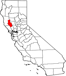
 Pepperwood Grove  Pepperwood Grove Location in California | |
| Coordinates: 39°03′29″N 122°46′53″W / 39.05806°N 122.78139°WCoordinates: 39°03′29″N 122°46′53″W / 39.05806°N 122.78139°W | |
| Country | United States |
| State | California |
| County | Lake County |
| Elevation[1] | 1,329 ft (405 m) |
Pepperwood Grove is an unincorporated community in Lake County, California.[1] It is located on Clear Lake 7.5 miles (12 km) east of Lakeport,[2] at an elevation of 1329 feet (405 m).[1]
References
This article is issued from Wikipedia - version of the 7/5/2016. The text is available under the Creative Commons Attribution/Share Alike but additional terms may apply for the media files.