Middletown, California
| Middletown, California | |
|---|---|
| Census-designated place | |
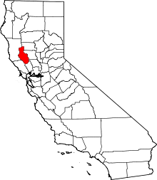
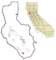 Location within Lake County and California | |
| Coordinates: 38°45′09″N 122°36′54″W / 38.75250°N 122.61500°WCoordinates: 38°45′09″N 122°36′54″W / 38.75250°N 122.61500°W[1] | |
| Country | United States |
| State | California |
| County | Lake |
| Area[2] | |
| • Total | 1.844 sq mi (4.776 km2) |
| • Land | 1.844 sq mi (4.776 km2) |
| • Water | 0 sq mi (0 km2) 0% |
| Elevation[1] | 1,099 ft (335 m) |
| Population (2010) | |
| • Total | 1,323 |
| • Density | 720/sq mi (280/km2) |
| Time zone | Pacific (PST) (UTC-8) |
| • Summer (DST) | PDT (UTC-7) |
| ZIP code | 95461 |
| Area code | 707 |
| GNIS feature IDs | 228626 [1] |
Middletown is a census-designated place (CDP) in Lake County, California, United States.[1] Its population was 1,323 at the 2010 census, up from 1,020 at the 2000 census. Middletown was given its name because it is halfway between Lower Lake and Calistoga which is 17 miles (27 km) to the south.[3] The town was severely damaged by the 2015 Valley Fire.
History
At one time, the community was known as Middle Station, and was a halfway point on the stagecoach route over Mt. St. Helena from Calistoga to Lower Lake. The first house was built at the site by J.H. Berry in 1870.[3] The town began in 1871.[3] The Middleton post office opened in 1871 and changed its name to Middletown in 1875.[3] Middletown enjoyed a robust quicksilver (mercury) mining industry through the end of the 19th century. By the early 1900s, cattle and sheep ranching were prominent, along with some limited pear and walnut production. A resort economy sprung up around the various natural springs, and the area around Middletown attracted vacationers from the Bay Area through the 1950s. As travel costs decreased, tourism to the resorts diminished as patrons were able use air travel to vacation in more far flung places. Many of the resorts closed in the 1960s. In the 1970s and early 1980, exploitation of nearby geothermal energy resources brought an influx of workers into the local economy. Electrical power plants powered by "steam wells" were built in the mountains above Middletown. As housing prices in the Bay Area increased in the late 20th century, Middletown and nearby Hidden Valley Lake enjoyed a population boom as commuters moved to the Middletown area looking for affordable housing; keeping their jobs 50 to 100 miles away in Santa Rosa, Napa, and San Francisco. Middletown is currently populated primarily by commuters and retirees, enjoying a modest tourist trade based primarily on Harbin Hot Springs and the Twin Pine Casino located on the local Rancheria south of the town.
2015 Valley Fire
On September 12, 2015, about half the town, including city blocks, commercial buildings and an apartment complex, was destroyed by the fast-moving Valley Fire.[4] The town was directly in the path of the advancing fire, and suffered a "devastating blow". [5][6][7]
Geography
Middletown has an elevation of 1,099 feet (335 m).[1] According to the United States Census Bureau, the CDP has a total area of 1.8 square miles (4.7 km2), all of it land.
Climate
This region experiences warm (but not hot) and dry summers, with no average monthly temperatures above 71.6 °F. According to the Köppen Climate Classification system, Middletown has a warm-summer Mediterranean climate, abbreviated "Csb" on climate maps.[8]
Demographics
| Historical population | |||
|---|---|---|---|
| Census | Pop. | %± | |
| 2000 | 1,020 | — | |
| 2010 | 1,323 | 29.7% | |
2010
The 2010 United States Census[10] reported that Middletown had a population of 1,323. The population density was 717.4 people per square mile (277.0/km²). The racial makeup of Middletown was 985 (74.5%) White, 5 (0.4%) African American, 28 (2.1%) Native American, 18 (1.4%) Asian, 0 (0.0%) Pacific Islander, 225 (17.0%) from other races, and 62 (4.7%) from two or more races. Hispanic or Latino of any race were 413 persons (31.2%).
The Census reported that 1,317 people (99.5% of the population) lived in households, 6 (0.5%) lived in non-institutionalized group quarters, and 0 (0%) were institutionalized.
There were 508 households, out of which 189 (37.2%) had children under the age of 18 living in them, 223 (43.9%) were opposite-sex married couples living together, 72 (14.2%) had a female householder with no husband present, 41 (8.1%) had a male householder with no wife present. There were 36 (7.1%) unmarried opposite-sex partnerships, and 4 (0.8%) same-sex married couples or partnerships. 140 households (27.6%) were made up of individuals and 52 (10.2%) had someone living alone who was 65 years of age or older. The average household size was 2.59. There were 336 families (66.1% of all households); the average family size was 3.15.
The population was spread out with 376 people (28.4%) under the age of 18, 114 people (8.6%) aged 18 to 24, 309 people (23.4%) aged 25 to 44, 374 people (28.3%) aged 45 to 64, and 150 people (11.3%) who were 65 years of age or older. The median age was 37.4 years. For every 100 females there were 102.9 males. For every 100 females age 18 and over, there were 103.2 males.
There were 557 housing units at an average density of 302.0 per square mile (116.6/km²), of which 251 (49.4%) were owner-occupied, and 257 (50.6%) were occupied by renters. The homeowner vacancy rate was 3.8%; the rental vacancy rate was 4.1%. 659 people (49.8% of the population) lived in owner-occupied housing units and 658 people (49.7%) lived in rental housing units.
2000
As of the census[11] of 2000, there were 1,020 people, 392 households, and 263 families residing in the CDP. The population density was 395.6 people per square mile (152.6/km²). There were 427 housing units at an average density of 165.6 per square mile (63.9/km²). The racial makeup of the CDP was 83.73% White, 0.39% African American, 1.86% Native American, 1.67% Asian, 0.69% Pacific Islander, 8.24% from other races, and 3.43% from two or more races. Hispanic or Latino of any race were 22.84% of the population.
There were 392 households out of which 32.9% had children under the age of 18 living with them, 47.4% were married couples living together, 12.0% had a female householder with no husband present, and 32.7% were non-families. 24.0% of all households were made up of individuals and 10.2% had someone living alone who was 65 years of age or older. The average household size was 2.56 and the average family size was 3.05.
In the CDP the population was spread out with 26.6% under the age of 18, 7.5% from 18 to 24, 26.9% from 25 to 44, 23.9% from 45 to 64, and 15.2% who were 65 years of age or older. The median age was 38 years. For every 100 females there were 110.3 males. For every 100 females age 18 and over, there were 105.2 males.
The median income for a household in the CDP was $35,278, and the median income for a family was $38,571. Males had a median income of $33,214 versus $26,515 for females. The per capita income for the CDP was $14,135. About 21.2% of families and 20.9% of the population were below the poverty line, including 22.1% of those under age 18 and 28.3% of those age 65 or over.
Tourist attractions
Harbin Hot Springs, a New Age retreat center with spring pools, conference facilities, daily activities and classes, is located northwest of town. The Hot Springs was decimated by the 2015 California wildfires.
The Middletown Rancheria, an Indian reservation of Pomo, Lake Miwok, Wappo, and Wintu is located just south of town.
Government
In the California State Legislature, Middletown is in the 2nd Senate District, represented by Democrat Mike McGuire, and in the 4th Assembly District, represented by Democrat Cecilia Aguiar-Curry.[12]
In the United States House of Representatives, Middletown is in California's 5th congressional district, represented by Democrat Mike Thompson.[13]
Lake County is divided into five supervisorial districts, and Middletown is in District 1.[14] As of January 2014, Jim Comstock is the supervisor for District 1.[15]
References
- 1 2 3 4 5 Geographic Names Information System (GNIS) details for Middletown, California; United States Geological Survey (USGS); January 19, 1981.
- ↑ "2010 Census U.S. Gazetteer Files – Places – California". United States Census Bureau.
- 1 2 3 4 Durham, David L. (1998). California's Geographic Names: A Gazetteer of Historic and Modern Names of the State. Clovis, Calif.: Word Dancer Press. p. 106. ISBN 1-884995-14-4.
- ↑ Rossman, Randi; Payne, Paul (September 13, 2015). "Valley Fire: Devastation during the night as fire destroys homes". Santa Rosa Press Democrat. Retrieved September 13, 2015.
- ↑ St. John, Paige (September 13, 2015). "Middletown suffers a devastating blow". Los Angeles Times. Retrieved September 13, 2015.
- ↑ Lovett, Ian; Southall, Ashley (2015-09-13). "California Wildfires Prompt State of Emergency". New York Times. Retrieved 2015-09-13.
- ↑ Lovett, Ian; Southall, Ashley (September 13, 2015). "Moving Fast, Fire Scorches Community in California". New York Times. Retrieved September 13, 2015.
- ↑ Climate Summary for Middletown, California
- ↑ U.S. Decennial Census; census.gov
- ↑ "2010 Census Interactive Population Search: CA - Middletown CDP". U.S. Census Bureau. Retrieved July 12, 2014.
- ↑ "American FactFinder". United States Census Bureau. Retrieved 2008-01-31.
- ↑ "Statewide Database". UC Regents. Retrieved December 5, 2014.
- ↑ "California's 5th Congressional District - Representatives & District Map". Civic Impulse, LLC. Retrieved March 3, 2013.
- ↑ "Board of Supervisors". County of Lake, California. Retrieved January 9, 2015.
- ↑ "District 1". County of Lake, California. Retrieved January 9, 2015.
Further reading
- Our small town: a brief history of Middletown, Lake County, California community treasures (1999). OCLC 46540961
- Campbell, W. L. (Rohnert Park, Calif., 2000). The development of first, second, and third grade mathematics benchmark tests for the Middletown Unified School District: alignment with the state standards OCLC 46359225
- Moratto, M. J. (1974). An evaluation of the archaeological resources near Middletown, California OCLC 10261459 San Francisco: Archaeological Research Laboratory, Dept. of Anthropology, San Francisco State University
- Lusk, W. C., Reed, A. D., & Houston, C. E. (1963). Potential economic value of agricultural water in the Middletown Area of Lake County OCLC 24359273 Kelseyville, University of California, Agricultural Extension Service.
- United States. (1965). Project report on the recreation potentialities of the proposed Middletown Project, Lake County, California OCLC 24359190 San Francisco: The Service
- Tritchler, C. (1992). Middletown Cemetery, Butts Canyon Road and Highway 29, Lake County, Middletown, California: an inventory of gravesites, Middletown Cemetery District OCLC 28190358