Clearlake, California
| Clearlake, California | |
|---|---|
| City | |
| Motto: "On the shores of beautiful Clear Lake" | |
|
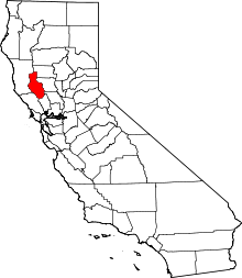
Location within Lake County and California | |
| Coordinates: 38°57′30″N 122°37′35″W / 38.95833°N 122.62639°WCoordinates: 38°57′30″N 122°37′35″W / 38.95833°N 122.62639°W | |
| Country |
|
| State |
|
| County | Lake |
| Incorporated (city) | November 14, 1980[1] |
| Named for | Clear Lake |
| Area[2] | |
| • Total | 10.581 sq mi (27.404 km2) |
| • Land | 10.129 sq mi (26.234 km2) |
| • Water | 0.452 sq mi (1.170 km2) 4.27% |
| Elevation[3] | 1,417 ft (432 m) |
| Population (2010) | |
| • Total | 15,250 |
| • Density | 1,400/sq mi (560/km2) |
| Time zone | Pacific (PST) (UTC-8) |
| • Summer (DST) | PDT (UTC-7) |
| ZIP code | 95422 |
| Area code | 707 |
| FIPS code | 06-13945 |
| GNIS feature IDs | 1657240, 2409479 |
| Website | City Website |
Clearlake is a city in Lake County, California.[3] Clearlake is 4.5 miles (7.2 km) north-northwest of Lower Lake,[4] at an elevation of 1417 feet (432 m).[3] As of the 2010 census, the city had a total population of 15,250, up from 13,142 at the 2000 census. It takes its name from Clear Lake.
History
The Clearlake post office opened in 1923, "Knocti" then Clearlake Highlands until incorporation in 1981 when the official name became City of Clearlake.
The first inhabitants of Clearlake were the Pomo Indians who gave the name to many of the areas features including Mount Konocti. The Pomo suffered mistreatment at the hands of European settlers which resulted in a massive wave of deaths. The result of this was massive amounts of land freed up for the white settlers who arrived during the gold rush.[5]
Geography
Clearlake is located at 38°57'30" North, 122°37'35" West.[3]
According to the United States Census Bureau, the city has a total area of 10.6 square miles (27 km2), of which, 10.1 square miles (26 km2) of it is land and 0.5 square miles (1.3 km2) of it is water. The total area is 4.27% water.
Climate
Clearlake has a hot-summer Mediterranean climate (Csa) according to the Köppen climate classification system.
| Climate data for Clearlake, California (1981–2010 normals) | |||||||||||||
|---|---|---|---|---|---|---|---|---|---|---|---|---|---|
| Month | Jan | Feb | Mar | Apr | May | Jun | Jul | Aug | Sep | Oct | Nov | Dec | Year |
| Record high °F (°C) | 76 (24) |
81 (27) |
84 (29) |
94 (34) |
101 (38) |
114 (46) |
113 (45) |
112 (44) |
111 (44) |
104 (40) |
92 (33) |
78 (26) |
114 (46) |
| Average high °F (°C) | 55 (13) |
58 (14) |
62 (17) |
67 (19) |
75 (24) |
84 (29) |
92 (33) |
90 (32) |
85 (29) |
75 (24) |
62 (17) |
55 (13) |
71.7 (22) |
| Average low °F (°C) | 32 (0) |
34 (1) |
36 (2) |
39 (4) |
45 (7) |
51 (11) |
55 (13) |
53 (12) |
49 (9) |
42 (6) |
35 (2) |
32 (0) |
41.9 (5.6) |
| Record low °F (°C) | 8 (−13) |
16 (−9) |
17 (−8) |
23 (−5) |
28 (−2) |
34 (1) |
39 (4) |
40 (4) |
30 (−1) |
21 (−6) |
19 (−7) |
6 (−14) |
6 (−14) |
| Average precipitation inches (mm) | 6.45 (163.8) |
5.91 (150.1) |
4.53 (115.1) |
1.73 (43.9) |
1.13 (28.7) |
.22 (5.6) |
.02 (0.5) |
.10 (2.5) |
.43 (10.9) |
1.44 (36.6) |
3.51 (89.2) |
5.95 (151.1) |
31.42 (798) |
| Source: [6] | |||||||||||||
Demographics
| Historical population | |||
|---|---|---|---|
| Census | Pop. | %± | |
| 1990 | 11,804 | — | |
| 2000 | 13,142 | 11.3% | |
| 2010 | 15,250 | 16.0% | |
| Est. 2015 | 15,182 | [7] | −0.4% |
2010
The 2010 United States Census[9] reported that Clearlake had a population of 15,250. The population density was 1,441.3 people per square mile (556.5/km²). The racial makeup of Clearlake was 11,262 (73.8%) White, 614 (4.0%) African American, 400 (2.6%) Native American, 161 (1.1%) Asian, 27 (0.2%) Pacific Islander, 1,805 (11.8%) from other races, and 981 (6.4%) from two or more races. Hispanic or Latino of any race were 3,248 persons (21.3%).
The Census reported that 14,790 people (97.0% of the population) lived in households, 366 (2.4%) lived in non-institutionalized group quarters, and 94 (0.6%) were institutionalized.
There were 5,970 households, out of which 1,859 (31.1%) had children under the age of 18 living in them, 1,957 (32.8%) were opposite-sex married couples living together, 1,013 (17.0%) had a female householder with no husband present, 448 (7.5%) had a male householder with no wife present. There were 650 (10.9%) unmarried opposite-sex partnerships, and 71 (1.2%) same-sex married couples or partnerships. 1,898 households (31.8%) were made up of individuals and 739 (12.4%) had someone living alone who was 65 years of age or older. The average household size was 2.48. There were 3,418 families (57.3% of all households); the average family size was 3.11.
The population was spread out with 3,656 people (24.0%) under the age of 18, 1,528 people (10.0%) aged 18 to 24, 3,384 people (22.2%) aged 25 to 44, 4,389 people (28.8%) aged 45 to 64, and 2,293 people (15.0%) who were 65 years of age or older. The median age was 39.9 years. For every 100 females there were 99.9 males. For every 100 females age 18 and over, there were 96.6 males.
There were 8,035 housing units at an average density of 759.4 per square mile (293.2/km²), of which 3,190 (39.7) were owner-occupied, 2,780 (34.6%) were occupied by renters and 2065 (25.7%) were vacant. The homeowner vacancy rate was 5.9%; the rental vacancy rate was 12.1%. 7,595 people (49.8% of the population) lived in owner-occupied housing units and 7,195 people (47.2%) lived in rental housing units.
2000
As of the census[10] of 2000, there are 13,142 people, 5,532 households, and 3,313 families residing in the city. The population density is 1,290.9 people per square mile (498.4/km²). There are 7,605 housing units at an average density of 747.0 per square mile (288.4/km²). The racial makeup of the city is 82.4% White, 5.2% Black or African American, 2.7% Native American, 1.1% Asian, 0.2% Pacific Islander, 3.7% from other races, and 4.8% from two or more races. 11.0% of the population are Hispanic or Latino of any race.
There are 5,532 households out of which 26.4% have children under the age of 18 living with them, 38.1% are married couples living together, 15.7% have a female householder with no husband present, and 40.1% are non-families. 32.9% of all households are made up of individuals and 16.1% have someone living alone who is 65 years of age or older. The average household size is 2.35 and the average family size is 2.96.
In the city the population is spread out with 25.8% under the age of 18, 6.7% from 18 to 24, 23.1% from 25 to 44, 24.1% from 45 to 64, and 20.3% who are 65 years of age or older. The median age is 41 years. For every 100 females there are 91.9 males. For every 100 females age 18 and over, there are 87.8 males.
The median income for a household in the city is $19,863, and the median income for a family is $25,504. Males have a median income of $24,694 versus $18,207 for females. The per capita income for the city is $12,538. 28.6% of the population and 23.5% of families are below the poverty line. Out of the total population, 39.8% of those under the age of 18 and 8.4% of those 65 and older are living below the poverty line.
Government
In the state legislature, Clearlake is in the 2nd Senate District, represented by Democrat Mike McGuire,[11] and in the 4th Assembly District, represented by Democrat Cecilia Aguiar-Curry.[12]
Federally, Clearlake is in California's 3rd congressional district, represented by Democrat John Garamendi.[13]
Infrastructure
According to a 2012 road report, ~44% of the city's roads are unpaved,[14] including dozens of miles of urban residential streets.
Notable people
- Michael Berryman, actor
- Randy Hennis, baseball player
See also
References
- ↑ "California Cities by Incorporation Date". California Association of Local Agency Formation Commissions. Archived from the original (Word) on November 3, 2014. Retrieved August 25, 2014.
- ↑ "2010 Census U.S. Gazetteer Files – Places – California". United States Census Bureau.
- 1 2 3 4 "Clearlake". Geographic Names Information System. United States Geological Survey.
- ↑ Durham, David L. (1998). California's Geographic Names: A Gazetteer of Historic and Modern Names of the State. Clovis, Calif.: Word Dancer Press. p. 39. ISBN 1-884995-14-4.
- ↑ "About Lake County: History and Heritage". Lake County Visitor Center. Retrieved 2010-02-23.
- ↑ http://www.wrcc.dri.edu/cgi-bin/cliMAIN.pl?ca1806
- ↑ "Annual Estimates of the Resident Population for Incorporated Places: April 1, 2010 to July 1, 2015". Retrieved July 2, 2016.
- ↑ "Census of Population and Housing". Census.gov. Archived from the original on May 11, 2015. Retrieved June 4, 2015.
- ↑ "2010 Census Interactive Population Search: CA - Clearlake city". U.S. Census Bureau. Retrieved July 12, 2014.
- ↑ "American FactFinder". United States Census Bureau. Archived from the original on September 11, 2013. Retrieved 2008-01-31.
- ↑ "Senators". State of California. Retrieved August 31, 2014.
- ↑ "Members Assembly". State of California. Retrieved August 31, 2014.
- ↑ "California's 3rd Congressional District - Representatives & District Map". Civic Impulse, LLC. Retrieved March 1, 2013.
- ↑ Lake County News 3-22-12