Pontiac, Indiana
| Pontiac | |
|---|---|
| Unincorporated community | |
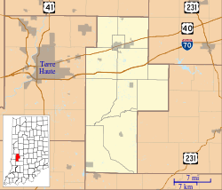 Pontiac Location in Clay County | |
| Coordinates: 39°35′25″N 87°07′07″W / 39.59028°N 87.11861°WCoordinates: 39°35′25″N 87°07′07″W / 39.59028°N 87.11861°W | |
| Country | United States |
| State | Indiana |
| County | Clay |
| Township | Van Buren |
| Elevation[1] | 689 ft (210 m) |
| ZIP code | 47837 |
| FIPS code | 18-61038[2] |
| GNIS feature ID | 441432 |
Pontiac is an unincorporated community in Van Buren Township, Clay County, Indiana. It is part of the Terre Haute Metropolitan Statistical Area.
History
Pontiac was laid out in 1871 in anticipation of the railroad being built through it.[3] It was named after Chief Pontiac.[4]
Geography
Pontiac is located at 39°35′25″N 87°07′07″W / 39.59028°N 87.11861°W.
References
- ↑ "US Board on Geographic Names". United States Geological Survey. 2007-10-25. Retrieved 2008-01-31.
- ↑ "American FactFinder". United States Census Bureau. Retrieved 2008-01-31.
- ↑ Blanchard, Charles (1884). Counties of Clay and Owen, Indiana: Historical and Biographical. F.A. Battey & Company. p. 251.
- ↑ Baker, Ronald L. (October 1995). From Needmore to Prosperity: Hoosier Place Names in Folklore and History. Indiana University Press. p. 268. ISBN 978-0-253-32866-3.
This village, named for the Ottawa chief Pontiac...
Municipalities and communities of Clay County, Indiana, United States | ||
|---|---|---|
| City | ||
| Towns | ||
| Townships | ||
| CDP | ||
| Other unincorporated communities |
| |
| Ghost towns | ||
| Footnotes | ‡This populated place also has portions in an adjacent county or counties | |
This article is issued from Wikipedia - version of the 10/5/2016. The text is available under the Creative Commons Attribution/Share Alike but additional terms may apply for the media files.