Brazil Township, Clay County, Indiana
| Brazil Township | |
|---|---|
| Township | |
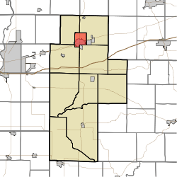 Location of Brazil Township in Clay County | |
| Coordinates: 39°32′08″N 87°07′22″W / 39.53556°N 87.12278°WCoordinates: 39°32′08″N 87°07′22″W / 39.53556°N 87.12278°W | |
| Country | United States |
| State | Indiana |
| County | Clay |
| Government | |
| • Type | Indiana township |
| Area | |
| • Total | 6.52 sq mi (16.9 km2) |
| • Land | 6.46 sq mi (16.7 km2) |
| • Water | 0.05 sq mi (0.1 km2) |
| Elevation[1] | 686 ft (209 m) |
| Population (2010) | |
| • Total | 8,471 |
| • Density | 1,311/sq mi (506/km2) |
| FIPS code | 18-07192[2] |
| GNIS feature ID | 453135 |
Brazil Township is one of eleven townships in Clay County, Indiana. As of the 2010 census, its population was 8,471 and it contained 3,806 housing units.[3]
History
Brazil Township was organized in 1868.[4]
Geography
According to the 2010 census, the township has a total area of 6.52 square miles (16.9 km2), of which 6.46 square miles (16.7 km2) (or 99.08%) is land and 0.05 square miles (0.13 km2) (or 0.77%) is water.[3]
Cities and towns
- Brazil (the county seat) (north three-quarters)
Unincorporated towns
(This list is based on USGS data and may include former settlements.)
Adjacent townships
- Van Buren Township (northeast)
- Jackson Township (southeast)
- Posey Township (southwest)
- Dick Johnson Township (northwest)
Major highways
Cemeteries
The township contains 4 cemeteries: Old Hill, Stunkard, Otter Creek and Restlawn.
References
- "Brazil Township, Clay County, Indiana". Geographic Names Information System. United States Geological Survey. Retrieved 2009-09-24.
- United States Census Bureau cartographic boundary files
- ↑ "US Board on Geographic Names". United States Geological Survey. 2007-10-25. Retrieved 2008-01-31.
- ↑ "American FactFinder". United States Census Bureau. Archived from the original on 2013-09-11. Retrieved 2008-01-31.
- 1 2 "Population, Housing Units, Area, and Density: 2010 - County -- County Subdivision and Place -- 2010 Census Summary File 1". United States Census. Retrieved 2013-05-10.
- ↑ Blanchard, Charles (1884). Counties of Clay and Owen, Indiana: Historical and Biographical. F.A. Battey & Company. p. 84.
External links
Municipalities and communities of Clay County, Indiana, United States | ||
|---|---|---|
| City | ||
| Towns | ||
| Townships | ||
| CDP | ||
| Other unincorporated communities |
| |
| Ghost towns | ||
| Footnotes | ‡This populated place also has portions in an adjacent county or counties | |
This article is issued from Wikipedia - version of the 11/7/2016. The text is available under the Creative Commons Attribution/Share Alike but additional terms may apply for the media files.