Dick Johnson Township, Clay County, Indiana
| Dick Johnson Township | |
|---|---|
| Township | |
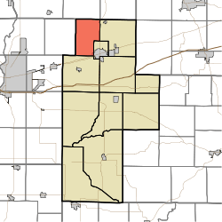 Location of Dick Johnson Township in Clay County | |
| Coordinates: 39°33′53″N 87°09′49″W / 39.56472°N 87.16361°WCoordinates: 39°33′53″N 87°09′49″W / 39.56472°N 87.16361°W | |
| Country | United States |
| State | Indiana |
| County | Clay |
| Government | |
| • Type | Indiana township |
| Area | |
| • Total | 21.56 sq mi (55.8 km2) |
| • Land | 21.46 sq mi (55.6 km2) |
| • Water | 0.1 sq mi (0.3 km2) |
| Elevation[1] | 646 ft (197 m) |
| Population (2010) | |
| • Total | 1,453 |
| • Density | 67.7/sq mi (26.1/km2) |
| FIPS code | 18-18118[2] |
| GNIS feature ID | 453265 |
Dick Johnson Township is one of eleven townships in Clay County, Indiana. As of the 2010 census, its population was 1,453 and it contained 584 housing units.[3]
History
Dick Johnson Township was established in the late 1830s. This township was named for Richard Mentor Johnson, the ninth Vice President of the United States, serving in the administration of Martin Van Buren. There is also a Van Buren Township in Clay County in honor of the 8th President.[4]
Geography
According to the 2010 census, the township has a total area of 21.56 square miles (55.8 km2), of which 21.46 square miles (55.6 km2) (or 99.54%) is land and 0.1 square miles (0.26 km2) (or 0.46%) is water.[3]
Cities and towns
- Brazil (northwest edge)
Unincorporated towns
(This list is based on USGS data and may include former settlements.)
Adjacent townships
- Raccoon Township, Parke County (north)
- Jackson Township, Parke County (northeast)
- Van Buren Township (east)
- Brazil Township (southeast)
- Posey Township (south)
- Nevins Township, Vigo County (west)
Major highways
Cemeteries
The township contains 17 cemeteries: Archer, Carter, Orchard, Perth, Saint Marys, Sampson, Greek Catholic, Cottage Hill, Eldridge, Don & Chris Loughmiller, [Unnamed], Bee Ridge, Rock Run, Kessel, Percals, Odell, & Webster
References
- "Dick Johnson Township, Clay County, Indiana". Geographic Names Information System. United States Geological Survey. Retrieved 2009-09-24.
- United States Census Bureau cartographic boundary files
- ↑ "US Board on Geographic Names". United States Geological Survey. 2007-10-25. Retrieved 2008-01-31.
- ↑ "American FactFinder". United States Census Bureau. Retrieved 2008-01-31.
- 1 2 "Population, Housing Units, Area, and Density: 2010 - County -- County Subdivision and Place -- 2010 Census Summary File 1". United States Census. Retrieved 2013-05-10.
- ↑ Blanchard, Charles (1884). Counties of Clay and Owen, Indiana: Historical and Biographical. F.A. Battey & Company. p. 83.
External links
Municipalities and communities of Clay County, Indiana, United States | ||
|---|---|---|
| City | ||
| Towns | ||
| Townships | ||
| CDP | ||
| Other unincorporated communities |
| |
| Ghost towns | ||
| Footnotes | ‡This populated place also has portions in an adjacent county or counties | |