Réchicourt-la-Petite
For other uses, see Réchicourt-le-Château.
| Réchicourt-la-Petite | |
|---|---|
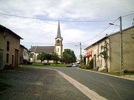 | |
 Réchicourt-la-Petite | |
|
Location within Grand Est region  Réchicourt-la-Petite | |
| Coordinates: 48°43′11″N 6°35′01″E / 48.7197°N 6.5836°ECoordinates: 48°43′11″N 6°35′01″E / 48.7197°N 6.5836°E | |
| Country | France |
| Region | Grand Est |
| Department | Meurthe-et-Moselle |
| Arrondissement | Lunéville |
| Canton | Arracourt |
| Intercommunality | Communauté de communes du Pays du Sânon |
| Government | |
| • Mayor (2008–2014) | Philippe Guillaumont |
| Area1 | 5.5 km2 (2.1 sq mi) |
| Population (1999)2 | 73 |
| • Density | 13/km2 (34/sq mi) |
| Time zone | CET (UTC+1) |
| • Summer (DST) | CEST (UTC+2) |
| INSEE/Postal code | 54446 / 54370 |
| Elevation |
228–313 m (748–1,027 ft) (avg. 258 m or 846 ft) |
|
1 French Land Register data, which excludes lakes, ponds, glaciers > 1 km² (0.386 sq mi or 247 acres) and river estuaries. 2 Population without double counting: residents of multiple communes (e.g., students and military personnel) only counted once. | |
Réchicourt-la-Petite is a commune in the Meurthe-et-Moselle department in north-eastern France.
See also
| Wikimedia Commons has media related to Réchicourt-la-Petite. |
This article is issued from Wikipedia - version of the 3/15/2016. The text is available under the Creative Commons Attribution/Share Alike but additional terms may apply for the media files.