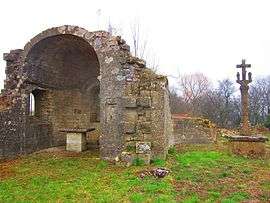
Sancy, Meurthe-et-Moselle
| Sancy | ||
|---|---|---|
 | ||
| ||
 Sancy | ||
|
Location within Grand Est region  Sancy | ||
| Coordinates: 49°20′54″N 5°55′33″E / 49.3483°N 5.9258°ECoordinates: 49°20′54″N 5°55′33″E / 49.3483°N 5.9258°E | ||
| Country | France | |
| Region | Grand Est | |
| Department | Meurthe-et-Moselle | |
| Arrondissement | Arrondissement of Briey | |
| Canton | Canton of Audun-le-Roman | |
| Intercommunality | Communauté de communes du Pays Audunois | |
| Government | ||
| • Mayor (2008–2014) | Daniel Matergia | |
| Area1 | 13.19 km2 (5.09 sq mi) | |
| Population (1999)2 | 327 | |
| • Density | 25/km2 (64/sq mi) | |
| Time zone | CET (UTC+1) | |
| • Summer (DST) | CEST (UTC+2) | |
| INSEE/Postal code | 54491 / 54560 | |
| Elevation |
254–358 m (833–1,175 ft) (avg. 340 m or 1,120 ft) | |
|
1 French Land Register data, which excludes lakes, ponds, glaciers > 1 km² (0.386 sq mi or 247 acres) and river estuaries. 2 Population without double counting: residents of multiple communes (e.g., students and military personnel) only counted once. | ||
.svg.png)
Sancy (Lorraine Franconian Senzech) is a commune in the Meurthe-et-Moselle department in north-eastern France.
See also
| Wikimedia Commons has media related to Sancy. |
This article is issued from Wikipedia - version of the 11/20/2014. The text is available under the Creative Commons Attribution/Share Alike but additional terms may apply for the media files.