Rochecorbon
| Rochecorbon | |
|---|---|
|
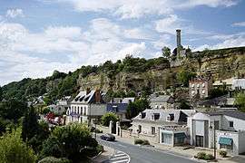
Rochecorbon and the "lantern" | |
 Rochecorbon | |
|
Location within Centre-Val de Loire region  Rochecorbon | |
| Coordinates: 47°24′55″N 0°45′21″E / 47.4153°N 0.7558°ECoordinates: 47°24′55″N 0°45′21″E / 47.4153°N 0.7558°E | |
| Country | France |
| Region | Centre-Val de Loire |
| Department | Indre-et-Loire |
| Arrondissement | Tours |
| Canton | Vouvray |
| Government | |
| • Mayor (2008–2014) | Bernard Plat |
| Area1 | 17.09 km2 (6.60 sq mi) |
| Population (2009)2 | 3,282 |
| • Density | 190/km2 (500/sq mi) |
| Time zone | CET (UTC+1) |
| • Summer (DST) | CEST (UTC+2) |
| INSEE/Postal code | 37203 / 37210 |
| Elevation | 47–124 m (154–407 ft) |
|
1 French Land Register data, which excludes lakes, ponds, glaciers > 1 km² (0.386 sq mi or 247 acres) and river estuaries. 2 Population without double counting: residents of multiple communes (e.g., students and military personnel) only counted once. | |
Rochecorbon is a commune in the Indre-et-Loire department in central France.
Population
| Historical population | ||
|---|---|---|
| Year | Pop. | ±% |
| 1793 | 1,378 | — |
| 1800 | 1,382 | +0.3% |
| 1806 | 1,385 | +0.2% |
| 1821 | 1,593 | +15.0% |
| 1831 | 1,742 | +9.4% |
| 1836 | 1,746 | +0.2% |
| 1841 | 1,722 | −1.4% |
| 1846 | 1,755 | +1.9% |
| 1851 | 1,676 | −4.5% |
| 1856 | 1,579 | −5.8% |
| 1861 | 1,592 | +0.8% |
| 1866 | 1,545 | −3.0% |
| 1872 | 1,521 | −1.6% |
| 1876 | 1,539 | +1.2% |
| 1881 | 1,554 | +1.0% |
| 1886 | 1,601 | +3.0% |
| 1891 | 1,564 | −2.3% |
| 1896 | 1,544 | −1.3% |
| 1901 | 1,612 | +4.4% |
| 1906 | 1,572 | −2.5% |
| 1911 | 1,524 | −3.1% |
| 1921 | 1,543 | +1.2% |
| 1926 | 1,678 | +8.7% |
| 1931 | 1,824 | +8.7% |
| 1936 | 1,821 | −0.2% |
| 1946 | 1,868 | +2.6% |
| 1954 | 2,094 | +12.1% |
| 1962 | 2,089 | −0.2% |
| 1968 | 2,216 | +6.1% |
| 1975 | 2,349 | +6.0% |
| 1982 | 2,711 | +15.4% |
| 1990 | 2,685 | −1.0% |
| 1999 | 2,982 | +11.1% |
| 2006 | 3,213 | +7.7% |
| 2009 | 3,282 | +2.1% |
See also
References
| Wikimedia Commons has media related to Rochecorbon. |
This article is issued from Wikipedia - version of the 2/18/2015. The text is available under the Creative Commons Attribution/Share Alike but additional terms may apply for the media files.