Saint-Laurent-en-Gâtines
| Saint-Laurent-en-Gâtines | |
|---|---|
|
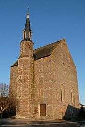
The church of Saint-Laurent, in Saint-Laurent-en-Gâtines | |
 Saint-Laurent-en-Gâtines | |
|
Location within Centre-Val de Loire region  Saint-Laurent-en-Gâtines | |
| Coordinates: 47°35′17″N 0°46′41″E / 47.5881°N 0.7781°ECoordinates: 47°35′17″N 0°46′41″E / 47.5881°N 0.7781°E | |
| Country | France |
| Region | Centre-Val de Loire |
| Department | Indre-et-Loire |
| Arrondissement | Tours |
| Canton | Château-Renault |
| Intercommunality | Castelrenaudais |
| Government | |
| • Mayor (2008–2014) | Isabelle Senechal |
| Area1 | 31.62 km2 (12.21 sq mi) |
| Population (2009)2 | 916 |
| • Density | 29/km2 (75/sq mi) |
| Time zone | CET (UTC+1) |
| • Summer (DST) | CEST (UTC+2) |
| INSEE/Postal code | 37224 / 37380 |
| Elevation | 110–171 m (361–561 ft) |
|
1 French Land Register data, which excludes lakes, ponds, glaciers > 1 km² (0.386 sq mi or 247 acres) and river estuaries. 2 Population without double counting: residents of multiple communes (e.g., students and military personnel) only counted once. | |
Saint-Laurent-en-Gâtines is a commune in the Indre-et-Loire department in central France.
Population
| Historical population | ||
|---|---|---|
| Year | Pop. | ±% |
| 1793 | 486 | — |
| 1800 | 541 | +11.3% |
| 1806 | 585 | +8.1% |
| 1821 | 626 | +7.0% |
| 1831 | 828 | +32.3% |
| 1836 | 818 | −1.2% |
| 1841 | 897 | +9.7% |
| 1846 | 889 | −0.9% |
| 1851 | 862 | −3.0% |
| 1856 | 902 | +4.6% |
| 1861 | 857 | −5.0% |
| 1866 | 829 | −3.3% |
| 1872 | 824 | −0.6% |
| 1876 | 801 | −2.8% |
| 1881 | 821 | +2.5% |
| 1886 | 847 | +3.2% |
| 1891 | 857 | +1.2% |
| 1896 | 841 | −1.9% |
| 1901 | 799 | −5.0% |
| 1906 | 793 | −0.8% |
| 1911 | 763 | −3.8% |
| 1921 | 726 | −4.8% |
| 1926 | 714 | −1.7% |
| 1931 | 657 | −8.0% |
| 1936 | 646 | −1.7% |
| 1946 | 631 | −2.3% |
| 1954 | 596 | −5.5% |
| 1962 | 598 | +0.3% |
| 1968 | 533 | −10.9% |
| 1975 | 471 | −11.6% |
| 1982 | 546 | +15.9% |
| 1990 | 690 | +26.4% |
| 1999 | 728 | +5.5% |
| 2006 | 886 | +21.7% |
| 2009 | 916 | +3.4% |
See also
References
| Wikimedia Commons has media related to Saint-Laurent-en-Gâtines. |
This article is issued from Wikipedia - version of the 2/19/2015. The text is available under the Creative Commons Attribution/Share Alike but additional terms may apply for the media files.