Nazelles-Négron
| Nazelles-Négron | ||
|---|---|---|
|
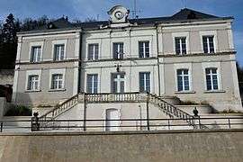
Town hall | ||
| ||
 Nazelles-Négron | ||
|
Location within Centre-Val de Loire region  Nazelles-Négron | ||
| Coordinates: 47°25′58″N 0°57′15″E / 47.4328°N 0.9542°ECoordinates: 47°25′58″N 0°57′15″E / 47.4328°N 0.9542°E | ||
| Country | France | |
| Region | Centre-Val de Loire | |
| Department | Indre-et-Loire | |
| Arrondissement | Tours | |
| Canton | Amboise | |
| Government | ||
| • Mayor (2008–2014) | Edwige Dubois | |
| Area1 | 22.32 km2 (8.62 sq mi) | |
| Population (2009)2 | 3,544 | |
| • Density | 160/km2 (410/sq mi) | |
| Time zone | CET (UTC+1) | |
| • Summer (DST) | CEST (UTC+2) | |
| INSEE/Postal code | 37163 / 37530 | |
| Elevation | 51–114 m (167–374 ft) | |
|
1 French Land Register data, which excludes lakes, ponds, glaciers > 1 km² (0.386 sq mi or 247 acres) and river estuaries. 2 Population without double counting: residents of multiple communes (e.g., students and military personnel) only counted once. | ||
.svg.png)
Nazelles-Négron is a commune in the Indre-et-Loire department in central France.
Population
| Historical population | ||
|---|---|---|
| Year | Pop. | ±% |
| 1793 | 899 | — |
| 1800 | 959 | +6.7% |
| 1806 | 960 | +0.1% |
| 1821 | 995 | +3.6% |
| 1831 | 1,107 | +11.3% |
| 1836 | 1,116 | +0.8% |
| 1841 | 1,103 | −1.2% |
| 1846 | 1,076 | −2.4% |
| 1851 | 1,093 | +1.6% |
| 1856 | 1,146 | +4.8% |
| 1861 | 1,209 | +5.5% |
| 1866 | 1,234 | +2.1% |
| 1872 | 1,153 | −6.6% |
| 1876 | 1,129 | −2.1% |
| 1881 | 1,195 | +5.8% |
| 1886 | 1,245 | +4.2% |
| 1891 | 1,277 | +2.6% |
| 1896 | 1,235 | −3.3% |
| 1901 | 1,211 | −1.9% |
| 1906 | 1,283 | +5.9% |
| 1911 | 1,301 | +1.4% |
| 1921 | 1,290 | −0.8% |
| 1926 | 1,318 | +2.2% |
| 1931 | 1,402 | +6.4% |
| 1936 | 1,368 | −2.4% |
| 1946 | 1,375 | +0.5% |
| 1954 | 1,509 | +9.7% |
| 1962 | 1,743 | +15.5% |
| 1968 | 1,747 | +0.2% |
| 1975 | 2,920 | +67.1% |
| 1982 | 3,263 | +11.7% |
| 1990 | 3,547 | +8.7% |
| 1999 | 3,633 | +2.4% |
| 2006 | 3,595 | −1.0% |
| 2009 | 3,544 | −1.4% |
See also
References
| Wikimedia Commons has media related to Nazelles-Négron. |
This article is issued from Wikipedia - version of the 3/15/2016. The text is available under the Creative Commons Attribution/Share Alike but additional terms may apply for the media files.