Saint-Michel-sur-Loire
| Saint-Michel-sur-Loire | |
|---|---|
|
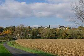
A general view of Saint-Michel-sur-Loire | |
 Saint-Michel-sur-Loire | |
|
Location within Centre-Val de Loire region  Saint-Michel-sur-Loire | |
| Coordinates: 47°18′30″N 0°21′00″E / 47.3083°N 0.35°ECoordinates: 47°18′30″N 0°21′00″E / 47.3083°N 0.35°E | |
| Country | France |
| Region | Centre-Val de Loire |
| Department | Indre-et-Loire |
| Arrondissement | Chinon |
| Canton | Langeais |
| Intercommunality | Touraine Nord-Ouest |
| Government | |
| • Mayor (2008–2014) | Jean-Pierre Josse |
| Area1 | 17.51 km2 (6.76 sq mi) |
| Population (2009)2 | 614 |
| • Density | 35/km2 (91/sq mi) |
| Time zone | CET (UTC+1) |
| • Summer (DST) | CEST (UTC+2) |
| INSEE/Postal code | 37227 / 37130 |
| Elevation | 32–108 m (105–354 ft) |
|
1 French Land Register data, which excludes lakes, ponds, glaciers > 1 km² (0.386 sq mi or 247 acres) and river estuaries. 2 Population without double counting: residents of multiple communes (e.g., students and military personnel) only counted once. | |
Saint-Michel-sur-Loire is a commune in the Indre-et-Loire department in central France.
Population
| Historical population | ||
|---|---|---|
| Year | Pop. | ±% |
| 1793 | 643 | — |
| 1800 | 686 | +6.7% |
| 1806 | 691 | +0.7% |
| 1821 | 755 | +9.3% |
| 1831 | 808 | +7.0% |
| 1836 | 820 | +1.5% |
| 1841 | 852 | +3.9% |
| 1846 | 833 | −2.2% |
| 1851 | 807 | −3.1% |
| 1856 | 784 | −2.9% |
| 1861 | 739 | −5.7% |
| 1866 | 749 | +1.4% |
| 1872 | 753 | +0.5% |
| 1876 | 717 | −4.8% |
| 1881 | 709 | −1.1% |
| 1886 | 715 | +0.8% |
| 1891 | 696 | −2.7% |
| 1896 | 699 | +0.4% |
| 1901 | 671 | −4.0% |
| 1906 | 651 | −3.0% |
| 1911 | 650 | −0.2% |
| 1921 | 565 | −13.1% |
| 1926 | 573 | +1.4% |
| 1931 | 509 | −11.2% |
| 1936 | 502 | −1.4% |
| 1946 | 474 | −5.6% |
| 1954 | 537 | +13.3% |
| 1962 | 534 | −0.6% |
| 1968 | 514 | −3.7% |
| 1975 | 412 | −19.8% |
| 1982 | 432 | +4.9% |
| 1990 | 535 | +23.8% |
| 1999 | 509 | −4.9% |
| 2006 | 560 | +10.0% |
| 2009 | 614 | +9.6% |
See also
References
| Wikimedia Commons has media related to Saint-Michel-sur-Loire. |
This article is issued from Wikipedia - version of the 2/19/2015. The text is available under the Creative Commons Attribution/Share Alike but additional terms may apply for the media files.