Saint-Benoît-la-Forêt
| Saint-Benoît-la-Forêt | |
|---|---|
|
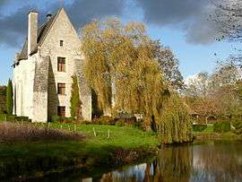
Former Benedectine abbey | |
 Saint-Benoît-la-Forêt | |
|
Location within Centre-Val de Loire region  Saint-Benoît-la-Forêt | |
| Coordinates: 47°13′18″N 0°19′23″E / 47.2217°N 0.3231°ECoordinates: 47°13′18″N 0°19′23″E / 47.2217°N 0.3231°E | |
| Country | France |
| Region | Centre-Val de Loire |
| Department | Indre-et-Loire |
| Arrondissement | Chinon |
| Canton | Azay-le-Rideau |
| Intercommunality | Rivière-Chinon-Saint-Benoît-la-Forêt |
| Government | |
| • Mayor (2008–2014) | Didier Guilbault |
| Area1 | 35.25 km2 (13.61 sq mi) |
| Population (2009)2 | 862 |
| • Density | 24/km2 (63/sq mi) |
| Time zone | CET (UTC+1) |
| • Summer (DST) | CEST (UTC+2) |
| INSEE/Postal code | 37210 / 37500 |
| Elevation | 50–119 m (164–390 ft) |
|
1 French Land Register data, which excludes lakes, ponds, glaciers > 1 km² (0.386 sq mi or 247 acres) and river estuaries. 2 Population without double counting: residents of multiple communes (e.g., students and military personnel) only counted once. | |
Saint-Benoît-la-Forêt is a commune in the Indre-et-Loire department in central France.
Population
| Historical population | ||
|---|---|---|
| Year | Pop. | ±% |
| 1793 | 482 | — |
| 1800 | 490 | +1.7% |
| 1806 | 581 | +18.6% |
| 1821 | 535 | −7.9% |
| 1831 | 534 | −0.2% |
| 1836 | 537 | +0.6% |
| 1841 | 577 | +7.4% |
| 1846 | 552 | −4.3% |
| 1851 | 555 | +0.5% |
| 1856 | 518 | −6.7% |
| 1861 | 520 | +0.4% |
| 1866 | 488 | −6.2% |
| 1872 | 483 | −1.0% |
| 1876 | 467 | −3.3% |
| 1881 | 473 | +1.3% |
| 1886 | 466 | −1.5% |
| 1891 | 425 | −8.8% |
| 1896 | 449 | +5.6% |
| 1901 | 454 | +1.1% |
| 1906 | 503 | +10.8% |
| 1911 | 455 | −9.5% |
| 1921 | 374 | −17.8% |
| 1926 | 360 | −3.7% |
| 1931 | 322 | −10.6% |
| 1936 | 285 | −11.5% |
| 1946 | 326 | +14.4% |
| 1954 | 370 | +13.5% |
| 1962 | 376 | +1.6% |
| 1968 | 334 | −11.2% |
| 1975 | 1,335 | +299.7% |
| 1982 | 1,177 | −11.8% |
| 1990 | 946 | −19.6% |
| 1999 | 766 | −19.0% |
| 2006 | 805 | +5.1% |
| 2009 | 862 | +7.1% |
See also
References
| Wikimedia Commons has media related to Saint-Benoît-la-Forêt. |
This article is issued from Wikipedia - version of the 2/11/2016. The text is available under the Creative Commons Attribution/Share Alike but additional terms may apply for the media files.