Romulus, Michigan
| City of Romulus, Michigan | ||
|---|---|---|
| City | ||
|
Downtown Romulus, westbound Goddard Road | ||
| ||
|
Nickname(s): "Rom-Town", "Gateway to the World", "Gateway City" | ||
|
Motto: "With Pride, With Unity" (Industry and its Citizens working together) | ||
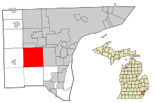 Location of Romulus, Michigan | ||
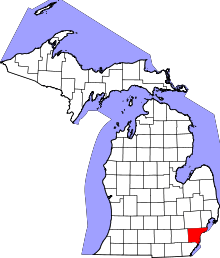
 City of Romulus, Michigan Location in the United States | ||
| Coordinates: 42°13′20″N 83°23′48″W / 42.22222°N 83.39667°W | ||
| Country | United States | |
| State | Michigan | |
| County | Wayne | |
| Settled | 1826 | |
| Organized | 1835 | |
| Incorporation | 1970 | |
| Government | ||
| • Mayor | LeRoy D. Burcroff | |
| Area[1] | ||
| • Total | 35.96 sq mi (93.14 km2) | |
| • Land | 35.61 sq mi (92.23 km2) | |
| • Water | 0.35 sq mi (0.91 km2) | |
| Elevation | 659 ft (201 m) | |
| Population (2010)[2] | ||
| • Total | 23,989 | |
| • Estimate (2012[3]) | 23,592 | |
| • Density | 673.7/sq mi (260.1/km2) | |
| Time zone | Eastern (EST) (UTC-5) | |
| • Summer (DST) | EDT (UTC-4) | |
| ZIP code | 48174 | |
| Area code(s) | 734 | |
| FIPS code | 26-69420 | |
| GNIS feature ID | 0636147[4] | |
| Website | www.romulusgov.com | |


Romulus is a suburban city of Metro Detroit, located in Wayne County in the U.S. state of Michigan. The population was 23,989 at the 2010 census, an increase from 22,979 in 2000, making the city the 80th largest city in Michigan. Romulus is home to Detroit Metropolitan Wayne County Airport and a General Motors plant (Romulus Engine) that opened in 1976. The city is the westernmost community in the Downriver area in Wayne County.
Geography
According to the United States Census Bureau, the city has a total area of 35.96 square miles (93.14 km2), of which 35.61 square miles (92.23 km2) is land and 0.35 square miles (0.91 km2) is water.[1]
Romulus is in the south-central portion of Wayne County. Interstate 94 (I-94) and I-275 run through the city.[5]
The City of Romulus is bordered to the north by Van Born Road, to the south by Pennsylvania Road, to the east by Inkster Road, and to the west by Hannan Road.
Demographics
| Historical population | |||
|---|---|---|---|
| Census | Pop. | %± | |
| 1930 | 755 | — | |
| 1980 | 24,857 | — | |
| 1990 | 22,897 | −7.9% | |
| 2000 | 22,979 | 0.4% | |
| 2010 | 23,989 | 4.4% | |
| Est. 2015 | 23,417 | [6] | −2.4% |
| U.S. Decennial Census 2011 estimate | |||
2010 census
As of the census[2] of 2010, there were 23,989 people, 8,975 households, and 6,135 families residing in the city. The population density was 673.7 inhabitants per square mile (260.1/km2). There were 9,946 housing units at an average density of 279.3 per square mile (107.8/km2). The racial makeup of the city was 50.5% White, 43% African American, 0.5% Native American, 1.1% Asian, 0.1% Pacific Islander, 0.9% from other races, and 3.9% from two or more races. Hispanic or Latino of any race were 3.0% of the population.
There were 8,975 households of which 37.8% had children under the age of 18 living with them, 40.7% were married couples living together, 21.1% had a female householder with no husband present, 6.6% had a male householder with no wife present, and 31.6% were non-families. 26.0% of all households were made up of individuals and 8.2% had someone living alone who was 65 years of age or older. The average household size was 2.64 and the average family size was 3.16.
The median age in the city was 36.2 years. 26.8% of residents were under the age of 18; 9.2% were between the ages of 18 and 24; 27.4% were from 25 to 44; 27% were from 45 to 64; and 9.8% were 65 years of age or older. The gender makeup of the city was 48.4% male and 51.6% female.
2000 census
As of the census of 2000, there were 22,979 people, 8,439 households, and 5,941 families residing in the city. The population density was 639.9 per square mile (247.1/km²). There were 8,943 housing units at an average density of 249.0 per square mile (96.2/km²). The racial makeup of the city was 65.36% White, 29.99% African American, 0.54% Native American, 0.59% Asian, 0.09% Pacific Islander, 0.81% from other races, and 2.63% from two or more races. Hispanic or Latino of any race were 2.01% of the population.
There were 8,439 households out of which 36.7% had children under the age of 18 living with them, 46.5% were married couples living together, 18.5% had a female householder with no husband present, and 29.6% were non-families. 23.8% of all households were made up of individuals and 7.2% had someone living alone who was 65 years of age or older. The average household size was 2.70 and the average family size was 3.19.
In the cities population consists of 29.2% under the age of 18, 8.4% from 18 to 24, 31.7% from 25 to 44, 22.8% from 45 to 64, and 7.9% who were 65 years of age or older. The median age was 33 years. For every 100 females there were 95.1 males. For every 100 females age 18 and over, there were 92.6 males.
The median income for a household in the city was $45,088, and the median income for a family was $51,497. Males had a median income of $41,372 versus $27,517 for females. The per capita income for the city was $19,679. About 10.6% of families and 12.6% of the population were below the poverty line, including 16.8% of those under age 18 and 12.4% of those age 65 or over.
History
The first white settler in Romulus was Samuel Polyne, a French-Canadian, who settled on section 2 in 1826, though he left soon after the township was organized in 1835.
The first settler in the area that was the village of Romulus prior to the 1865 annexation of the whole village and township into one city was Samuel McMath, who moved from New York state to the area in 1827. He improved land and planned to bring his family to settle there, but he died before he could carry out this plan.[7]
Solomon Whitaker, Charles and Joseph Pulcifer located in the area in 1830, and in 1833, Jenks Pullen and his six sons settled at what became known as "Pullen's Corners" (located in section 19 at the intersection that is now commonly called "Five Points"). Pullen's Corners was platted in 1836. The community later took on the name of the township.[8][9][10][11]
The township of Romulus was set off from a part of Huron Township by an Act of the Territorial Legislature on March 17, 1835, and the first township meeting was held on April 16, 1835, two years before the State of Michigan was admitted in to the Union (1837), in the house of Joseph T. Pullen. The first supervisor was David J. Pullen. The township's name was changed to "Wayne" on March 19, 1845, but was changed back to Romulus on January 16, 1848.[8][9][10][11]
Romulus incorporated as a city in 1970.[12]
Village of Romulus
The village of Romulus was platted on the Lansing B. Misner estate in 1871.[13]
Underground Railroad stops
Romulus was a stop of the Underground Railroad in the 1800s when slaves fled the inhumane conditions of plantations in the South to the free states of the North. There were two stops in Romulus and those structures are still intact to this day.
- Samuel Kingsley Home is a famous historic landmark in Romulus. During slave times, Samuel L. Kingsley lived in a house on Ozga Rd near Pullens Corners, what is today known as Five Points. He hid slaves in an underground cellar. Today, the house is located on Hunt Street across from the Romulus Historical Museum. The address to the house was 37426 S. Huron River Drive.
- The White Church at the Pullens Corner / Five Points was also an underground railroad stop. Today, the church, which is now called Romulus Wesleyan Church, still sits at the corner.
Preston
Preston was located in the north-east part of Romulus. It had a post office from 1899 to 1906.[14]
Airliner incidents
On August 16, 1987, Romulus was the site of the Northwest Airlines Flight 255 disaster, in which the plane serving the flight crashed into an overpass bridge and exploded just seconds after taking off. The crash killed all but one of the 155 passengers and crew and two more people on the roadway.[15]
On December 25, 2009, another Northwest plane, Flight 253, suffered an unsuccessful bombing incident as it approached Metro Airport. Nigerian man Umar Farouk Abdulmutallab from Al-Qaeda in the Arabian Peninsula was convicted of eight criminal counts and sentenced to four life sentences plus 50 years without parole. [16]
Chemical plant explosion
| Wikinews has related news: Detroit chemical plant experiences explosions, fire; residents evacuated |
On August 9, 2005 at approximately 9:30 p.m., the EQ Recovery Plant caught fire. Citizens within 1 to 1⅓ mile radius were forced to evacuate their homes. Romulus and Wayne fire crews and crews from neighboring communities managed to put out the fire after letting it burn down a little bit. Chemical-filled smoke filled the sky, causing respiratory problems. Many citizens from both Romulus and Wayne were taken to Oakwood Annapolis Hospital (now Beaumont Hospital-Wayne), about two miles from the explosion site. No one was injured.[17]
Government and infrastructure
City Government
The elected city officials for the City of Romulus as of November 2013:
| Official Position | Name of Official |
|---|---|
| Mayor | LeRoy D. Burcroff |
| City Clerk | Ellen Craig-Bragg |
| City Treasurer | Stacy Paige |
| City Council | John Barden Linda Choate William Wadsworth Jr. Celeste Roscoe Kathleen Abdo Harry Crout Sylvia Makowski |
Wayne County Airport Authority
The Wayne County Airport Authority has its headquarters in the former L.C. Smith Terminal at Detroit Metro Airport in Romulus. It also has an operational police department, which its headquarters is located in the 610 building of the airport on the East service Drive, near the L.C. Smith building. [18]
Infrastructure
The United States Postal Service operates the Romulus-Carl W. Morris Post Office located in downtown on Hunt Street and Goddard Road.[19]
Romulus has some retail in the city including a local supermarket, drug store, and a host of small businesses in the downtown district and throughout the city, as well as a Family Dollar and a Dollar General store on Wayne Road. Most citizens have to travel to adjacent communities to go to more prominent retailers and businesses such as Walmart due to the fact that there are no major businesses in the city.
Notable people
- Charley Lau - American baseball player and hitting coach
- Terry Mills - Former professional basketball player (Detroit Pistons)
- John Long - Former professional basketball player (Pistons)
- Grant Long - Former professional basketball player, nephew of John Long (Pistons)
- Fred Russell - Former professional football player
- Frank Sacka - Former American baseball player
- Sufjan Stevens - Musician
Parks and recreation

After a failed city millage in February 2011, city officials had to close all of the city parks in order to keep the city financially stable. However, the Downtown Development Authority were willing to maintain the operations of Mary Ann Banks Park & Historical Park, reopening the park in Spring 2011. By 2015, the city's finances had rebound and with determination from city officials and citizens, most the city's parks have reopened with better improvements and even opening a new park - including:
- Elmer Johnson Park
- Eugenio Fernandez Park
- Mary Ann Banks Park
- Oakbrook Neighborhood Park
- Romulus Historical Park
- St. Johns Lodge No.#44 Park (formerly Park #1)
It is uncertain about the future of Jimmie Raspberry Park & Beverly McAnally Park, both on the north side of the city, and Senior Citizens Park near downtown since their closures back in 2011.
The Romulus Athletic Center, located at 35765 Northline Road, is a facility for recreation and conferences. The state-of-the-art center with fitness facilities, a basketball court and a swimming pool opened on April 1, 2008.
Education


The Romulus Community School District serves and educates the children in the City of Romulus and other communities. The district is made up of a high school (Romulus Senior High School), a middle school (Romulus Middle School), and four elementary schools (Barth, Halecreek, Romulus, and Wick).
A portion is instead within the Wayne-Westland Community Schools.[20] It is zoned to Roosevelt-McGrath Elementary School in Wayne,[21] Adams Upper Elementary School in Westland,[22] Franklin Middle School in Wayne,[23] and Wayne Memorial High School in Wayne.[24]
Summit Academy Schools is a charter school in Romulus that is slowly gaining attention. It has had a 100% graduation rate and 100% college acceptance rate. It has also been ranked as one of the top 5% of schools in Michigan.
Popular culture
Released on his 2003 album entitled "Michigan", Sufjan Stevens recorded a single titled "Romulus". In 2010, "Meet Monica Velour", an independent comedy drama movie was partially filmed in Romulus along with other Detroit suburbs.
References
- 1 2 "US Gazetteer files 2010". United States Census Bureau. Retrieved 2012-11-25.
- 1 2 "American FactFinder". United States Census Bureau. Retrieved 2012-11-25.
- ↑ "Population Estimates". United States Census Bureau. Retrieved 2013-06-03.
- ↑ "US Board on Geographic Names". United States Geological Survey. 2007-10-25. Retrieved 2008-01-31.
- ↑ "Romulus." (Archive) Wayne County, Michigan. June 9, 2003. Retrieved on November 2, 2013.
- ↑ "Annual Estimates of the Resident Population for Incorporated Places: April 1, 2010 to July 1, 2015". Retrieved July 2, 2016.
- ↑ Romig, Walter. Michigan Place Names (Grosse Pointe: Walter Romig, n.d.) p. 483
- 1 2 Fuller, George Newman (2005) [1928?]. "County Organization and Government". Local history of Detroit and Wayne County / edited by George B. Catlin. Ann Arbor, Mich.: University of Michigan Library. pp. 109–110. Retrieved 2007-04-01.
- 1 2 Farmer, Silas (2005) [1890]. "Romulus Township". History of Detroit and Wayne County and early Michigan. Ann Arbor, Mich.: University of Michigan Library. pp. 1362–1364. Retrieved 2007-04-01.
- 1 2 Wayne County Historical and Pioneer Society. (2005) [1890]. "Romulus". In Frederick Carlisle. Chronography of notable events in the history of the Northwest Territory and Wayne County. Ann Arbor, Mich.: University of Michigan Library. p. 81. Retrieved 2007-04-01.
- 1 2 "Brief History of Romulus". City of Romulus. Archived from the original on 2006-10-31. Retrieved 2007-04-01.
- ↑ Romig. Michigan Place Names, p. 483
- ↑ Romig. Michigan PlaceNames. p. 484
- ↑ Romig. Michigan Place Names, p. 459
- ↑ ""Aircraft Accident Report, Northwest Airlines, Inc. McDonnell Douglas DC-9-82, N312RC, Detroit Metropolitan Wayne County Airport, Romulus, Michigan, August 16, 1987"" (PDF). national transportation safety board.
- ↑ "Underwear bomber Umar Farouk Abdulmutallab sentenced to life in prison". Daily Mail. London: Associated Press. February 16, 2012. Retrieved February 18, 2012.
- ↑ "'Toxic' Explosion Shakes Romulus". Archived from the original on 8 December 2010.
- ↑ "Travel Tips & Security Information :: Contact Us." Wayne County Airport Authority. Retrieved on December 11, 2010. "Wayne County Airport Authority Mailing Address Detroit Metropolitan Airport Smith Terminal - Mezzanine Level Detroit , MI 48242"
- ↑ "Post Office Location - ROMULUS." United States Postal Service. Retrieved on December 11, 2010.
- ↑ "Home." (Archive) Wayne-Westland Community Schools. Retrieved on November 12, 2012.
- ↑ "rooseveltm.pdf." (Archive) Wayne-Westland Community Schools. Retrieved on November 2, 2013.
- ↑ "adams.pdf." (Archive) Wayne-Westland Community Schools. Retrieved on November 2, 2013.
- ↑ "franklin.pdf." (Archive) Wayne-Westland Community Schools. Retrieved on November 2, 2013.
- ↑ "waynemem.pdf." (Archive) Wayne-Westland Community Schools. Retrieved on November 2, 2013.
External links
| Wikimedia Commons has media related to Romulus, Michigan. |
Municipalities and communities of Wayne County, Michigan, United States | ||
|---|---|---|
| Cities |
|  |
| Charter townships | ||
| General law townships | ||
| Unincorporated community | ||
| Footnotes | ‡This populated place also has portions in an adjacent county or counties | |
| Topics |  | |
|---|---|---|
| Detroit | ||
| Municipalities over 80,000 | ||
| Municipalities 40,000 to 80,000 | ||
| Cultural enclaves | ||
| Satellite cities | ||
| Counties in MSA | ||
| Counties in CSA | ||
Coordinates: 42°13′20″N 83°23′48″W / 42.22222°N 83.39667°W