Trenton, Michigan
| City of Trenton | |
|---|---|
| City | |
 | |
 | |
| Coordinates: 42°08′22″N 83°10′42″W / 42.13944°N 83.17833°W | |
| Country | United States |
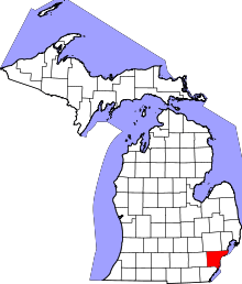
| State | Michigan |
| County | Wayne |
| Settled | 1816 |
| Incorporation | 1855 |
| Government | |
| • Mayor | Kyle F. Stack |
| Area[1] | |
| • Total | 7.51 sq mi (19.45 km2) |
| • Land | 7.28 sq mi (18.86 km2) |
| • Water | 0.23 sq mi (0.60 km2) |
| Elevation | 597 ft (182 m) |
| Population (2010)[2] | |
| • Total | 18,853 |
| • Estimate (2012[3]) | 18,562 |
| • Density | 2,589.7/sq mi (999.9/km2) |
| Time zone | EST (UTC-5) |
| • Summer (DST) | EDT (UTC-4) |
| ZIP code | 48183 |
| Area code(s) | 734 |
| FIPS code | 26-80420[4] |
| GNIS feature ID | 1615062[5] |
| Website | http://www.trentonmi.org/ |
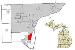
Trenton is a small city in Wayne County in the southeast portion of the U.S. state of Michigan. At the 2010 census, the city population was 18,853.[6] The city is part of Downriver, a collection of mostly blue-collar communities south of Detroit on the west bank of the Detroit River.
Many residents are employed in the city's factories such as the Chrysler Trenton Engine Plant,[7] Solutia, and the Trenton Channel Power Plant. Oakwood South Shore Hospital (formerly known as Seaway Hospital) is located within city limits and has 203 beds. The former McLouth Steel plant is also located in the city. There is rail service in the city. The city operates the 21,000-square-foot (2,000 m2) Trenton Veterans Memorial Library and a historical museum. Trenton has 15 churches of 10 denominations.
The Battle of Monguagon took place in Trenton on what is now the site of Elizabeth Park. Elizabeth Park is part of the Wayne County park system and was the first county park in Michigan, designated in 1919.
History
The founder of Trenton is considered to be Abram Caleb Truax, a member of the territorial militia in attendance when General William Hull surrendered Detroit to the British General Isaac Brock early in the War of 1812. After the war, in 1816, Truax acquired a large tract of land in the Michigan Territory along the Detroit River from the U.S. government and constructed a sawmill, church and store in what is today downtown Trenton. When Territorial Governor Lewis Cass organized Monguagon Township in 1827, Truax became the first Township Supervisor. He laid out the village of Truaxton in 1834. A post office had been established there named "Monguago" in 1828 with Truax as the first postmaster. The post office name was changed to "Truago" in 1837, and to "Trenton" in 1847, after a type of limestone mined from a local quarry. The village was platted and recorded under the name Trenton in 1850 by Abram's son and daughter George Brigham Truax and Sophia Slocum, the wife of industrialist Giles Slocum.[8][9][10] The Slocum family estate was given to the county, becoming what is known as Elizabeth Park, named after Elizabeth Slocum.
In 1834 an industrialist, Giles Bryan Slocum, constructed a dock, making Trenton a major hub of steamboat traffic.[11] In 1846, Capt. Arthur Edwards founded the Detroit & Cleveland Steamboat Company in Trenton. Through the late 1880s Trenton, like several Downriver communities, was known for its extensive shipyards. Sibley, Michigan would not be incorporated into Trenton until 1929.
Trenton was incorporated as a village in 1855.
A Detroit businessman and later Michigan's first U.S. attorney, Solomon Sibley, started a limestone quarry near Trenton, near what is today Fort Street and Sibley Road. Materials from the quarry were used to construct structures in Detroit, most notably Fort Detroit along the Detroit River. The quarry was later sold to Austin Church,[12] who used limestone to make baking soda, which he sold under his family's nameplate, Arm & Hammer. In 1900 the quarry was the site of the Sibley Quarry explosion.
Through the late 1880s and even early 1900s, Trenton prospered because it was roughly a day's journey between Detroit and Monroe, Michigan, which meant people traveling between the two cities would have to stop overnight in Trenton.[13]
Trenton annexed the village of Sibley (along the modern Riverview border) in 1929, extending the city's northern boundary to modern-day Sibley Road. Trenton was incorporated as a city in 1957. In 1920 a small light railroad ran along West Jefferson to Wyandotte. The rail services ended in 1934. The tracks were removed in 1942 for the war effort.
Geography
According to the United States Census Bureau, the city has a total area of 7.51 square miles (19.45 km2), of which 7.28 square miles (18.86 km2) is land and 0.23 square miles (0.60 km2) is water.[1] The city is located between Detroit and Monroe, Michigan, in the southeastern part of the state. The city is located on the western bank of the Detroit River and is bounded by Grosse Ile to the east, Riverview to the north, Brownstown Township to the west and south and Woodhaven to the west.
Demographics
| Historical population | |||
|---|---|---|---|
| Census | Pop. | %± | |
| 1880 | 1,103 | — | |
| 1890 | 789 | −28.5% | |
| 1920 | 1,682 | — | |
| 1930 | 4,022 | 139.1% | |
| 1940 | 5,284 | 31.4% | |
| 1950 | 6,222 | 17.8% | |
| 1960 | 18,439 | 196.4% | |
| 1970 | 24,127 | 30.8% | |
| 1980 | 22,762 | −5.7% | |
| 1990 | 20,586 | −9.6% | |
| 2000 | 19,584 | −4.9% | |
| 2010 | 18,853 | −3.7% | |
| Est. 2015 | 18,380 | [14] | −2.5% |
2010 census
As of the census[2] of 2010, there were 18,853 people, 7,988 households, and 5,159 families residing in the city. The population density was 2,589.7 inhabitants per square mile (999.9/km2). There were 8,539 housing units at an average density of 1,172.9 per square mile (452.9/km2). The racial makeup of the city was 95.5% White, 1.3% African American, 0.5% Native American, 0.7% Asian, 0.5% from other races, and 1.4% from two or more races. Hispanic or Latino of any race were 3.2% of the population.
There were 7,988 households of which 27.9% had children under the age of 18 living with them, 49.1% were married couples living together, 11.3% had a female householder with no husband present, 4.2% had a male householder with no wife present, and 35.4% were non-families. 32.3% of all households were made up of individuals and 16.4% had someone living alone who was 65 years of age or older. The average household size was 2.33 and the average family size was 2.95.
The median age in the city was 45 years. 21.3% of residents were under the age of 18; 7.7% were between the ages of 18 and 24; 21% were from 25 to 44; 30.3% were from 45 to 64; and 19.8% were 65 years of age or older. The gender makeup of the city was 48.1% male and 51.9% female.
2000 census
As of the census[4] of 2000, there were 19,584 people, 8,137 households, and 5,590 families residing in the city. The population density was 2,682.8 per square mile (1,035.8/km²). There were 8,345 housing units at an average density of 1,143.2 per square mile (441.4/km²). The racial makeup of the city was 96.92% White, 0.37% African American, 0.41% Native American, 0.78% Asian, 0.03% Pacific Islander, 0.23% from other races, and 1.26% from two or more races. Hispanic or Latino of any race were 1.99% of the population.
There were 8,137 households out of which 29.8% had children under the age of 18 living with them, 55.6% were married couples living together, 10.0% had a female householder with no husband present, and 31.3% were non-families. 28.6% of all households were made up of individuals and 14.1% had someone living alone who was 65 years of age or older. The average household size was 2.38 and the average family size was 2.93.
In the city the population was spread out with 23.3% under the age of 18, 6.0% from 18 to 24, 26.8% from 25 to 44, 24.3% from 45 to 64, and 19.6% who were 65 years of age or older. The median age was 42 years. For every 100 females there were 90.9 males. For every 100 females age 18 and over, there were 86.3 males.
The median income for a household in the city was $49,566, and the median income for a family was $61,891. Males had a median income of $52,123 versus $31,892 for females. The per capita income for the city was $25,288. About 4.0% of families and 5.1% of the population were below the poverty line, including 6.1% of those under age 18 and 4.1% of those age 65 or over.
City government
City Hall is located at 2800 Third Street.
The current city officials are:
- Mayor: Kyle F. Stack (2011)
- Mayor Pro-Tem: William LeFevre (2011)
- City Council: Timothy Taylor (2009), Timber R. Baun-Crooks (2009), Bob Howey (2011), Mary Ellen McLeod (2011), Terrence Teifer (2009)
- City Assessor: John Dahlquist (2011)
- City Clerk: Patricia M. Gearhart (2011)
- City Treasurer: Mike McCullough (2011)
Trenton has its own city wastewater treatment plant[16] and fire and police departments.
Public schools
Trenton has four public schools with more than 3,000 students total. The schools are Anderson Elementary School, Hedke Elementary School, Arthurs Middle School (still known as Monguagon) and Trenton High School.
Culture
Trenton features an active community revolving around sports. Its downtown area, along West Jefferson Avenue, features an annual craft fair the last weekend of June, called the Trenton Summer Festival.
The recently remodeled Trenton Village Theatre is located in the downtown area . The art deco theater was designed by Charles N. Agree, who also created the Grande Ballroom in Detroit, among many others.
Trenton operates the Bridge Cultural Center at 2427 West Road, a former farmhouse that now houses an array of yearly activities, including an annual Christmas fair and arts and crafts events.
Trenton is home to the Wyandot Nation of Anderdon, one of four Wyandot communities in North America.[17]
Festivals
Trenton has several festivals throughout the year:
- Roar on the River
- Taste of Trenton
- Country Christmas
- Somewhere in Time
- Trenton Summer Festival
- Scarecrow Festival
- Country on the River
Parks and recreation
The city recently spent $8.4 million to renovate the Kennedy Recreation Center, a 150,000-square-foot (14,000 m2) complex along West Road that includes ice rinks, meeting rooms, and Sports Services, a sporting goods shop. The Teifer rink was originally an outdoor rink, which opened during Christmas week in 1961. The facility is home to the Trenton, Riverview, Grosse Ile, and Gibraltar Carlson High School hockey teams.
Adjacent is the Kennedy Outdoor Aquatic Center, a 13,000-square-foot (1,200 m2) pool and water park that opened in 2005. The facility includes a 25-meter, 8-lane competitive pool with two diving boards, a 15-meter lap pool, a waterslide with separate splash area, and a 7,000-square-foot (650 m2) leisure pool.
The city has 200 acres (0.81 km2) of parks, including 22 operated by the city and 6 at schools. The city and Wayne County each also operate boat launches. The city of Trenton launch is located in Rotary Park, while the Wayne County launch is located at the south end of Elizabeth Park.
Along the Detroit River, Elizabeth Park, operated by Wayne County, is a popular destination for picnic-goers, fishermen, and boaters.
The city runs the Westfield Activities Center, which hosts meetings and houses the city's senior citizen program, the Teifer Building, and the Haas Park Building.
Notable people
- Steve Avery, former Atlanta Braves pitcher, was born in Trenton.
- Zak Bagans, host and lead investigator of the Travel Channel's paranormal series Ghost Adventures.
- Anthony Bass, pitcher for the San Diego Padres, was born and raised in Trenton, graduating from Trenton High school in 2005.
- Former U.S. President George H. W. Bush and his wife Barbara Bush lived in Trenton for two months in the spring of 1945 while Bush was stationed at nearby Naval Air Station Grosse Ile. This was the couple's first residence following their wedding in January 1945.
- Erik Condra, NHL ice hockey player, was born in Trenton.
- Larry DePalma, former NHL player, was born in Trenton, graduating from Trenton High School in 1983.
- Donald M. Dickinson, U.S. Postmaster General under President Grover Cleveland, was a resident of Trenton.
- Andy Greene, NHL player, was born in Trenton on October 30, 1982, graduating from Trenton High School in 2001.
- Ann Marie Lipinski, journalist and former editor of the Chicago Tribune, graduated from Trenton High School in 1974.
- Gary Lowe, Michigan State and NFL defensive back, was born in Trenton.
- Kevin Nash, professional wrestler and actor, was raised in Trenton.
- Lee Norwood, NHL player, grew up in Trenton.
- J. J. Putz, relief pitcher for the Arizona Diamondbacks, was raised in Trenton, graduating from Trenton High School in 1995.
- Mary Lynn Rajskub, comedian and actress, born and raised in Trenton, graduating from Trenton High School in 1989.
- Matt Shoemaker, starting pitcher for the Los Angeles Angels, grew up in Trenton and is a current resident.
- Bradley A. Smith, professor of law and Clinton appointee to the Federal Election Commission, was born and raised in Trenton, graduating from Trenton High School in 1976.
References
- 1 2 "US Gazetteer files 2010". United States Census Bureau. Archived from the original on 2012-01-24. Retrieved 2012-11-25.
- 1 2 "American FactFinder". United States Census Bureau. Retrieved 2012-11-25.
- ↑ "Population Estimates". United States Census Bureau. Archived from the original on 2013-06-17. Retrieved 2013-06-03.
- 1 2 "American FactFinder". United States Census Bureau. Archived from the original on 2013-09-11. Retrieved 2008-01-31.
- ↑ "US Board on Geographic Names". United States Geological Survey. 2007-10-25. Retrieved 2008-01-31.
- ↑ "Race, Hispanic or Latino, Age, and Housing Occupancy: 2010 Census Redistricting Data (Public Law 94-171) Summary File (QT-PL), Trenton city, Michigan". U.S. Census Bureau, American FactFinder 2. Archived from the original on September 11, 2013. Retrieved September 8, 2011.
- ↑ "Trenton Engine Plant". Chrysler. Retrieved 2007-06-05.
- ↑ "Compendium of history and biography of the city of Detroit and Wayne County, Michigan ...". umich.edu.
- ↑ "Chronography of notable events in the history of the Northwest Territory and Wayne County.". umich.edu.
- ↑ "Chronography of notable events in the history of the Northwest Territory and Wayne County.". umich.edu.
- ↑ "History of Trenton". City of Trenton. Archived from the original on 2007-05-18. Retrieved 2007-06-05.
- ↑ "History of the Logo". Church & Dwight. Retrieved 2007-06-05.
- ↑ Gillespie, Brendan. "Descendants of Philippe du Trieux". Jennifer Smith's Genealogy Page. Retrieved 2007-06-05.
Trenton's start was simply because of its location. It was the last high ground from Detroit to Monroe, and a day's journey from Detroit, an overnight stop.
- ↑ "Annual Estimates of the Resident Population for Incorporated Places: April 1, 2010 to July 1, 2015". Retrieved July 2, 2016.
- ↑ "Census of Population and Housing". Census.gov. Retrieved June 4, 2015.
- ↑ "Waste Water Treatment Plant". City of Trenton. Archived from the original on 2007-09-27. Retrieved 2007-06-05.
- ↑ "Archived copy". Archived from the original on 2012-08-01. Retrieved 2012-11-11. Wyandot Nation of Anderdon
External links
- City of Trenton official website
- Trenton Veterans Memorial Library
- Trenton Historical Society
- Trenton Public Schools
- Elizabeth Park
Municipalities and communities of Wayne County, Michigan, United States | ||
|---|---|---|
| Cities |
|  |
| Charter townships | ||
| General law townships | ||
| Unincorporated community | ||
| Footnotes | ‡This populated place also has portions in an adjacent county or counties | |
| Topics |  | |
|---|---|---|
| Detroit | ||
| Municipalities over 80,000 | ||
| Municipalities 40,000 to 80,000 | ||
| Cultural enclaves | ||
| Satellite cities | ||
| Counties in MSA | ||
| Counties in CSA | ||
Coordinates: 42°08′22″N 83°10′42″W / 42.13944°N 83.17833°W