Rouffiac, Cantal
| Rouffiac | |
|---|---|
|
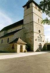
The church in Rouffiac | |
 Rouffiac | |
|
Location within Auvergne-Rhône-Alpes region  Rouffiac | |
| Coordinates: 45°01′25″N 2°08′17″E / 45.0236°N 2.1381°ECoordinates: 45°01′25″N 2°08′17″E / 45.0236°N 2.1381°E | |
| Country | France |
| Region | Auvergne-Rhône-Alpes |
| Department | Cantal |
| Arrondissement | Aurillac |
| Canton | Laroquebrou |
| Intercommunality | Entre deux Lacs en Châtaigneraie |
| Government | |
| • Mayor (2008–2014) | Géraud Terrisse |
| Area1 | 23.12 km2 (8.93 sq mi) |
| Population (2008)2 | 222 |
| • Density | 9.6/km2 (25/sq mi) |
| Time zone | CET (UTC+1) |
| • Summer (DST) | CEST (UTC+2) |
| INSEE/Postal code | 15165 / 15150 |
| Elevation |
280–685 m (919–2,247 ft) (avg. 580 m or 1,900 ft) |
|
1 French Land Register data, which excludes lakes, ponds, glaciers > 1 km² (0.386 sq mi or 247 acres) and river estuaries. 2 Population without double counting: residents of multiple communes (e.g., students and military personnel) only counted once. | |
Rouffiac is a commune in the Cantal department in south-central France.
Geography
The Maronne river forms part of the commune's northwestern border.
Population
| Historical population | ||
|---|---|---|
| Year | Pop. | ±% |
| 1962 | 415 | — |
| 1968 | 446 | +7.5% |
| 1975 | 343 | −23.1% |
| 1982 | 314 | −8.5% |
| 1990 | 260 | −17.2% |
| 1999 | 237 | −8.8% |
| 2008 | 222 | −6.3% |
See also
References
| Wikimedia Commons has media related to Rouffiac (Cantal). |
This article is issued from Wikipedia - version of the 2/11/2016. The text is available under the Creative Commons Attribution/Share Alike but additional terms may apply for the media files.