Védrines-Saint-Loup
| Védrines-Saint-Loup | |
|---|---|
|
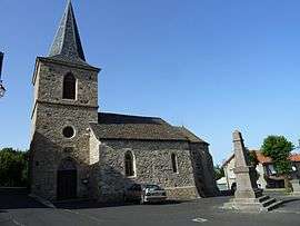
The church in Védrines-Saint-Loup | |
 Védrines-Saint-Loup | |
|
Location within Auvergne-Rhône-Alpes region  Védrines-Saint-Loup | |
| Coordinates: 45°04′14″N 3°16′57″E / 45.0706°N 3.2825°ECoordinates: 45°04′14″N 3°16′57″E / 45.0706°N 3.2825°E | |
| Country | France |
| Region | Auvergne-Rhône-Alpes |
| Department | Cantal |
| Arrondissement | Saint-Flour |
| Canton | Ruynes-en-Margeride |
| Intercommunality | Margeride-Truyère |
| Government | |
| • Mayor (2008–2014) | Hubert Vicard |
| Area1 | 27.56 km2 (10.64 sq mi) |
| Population (2008)2 | 146 |
| • Density | 5.3/km2 (14/sq mi) |
| Time zone | CET (UTC+1) |
| • Summer (DST) | CEST (UTC+2) |
| INSEE/Postal code | 15251 / 15100 |
| Elevation |
873–1,372 m (2,864–4,501 ft) (avg. 1,026 m or 3,366 ft) |
|
1 French Land Register data, which excludes lakes, ponds, glaciers > 1 km² (0.386 sq mi or 247 acres) and river estuaries. 2 Population without double counting: residents of multiple communes (e.g., students and military personnel) only counted once. | |
Védrines-Saint-Loup is a commune in the Cantal department in south-central France.
Population
| Historical population | ||
|---|---|---|
| Year | Pop. | ±% |
| 1962 | 292 | — |
| 1968 | 305 | +4.5% |
| 1975 | 238 | −22.0% |
| 1982 | 217 | −8.8% |
| 1990 | 184 | −15.2% |
| 1999 | 162 | −12.0% |
| 2008 | 146 | −9.9% |
See also
References
| Wikimedia Commons has media related to Védrines-Saint-Loup. |
This article is issued from Wikipedia - version of the 7/2/2016. The text is available under the Creative Commons Attribution/Share Alike but additional terms may apply for the media files.