Saignes, Cantal
| Saignes | ||
|---|---|---|
|
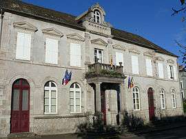
Town hall | ||
| ||
 Saignes | ||
|
Location within Auvergne-Rhône-Alpes region  Saignes | ||
| Coordinates: 45°20′08″N 2°28′48″E / 45.3356°N 2.48°ECoordinates: 45°20′08″N 2°28′48″E / 45.3356°N 2.48°E | ||
| Country | France | |
| Region | Auvergne-Rhône-Alpes | |
| Department | Cantal | |
| Arrondissement | Mauriac | |
| Canton | Saignes | |
| Intercommunality | Sumène Artense | |
| Government | ||
| • Mayor (2014–2020) | Hervé Goutille | |
| Area1 | 6.81 km2 (2.63 sq mi) | |
| Population (2012)2 | 883 | |
| • Density | 130/km2 (340/sq mi) | |
| Time zone | CET (UTC+1) | |
| • Summer (DST) | CEST (UTC+2) | |
| INSEE/Postal code | 15169 / 15240 | |
| Elevation |
442–780 m (1,450–2,559 ft) (avg. 480 m or 1,570 ft) | |
|
1 French Land Register data, which excludes lakes, ponds, glaciers > 1 km² (0.386 sq mi or 247 acres) and river estuaries. 2 Population without double counting: residents of multiple communes (e.g., students and military personnel) only counted once. | ||

Saignes is a commune in the département of Cantal in south-central France.
Population
| Historical population | ||
|---|---|---|
| Year | Pop. | ±% |
| 1962 | 642 | — |
| 1968 | 702 | +9.3% |
| 1975 | 735 | +4.7% |
| 1982 | 957 | +30.2% |
| 1990 | 1,009 | +5.4% |
| 1999 | 1,006 | −0.3% |
| 2008 | 898 | −10.7% |
| 2012 | 883 | −1.7% |
See also
References
| Wikimedia Commons has media related to Saignes (Cantal). |
This article is issued from Wikipedia - version of the 2/12/2016. The text is available under the Creative Commons Attribution/Share Alike but additional terms may apply for the media files.