Rush, Kentucky
| Rush, Kentucky | |
|---|---|
| Unincorporated community | |
|
A farm in Rush | |
 Rush  Rush Location within the state of Kentucky | |
| Coordinates: 38°17′53″N 82°44′53″W / 38.29806°N 82.74806°WCoordinates: 38°17′53″N 82°44′53″W / 38.29806°N 82.74806°W | |
| Country | United States |
| State | Kentucky |
| County | Boyd and Carter |
| Population (2000) | |
| • Total | 2,755 |
| Time zone | Eastern (EST) (UTC-5) |
| • Summer (DST) | EDT (UTC-4) |
| ZIP codes | 41168 |
| GNIS feature ID | 502475[1] |
Rush is an unincorporated community in Boyd and Carter counties in the U.S. state of Kentucky. As of the 2000 census, the community had a total population of 2,755 within its postal zip code.
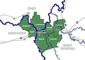
The Boyd County portion of Rush is a part of the Huntington-Ashland Metropolitan Statistical Area (MSA). As of the 2010 census, the MSA had a population of 287,702. New definitions from February 28, 2013 placed the population at 363,000.[2] The reason this community was given the name Rush is obscure.[3] It is located along US 60 and near I-64.
Education
- Ramey-Estep High School, is located in Boyd County.
- Star Elementary, is located in Carter County and is part of Carter County Public Schools.
- Boyd County Public Schools
External links
References
- ↑ U.S. Geological Survey Geographic Names Information System: Rush, Kentucky
- ↑ "Population statistics" (PDF).
- ↑ Rennick, Robert M. Kentucky Place Names. University Press of Kentucky. p. 258. ISBN 0-8131-2631-2.
This article is issued from Wikipedia - version of the 10/13/2016. The text is available under the Creative Commons Attribution/Share Alike but additional terms may apply for the media files.


