Boyd County, Kentucky
| Boyd County, Kentucky | |
|---|---|
 The Boyd County Courthouse in Catlettsburg, with a statue of John Milton Elliott | |
| Motto: Where Coal Meets Iron | |
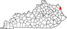 Location in the U.S. state of Kentucky | |
 Kentucky's location in the U.S. | |
| Founded | 1860 |
| Named for | Linn Boyd |
| Seat | Catlettsburg |
| Largest city | Ashland |
| Area | |
| • Total | 162 sq mi (420 km2) |
| • Land | 160 sq mi (414 km2) |
| • Water | 2.2 sq mi (6 km2), 1.3% |
| Population | |
| • (2010) | 49,542 |
| • Density | 310/sq mi (120/km²) |
| Congressional districts | 4th, 5th |
| Time zone | Eastern: UTC-5/-4 |
| Website |
boydcountyky |
Boyd County is a county located in the U.S. state of Kentucky. As of the 2010 census, the population was 49,542.[1] The county seat is Catlettsburg,[2] and its largest city is Ashland. The county was formed in 1860.[3] Its 160 square miles (410 km2) are found at the northeastern edge of the state near the Ohio River and Big Sandy River, nestled in the verdant rolling hills of Appalachia.
Boyd County is part of the Huntington-Ashland, WV-KY-OH Metropolitan Statistical Area (MSA). As of the 2010 census, the MSA had a population of 287,702. New definitions from February 28, 2013 placed the population at 363,000.[4]
History
Boyd County was the 107th of 120 counties formed in the state of Kentucky and was established in 1860 from parts of surrounding Greenup, Carter, and Lawrence counties.[3] It was named for Linn Boyd of Paducah, former U.S. congressman, Speaker of the United States House of Representatives, who died in 1859 soon after being elected lieutenant governor of Kentucky.[5]
The earliest evidence of human habitation in Boyd County exists in the forms of numerous earthen mounds containing human skeletons and burial goods giving evidence that prehistoric Native Americans inhabited the area. A 1973 archeological find revealed a serpent-shaped mound built of rocks dating to 2000 BC and stretching for 900 feet (270 m) along a ridge parallel to the Big Sandy River south of Catlettsburg.[6]
One of the early settlers in what is now Boyd County was Charles ("One-handed Charley") Smith, from Virginia. A veteran of the French and Indian War who had served under Col. George Washington in 1754, Smith received for that service roughly 400 acres (1.6 km2) around Chadwicks Creek, where he built a cabin in 1774.[6] Smith died in 1776 and in 1797 this land passed to Alexander Catlett for whom the town of Catlettsburg is named.
The Poage family arrived from Staunton, Virginia, in October 1799 and formed Poage's Landing, later renamed the city of Ashland.[7]
The first courthouse built in 1861 was replaced in 1912.[8]
Industry
Members of the Poage family built the steam-powered Clinton iron furnace in 1832, the earliest industry in present-day Boyd County. A total of twenty-nine charcoal-fueled iron furnaces operated on the Kentucky side of the Ohio River, seven of them in present-day Boyd County.
The Kentucky Iron, Coal and Manufacturing Company was incorporated on March 8, 1854, and it laid out the town of Ashland, then within Greenup County. The company purchased thousands of acres of coal, timber, and ore lands throughout the county. It invested US$210,000 in bonds of the Lexington & Big Sandy River Railroad Company, with the stipulation that the eastern division of that line extend into Ashland instead of ending, as originally planned, in Catlettsburg. The early presence of the railroad in Ashland was largely responsible for this city becoming the dominant municipality of the county.
Ashland furnace was sold to American Rolling Mill Company in 1921, which developed into Armco Steel Corporation. In 1963 Armco constructed the Amanda furnace, one of the largest blast furnaces in the world. Known today as AK Steel, the industry remains a major employer in northeastern Kentucky.
Ashland Oil, Inc., at one time the largest corporation headquartered in Kentucky, was started in 1924 at Leach Station, south of Catlettsburg, by Paul G. Blazer.[9] Best known for their Valvoline Oil products, Ashland Oil relocated to Covington, Kentucky in 1999, merged with Marathon Oil, and sold its remaining petroleum shares to Marathon in 2005, dissolving their petroleum division. The original oil refinery, located in Catlettsburg, is still in operation today and is currently owned by Marathon Oil.
Calgon Carbon constructed the Big Sandy Plant in 1961 and it has since became the world's largest producer of granular activated carbon. The facility produces in excess of 100 million pounds of granular activated carbon annually.[10]
Alcohol sales
Since 2007, Boyd County allows, with a permit, alcohol sales in restaurants that seat over 100 people and derive at least 70% of their income from food sales.[11] The one exception is the city of Ashland, where all retail alcohol sales are allowed with a permit. This makes the county officially a limited county with a wet city. Prior to 2007, alcohol sale in all areas of Boyd County, with the exception of Ashland, was prohibited.
Geography
According to the U.S. Census Bureau, the county has a total area of 162 square miles (420 km2), of which 160 square miles (410 km2) is land and 2.2 square miles (5.7 km2) (1.3%) is water.[12]
Adjacent counties
- Greenup County (northwest)
- Lawrence County, Ohio (northeast)
- Wayne County, West Virginia (east)
- Lawrence County (south)
- Carter County (west)
Demographics
| Historical population | |||
|---|---|---|---|
| Census | Pop. | %± | |
| 1870 | 8,573 | — | |
| 1880 | 12,165 | 41.9% | |
| 1890 | 14,033 | 15.4% | |
| 1900 | 18,834 | 34.2% | |
| 1910 | 23,444 | 24.5% | |
| 1920 | 29,281 | 24.9% | |
| 1930 | 43,849 | 49.8% | |
| 1940 | 45,938 | 4.8% | |
| 1950 | 49,949 | 8.7% | |
| 1960 | 52,163 | 4.4% | |
| 1970 | 52,376 | 0.4% | |
| 1980 | 55,513 | 6.0% | |
| 1990 | 51,150 | −7.9% | |
| 2000 | 49,752 | −2.7% | |
| 2010 | 49,542 | −0.4% | |
| Est. 2015 | 48,325 | [13] | −2.5% |
| U.S. Decennial Census[14] 1790-1960[15] 1900-1990[16] 1990-2000[17] 2010-2013[1] | |||
As of the census[18] of 2000, there were 49,752 people, 20,010 households, and 14,107 families residing in the county. The population density was 311 per square mile (120/km2). There were 21,976 housing units at an average density of 137 per square mile (53/km2). The racial makeup of the county was 95.97% White, 2.55% Black or African American, 0.16% Native American, 0.30% Asian, 0.14% from other races, and 0.88% from two or more races. 1.12% of the population were Hispanic or Latino of any race.
There were 20,010 households out of which 28.90% had children under the age of 18 living with them, 55.70% were married couples living together, 11.60% had a female householder with no husband present, and 29.50% were non-families. 26.50% of all households were made up of individuals and 12.20% had someone living alone who was 65 years of age or older. The average household size was 2.38 and the average family size was 2.86.
The age distribution was 21.80% under the age of 18, 8.30% from 18 to 24, 28.70% from 25 to 44, 25.60% from 45 to 64, and 15.60% who were 65 years of age or older. The median age was 40 years. For every 100 females there were 96.00 males. For every 100 females age 18 and over, there were 93.10 males.
The median income for a household in the county was $32,749, and the median income for a family was $41,125. Males had a median income of $35,728 versus $22,591 for females. The per capita income for the county was $18,212. About 11.50% of families and 15.50% of the population were below the poverty line, including 22.40% of those under age 18 and 12.10% of those age 65 or over.
Government and infrastructure
The Federal Bureau of Prisons operates the Federal Correctional Institution, Ashland in Summit, unincorporated Boyd County,[19][20] 5 miles (8.0 km) southwest of Ashland.[21]
Kentucky State Police Post 14 is located on U.S. 60 in Summit, next to Armco Park. In addition to Boyd County, troopers from Post 14 serve Carter, Greenup and Lawrence Counties.[22]
Politics
| Year | Republican | Democrat |
|---|---|---|
| 2016 | 66.45% 13,591 | 29.44% 6,021 |
| 2012 | 57.14% 10,884 | 40.82% 7,776 |
| 2008 | 55.30% 11,430 | 42.99% 8,886 |
| 2004 | 52.81% 11,501 | 46.53% 10,132 |
| 2000 | 48.21% 9,247 | 49.74% 9,541 |
Education
Colleges
Ashland Community and Technical College, in Ashland, is one of 16 two-year, open-admissions colleges of the Kentucky Community and Technical College System. Morehead State University also has a satellite campus located in Ashland.
Public school districts
- Boyd County Public School District serves the city of Catlettsburg and the surrounding county communities outside the city of Ashland and Westwood CDP
- Ashland Independent School District serving the city of Ashland.
- Fairview Independent School District serving the census-designated place of Westwood .
Private schools
- Holy Family. Holy Family is affiliated with the Holy Family Catholic Church and currently offers K-12 education.
- Rose Hill Christian. Rose Hill is affiliated with the Rose Hill Baptist Church and also offers K-12 education.
- Calvary Christian School. Calvary Christian School was closed in August 2012 by Grassland Community Church. It offered K-12.
Other schools
Communities
Cities
- Ashland
- Catlettsburg (county seat)
Census-designated places
Unincorporated communities
See also
- Ashland Commercial Historic District
- Catlett House
- National Register of Historic Places listings in Boyd County, Kentucky
References
- 1 2 "State & County QuickFacts". United States Census Bureau. Retrieved March 5, 2014.
- ↑ "Find a County". National Association of Counties. Archived from the original on 2011-05-31. Retrieved 2011-06-07.
- 1 2 "Boyd County". Kyenc.org. December 21, 1921. Retrieved April 12, 2013.
- ↑ "Population statistics" (PDF).
- ↑ The Register of the Kentucky State Historical Society, Volume 1. Kentucky State Historical Society. 1903. p. 34.
- 1 2 Thompson, George E. You Live Where?: Interesting and Unusual Facts about where We Live, p. 150. iUniverse (New York), 2009. Retrieved 11 August 2014.
- ↑ A history of Ashland, Kentucky, 1854-2004. Ashland Bicentennial Committee. 2004. 11 August 2014.
- ↑ Hogan, Roseann Reinemuth (1992). Kentucky Ancestry: A Guide to Genealogical and Historical Research. Ancestry Publishing. p. 198. Retrieved 26 July 2013.
- ↑ John E. Kleber Editor-in Chief, The Kentucky Encyclopedia: Blazer, Paul Garrett (Lexington : University of Kentucky Press, 1992) Page 87.
- ↑ Calgon Carbon Big Sandy Plant Retrieved 2014-03-21.
- ↑ "All precincts but one vote yes". Ashland Independent. Retrieved May 23, 2007.
- ↑ "2010 Census Gazetteer Files". United States Census Bureau. August 22, 2012. Retrieved August 12, 2014.
- ↑ "County Totals Dataset: Population, Population Change and Estimated Components of Population Change: April 1, 2010 to July 1, 2015". Retrieved July 2, 2016.
- ↑ "U.S. Decennial Census". United States Census Bureau. Archived from the original on May 11, 2015. Retrieved August 12, 2014.
- ↑ "Historical Census Browser". University of Virginia Library. Retrieved August 12, 2014.
- ↑ "Population of Counties by Decennial Census: 1900 to 1990". United States Census Bureau. Retrieved August 12, 2014.
- ↑ "Census 2000 PHC-T-4. Ranking Tables for Counties: 1990 and 2000" (PDF). United States Census Bureau. Retrieved August 12, 2014.
- ↑ "American FactFinder". United States Census Bureau. Archived from the original on 2013-09-11. Retrieved 2008-01-31.
- ↑ "FCI Ashland Contact Information." Federal Bureau of Prisons. Retrieved on February 1, 2011. "FCI ASHLAND FEDERAL CORRECTIONAL INSTITUTION ST. ROUTE 716 ASHLAND, KY 41105."
- ↑ "Admissions & Orientation (A&O) Handbook." Federal Correctional Institution, Ashland. 1 (1/51). Retrieved on February 1, 2011. "The Federal Correctional Institution of Ashland, Kentucky, is located five miles southwest of Ashland in Summit, Kentucky."
- ↑ "FCI Ashland." Federal Bureau of Prisons. Retrieved on February 1, 2011.
- ↑
- ↑ "Dave Leip's Atlas of U.S. Presidential Elections". Retrieved 2016-04-13.
External links
Municipalities and communities of Boyd County, Kentucky, United States | ||
|---|---|---|
| Cities | | |
| CDPs | ||
| Unincorporated communities | ||
| Ghost towns | ||
| Footnotes | ‡This populated place also has portions in an adjacent county or counties | |
| Principal cities | 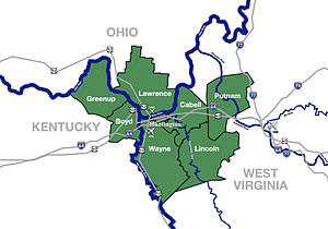 | |
|---|---|---|
| Municipalities with population over 5,000 | ||
| Municipalities with population 1,000–5,000 | ||
| Municipalities with population under 1,000 | ||
| West Virginia counties | ||
| Kentucky counties | ||
| Ohio counties | ||

Coordinates: 38°22′N 82°41′W / 38.36°N 82.69°W