Saint-Edmond
For the Vichy French cargo ship, see SS Saint Edmond.
Not to be confused with various different municipalities formerly known as Saint-Edmond, Quebec.
| Saint-Edmond | |
|---|---|
 | |
 Saint-Edmond | |
|
Location within Bourgogne-Franche-Comté region  Saint-Edmond | |
| Coordinates: 46°12′18″N 4°12′49″E / 46.205°N 4.2136°ECoordinates: 46°12′18″N 4°12′49″E / 46.205°N 4.2136°E | |
| Country | France |
| Region | Bourgogne-Franche-Comté |
| Department | Saône-et-Loire |
| Arrondissement | Charolles |
| Canton | Chauffailles |
| Area1 | 10.38 km2 (4.01 sq mi) |
| Population (2006)2 | 359 |
| • Density | 35/km2 (90/sq mi) |
| Time zone | CET (UTC+1) |
| • Summer (DST) | CEST (UTC+2) |
| INSEE/Postal code | 71408 / 71740 |
| Elevation |
279–387 m (915–1,270 ft) (avg. 387 m or 1,270 ft) |
|
1 French Land Register data, which excludes lakes, ponds, glaciers > 1 km² (0.386 sq mi or 247 acres) and river estuaries. 2 Population without double counting: residents of multiple communes (e.g., students and military personnel) only counted once. | |
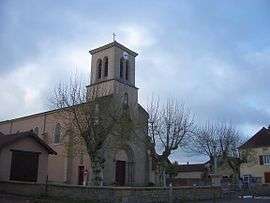
Saint-Edmond is a commune in the Saône-et-Loire department in the region of Bourgogne in eastern France.
See also
References
| Wikimedia Commons has media related to Saint-Edmond. |
This article is issued from Wikipedia - version of the 10/28/2016. The text is available under the Creative Commons Attribution/Share Alike but additional terms may apply for the media files.