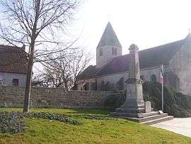
Le Breuil, Saône-et-Loire
| Le Breuil | |
|---|---|
 | |
 Le Breuil | |
|
Location within Bourgogne-Franche-Comté region  Le Breuil | |
| Coordinates: 46°47′43″N 4°29′01″E / 46.7953°N 4.4836°ECoordinates: 46°47′43″N 4°29′01″E / 46.7953°N 4.4836°E | |
| Country | France |
| Region | Bourgogne-Franche-Comté |
| Department | Saône-et-Loire |
| Arrondissement | Autun |
| Canton | Le Creusot-Est |
| Intercommunality | Creusot-Montceau |
| Area1 | 28.8 km2 (11.1 sq mi) |
| Population (2006)2 | 3,667 |
| • Density | 130/km2 (330/sq mi) |
| Time zone | CET (UTC+1) |
| • Summer (DST) | CEST (UTC+2) |
| INSEE/Postal code | 71059 / 71670 |
| Elevation |
277–421 m (909–1,381 ft) (avg. 338 m or 1,109 ft) |
|
1 French Land Register data, which excludes lakes, ponds, glaciers > 1 km² (0.386 sq mi or 247 acres) and river estuaries. 2 Population without double counting: residents of multiple communes (e.g., students and military personnel) only counted once. | |
Le Breuil is a commune in the Saône-et-Loire department in the region of Bourgogne in eastern France.
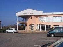
Town hall
See also
References
| Wikimedia Commons has media related to Le Breuil (Saône-et-Loire). |
This article is issued from Wikipedia - version of the 10/28/2016. The text is available under the Creative Commons Attribution/Share Alike but additional terms may apply for the media files.